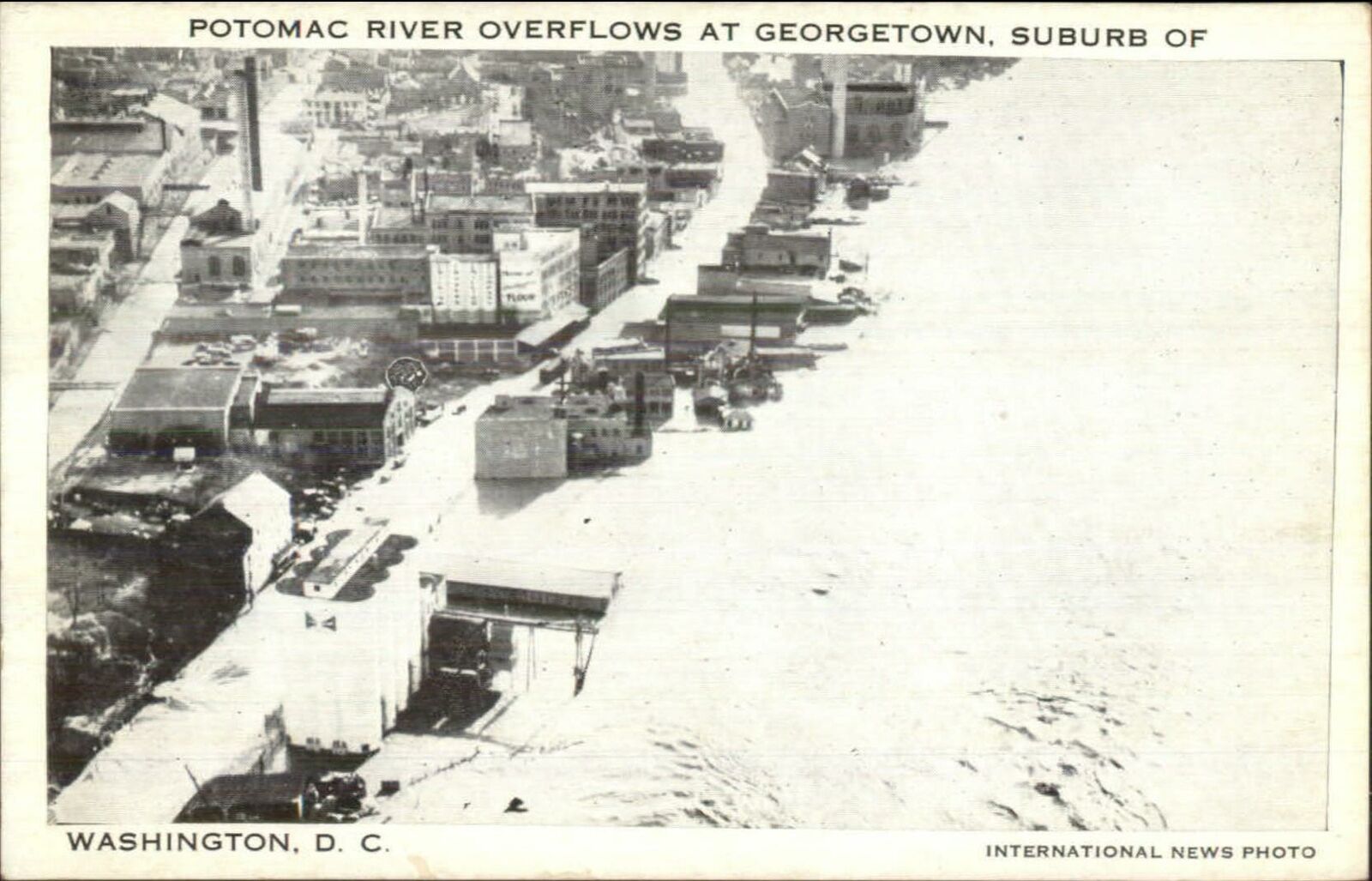
This postcard view of Georgetown, likely from 1942, shows some of the extensive flooding along the waterfront
At the same time, while searching for more info on flooding, I stumbled across some stock video footage that shows 1936 Georgetown for a brief moment. Photos of the branch are rare; video doubly so. The Georgetown section begins at about the 56-second mark.
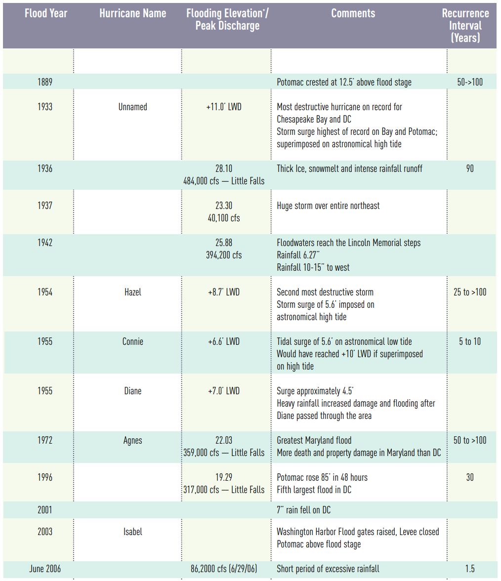
For reference, here is a list of major flood events in DC over the years, up to 2008.
https://www.ncpc.gov/docs/Flooding_and_Stormwater_in_Washington_DC_Jan2008.pdf