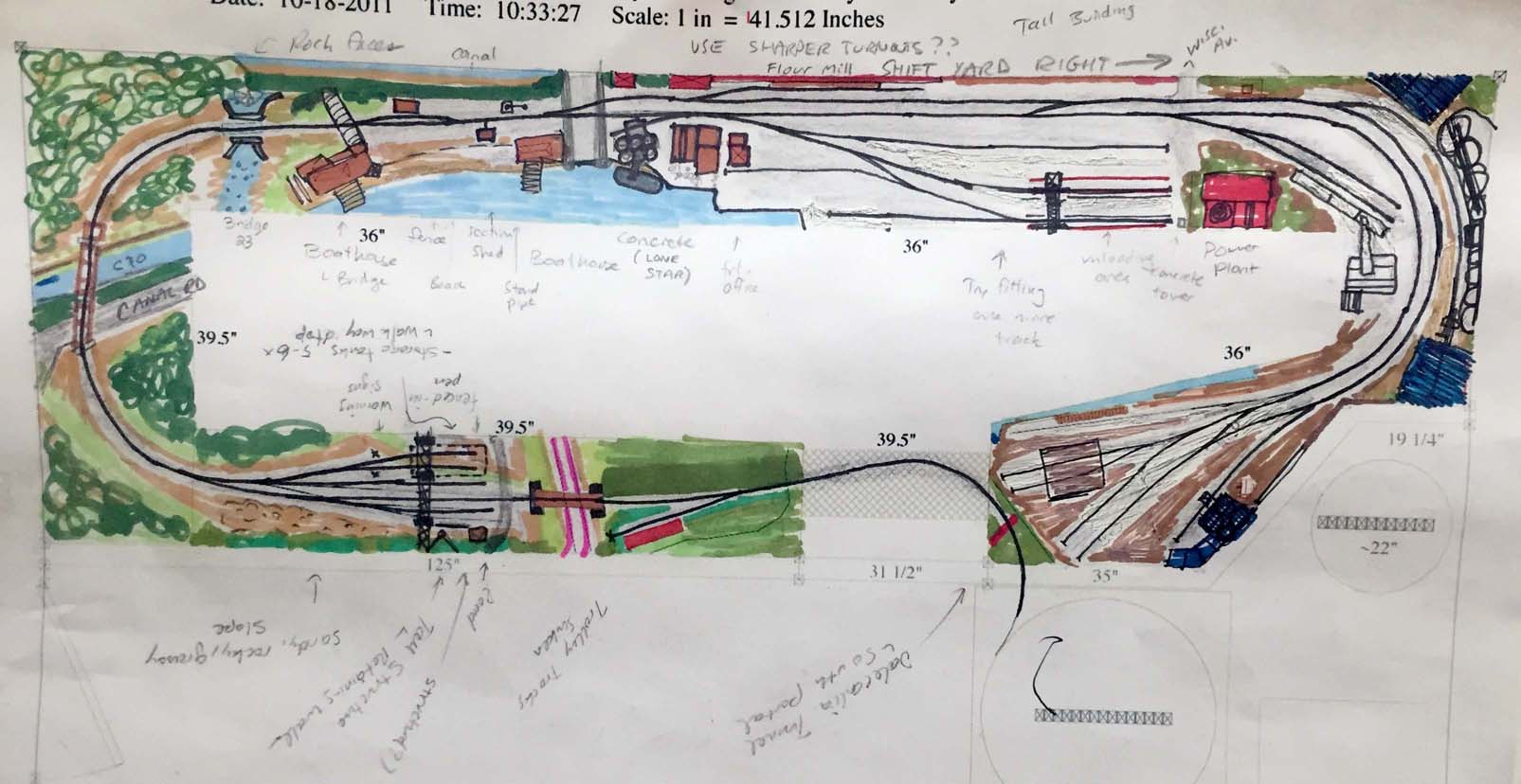
I created this a while ago but wanted to share it. This is a sketch I did showing rough scenery concepts for the lower level of the layout. What you have is the track entering from the helix at the bottom right. It exits from Dalecarlia Tunnel and then crosses a drop-down bridge, passes the Army Map siding and into the Dalecarlia water treatment facility yard area. From here the track continues down hill, crosses over the C&O canal, a Canal overflow/stream and into Georgetown. The line will pass the boat house, scale and under the Aqueduct bridge. In Georgetown there are several industries and yards for switching. The line continues through G-town and ends at the Coal & Ash house and King Coal.
The idea here is to get a rough idea for what will actually fit and a slight reality check for my own sanity. I know that the track layout is relatively accurate but this exercise really allowed me to see what will fit and what won’t. I removed a few things I thought I would be able to fit and added others that I had missed. I hope to create one for the upper deck but it’s just a matter of time if I ever get around to it.