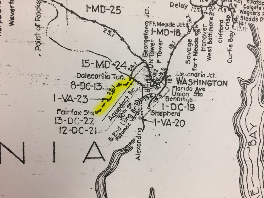
While visiting the B&ORRHS Archives building in Eldersburg, MD today I noticed an interesting depiction on the large Valuation Map “key” hanging on the wall in the collections room. This is a comprehensive view of the entire B&O RR system, with indications for major sections, distances and locations. On the map, the Georgetown Branch is indicated. However, there is a junction point at “Dalecarlia Tun.” where the Branch continues on down along the Potomac River into Georgetown. However, at the junction, there is also a dashed line that proceeds across the Potomac River and on into Virginia, terminating at “Fairfax Sta.” I have highlighted it in yellow on the photo I snapped with my phone, below.
I have researched this proposed line before, in fact I purchased a map off of eBay that showed the same proposed line and shared it on this blog. The curious thing to me is that the proposed line, which was one of the early visions/purposes for the “Georgetown Branch” was never actually built. But, it is indicated on this map, which means there are likely official Valuation maps associated with this right of way. Looking at the map, I see 8-DC-13, 1-VA-23, 13-DC-22 and 12-DC-21. I believe those are all references to maps and will have to check with the Archives to see what they have on hand. Onward…
