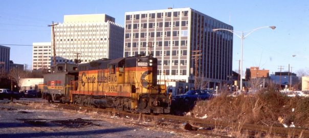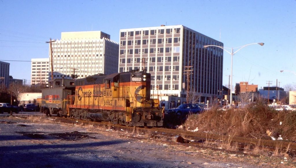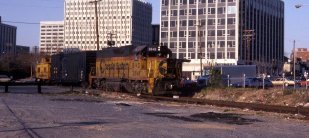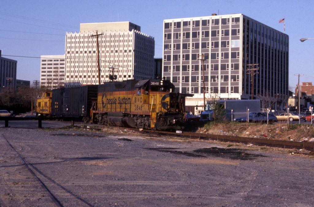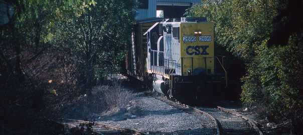
The local is slowly crossing Bethesda Ave on a sunny April day as it makes its way West toward Georgetown. Today’s turn has a single boxcar and caboose. The same loco is seen in another photo from four days later, previously posted to the blog! Note the “Radio …” text written within the blue of the Chessie logo on the nose. “Radio Equipped” graffiti, perhaps?
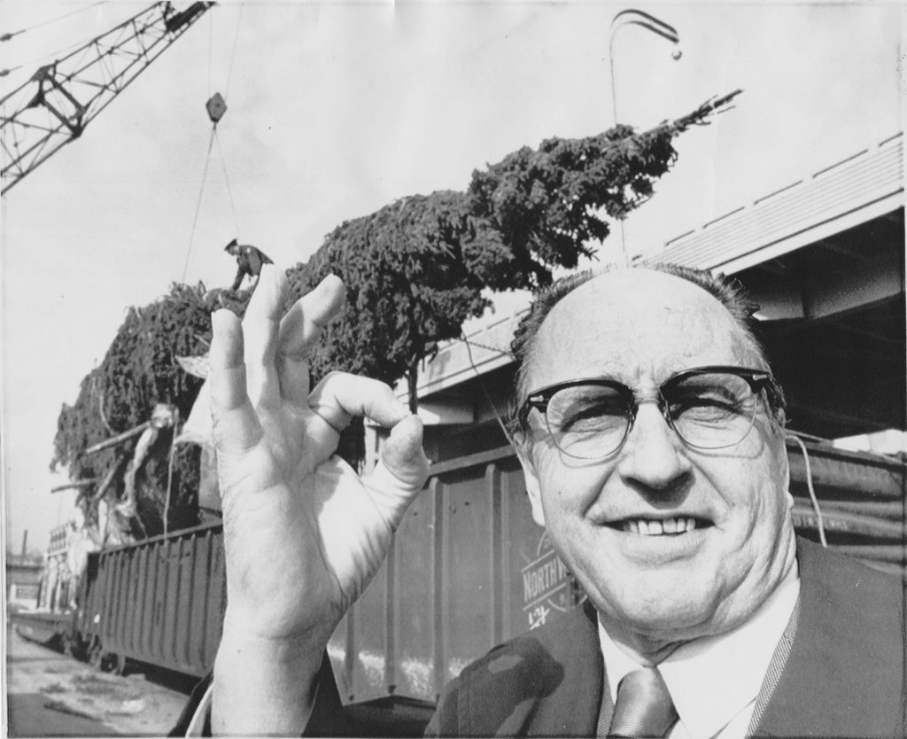
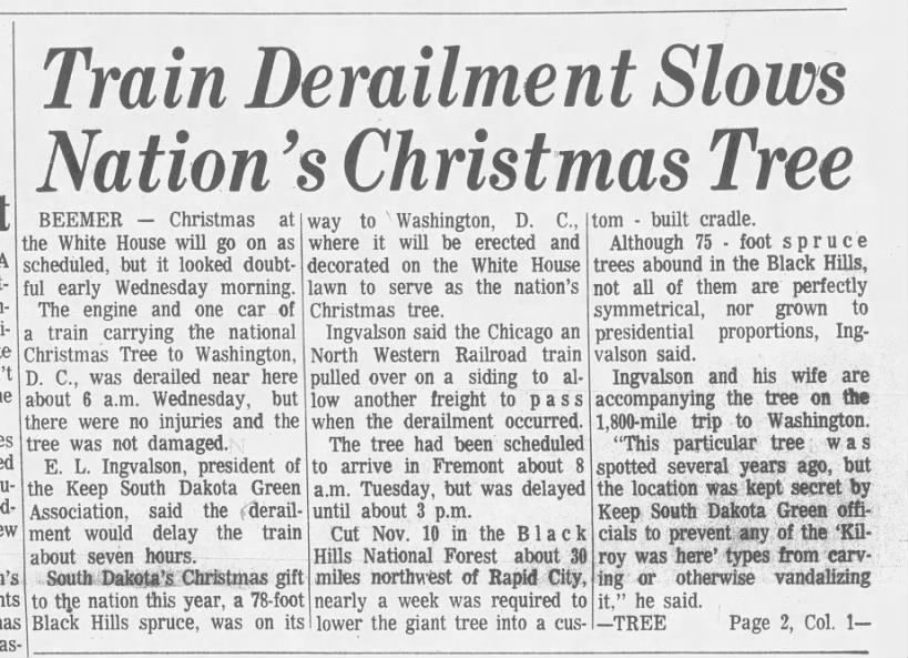
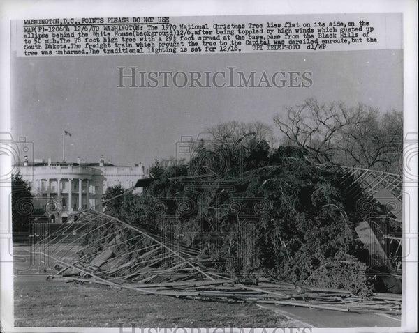
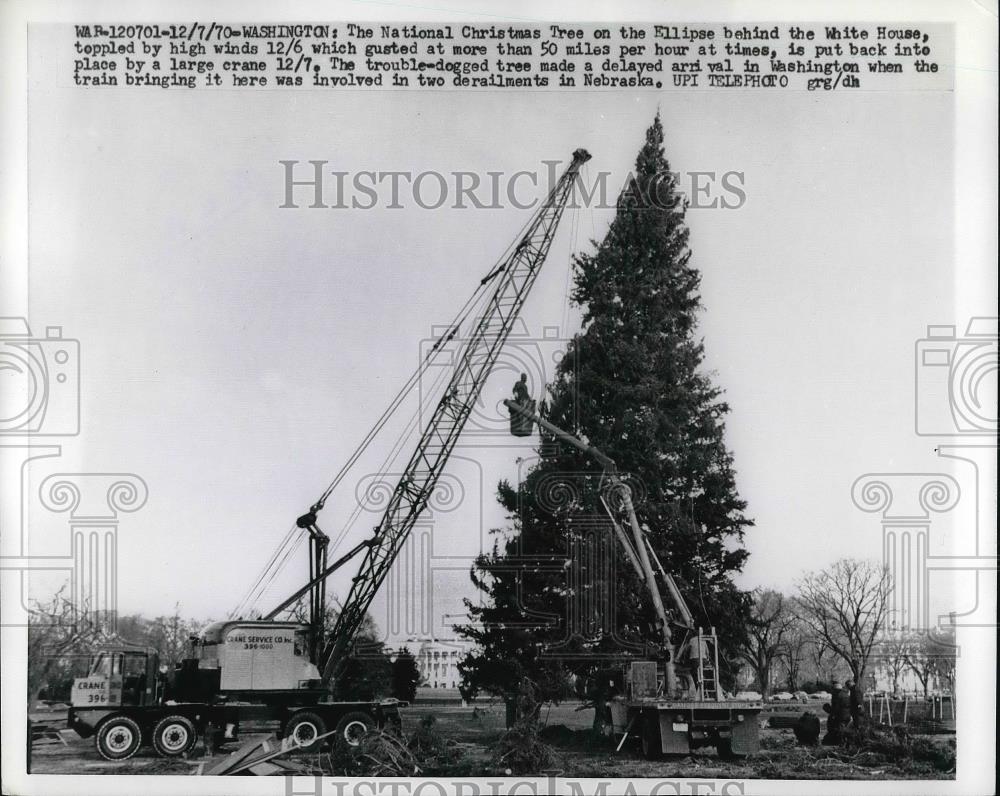
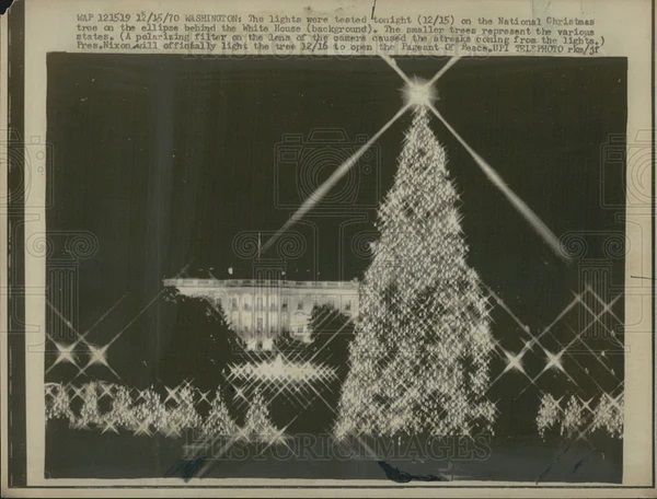
I stumbled on this image on eBay and had to snag it. Yes, I know it’s not great with “A-OK” Paddy taking up most of the frame, but these things are hard to come by so I’ll take what I can get. 🙂 Anyway, this depicts one of the most cursed shipments I’ve ever heard of on the Georgetown Branch.
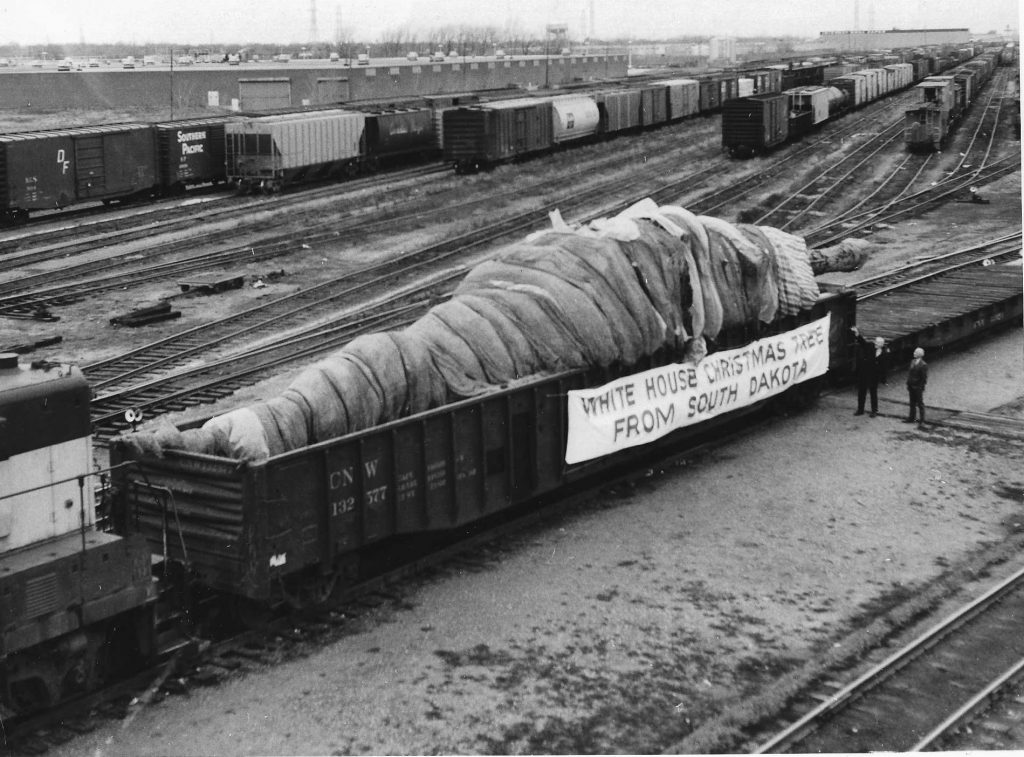
Since 1954 the National Christmas Tree was shipped via rail from destinations far and wide across America, often arriving in Georgetown to be transloaded by crane to a flatbed truck, driven across DC to the Mall, and erected in front of the White House for the Pageant of Peace. In 1970, a 78′ spruce in Nemo, South Dakota was selected. The tree was felled on Nov 10th and loaded onto a truck for the 22 mile journey to Rapid City, SD. There it was loaded onto Chicago North Western 132577, a 70-ton 65’6″ gondola, to begin its journey to the Nation’s Capital on Nov 16th.
Unfortunately the train derailed twice along the way. The first was two days after departing Rapid City near the town of Beemer, NE on Wed Nov 18th when the train took a siding and derailed.
The ill-fated train would derail again, this time outside of Pittsburg, PA. It arrived a bit early to DC and had to layover from November 24 to 27 on the US Army Map Agency siding, adjacent to the south entrance of Dalecarlia Tunnel. The train would continue on to Georgetown on November 28, where it would arrive in the yard to be transloaded onto a flatbed truck and head to its final destination, the National Mall, where it would be the centerpiece of the Pageant of Peace.
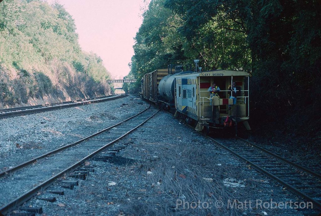
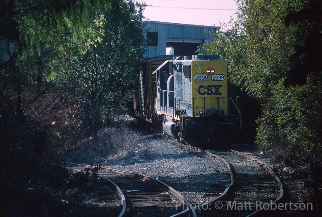
You read that right! Friend Matt Robertson shared two photos he shot himself back in October 1995 of local D782 (out of Jessup, MD by this time) working the Mason-Dixon Recycling plant, which of course used to be E.C. Keys; one of the oldest industries on the GB.
Matt writes: “Local is the D782 which operated out of Jessup on weekday afternoons. They worked industries on the Capital Sub and Metropolitan Sub as far west as Derwood in this era. Honestly I don’t know where the tank car came from. They are working the only place left on the GT branch by this time. I believe it loaded scrap paper and the two Railbox cars will be placed. I think maybe they pulled some cars out too but unfortunately these pics are the only two I took.”
Going back through my notes, to add some context to the Junction in the later years, I found a reference from the old Yahoo! Group where Christopher Parker wrote: “I first saw Georgetown Junction in 1981 and the coal trestle hadn’t been there for some time. It was an empty gravel lot, with only a concrete abutment and the bit of track that rested on solid ground. No switch. At that time the Mason-Dixon Recycling siding was gone too. It was Silver Spring Recycling then, and I remember seeing lots of Garden State Paper trucks up there. Sometime between 1982 and 1984 (?) the siding was relayed. The USGS topo map from 1971 shows the coal trestle, but that’s not terribly reliable.”
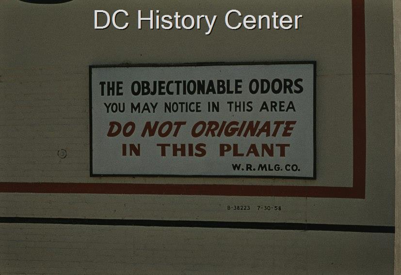
The Hopfenmaier rendering plant was a fixture on the Georgetown waterfront, producing constant odors of putrescence from 1873 to its demise in 1971. The Wilkins Rogers milling co across the street produced baking goods, receiving grains via rail and shipping out their mixes to local grocery stores and distributors via truck. In the 1950s and 1960s, as more and more of Georgetown became residential, folks were really starting to take notice of the incredible odors that permeated. Even when the plant wasn’t operating, on very hot days the caked-on slime and sludge from the plant would permeate the air along the waterfront. At some point around 1958, in protest, the Wilkins Rogers company had this sign created and mounted prominently on their mill where passing motorists on the Whitehurst Freeway could view it.
It read “THE OBJECTIONAL ODORS YOU MAY NOTICE IN THIS AREA, DO NOT ORIGINATE IN THIS PLANT. W.R.MLG. CO.”
In the late 1960s the government even used a sort of “smell-o-meter” to try to detect dangerous levels of chemicals. This failed, but eventually the Government “won” by buying out the Hopfenmaier company and razing it ca 1971.
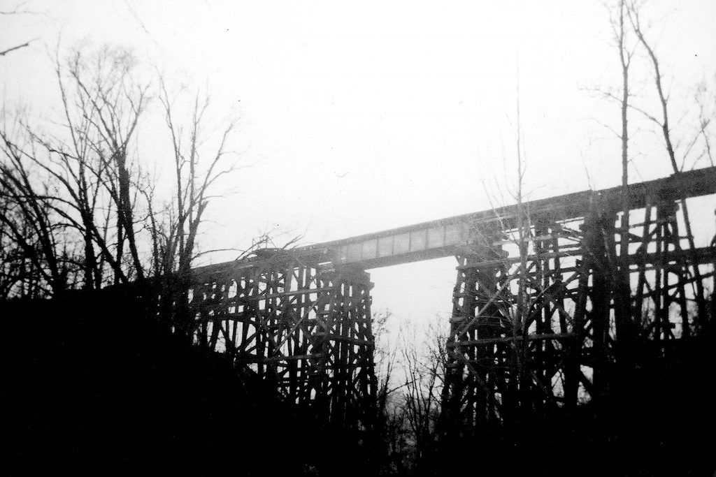
Earlier this week my model railroad club visited the historic B&O station in downtown Silver Spring, MD to assist in reassembling the model railroad there in the baggage room. The layout had recently been moved due to some HVAC work above. While there, the host gave me a tour of the building. As I entered the station master’s office, and was glancing around, a poster board with photos caught my eye. On it were a collection of images from the long time Silver Spring station agent, Robert Davis, taken in the late 1940s mostly depicting the railroad in the area; wrecks, maintenance work, etc. But there were two photos that jumped off the poster for me. First is this image of the Rock Creek Trestle:
The reason this image is so special to me, is it is perhaps the best image I’ve seen that shows the trestle as it stood from the mid 1940’s until the Hurricane Agnes flood of 1972 when the west side of the trestle collapsed, forever changing the bridge. The trestle was demolished in 2019 to make way for the Purple Line. We are looking north in the photo, trains to Georgetown would be heading to the left.
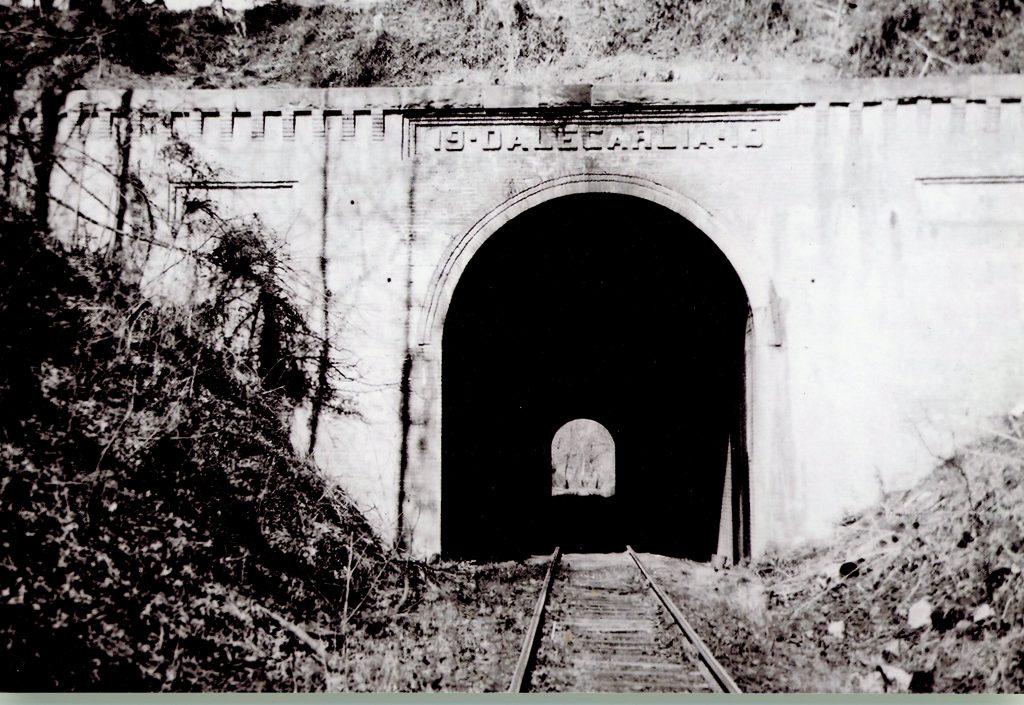
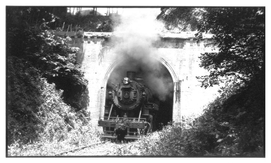
This image shows the south portal of the Dalecarlia Tunnel. For context, just eight months earlier the B&O ran an excursion for the MSME, taking Q-1c 4320 out for a grand trip to Georgetown and back.
It was a delight to stumble upon these two photos. I am always looking for images to fill in the gaps of understanding and context as I do my research and these are two that I’d never before seen. I am hoping that there are more!
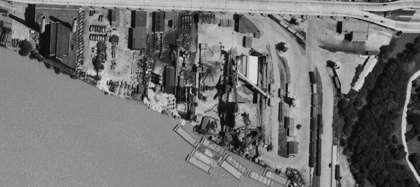
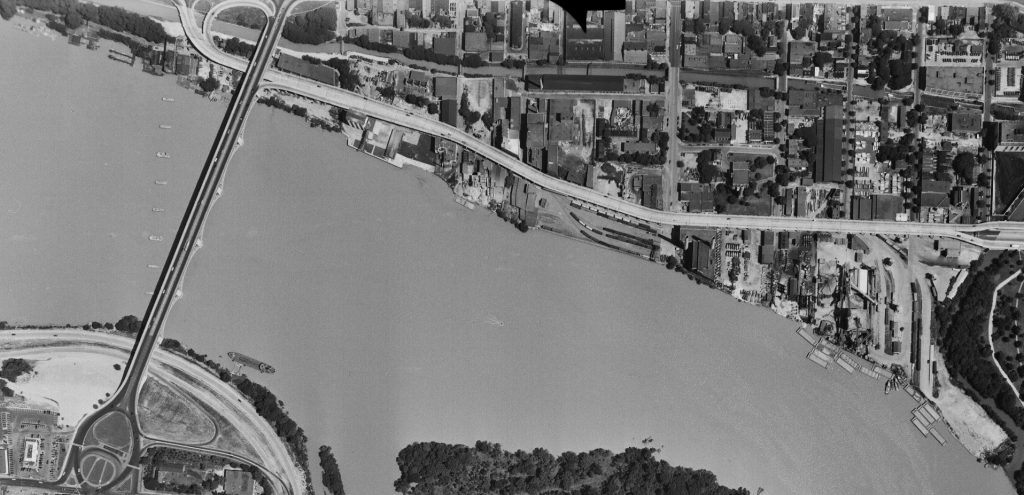
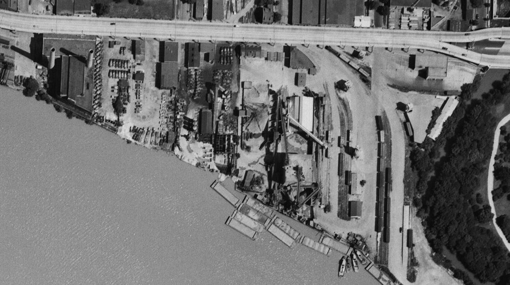
While going through some old notes today I found a link to the USGS EarthExplorer website with the note “will want to create a login.” This puzzled me, so I went ahead and explored the site a bit. After creating a login (a somewhat involved process) I was able to access some pretty wonderful imagery. There are aerials going back to 1949 and some of them are full of tremendous detail that I enjoyed exploring. First up is a crop of the downtown Georgetown area:
Let’s drill down a bit.
Starting on the east end of town, we see a relatively busy yard full of boxcars, covered hoppers and a gondola. The photo was taken in early July so it’s not surprising that there aren’t too many coal cars in the yard. The switching loco is visible at the top right next to the Whitehurst. Note the sharp shadows being cast. A fantastic view of the Smoot Sand & Gravel operation along with the cement vendors next door. It’s pretty incredible how many trucks they had! The idle power plant stands silent.
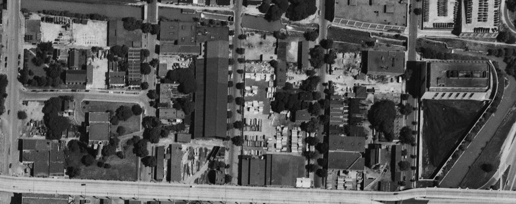
On the north side of Whitehurst we get a closer look at some industries. To the right is the West Heating Plant and its large coal yard. Next is the diminutive King & Sons Coal, still in service, but not long for the world. Next door is the massive sprawling W. T. Galliher Lumber complex with its large storage yard. They were a major customer of the Branch up to near its end. Further left is the massive Rosslyn Steel shed, with a freight car on the siding leading into the plant. Note that about four years prior the massive cement silo structure which sat along that curved track had been removed. Next is the DC Incinerator and then Wisconsin Ave.
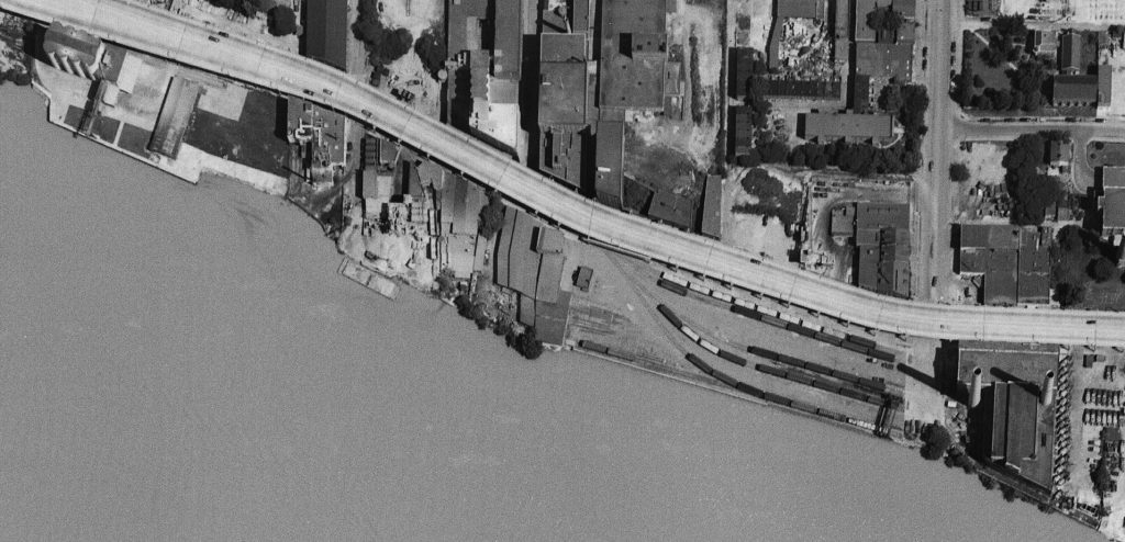
Now we get a nice look at the “new yard” which is really packed! From my eyes, it looks like there’s ten carloads of gravel (or other aggregate) sitting in the yard along with many boxcars and at least one gondola. On the left side of the yard are the two old MoW cars which housed equipment. The Maloney Concrete batch plant was across the street. Several other industries are visible as we move further to the west.
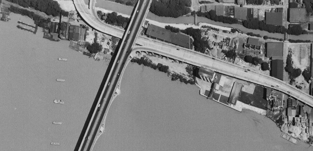
Finally, here’s the west end of the industrial area of town. Some great views of Lone Star cement, Key Bridge and all the layout of industries in this area. For sure all of these images will be indispensable when planning the Georgetown area of my model RR because this is pretty much exactly how I’d like to represent it! Very exciting to find this image set.
A recent eBay purchase. The caption on the back reads “B+O No. 6 “Capitol Limited” + P-1d 5038 4-6-2 Geo’town Jct, MD. 8:41AM 4-6-36 (all Pullman consist)” (Collection of Jay Williams & Big Four Graphics)
The view is looking North, and the train is headed for Union Station, DC. It has just passed under Talbot Ave (seen in the background) and the westbound siding for the Georgetown Branch with a boxcar sitting on it. Visible just in front of the pilot is the turnout (and lantern signal) for the Georgetown Branch. Note that at this point the long siding that extended from Silver Spring all the way to the siding with the boxcar on it where it rejoined the Westbound main. A phone call box is visible to the right.
A recent post by the Purple Line folks got me thinking about how much the Connecticut Ave crossing at Chevy Chase has changed in recent years. Here are a small collection of Google Map screenshots showing the conditions: