Recently Lance Mindheim visited Kelly Regan’s Georgetown Branch layout and did a very nice writeup on the project! I highly recommend you visit Lance’s blog and have a look. Bravo, Kelly!
Category Archives: Georgetown Branch related links
Georgetown Branch Clinic on YouTube
Back in September I gave a clinic at the Mid Atlantic Railway Prototype Modeler meet on the Georgetown Branch project. It was a blast! Last week I gave the presentation for the Operations Special Interest Group (OpSIG) and thankfully it has been recorded and posted to YouTube for all to enjoy.
Many thanks to the OpSIG team for having me!
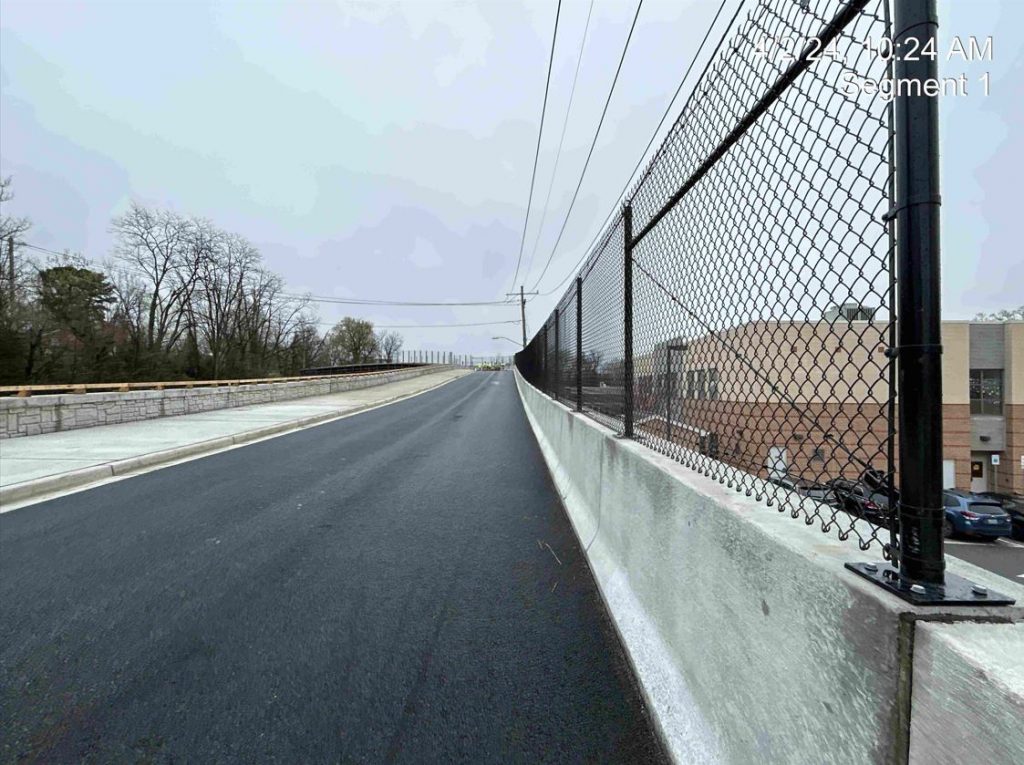
New Talbot Ave Bridge is Open
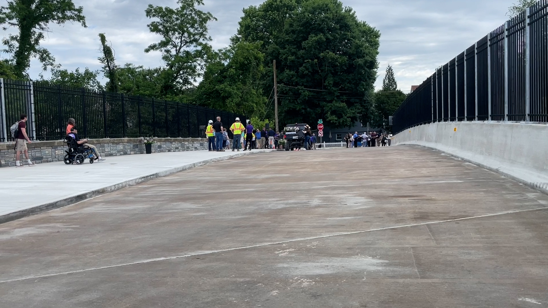
The new Talbot Ave bridge across the Metropolitan Branch at Georgetown Jct has officially opened.
https://x.com/MCDOTNow/status/1795569974876270652
1951 Georgetown Aerial Images
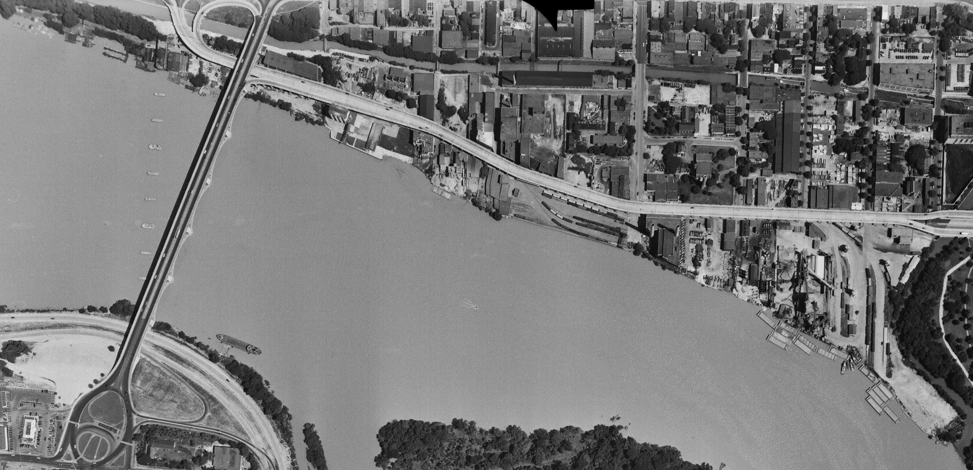
While going through some old notes today I found a link to the USGS EarthExplorer website with the note “will want to create a login.” This puzzled me, so I went ahead and explored the site a bit. After creating a login (a somewhat involved process) I was able to access some pretty wonderful imagery. There are aerials going back to 1949 and some of them are full of tremendous detail that I enjoyed exploring. First up is a crop of the downtown Georgetown area:
Let’s drill down a bit.
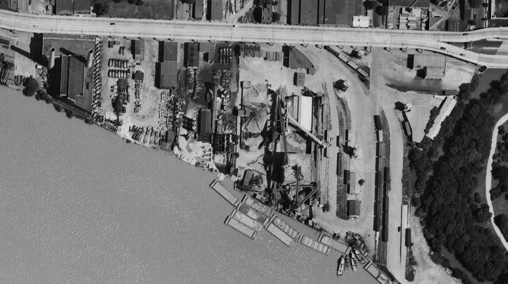
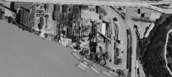
Starting on the east end of town, we see a relatively busy yard full of boxcars, covered hoppers and a gondola. The photo was taken in early July so it’s not surprising that there aren’t too many coal cars in the yard. The switching loco is visible at the top right next to the Whitehurst. Note the sharp shadows being cast. A fantastic view of the Smoot Sand & Gravel operation along with the cement vendors next door. It’s pretty incredible how many trucks they had! The idle power plant stands silent.
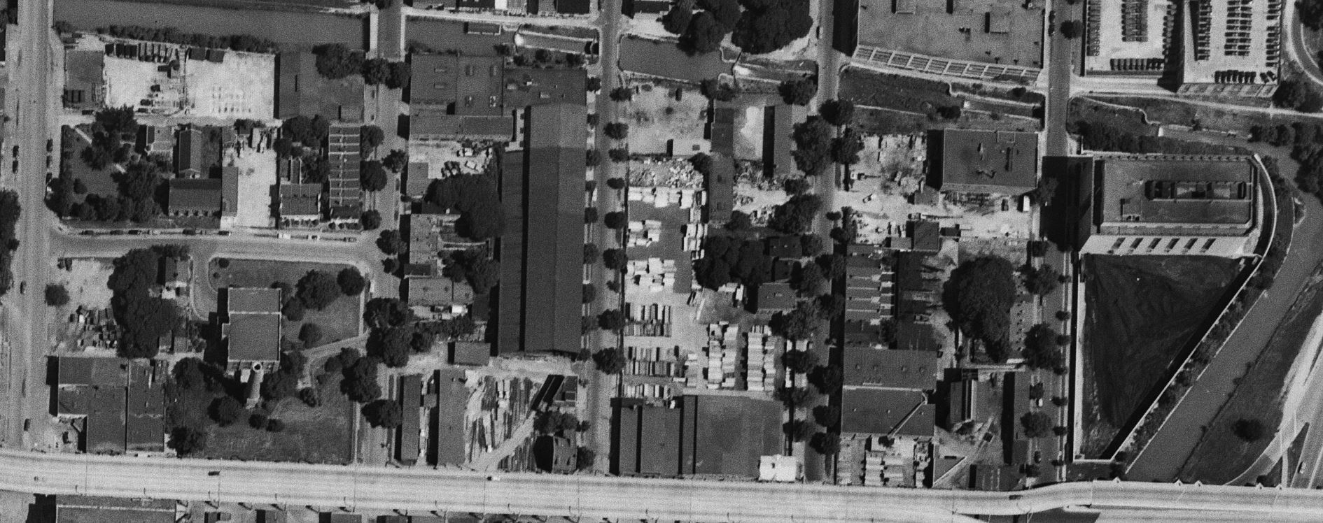
On the north side of Whitehurst we get a closer look at some industries. To the right is the West Heating Plant and its large coal yard. Next is the diminutive King & Sons Coal, still in service, but not long for the world. Next door is the massive sprawling W. T. Galliher Lumber complex with its large storage yard. They were a major customer of the Branch up to near its end. Further left is the massive Rosslyn Steel shed, with a freight car on the siding leading into the plant. Note that about four years prior the massive cement silo structure which sat along that curved track had been removed. Next is the DC Incinerator and then Wisconsin Ave.
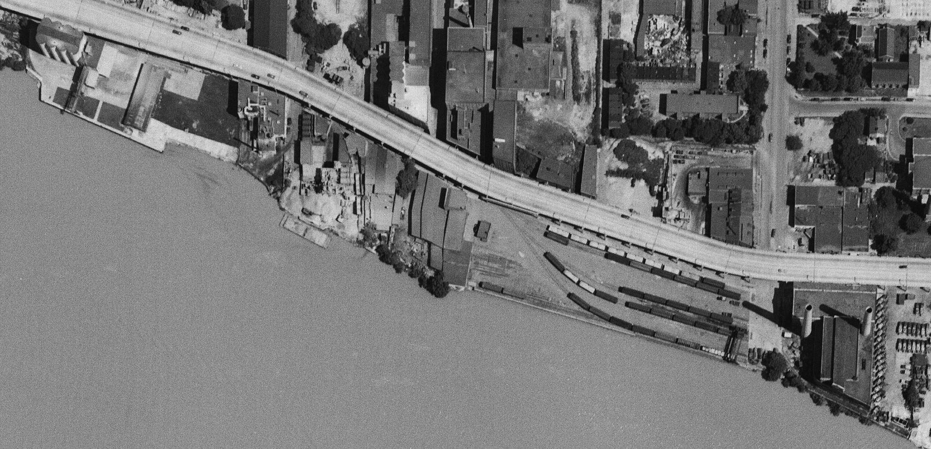
Now we get a nice look at the “new yard” which is really packed! From my eyes, it looks like there’s ten carloads of gravel (or other aggregate) sitting in the yard along with many boxcars and at least one gondola. On the left side of the yard are the two old MoW cars which housed equipment. The Maloney Concrete batch plant was across the street. Several other industries are visible as we move further to the west.
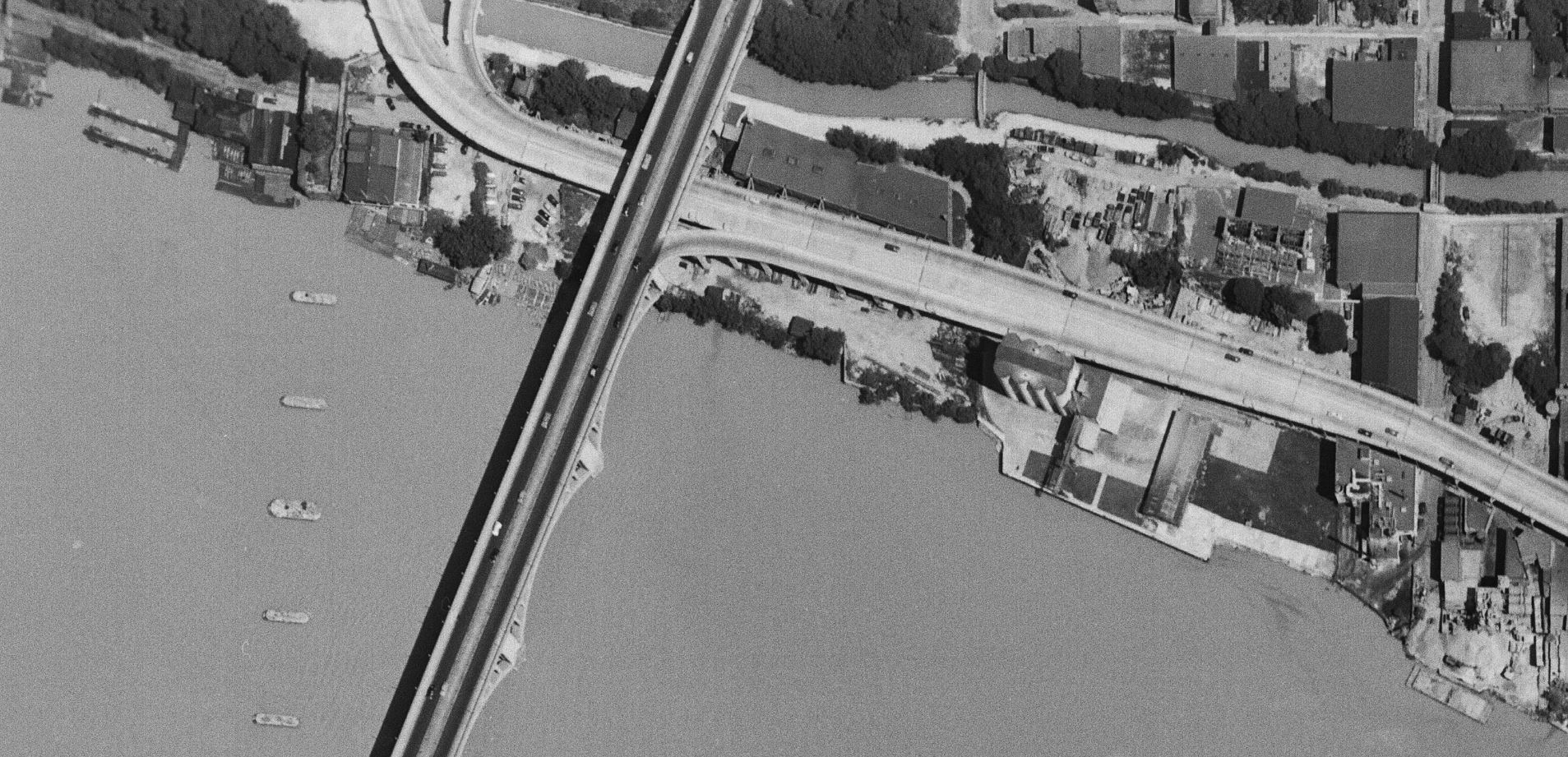
Finally, here’s the west end of the industrial area of town. Some great views of Lone Star cement, Key Bridge and all the layout of industries in this area. For sure all of these images will be indispensable when planning the Georgetown area of my model RR because this is pretty much exactly how I’d like to represent it! Very exciting to find this image set.
May 13, 1924: Flooding in Georgetown
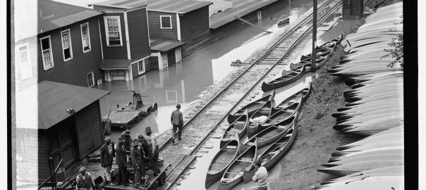
Stumbled across this photo on eBay earlier this week (above) and it reminded me that I’ve been sitting on a handful of really fascinating images I found on the Library of Congress site capturing the flood of May 13, 1924. Like so many things on eBay it’s far from rare or original, but rather just an overpriced print of a Library of Congress file that you can snag at high-res via the website. Pro tip – before you purchase that print, search the LoC thoroughly to possibly save yourself some dough.
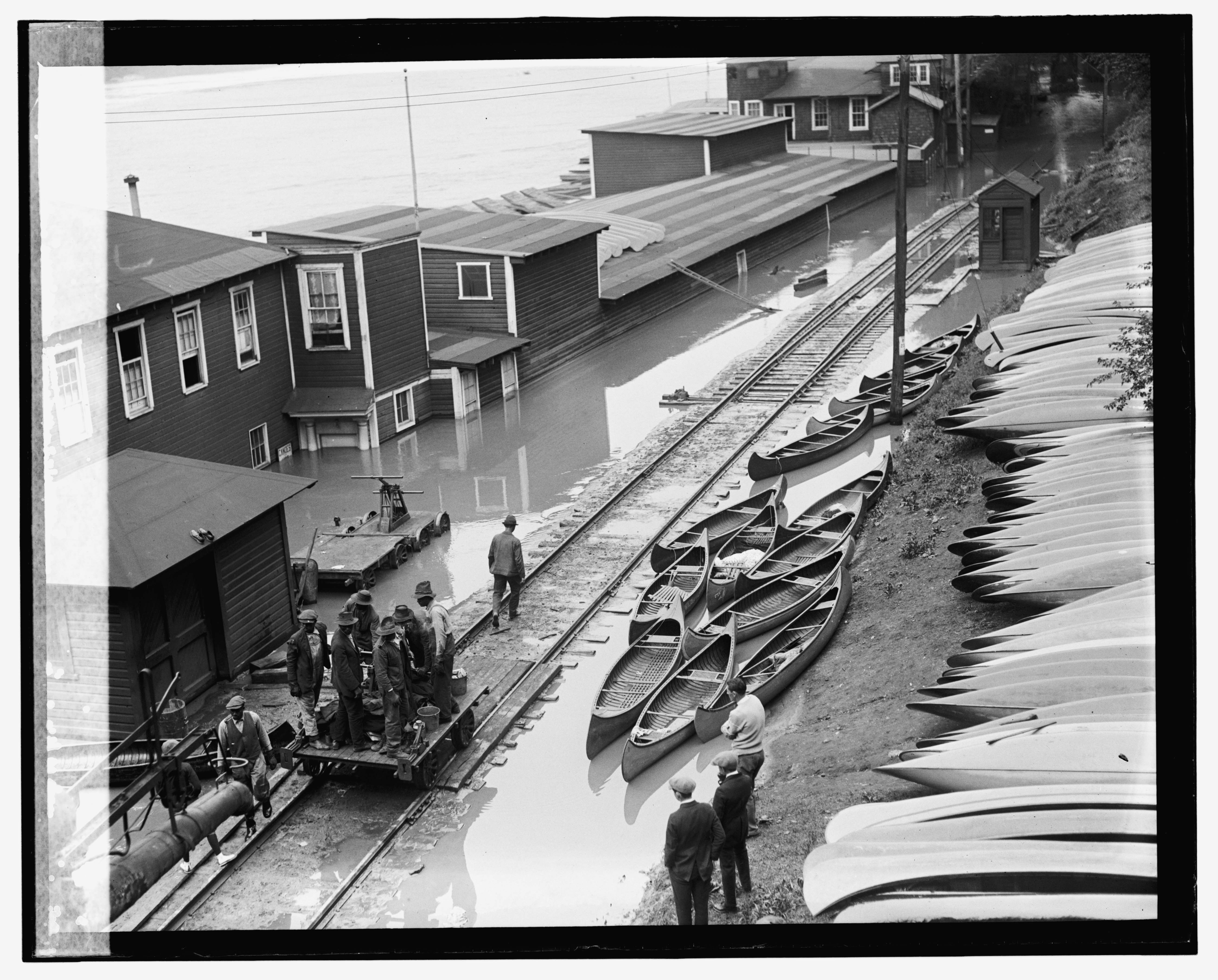
The subject matter is interesting because it shows not only the scale house in Georgetown, but also a hand cart full of railroad employees, no doubt headed out to inspect the line as the waters recede. Note the jacks and other tools they have on the cart. They would have been met with some troubling finds. There are many photos on the LoC – here is a selection of relevant ones I found interesting. In the following image I believe it is the same crew; note the lighter color pants on the gentleman standing at the back left of the hand cart, visible in both photos. Note the detail of the scale and scale house as well as all the equipment around the section shed.
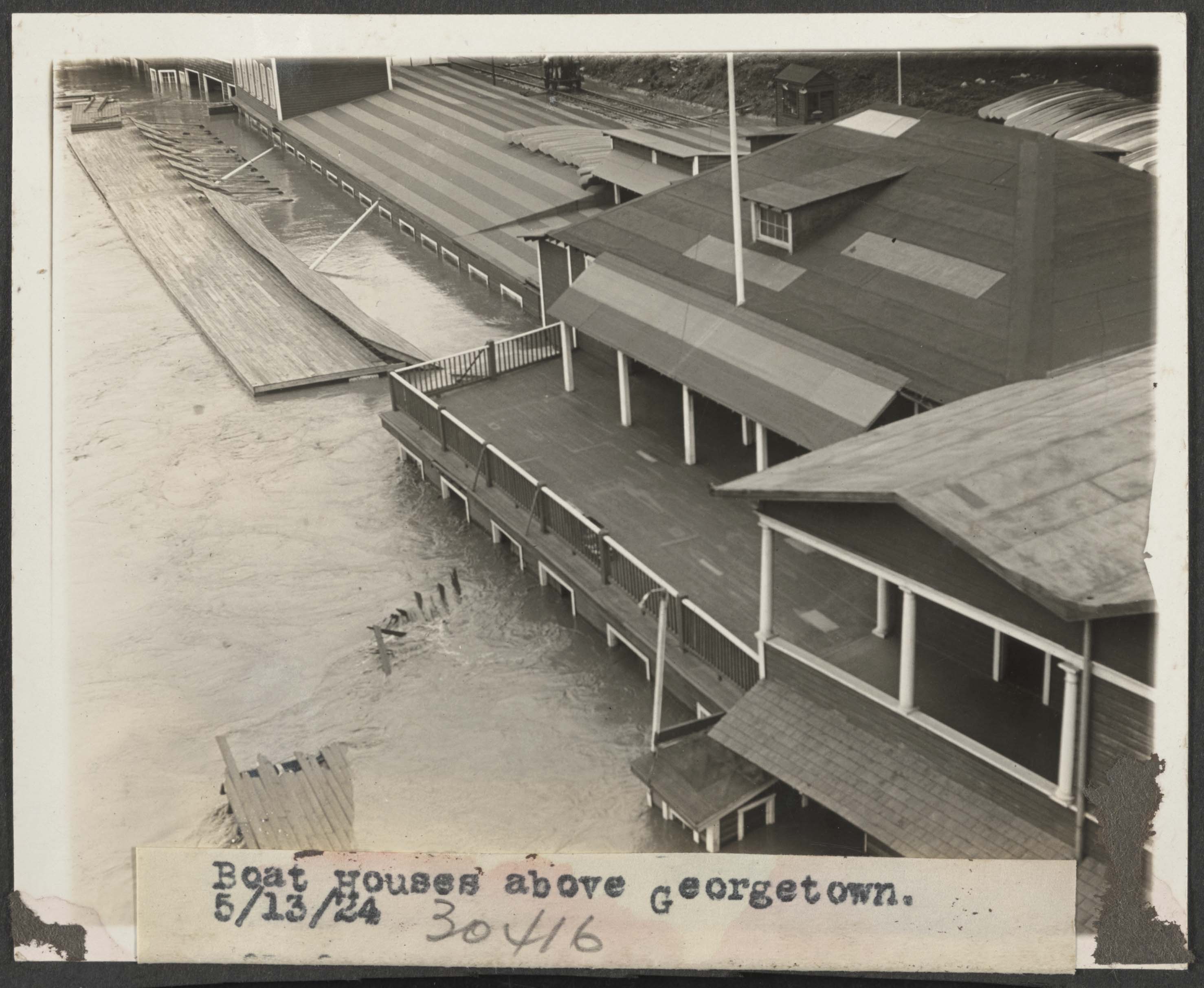
Flood. , 1924. Photograph. https://www.loc.gov/item/2016837495/.
A neat thing I noticed, if you look really closely in the top right, you’ll see a B&O steam loco doing some switching, with someone sitting on the front pilot. It is likely moving the freight cars you’ll see in some of the next photos. Pretty cool!

Flood. , 1924. Photograph. https://www.loc.gov/item/2016837490/.
Eric Hansmann has a wonderful set of resources for the 1926 B&O freight car fleet: https://designbuildop.hansmanns.org/bo-freight-car-fleet-of-1926/
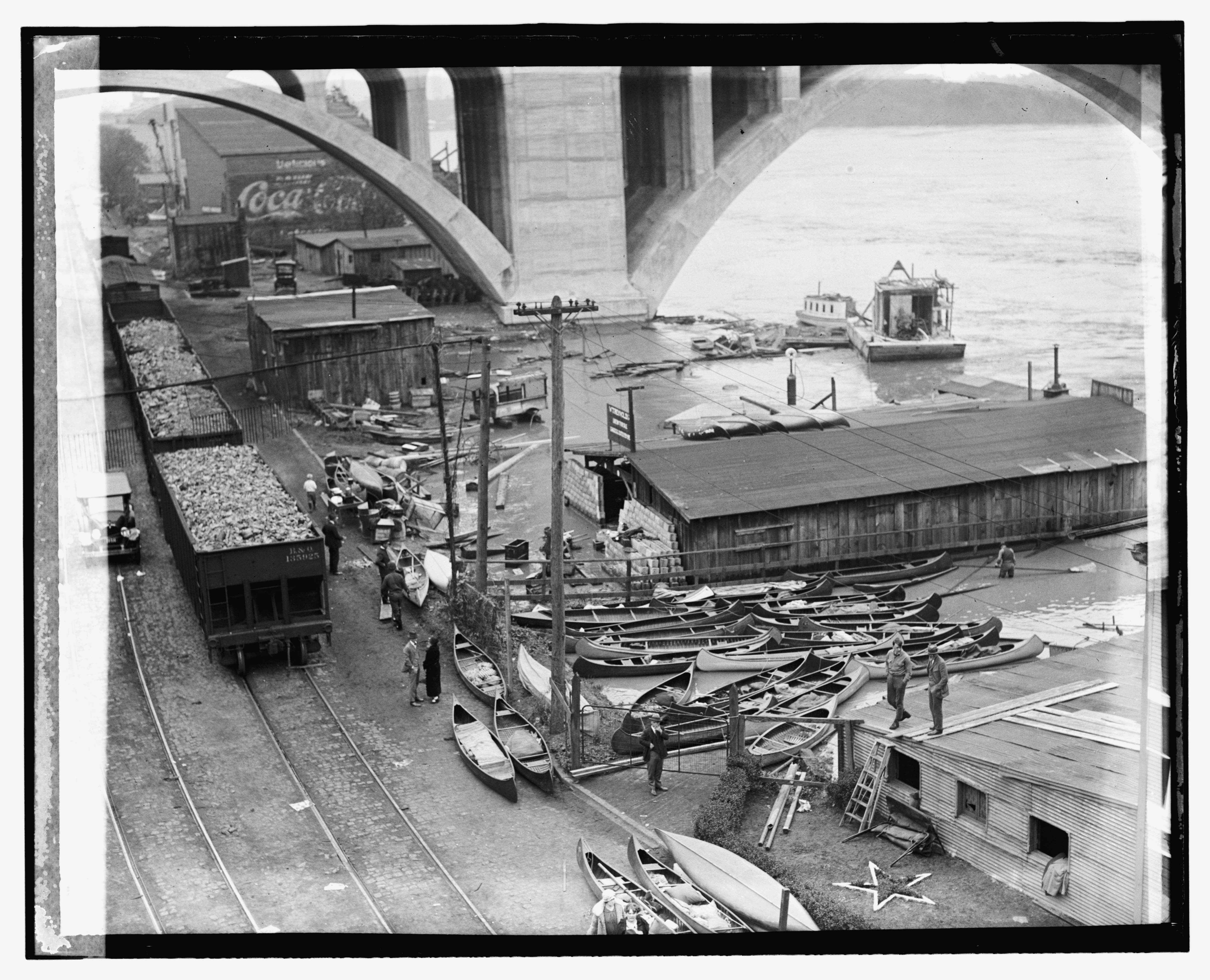
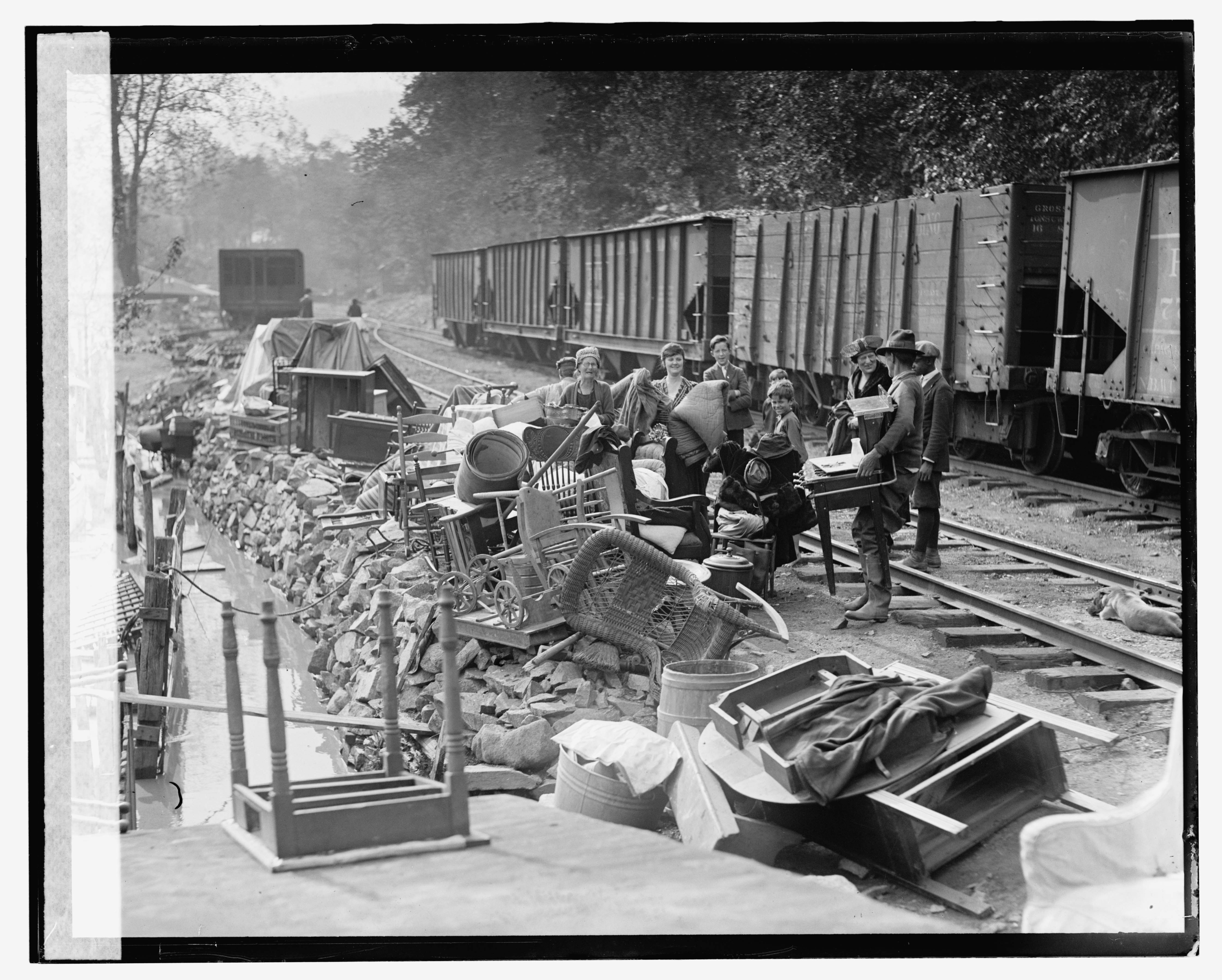
B&O Hopper 135925 is a class W-1 (135000-135999) 2511 cu/ft capacity, blt 1910. A bit further down the line, just past the boathouses and at the west end of the long passing siding, we come to another string of hoppers and some folks who have rescued their belongings from the floodwaters. The shoreline of the Potomac was absolutely littered with small shacks and cabins that folks had to escape the downtown hustle-and-bustle. Stretching all the way up to Chain Bridge, these shacks were a fascinating part of the history of Georgetown.
Flood. , 1924. Photograph. https://www.loc.gov/item/2016837488/.
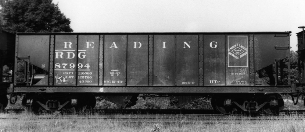
Attempting to ID the freight cars, it looks like from the right to left we have:
- 1: Philadelphia & Reading 77xxx – 34′ 55-ton arch bar trucks, 1880 cu.ft. capacity hopper, class HTh (nos 74500 – 78999), built 1916-17 by Standard Steel Car. Approx. 4495 on the roster in 1924. Detailed roster info from RT&HS. Builders photo from Kinkaid collection here and here.
- 2: Philadelphia & Reading 30′ 40-ton, 1485 cu.ft. capacity hopper, class HTk (nos 61000 – 61863), being rebuilt in 1921 from HTb (blt 1902) series 60000-60999 by AC&F. Note unusual Fox Pressed Steel Trucks. In 1924 there were 854 on the roster. Detailed roster info from RT&HS Pic from Kinkaid collection.
- 3 & 4: Based on the distinctive side sills, these appear to also be Philadelphia & Reading class HTf hoppers, but slightly modified from as-built images I found. The HTf (86000-89999) was a 34′, 55 ton, 1843 cu.ft. capacity car with arch bar trucks. They were built in four batches from 1910-11 and again in 1913. In 1924 there were 3970 on the rails. Likely after shopping they received grab irons on the sides as well as some sort of bracket/brace above each bolster on the side sill. Early photos do not show these brackets. Here are some builders photos from the Kincaid collection one two three. Here is a photo of one with the brackets from Shamokin Div website. Detailed roster info from RT&HS.
- 5 & 6 These cars are just too far off for me to get a read on what they are.
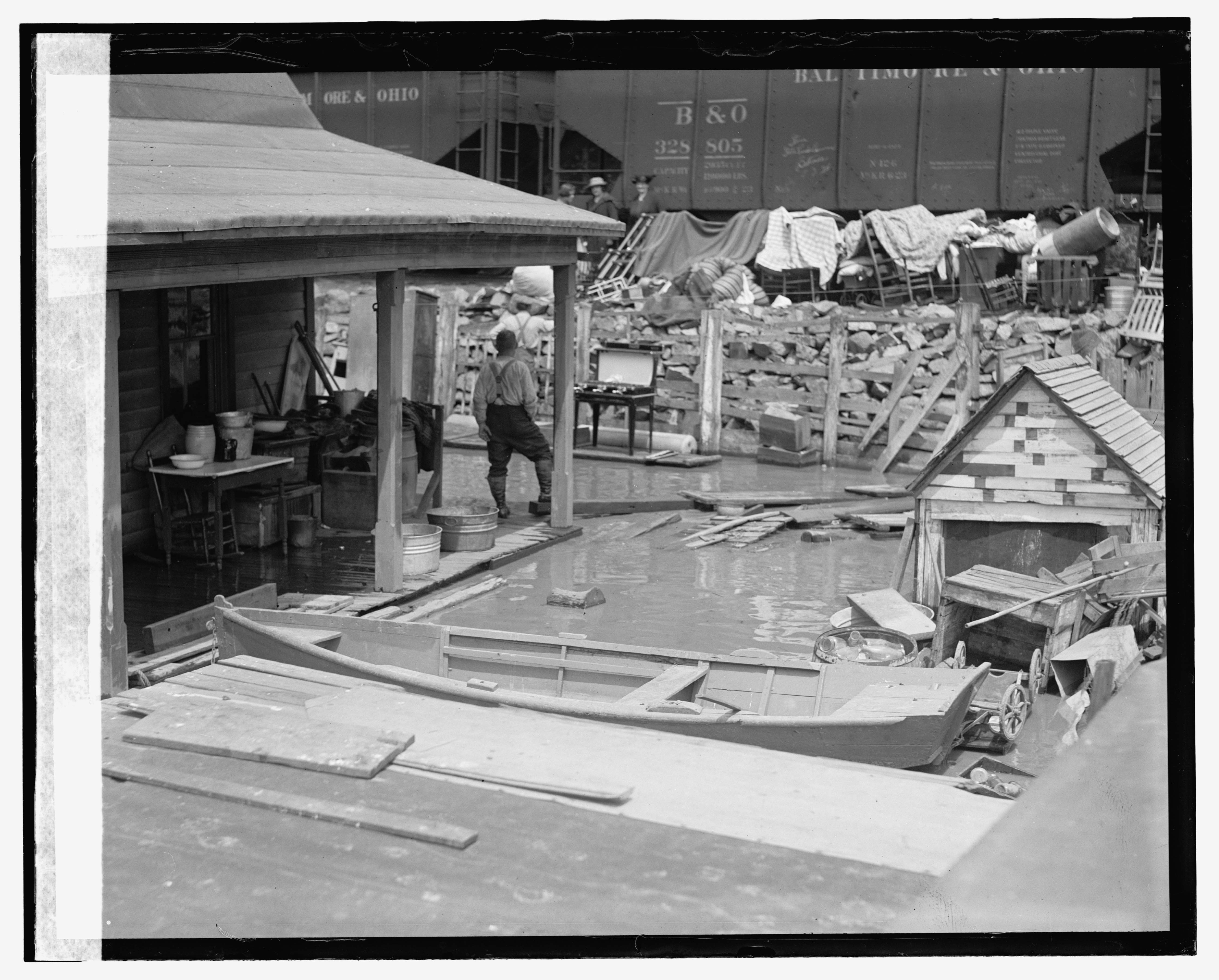
I believe the cars are actually being moved. Why? Because in this next photo, which is of the same subjects, there are different cars in view:
Flood. , 1924. Photograph. https://www.loc.gov/item/2016837496/.
Two B&O Hoppers in view:
- 1: BO 328805, class N-12g (327000-331999) (4998 cars) 1800 cu.ft capacity, blt 1923.
- 2: BO ? – appears to possibly be another N-12 class.
Flood. , 1924. Photograph. https://www.loc.gov/item/2016837486/.
Flood. , 1924. Photograph. https://www.loc.gov/item/2016837494/.
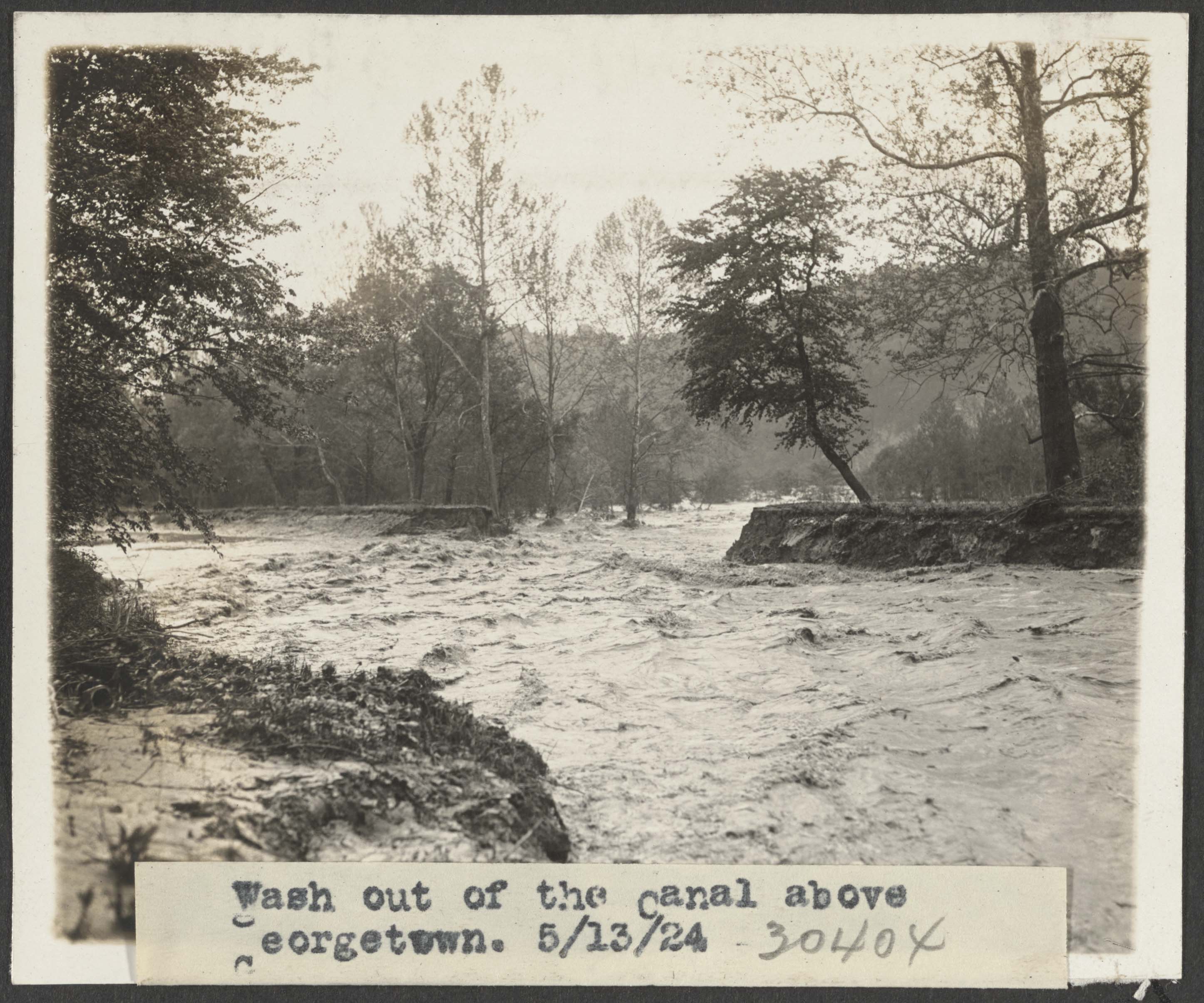
The B&O RR had gained a controlling stake in the C&O Canal, in 1890 it was put into receivership. The B&O wanted to prevent other railroads from purchasing the right of way. A history of damaging floods and maintenance headaches meant that the canal was holding on for dear life but thanks to many unusual years of relatively minor flood issues, the canal soldiered on. The B&O had to maintain it just enough to keep it in service, which they did. That is until 1924.
The first flood of 1924 came in March but it was largely focused on Northern sections of the Canal. Repairs were not too overwhelming and were undertaken by contractors for the B&O. The flood that occurred two months later in May was another story, and proved to be too much for the Canal to survive in the long run. By August of that year, the Canal had largely been shut down save for some sections kept open for various contract obligations.
Flood. , 1924. Photograph. https://www.loc.gov/item/2016837498/.
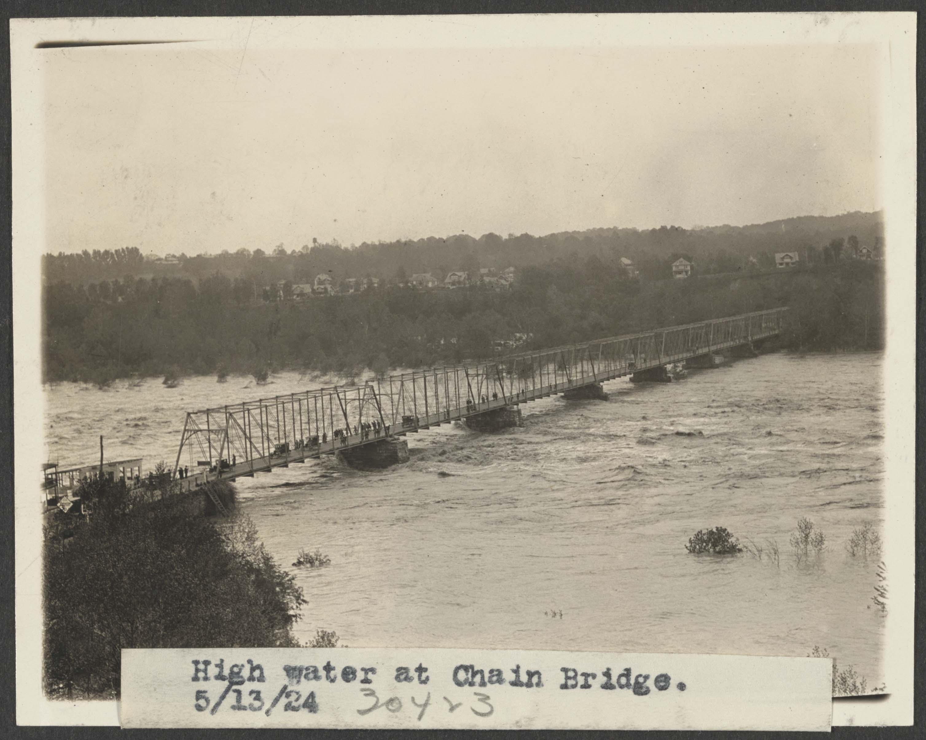
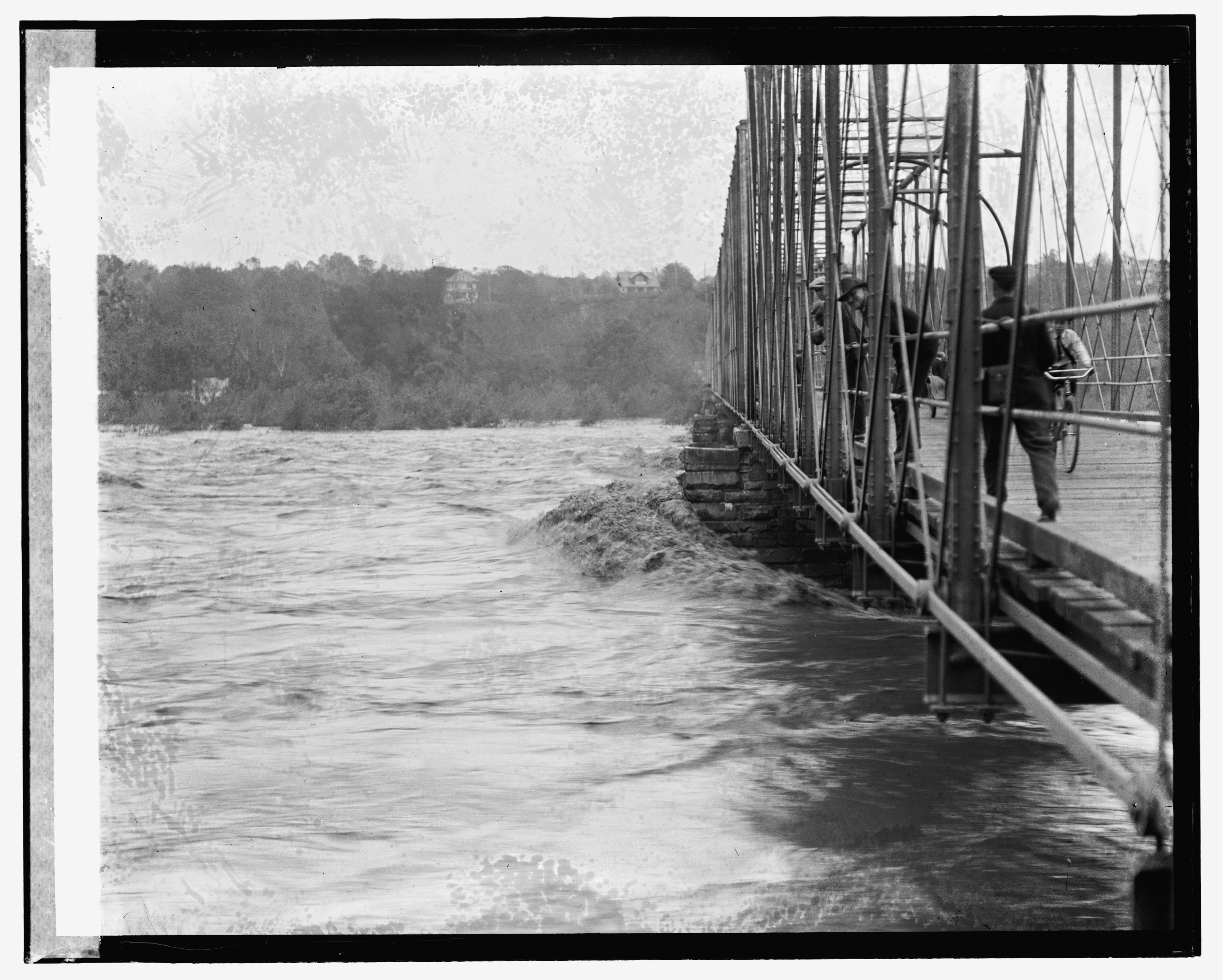
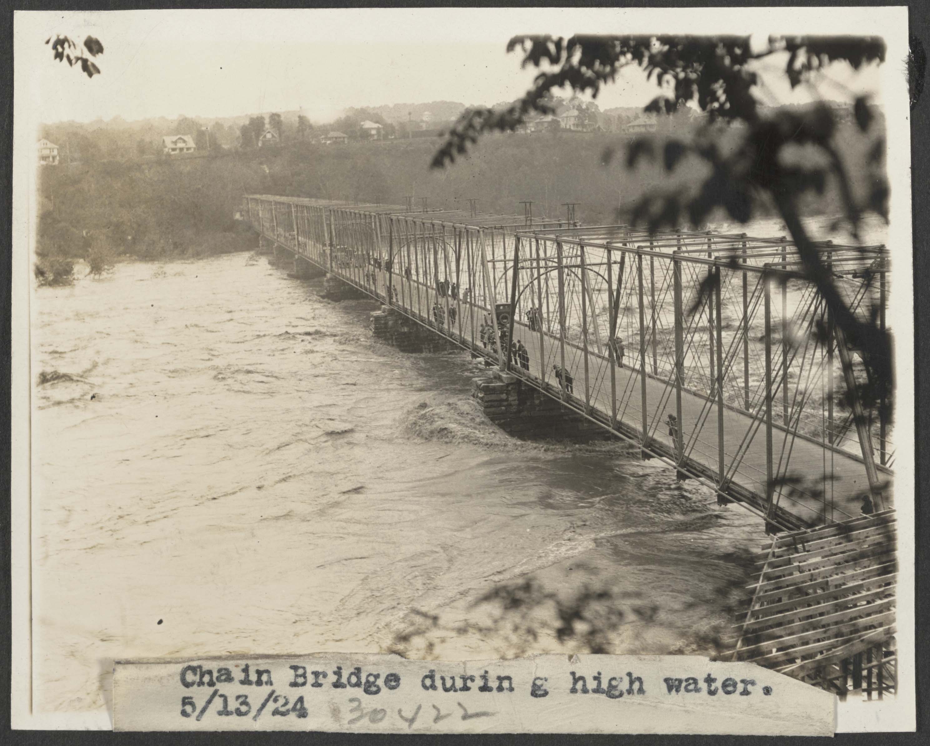
There were many historic floods on the Potomac, and many which affected operations on the Georgetown Branch. In fact, in many instances, the flooding dictated the survival of the line – remember famously the engine that was stranded in Georgetown after the devastating flooding from Hurricane Agnes, which toppled the Rock Creek trestle and damaged many waterfront industries. The 1924 flood, in particular, was interesting because afterwards the B&O was finally able to neglect the waterway, performing only minor maintenance on it until selling to the National Park Service in the late 1930s.
More LoC photos here: https://www.loc.gov/search/?in=&q=11200+flood&new=true
A fantastic history of the C&O Canal and flooding, published by the National Park Servicehttps://www.nps.gov/parkhistory/online_books/choh/trouble.pdf

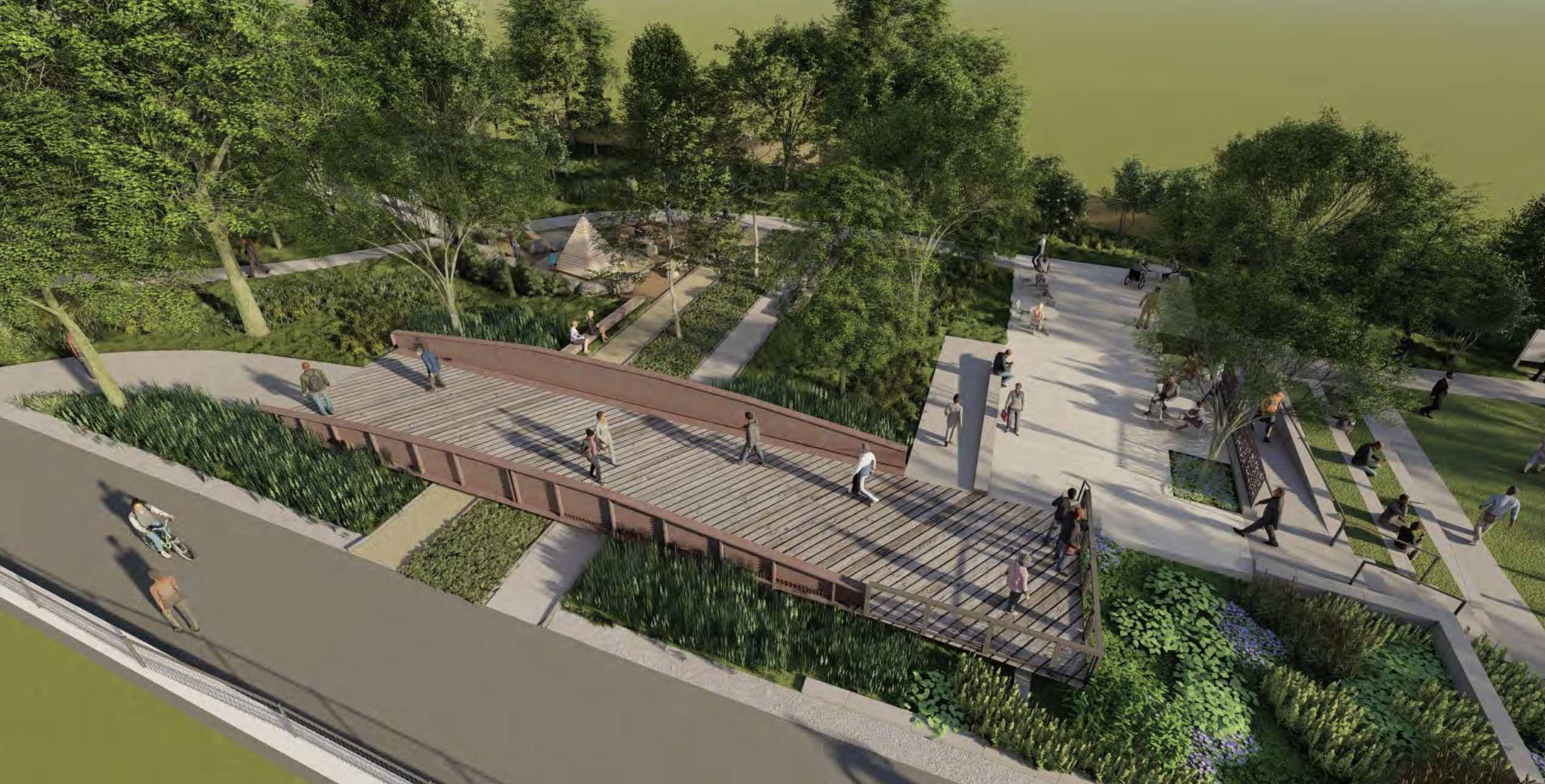
Talbot Avenue Bridge Preservation and Park
One of the great things from all of the Purple Line destruction/construction is the preservation of the historic Talbot Ave bridge that once spanned the Metropolitan Branch at Georgetown Junction. As you may recall, back in 2019 the bridge was removed in preparation for the installation of the additional two tracks and a new overpass. The County planned to save the bridge for a future installation in a park, and we finally have some renderings of what it may look like.
At the Lyttonsville Park community meeting, a slide presentation outlined the current designs and status. Link to the slide presentation: https://montgomeryparks.org/wp-content/uploads/2020/11/Lyttonsville-community-3-2023-0330-web-r.pdf
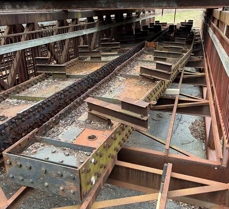
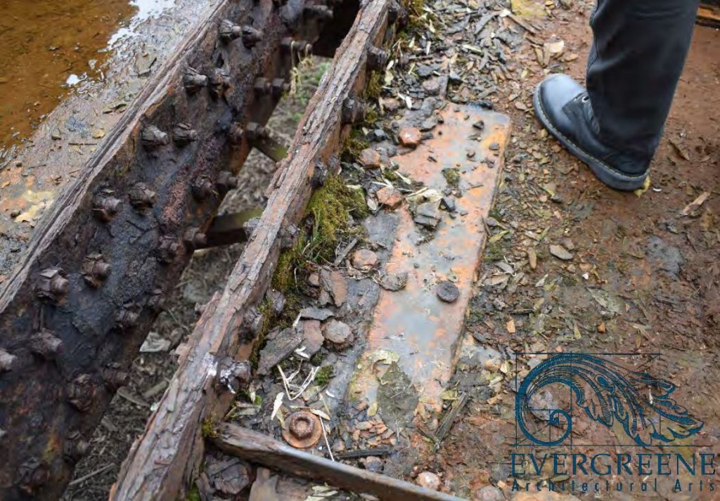
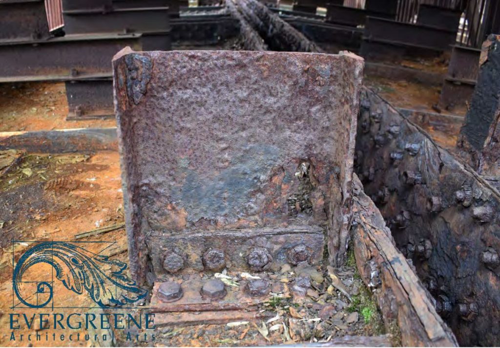
In the presentation are several really neat photos of the current state of the bridge. The girders, one of the only parts of the original 1916 construction, are preserved, sitting atop the pedestrian bridge sections that once topped the Rock Creek trestle. Not sure of the current location; probably in a Purple Line storage yard.
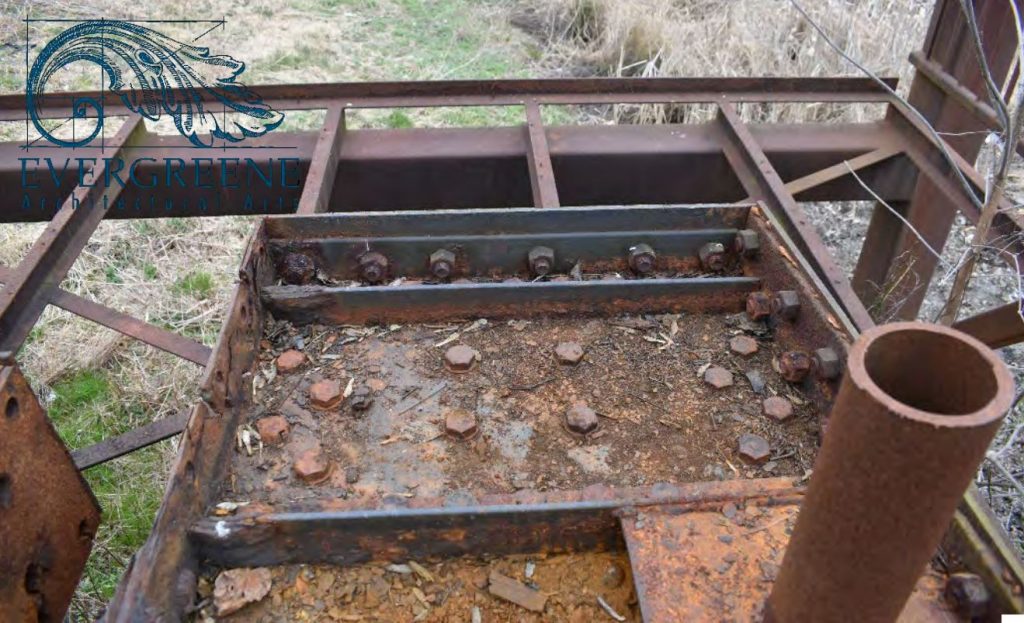
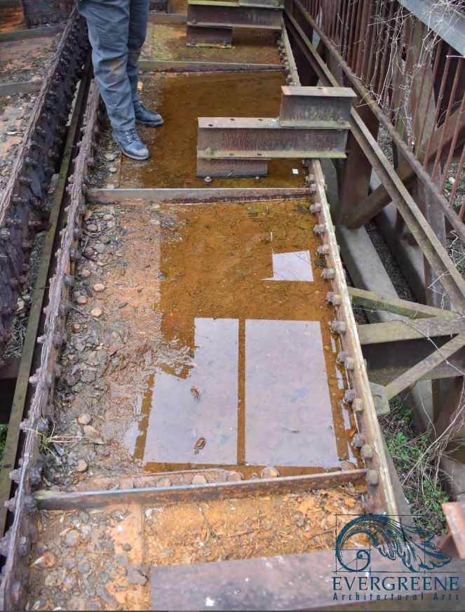
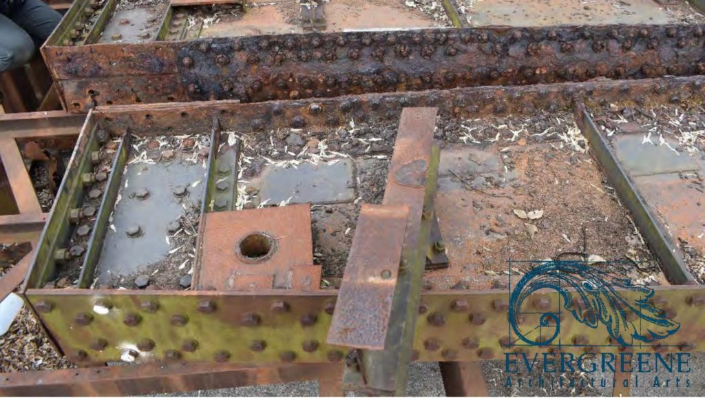
A hundred years of weather, deferred maintenance and punishment has not been kind to the old steel, and it shows. I’m so grateful it will be refurbished and preserved; a small piece of railroad history that will continue to be enjoyed for generations to come. I’ll take it. Plus, I can actually go and get more measurements if I need them! 🙂
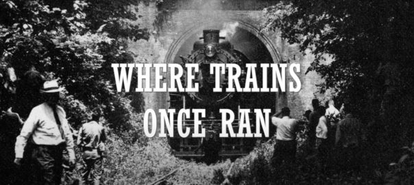
Where Trains Once Ran; A Georgetown Branch Documentary
Well, this was a special project that I can finally share with everyone. A few months back I was contacted by a Georgetown University graduate student who was putting together a brief documentary on the Georgetown Branch; specifically its history and transformation into a rail trail. We initially shared stories and historic reference material and eventually I was interviewed on-camera at home. I think the project turned out brilliantly and my hats off to Evan, the director, producer, writer – well, everything! He did an awesome job capturing the entire story of the Branch. I hope you enjoy!
Brief Shots of Georgetown in 1963
I’ll take what I can get. Here’s a very brief shot of Georgetown, looking toward the Smoot Sand & Gravel plant and Key Bridge. Pretty cool! (Fast forward to 2:56 if it doesn’t begin at that mark.)
And here’s another from the 1940s: (Starts at 4:42)
Another from 1940: (Starts at 0:51)
On Line: Briggs Filtration Co. & Hot Shoppes
In my seemingly never ending quest to discover and decipher industries that were served by the B&O on the Georgetown Branch I have often had to put pins in things until more information comes to light or I have the time to delve deeper into said customers. A few months back a chance photo on Facebook did just such a thing; opened the door to some brand new views of industries that I know very little about.
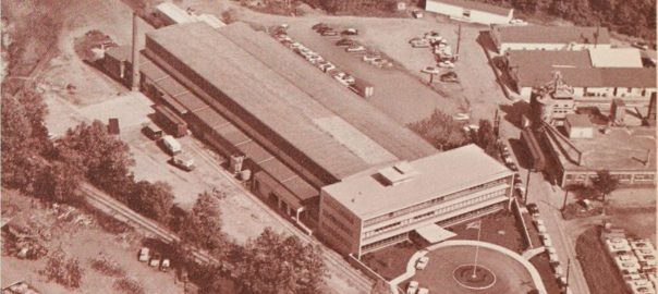
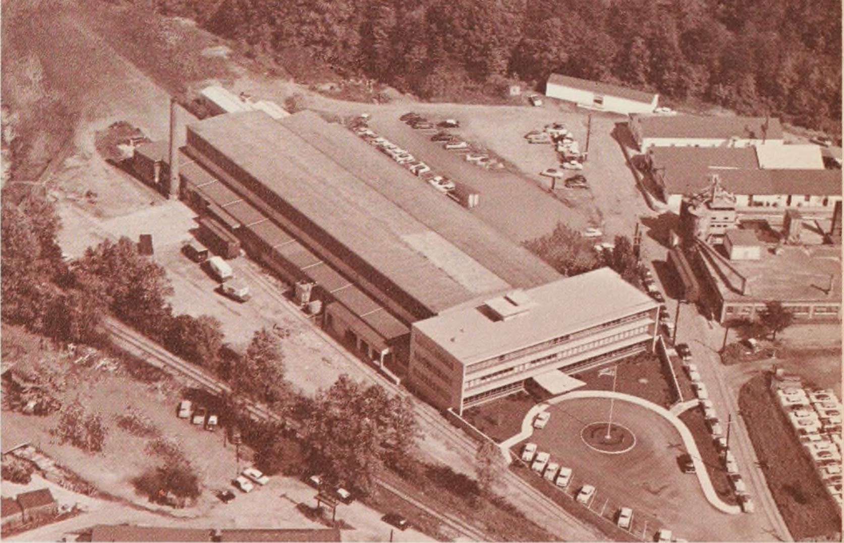
We’re going to take a look at two industries; The Briggs Filtration Co. (aka Briggs Clarifier Co.) and Hot Shoppes (which eventually became Marriott Corp.) which were located next door to one another in Bethesda, MD at River Road, yet were served by completely separate sidings. Let’s start with an overhead view from Historic Aerials, ca 1949:

Briggs Clarifier / Briggs Filtration Co.
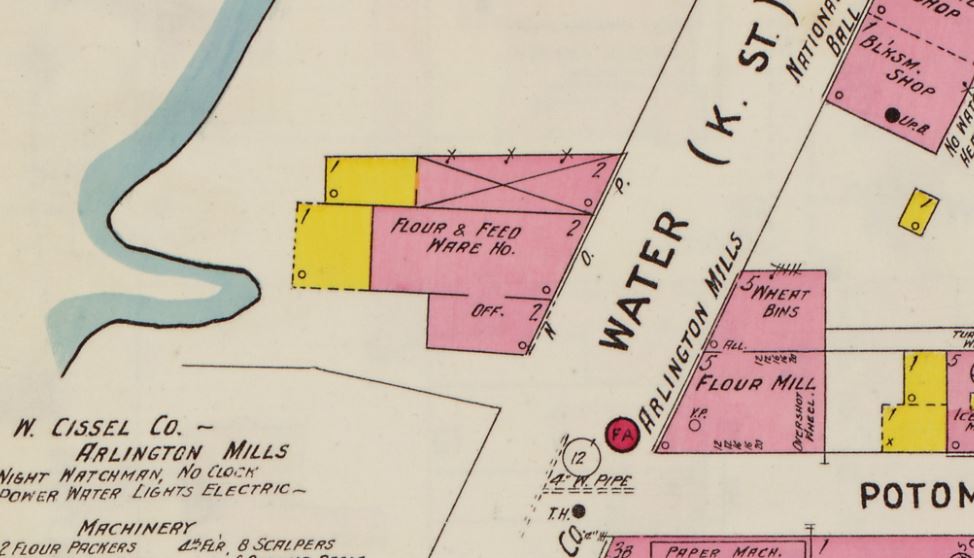
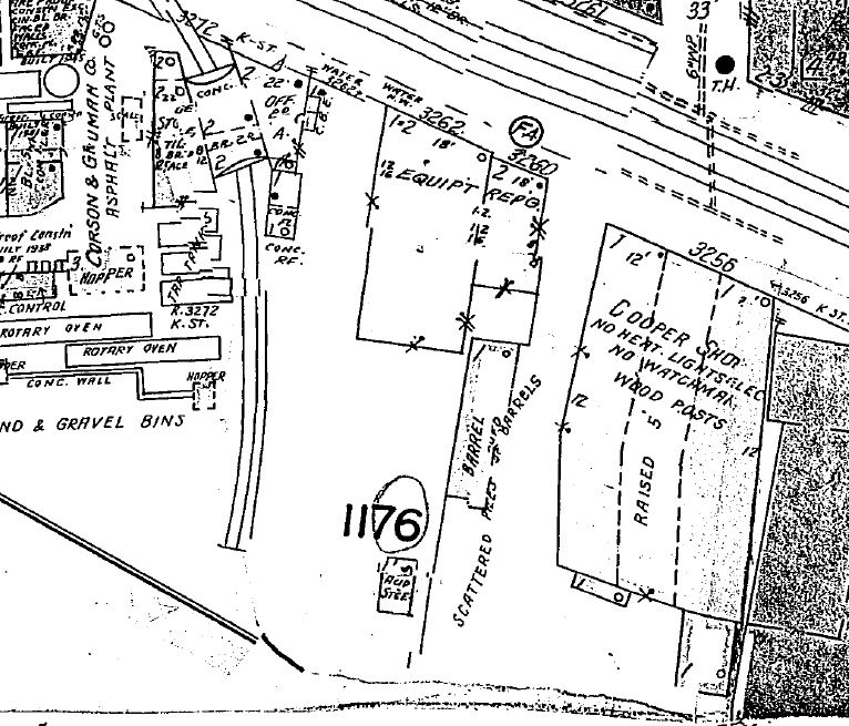
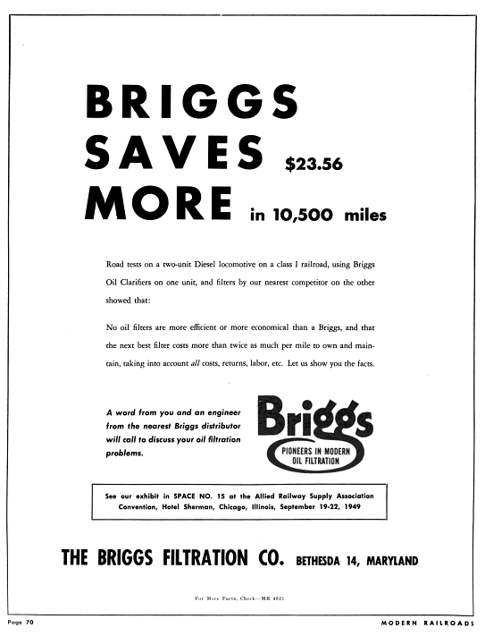
Briggs produced valves, hot water heating boilers and oil filters. A simple Google search will turn up various patents (1) and law suit filings, along with some trade catalogs and maybe even an advertisement. A bit of a digression to Georgetown: while I don’t have a detailed history worked up, what I can gather is that their office was located in Georgetown at 3262 K St, right across the street from Wilkins-Rogers Milling Co. The 1916 Sanborn map reads “Flour & Feed Ware Ho” located at 3262 K St.:
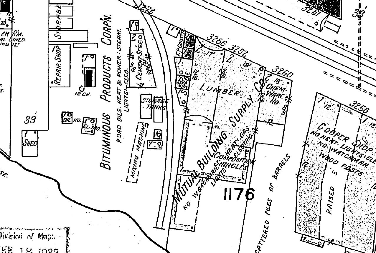
The 1927 Sanborn Map:
I checked a Sanborn map that has a 1932 date and it does not show Briggs Clarifier listed, but rather Mutual Building Supply Co.:
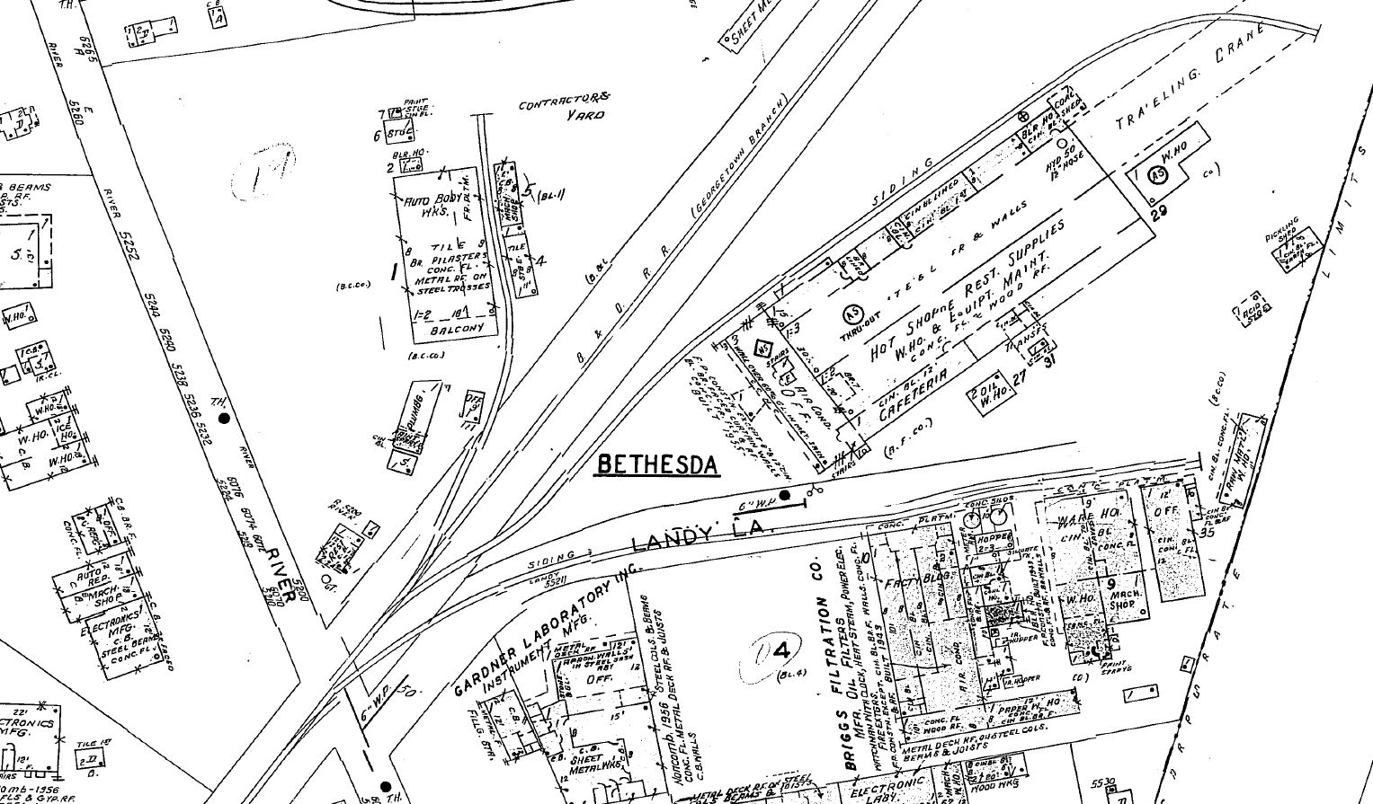
Ok, back to Bethesda. At some point they either moved or expanded (or perhaps were co-located) to a location in Bethesda at River Rd. off of Landy Ln. This fairly large facility, on the East side of Landy Ln. included several warehouse / manufacturing structures. Here is the Sanborn Map ca 1957:
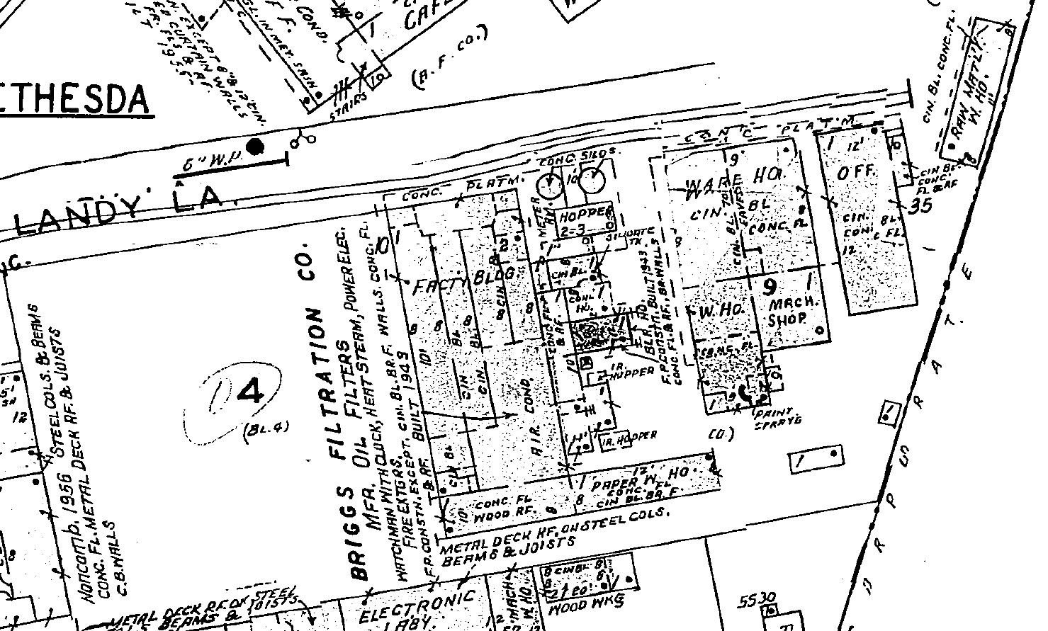
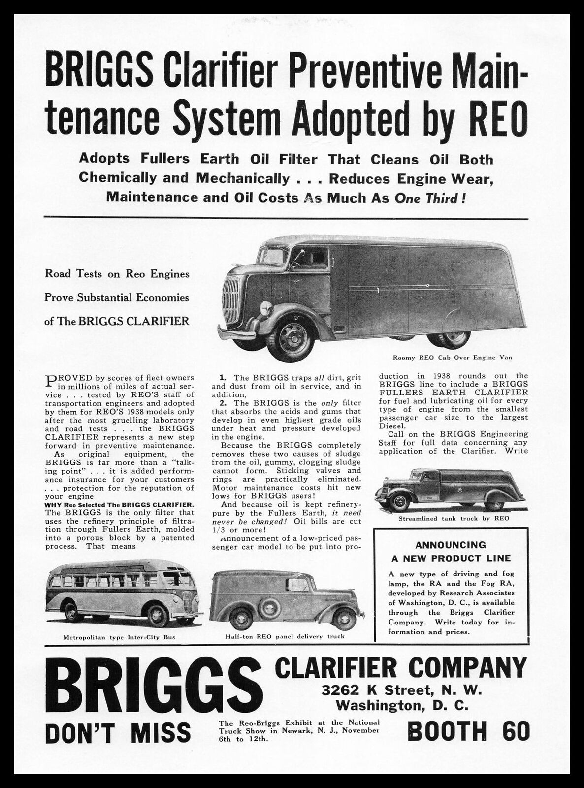
As you can see from the map, the B&O siding ran down Landy Ln, passing alongside the factory complex. Later advertising shows the name changed to The Briggs Filtration Co. and also had a Bethesda, MD address:
Hot Shoppes / Marriott Corp.
I’m not going to go into detail on the history of Hot Shoppes & Marriott because it’s been done before in lots of detail and with great imagery! The Streets of Washington blog did a great post on it some years back. Check that out to get a feel for the background of this local DC institution. I posted this photo last April of the Hot Shoppes HQ located at 5161 River Rd, with the Briggs Filtration Co just off to the right.
https://collections.lib.utah.edu/ark:/87278/s6029bvz
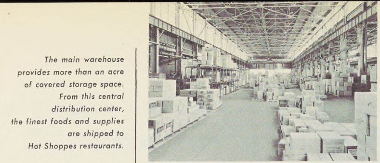
Judging from the photo, it’s obvious that Hot Shoppes would receive all sorts of perishables related to the bustling restaurant industry. Machinery, furniture and other supplies related to the expansion of the business would also probably pass through the warehouse. There was also a coal house & boiler room at the north end of the building.
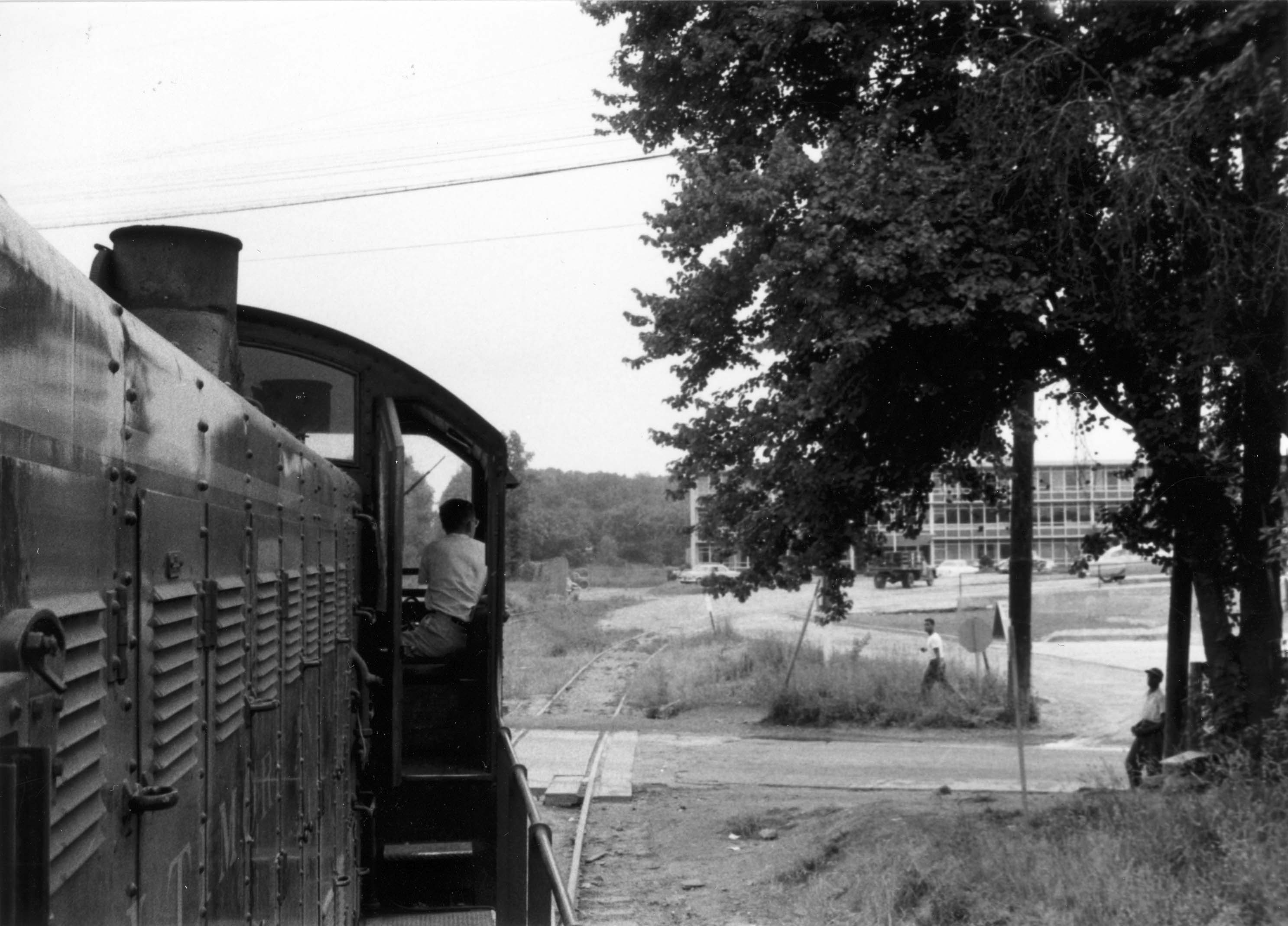
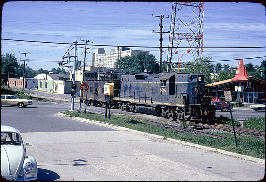
In this fantastic photo from Mr. Bill Duvall there’s a lot to see. The view is facing away from the Marriott warehouse, standing on Landy Ln. The yellow & white sign next to the loco reads “Marriott Corporation, 5161 River Road.” The fast food restaurant behind the loco is none other than a JR Hot Shoppes restaurant. The slogan reads “Happiness is Eating Here.”
As a side note, I attended Fourth Presbyterian Church throughout my teen years. We would go to Roy Rogers (which succeeded JR Hot Shoppes) every Sunday after church with friends. It is now a McDonald’s. Note the WDCA20 studio and tower in the background. I may or may not have some friends who climbed to the top of that tower one hot summer about twenty years ago.
BONUS: If we look to the other direction from the photo of the two gentlemen above, we see additional industries just out of view that were also served by rail. There was an auto body/repair shop and more. The siding went between the larger structure and the two smaller sheds, spanning the entire length of the buildings.
Back in 2003, when I went on my first Georgetown Branch exploration, we stumbled across rails embedded in the ground here where the auto repair shop was once located. We also walked around the area near Hot Shoppes / Briggs Clarifier. You can view the photos in the Gallery, here. I hope you’ve enjoyed a bit more insight into the Briggs Filtration Co. & Hot Shoppes warehouses in Bethesda.
Epilog
The Hot Shoppes facility is still standing. It now houses the Washington Episcopal School. They have modified much of the facility but the overall structure can still be observed today.
The Briggs Filtration facility is now gone, having been razed and turned into a soccer field for the adjacent school. However, for the time being you can still view the old structure on Google Street View! (Until they update it.)
And as one final gasp for the old Georgetown Branch, tracks are still visible embedded in Landy Ln. Go visit them when you can.
If you have any additional information, maps, photos or stories about these industries, I’d love to hear about them!
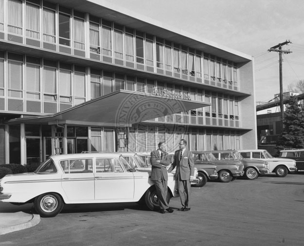
Hot Shoppes HQ in 1959
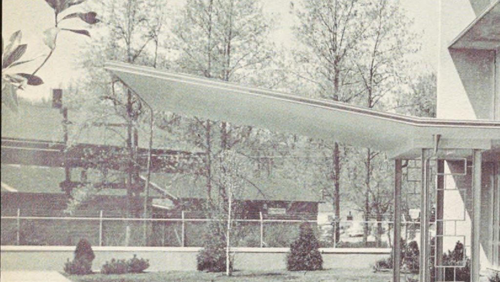
This neat photo from 1959 of the front of the Hot Shoppes Inc. (later Marriott) HQ at 5161 River Rd was shared on the Bethesda Chevy Chase Back In The Day Facebook Group, by P. Wilson (Thanks!). The Georgetown Branch passed just behind the photographer, the siding that served the building was located just to the left of the building. In the distance to the right, we can see a boxcar spotted at the industry located next door on Landy Ln. I’m not certain what this industry was but they had a large loading hopper.

J. Willard Marriott and George Romney standing in front of the offices of Hot Shoppes, Inc. , 1959. Multimedia Archives, Special Collections, J. Willard Marriott Library, University of Utah, P0164 J. Willard and Alice Sheets Marriott Photograph Collection
https://collections.lib.utah.edu/ark:/87278/s6029bvz