While going through some old notes today I found a link to the USGS EarthExplorer website with the note “will want to create a login.” This puzzled me, so I went ahead and explored the site a bit. After creating a login (a somewhat involved process) I was able to access some pretty wonderful imagery. There are aerials going back to 1949 and some of them are full of tremendous detail that I enjoyed exploring. First up is a crop of the downtown Georgetown area:
Let’s drill down a bit.
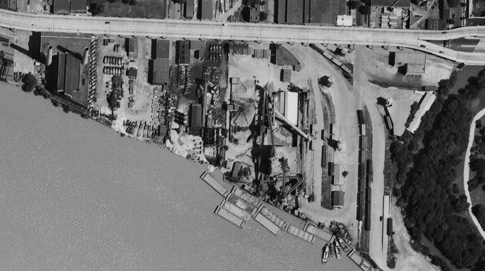
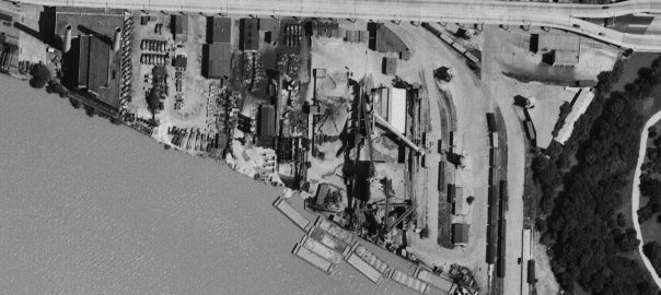
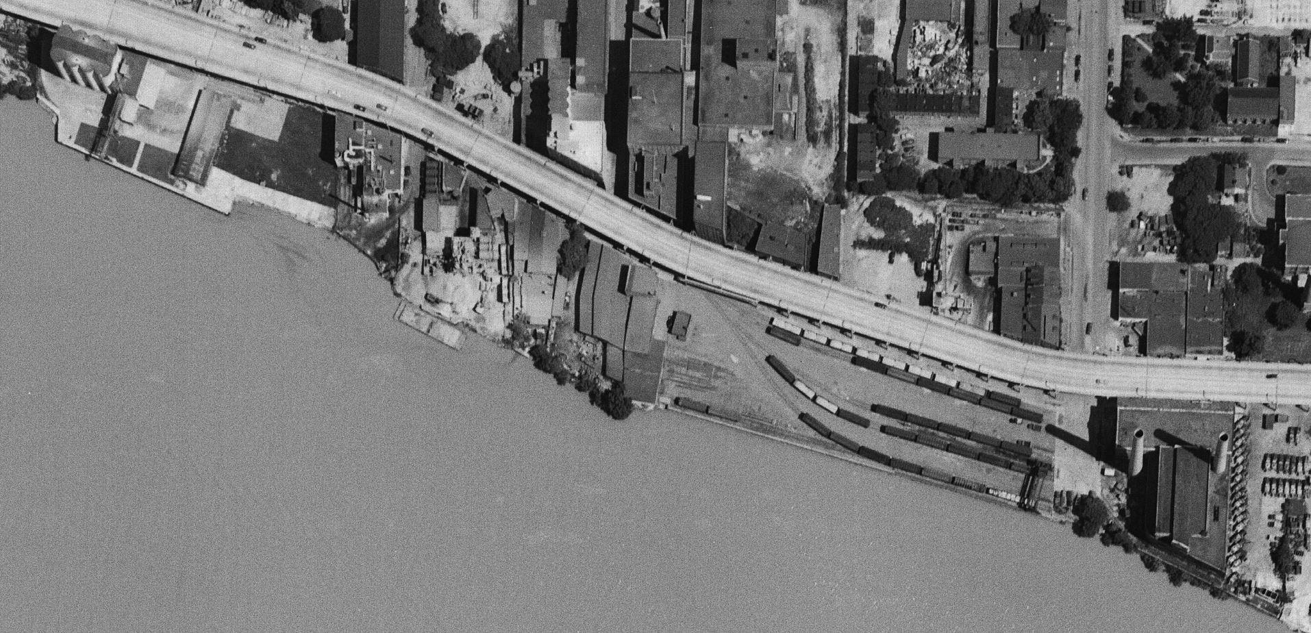
Starting on the east end of town, we see a relatively busy yard full of boxcars, covered hoppers and a gondola. The photo was taken in early July so it’s not surprising that there aren’t too many coal cars in the yard. The switching loco is visible at the top right next to the Whitehurst. Note the sharp shadows being cast. A fantastic view of the Smoot Sand & Gravel operation along with the cement vendors next door. It’s pretty incredible how many trucks they had! The idle power plant stands silent.
On the north side of Whitehurst we get a closer look at some industries. To the right is the West Heating Plant and its large coal yard. Next is the diminutive King & Sons Coal, still in service, but not long for the world. Next door is the massive sprawling W. T. Galliher Lumber complex with its large storage yard. They were a major customer of the Branch up to near its end. Further left is the massive Rosslyn Steel shed, with a freight car on the siding leading into the plant. Note that about four years prior the massive cement silo structure which sat along that curved track had been removed. Next is the DC Incinerator and then Wisconsin Ave.
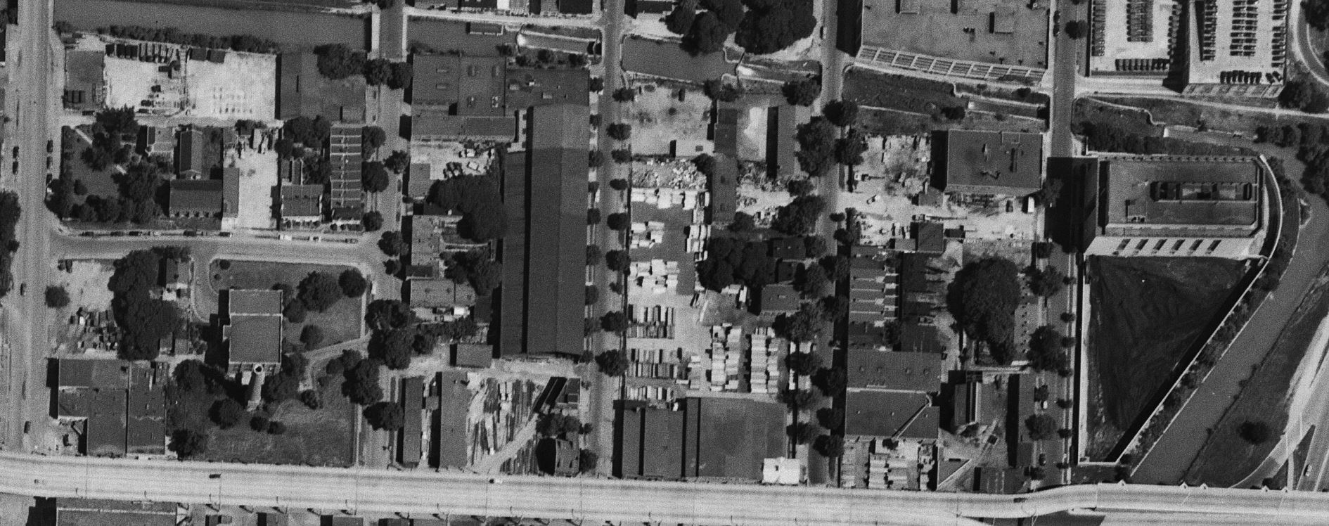
Now we get a nice look at the “new yard” which is really packed! From my eyes, it looks like there’s ten carloads of gravel (or other aggregate) sitting in the yard along with many boxcars and at least one gondola. On the left side of the yard are the two old MoW cars which housed equipment. The Maloney Concrete batch plant was across the street. Several other industries are visible as we move further to the west.
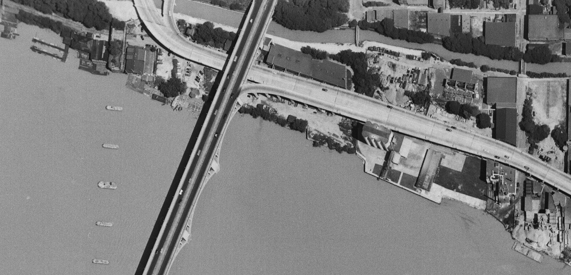
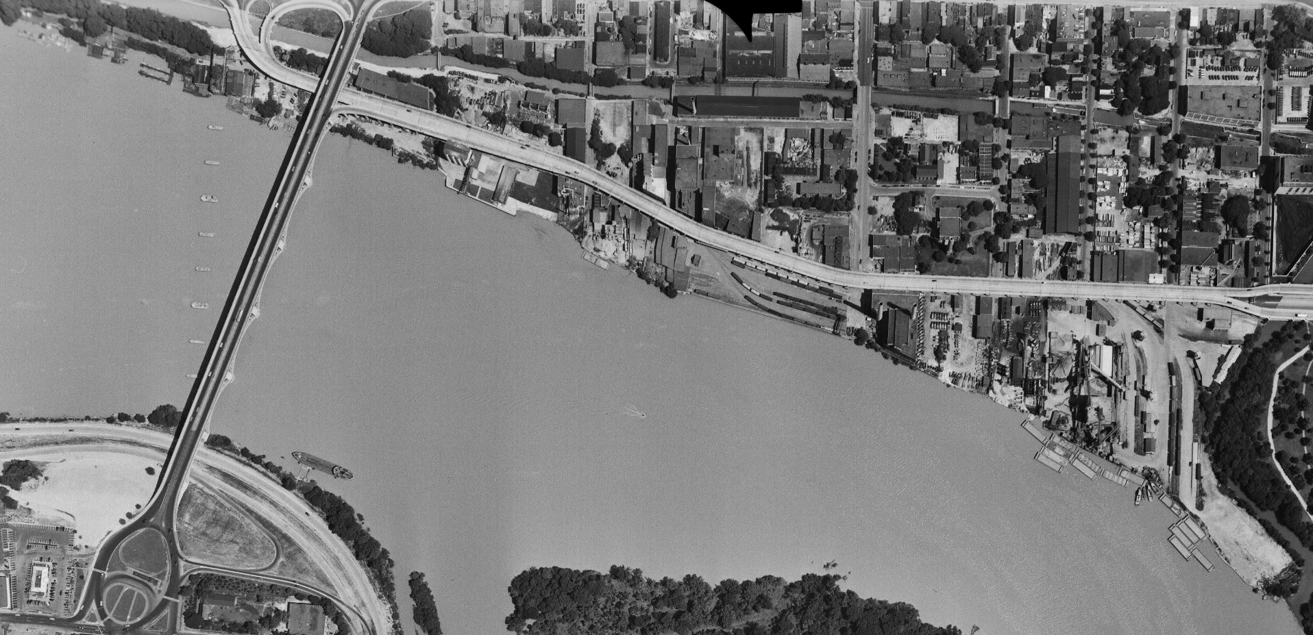
Finally, here’s the west end of the industrial area of town. Some great views of Lone Star cement, Key Bridge and all the layout of industries in this area. For sure all of these images will be indispensable when planning the Georgetown area of my model RR because this is pretty much exactly how I’d like to represent it! Very exciting to find this image set.
Good stuff, as always. The configuration of sidings east of Smoot Sand & Gravel is curious. This much is clear: there are four distinct linear track beds. The first, a single track, is specific to Smoot. But the second, third, and fourth trackbeds appear to be beyond the reach of Smoot’s conveyors. The second and third beds accommodate a pair of tracks each, which allows bulk transshipments to trucks parked along each side. Do the second and third pairs provide overflow parking for B&O’s new yard? The third pair of rails (from the left) extends all the way down to the river front. If the intent is to allow rail-to-barge transshipments, the necessary equipment for doing this is not evident. The eastern-most (next to Rock Creek) is a single-track bed that serves a wedge-shaped building, then extends beyond that to serve a ramp that slopes down to one of the least convenient spaces for parking whatever is being offloaded. Granted, land uses change more quickly than track configurations. All of it means nothing today, but it’s fun to speculate what’s happening here.
This has nothing to do with the Georgetown Branch, but it’s interesting to see a freighter berthed on the Virginia side just below Key Bridge – there’s certainly a reason, but it’s not obvious from the photo. There’s more here, but I’ve got my nickel’s worth for now…
Christopher: East of Smoot Sand & Gravel there were a number of what would today be considered transloading operations that leased space in the yard . Several cement silos were in the yard. Gallagher lumber took its lumber from the loading dock built on the far track – I see a boxcar there in this view. Given all the other boxcars in the photo I imagine your theory about overflow from the new yard might be correct.
In 1972 Hurricane Agnes not only destroyed part of the Rock Creek trestle, but also left hanging without the support of soil and thus resembling a roller coaster ride going up and down from Fletcher ‘s Boathouse. My father took me there a few days after Agnes had hit. Since the boathouse and the railroad tracks, which ran alongside the Canal, were in between the Canal and the Potomac River. When Hurricane Agnes struck, the Canal and the Potomac River rose up, met, and flooded the Boathouse by several feet. I am sure that the CSX co. had to shell out a lot of money to fix the track so that they could empty the Branch Line of all the train cars. Could this have been the beginning of the end of the Line?
Michael, thanks for that info! For sure the damage from Agnes was a big blow to operations on the Branch in the long run. I have oft wondered if the railroad hadn’t had a loco down in Georgetown, would they have filed for abandonment at that point. There were still several customers on the line in the early 1970s, so it wasn’t a lost cause, but certainly in the late 70s they were running thin. Somewhere I have some photos of the damage at Fletcher’s from Agnes – it’s stunning. The tracks just left dangling in mid-air!