While going through some old notes today I found a link to the USGS EarthExplorer website with the note “will want to create a login.” This puzzled me, so I went ahead and explored the site a bit. After creating a login (a somewhat involved process) I was able to access some pretty wonderful imagery. There are aerials going back to 1949 and some of them are full of tremendous detail that I enjoyed exploring. First up is a crop of the downtown Georgetown area:
Let’s drill down a bit.
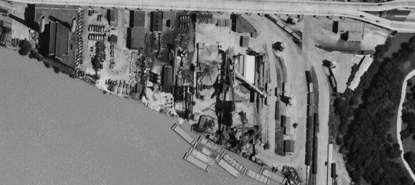
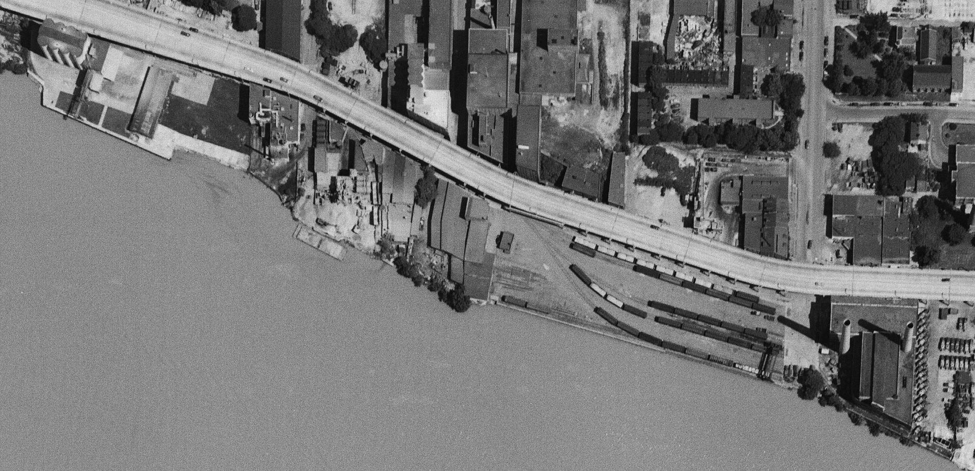
Starting on the east end of town, we see a relatively busy yard full of boxcars, covered hoppers and a gondola. The photo was taken in early July so it’s not surprising that there aren’t too many coal cars in the yard. The switching loco is visible at the top right next to the Whitehurst. Note the sharp shadows being cast. A fantastic view of the Smoot Sand & Gravel operation along with the cement vendors next door. It’s pretty incredible how many trucks they had! The idle power plant stands silent.
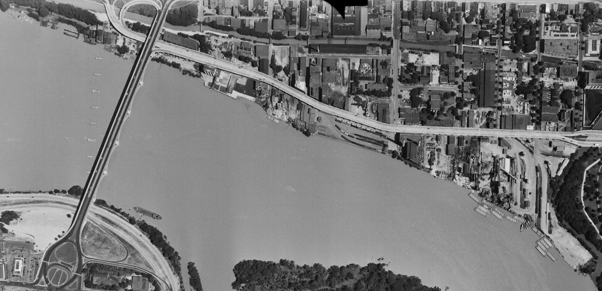
On the north side of Whitehurst we get a closer look at some industries. To the right is the West Heating Plant and its large coal yard. Next is the diminutive King & Sons Coal, still in service, but not long for the world. Next door is the massive sprawling W. T. Galliher Lumber complex with its large storage yard. They were a major customer of the Branch up to near its end. Further left is the massive Rosslyn Steel shed, with a freight car on the siding leading into the plant. Note that about four years prior the massive cement silo structure which sat along that curved track had been removed. Next is the DC Incinerator and then Wisconsin Ave.
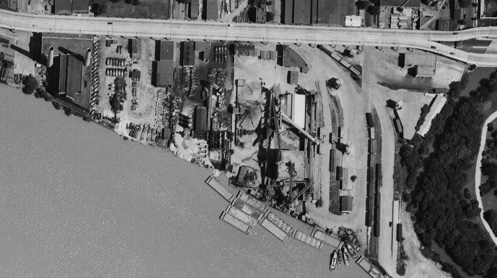
Now we get a nice look at the “new yard” which is really packed! From my eyes, it looks like there’s ten carloads of gravel (or other aggregate) sitting in the yard along with many boxcars and at least one gondola. On the left side of the yard are the two old MoW cars which housed equipment. The Maloney Concrete batch plant was across the street. Several other industries are visible as we move further to the west.
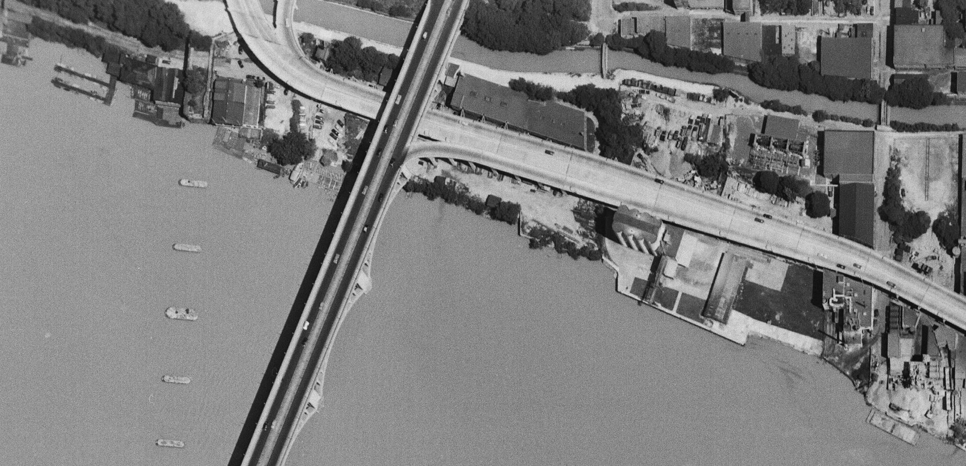
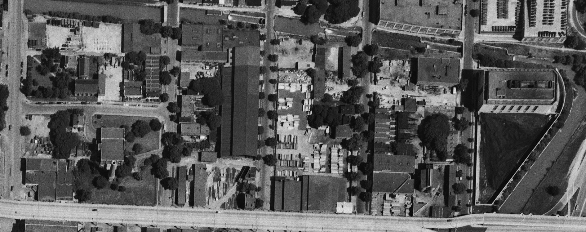
Finally, here’s the west end of the industrial area of town. Some great views of Lone Star cement, Key Bridge and all the layout of industries in this area. For sure all of these images will be indispensable when planning the Georgetown area of my model RR because this is pretty much exactly how I’d like to represent it! Very exciting to find this image set.