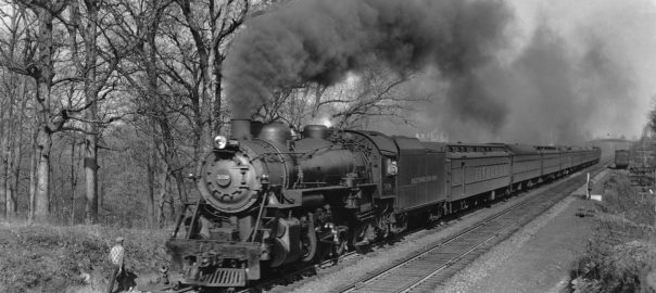
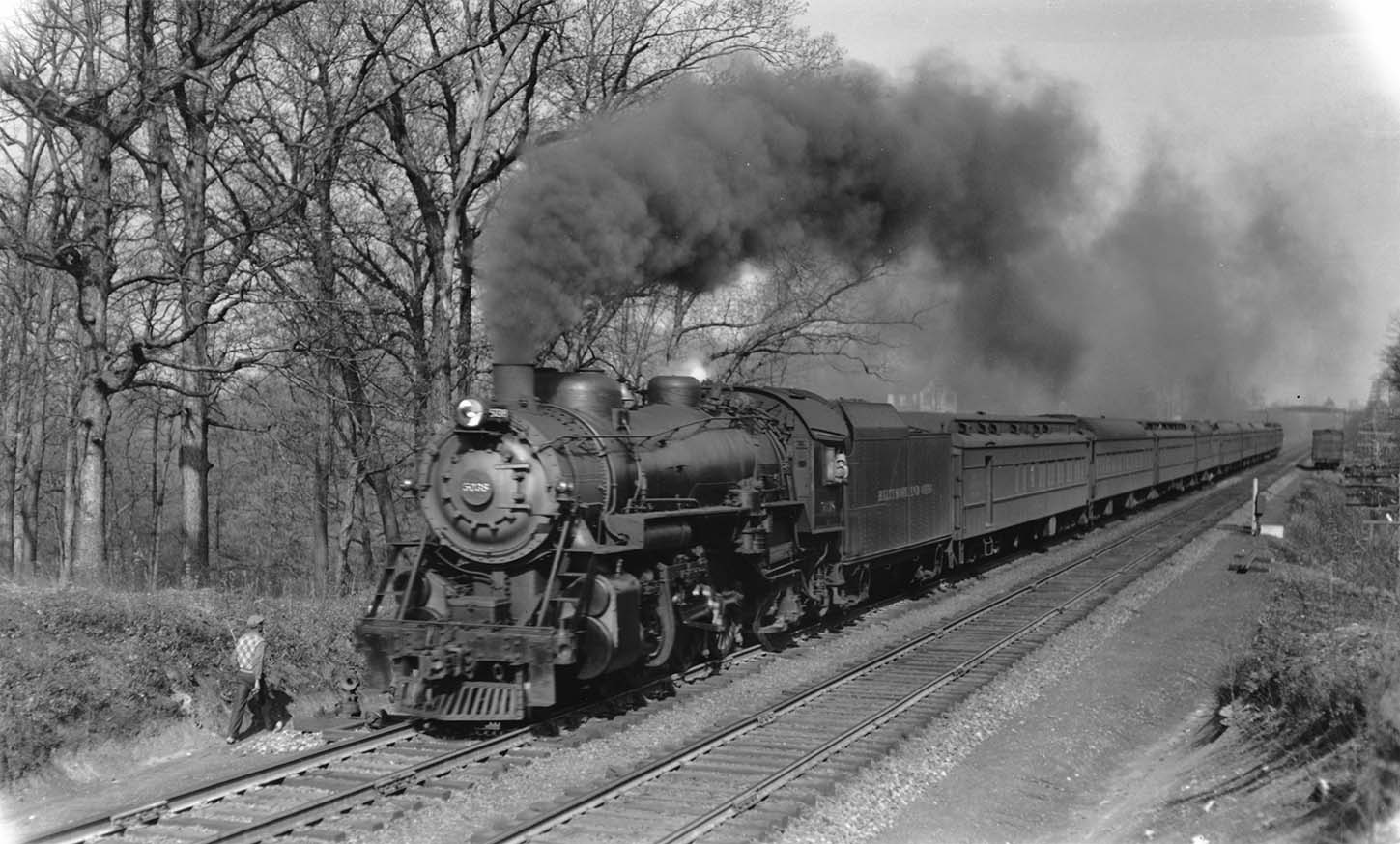
A recent eBay purchase. The caption on the back reads “B+O No. 6 “Capitol Limited” + P-1d 5038 4-6-2 Geo’town Jct, MD. 8:41AM 4-6-36 (all Pullman consist)” (Collection of Jay Williams & Big Four Graphics)
Capitol Limited thundering past Georgetown Junction.
The view is looking North, and the train is headed for Union Station, DC. It has just passed under Talbot Ave (seen in the background) and the westbound siding for the Georgetown Branch with a boxcar sitting on it. Visible just in front of the pilot is the turnout (and lantern signal) for the Georgetown Branch. Note that at this point the long siding that extended from Silver Spring all the way to the siding with the boxcar on it where it rejoined the Westbound main. A phone call box is visible to the right.
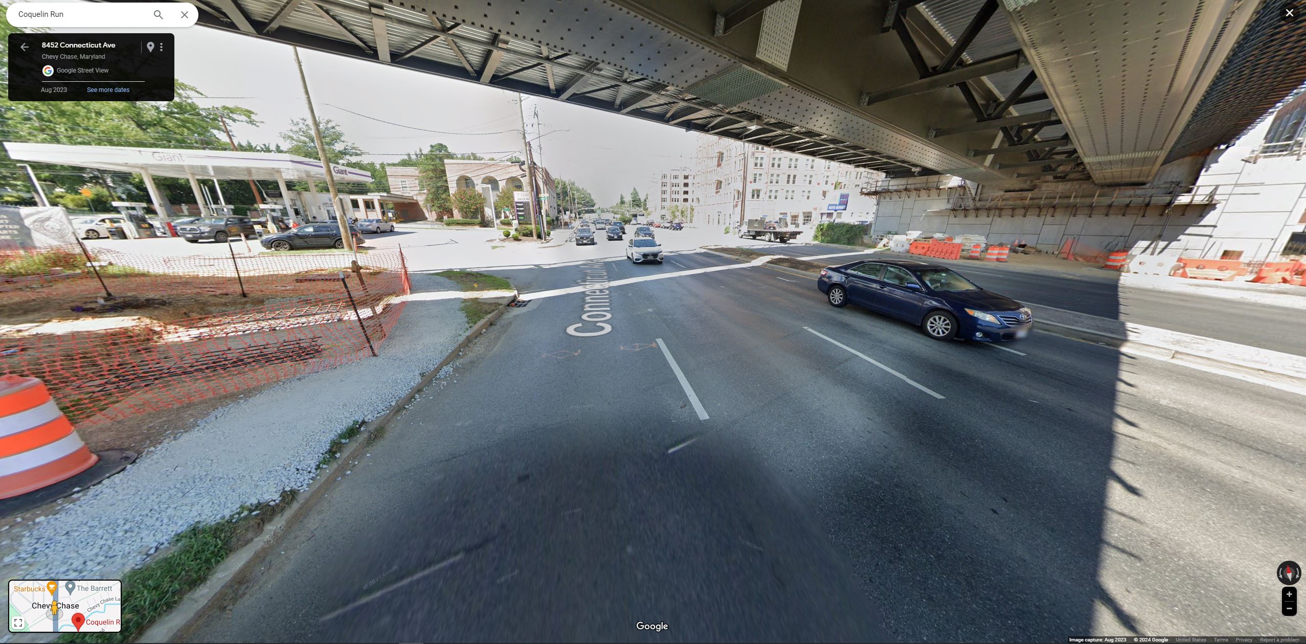
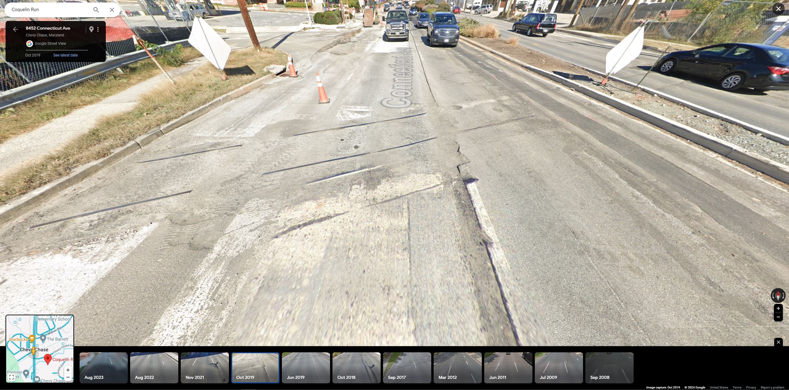
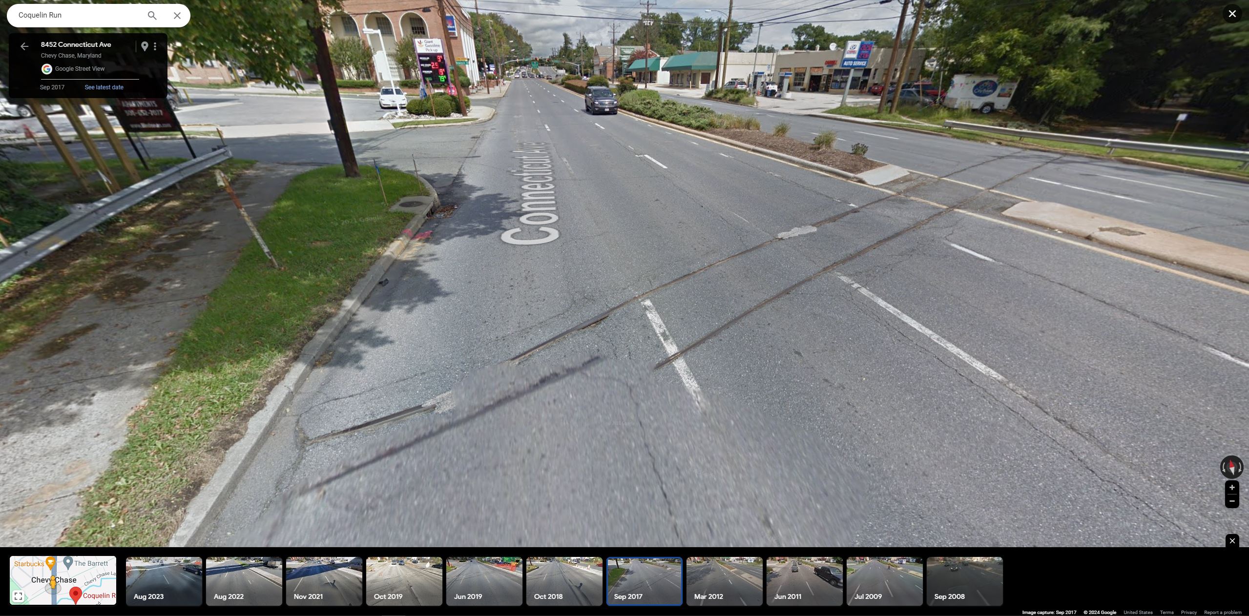
A recent post by the Purple Line folks got me thinking about how much the Connecticut Ave crossing at Chevy Chase has changed in recent years. Here are a small collection of Google Map screenshots showing the conditions:
2023 – the new overhead bridge is up, but yet, the old rails still poke through the roadway in some places. Amazing.2019 – The bridge had not been erected and the road was being resurfaced, revealing the tracks one more. Note that the island is now blocking the tracks. 2017 – As late as this, the tracks are still evident and there is a break in the right of way for the tracks to pass through. As if that train would one day come.
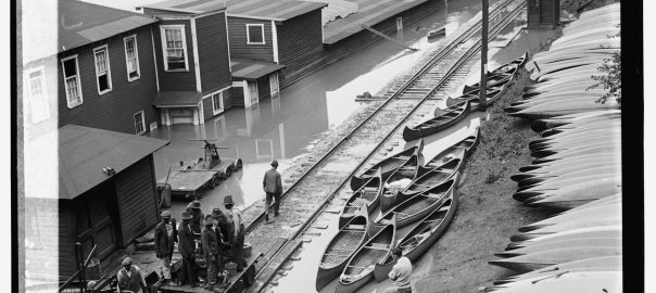
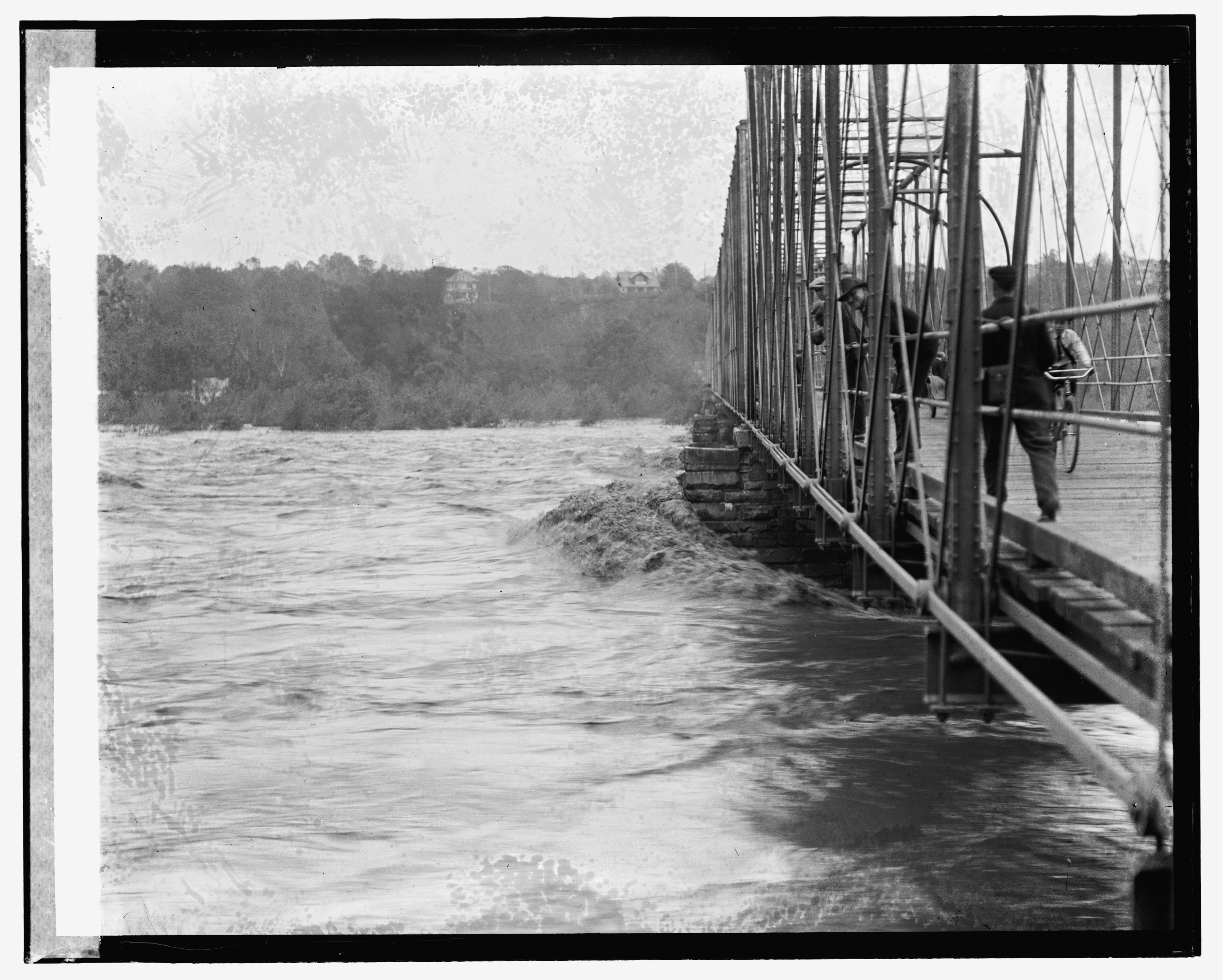
Stumbled across this photo on eBay earlier this week (above) and it reminded me that I’ve been sitting on a handful of really fascinating images I found on the Library of Congress site capturing the flood of May 13, 1924. Like so many things on eBay it’s far from rare or original, but rather just an overpriced print of a Library of Congress file that you can snag at high-res via the website. Pro tip – before you purchase that print, search the LoC thoroughly to possibly save yourself some dough.
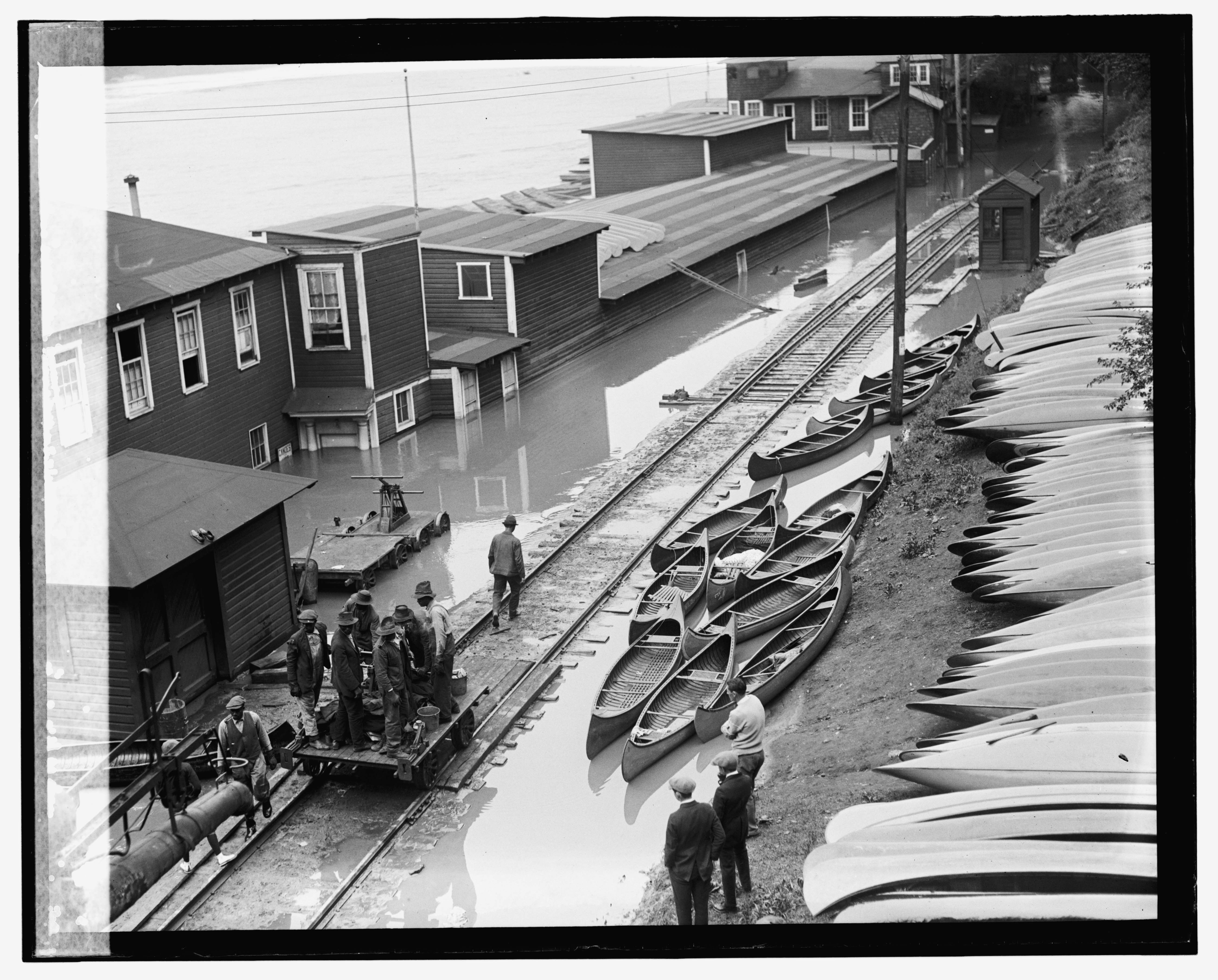
The subject matter is interesting because it shows not only the scale house in Georgetown, but also a hand cart full of railroad employees, no doubt headed out to inspect the line as the waters recede. Note the jacks and other tools they have on the cart. They would have been met with some troubling finds. There are many photos on the LoC – here is a selection of relevant ones I found interesting. In the following image I believe it is the same crew; note the lighter color pants on the gentleman standing at the back left of the hand cart, visible in both photos. Note the detail of the scale and scale house as well as all the equipment around the section shed.
May 13, 1924. The B&O section crew prepares to head out to inspect the line. The view is from the Aqueduct bridge facing west. The section shed is on the left and the scale and scale house is visible to the right. Also note the trunk of the water column in the bottom left. Flood. , 1924. Photograph. https://www.loc.gov/item/2016837495/.
A neat thing I noticed, if you look really closely in the top right, you’ll see a B&O steam loco doing some switching, with someone sitting on the front pilot. It is likely moving the freight cars you’ll see in some of the next photos. Pretty cool!
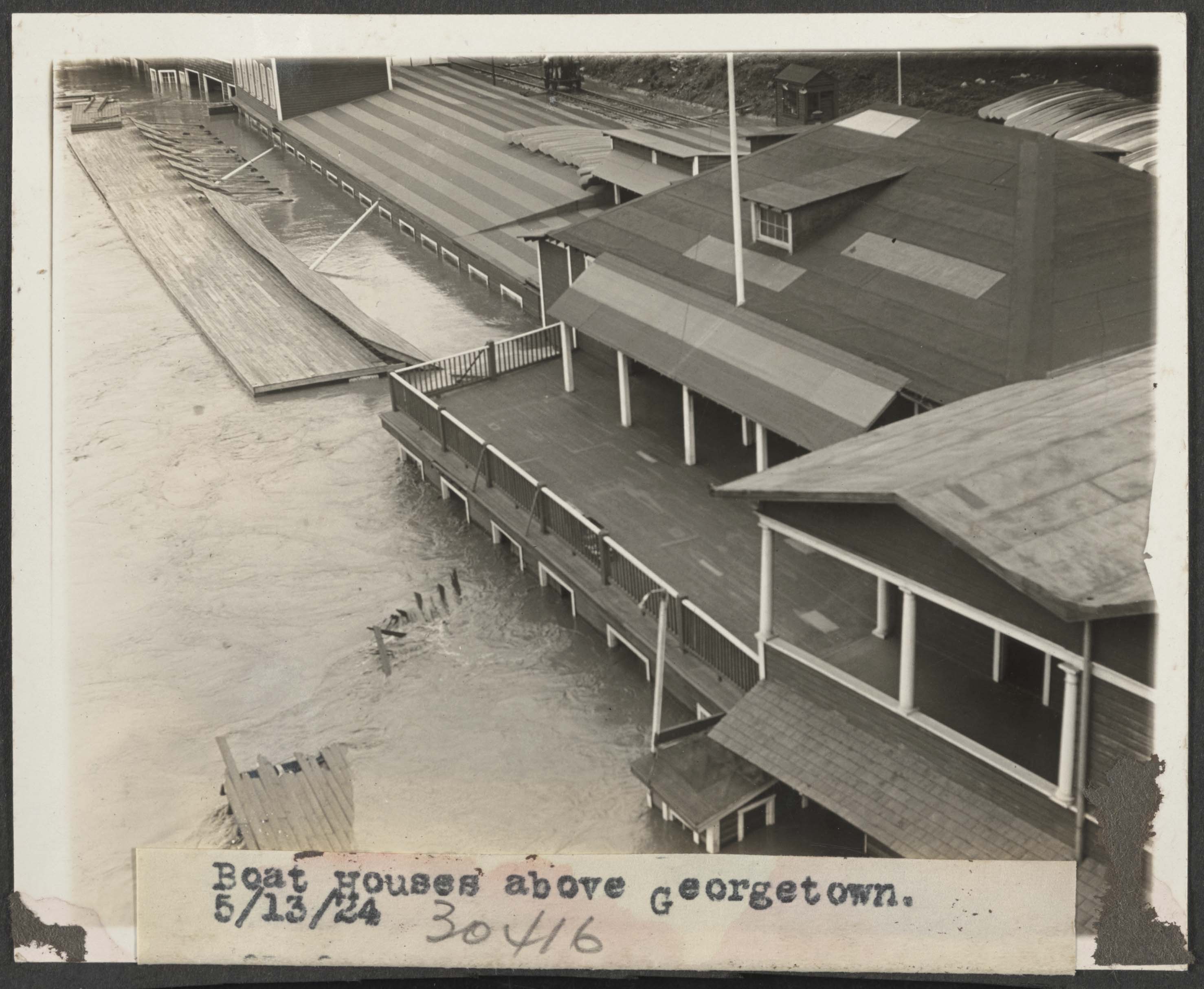
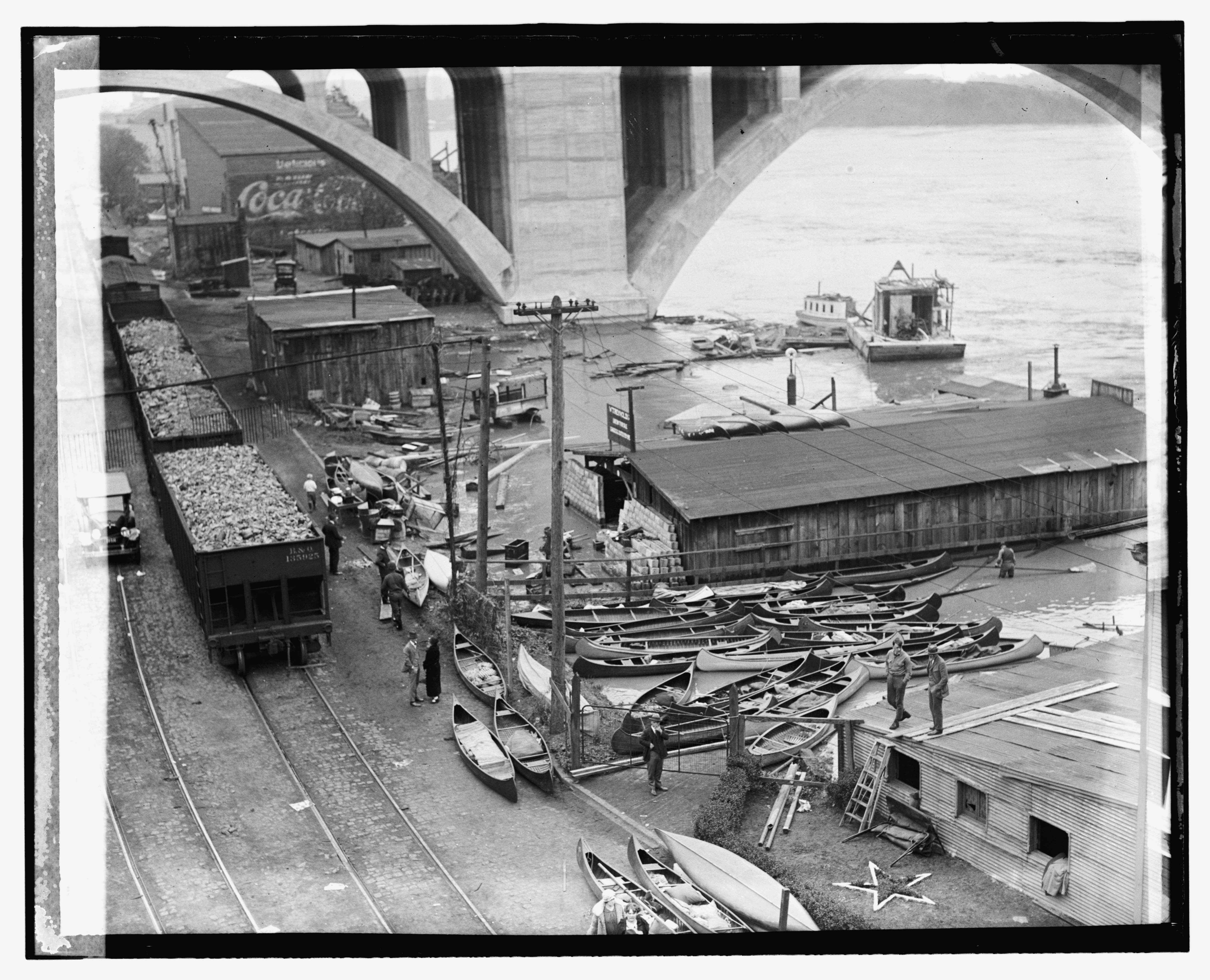
A B&O steam engine is visible in the distance. May 13, 1924 . View from the Aqueduct bridge again, now facing east. Looking down on the boat yards adjacent to the Key Bridge, much of it washed away and damaged. B&O hopper 135925 and others sit loaded with aggregates, likely from the Smoot Sand & Gravel plant. Flood. , 1924. Photograph. https://www.loc.gov/item/2016837490/.
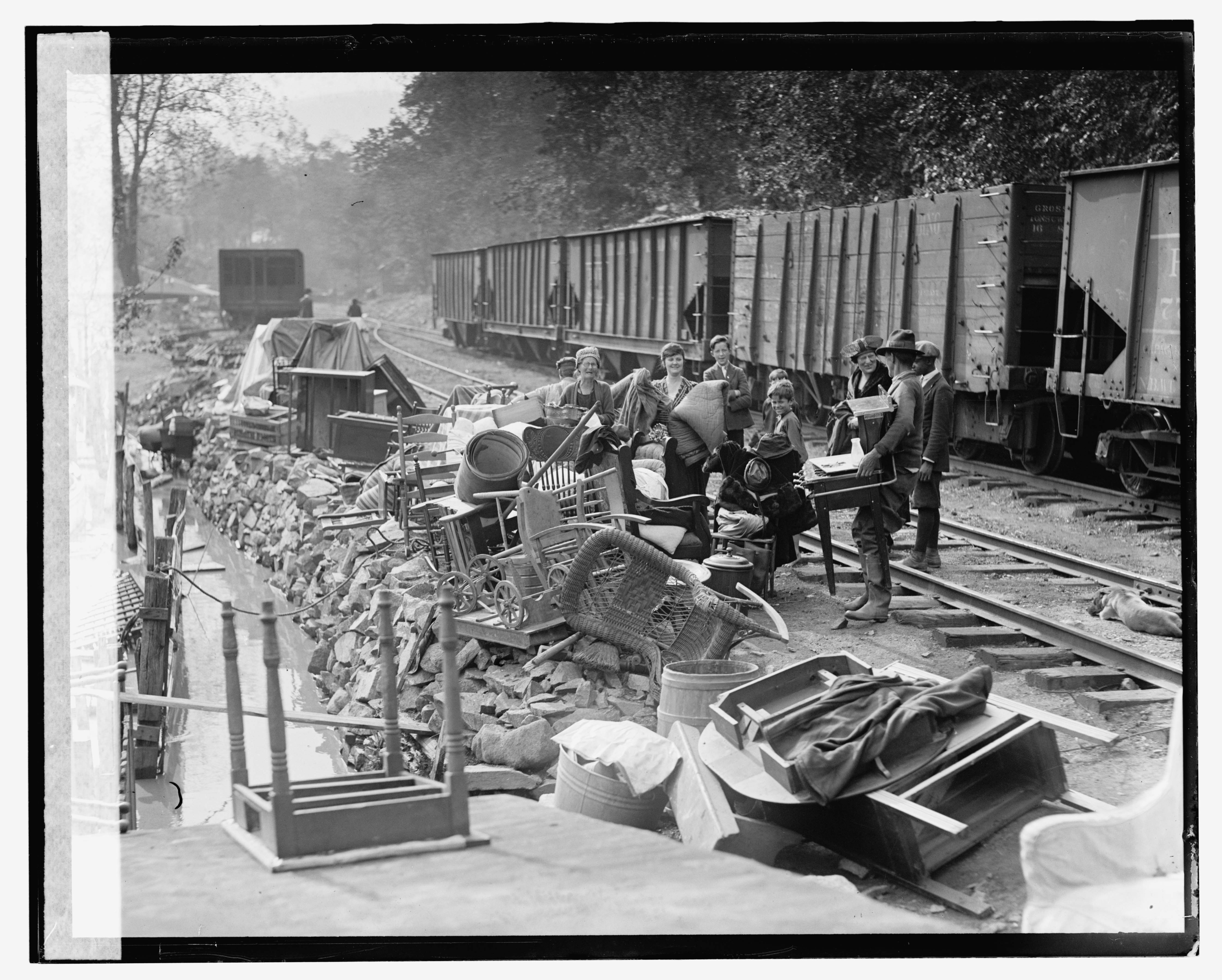
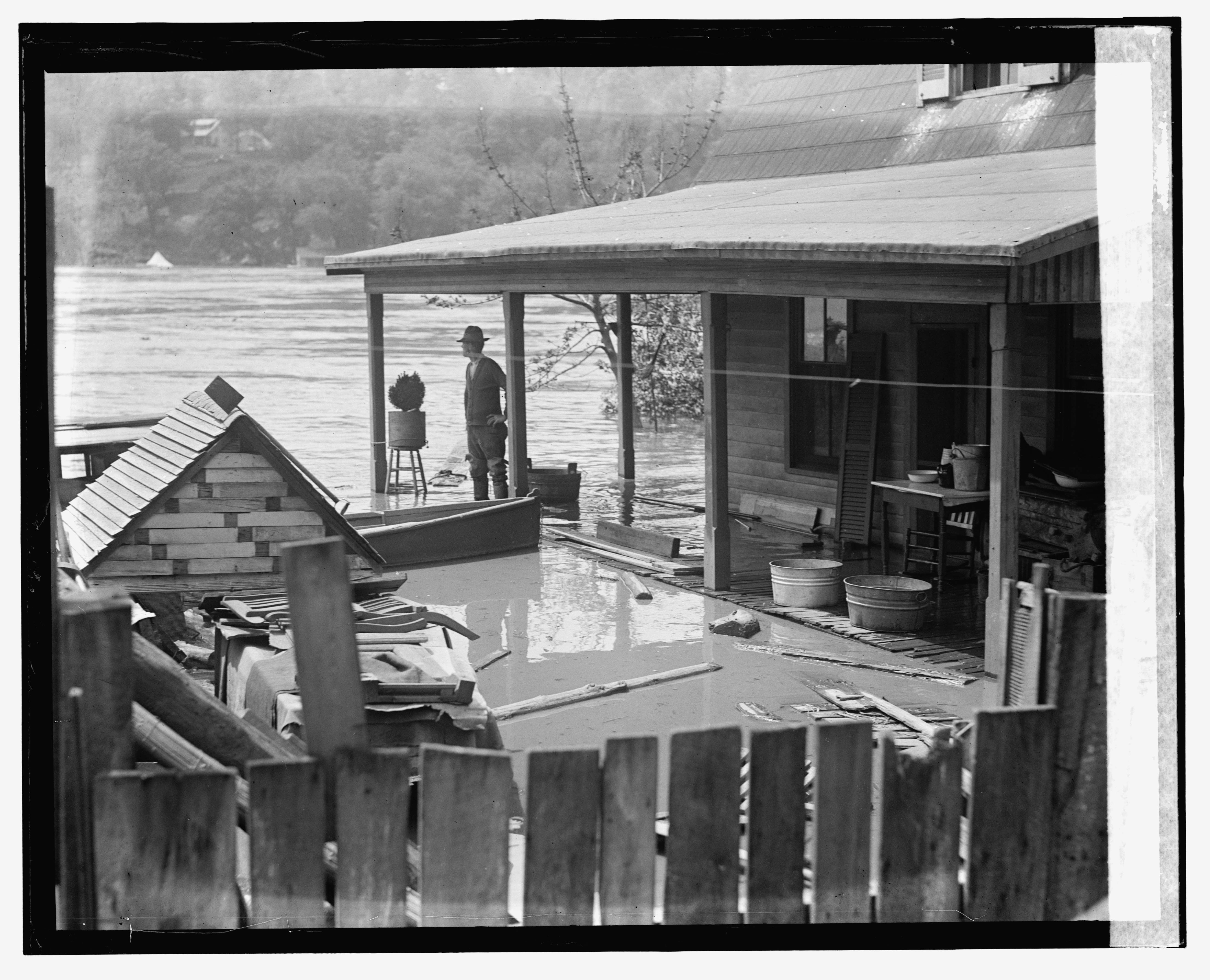
B&O Hopper 135925 is a class W-1 (135000-135999) 2511 cu/ft capacity, blt 1910. A bit further down the line, just past the boathouses and at the west end of the long passing siding, we come to another string of hoppers and some folks who have rescued their belongings from the floodwaters. The shoreline of the Potomac was absolutely littered with small shacks and cabins that folks had to escape the downtown hustle-and-bustle. Stretching all the way up to Chain Bridge, these shacks were a fascinating part of the history of Georgetown.
May 13, 1924. We’re a bit further west now, at the end of the long passing siding and near the small 2-track yard that was there. Have yet to figure out the purpose of that yard, but the coal car in the distance is spotted on one of the sidings. Flood. , 1924. Photograph. https://www.loc.gov/item/2016837488/.
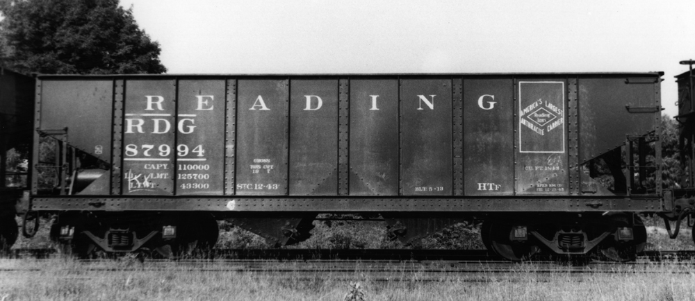
Attempting to ID the freight cars, it looks like from the right to left we have:
1: Philadelphia & Reading 77xxx – 34′ 55-ton arch bar trucks, 1880 cu.ft. capacity hopper, class HTh (nos 74500 – 78999), built 1916-17 by Standard Steel Car. Approx. 4495 on the roster in 1924. Detailed roster info from RT&HS. Builders photo from Kinkaid collection here and here.
3 & 4: Based on the distinctive side sills, these appear to also be Philadelphia & Reading class HTf hoppers, but slightly modified from as-built images I found. The HTf (86000-89999) was a 34′, 55 ton, 1843 cu.ft. capacity car with arch bar trucks. They were built in four batches from 1910-11 and again in 1913. In 1924 there were 3970 on the rails. Likely after shopping they received grab irons on the sides as well as some sort of bracket/brace above each bolster on the side sill. Early photos do not show these brackets. Here are some builders photos from the Kincaid collection onetwothree. Here is a photo of one with the brackets from Shamokin Div website. Detailed roster info from RT&HS.
5 & 6 These cars are just too far off for me to get a read on what they are.
I believe the cars are actually being moved. Why? Because in this next photo, which is of the same subjects, there are different cars in view:
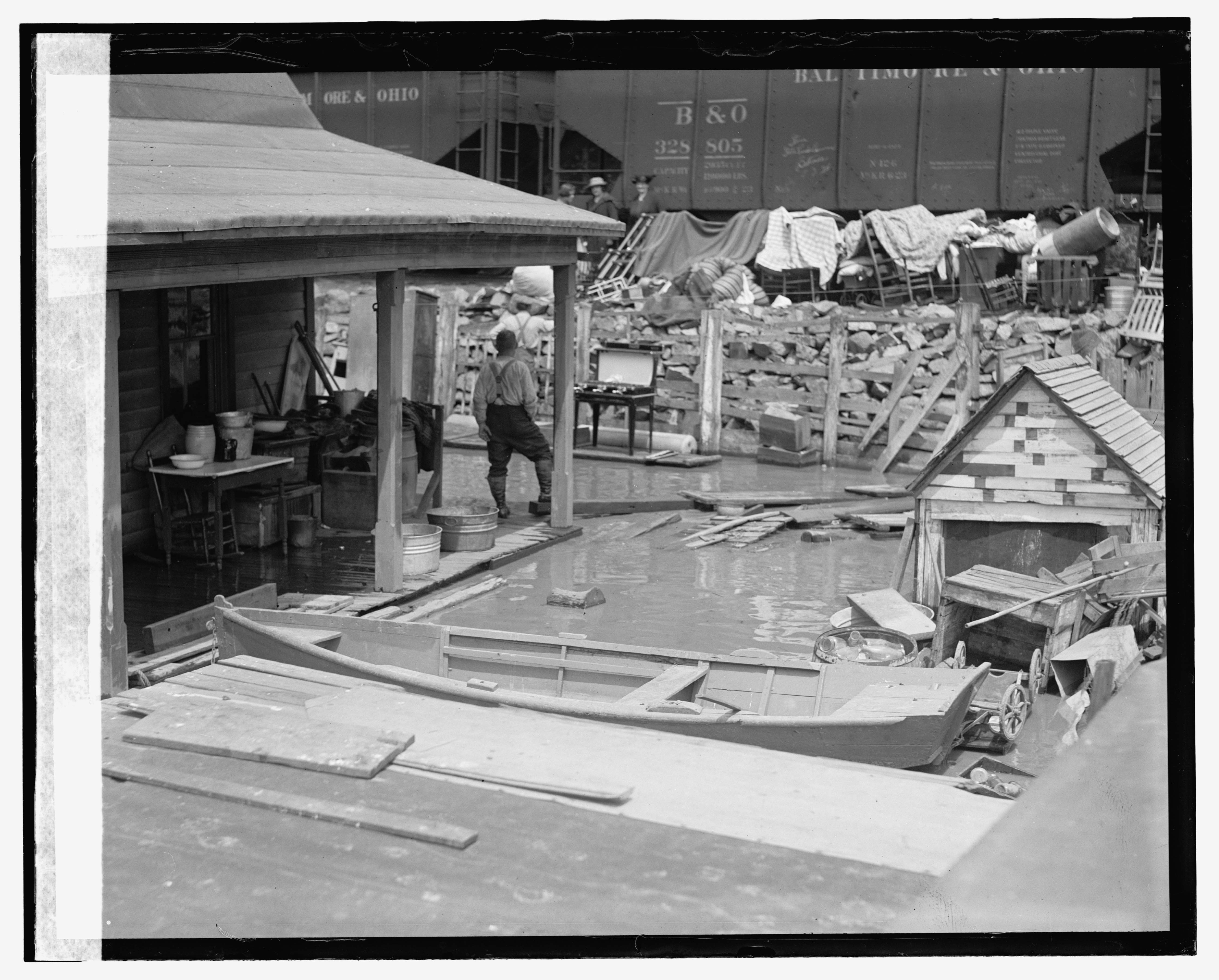
May 13, 1924. Same spot as previous photo, looking toward the track. The freight cars have moved! BO 328805. Flood. , 1924. Photograph. https://www.loc.gov/item/2016837496/.
Two B&O Hoppers in view:
1: BO 328805, class N-12g (327000-331999) (4998 cars) 1800 cu.ft capacity, blt 1923.
2: BO ? – appears to possibly be another N-12 class.
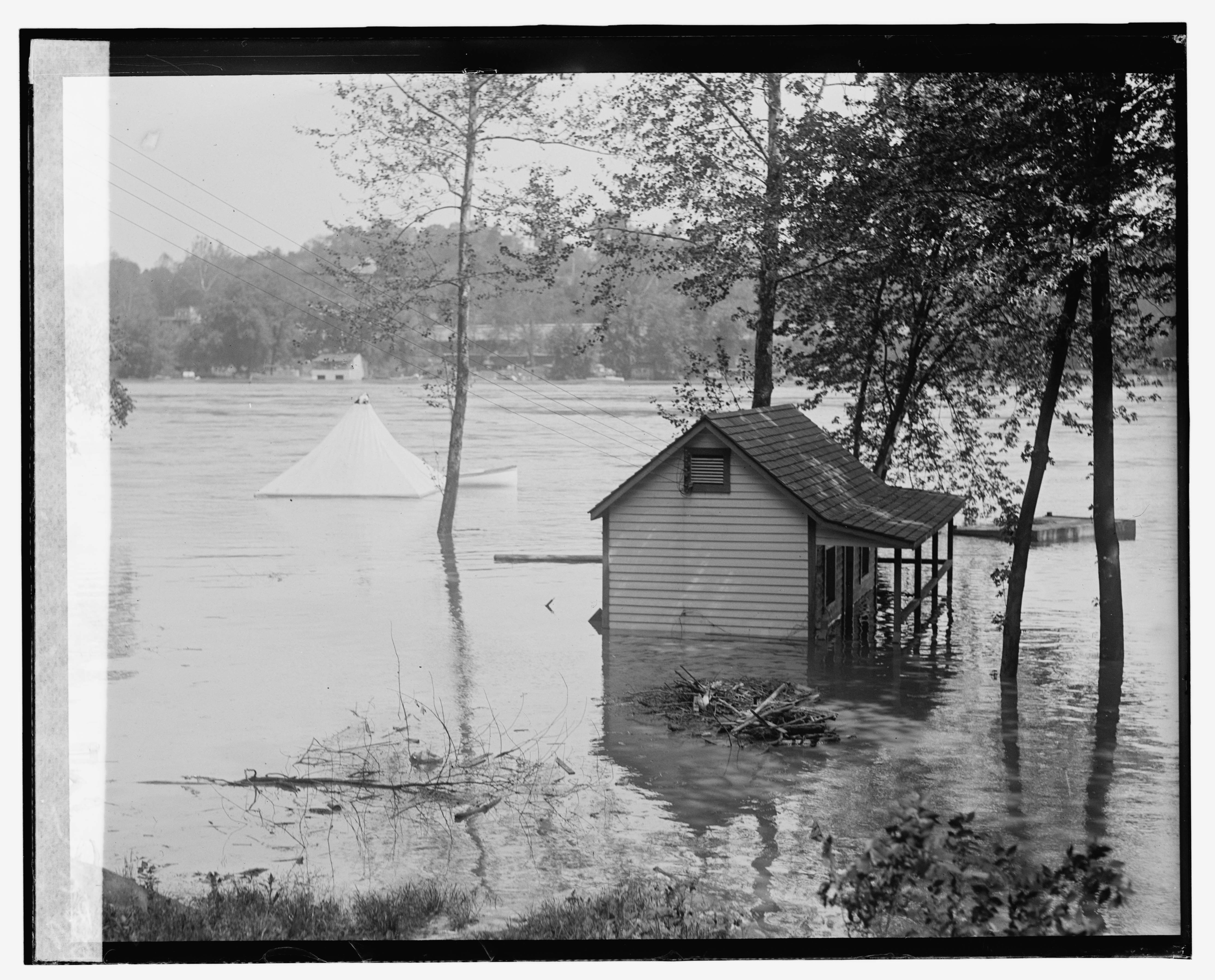
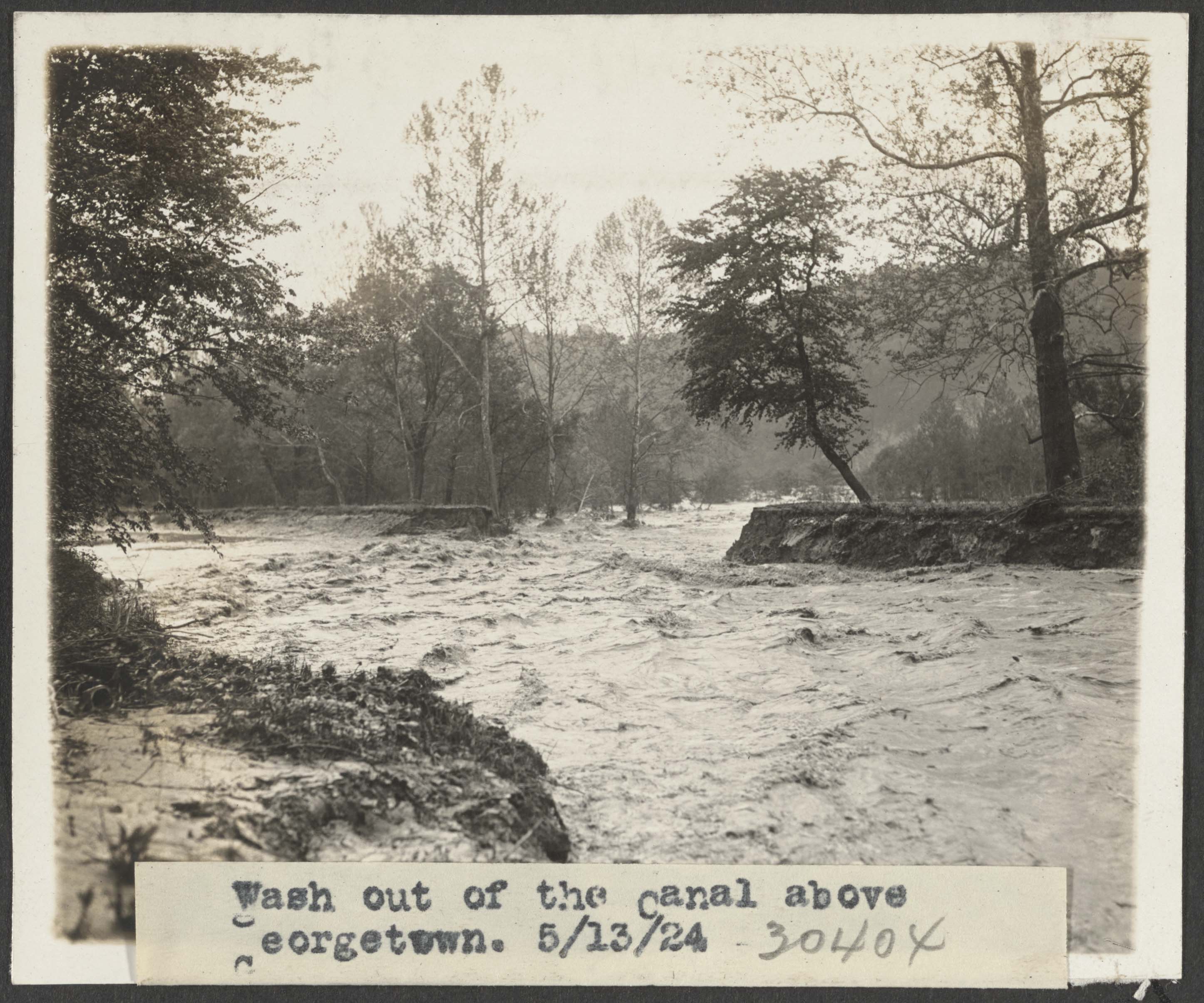
May 13, 1924. View of the shack seen above, looking out at the Potomac. Note the white tent in the distance, you’ll see it in the next photo shot from the Virginia shore. Flood. , 1924. Photograph. https://www.loc.gov/item/2016837486/. May 13, 1924. View from the Virginia shore looking back at Georgetown. The hopper cars seen above are visible just left of center. Flood. , 1924. Photograph. https://www.loc.gov/item/2016837494/. May 13, 1924, Wash out of the Canal above Georgetown. The tracks of the B&O Georgetown Branch would likely be on the other side of the Canal towpath (washed out). https://hdl.loc.gov/loc.pnp/ppmsca.86005
The B&O RR had gained a controlling stake in the C&O Canal, in 1890 it was put into receivership. The B&O wanted to prevent other railroads from purchasing the right of way. A history of damaging floods and maintenance headaches meant that the canal was holding on for dear life but thanks to many unusual years of relatively minor flood issues, the canal soldiered on. The B&O had to maintain it just enough to keep it in service, which they did. That is until 1924.
The first flood of 1924 came in March but it was largely focused on Northern sections of the Canal. Repairs were not too overwhelming and were undertaken by contractors for the B&O. The flood that occurred two months later in May was another story, and proved to be too much for the Canal to survive in the long run. By August of that year, the Canal had largely been shut down save for some sections kept open for various contract obligations.
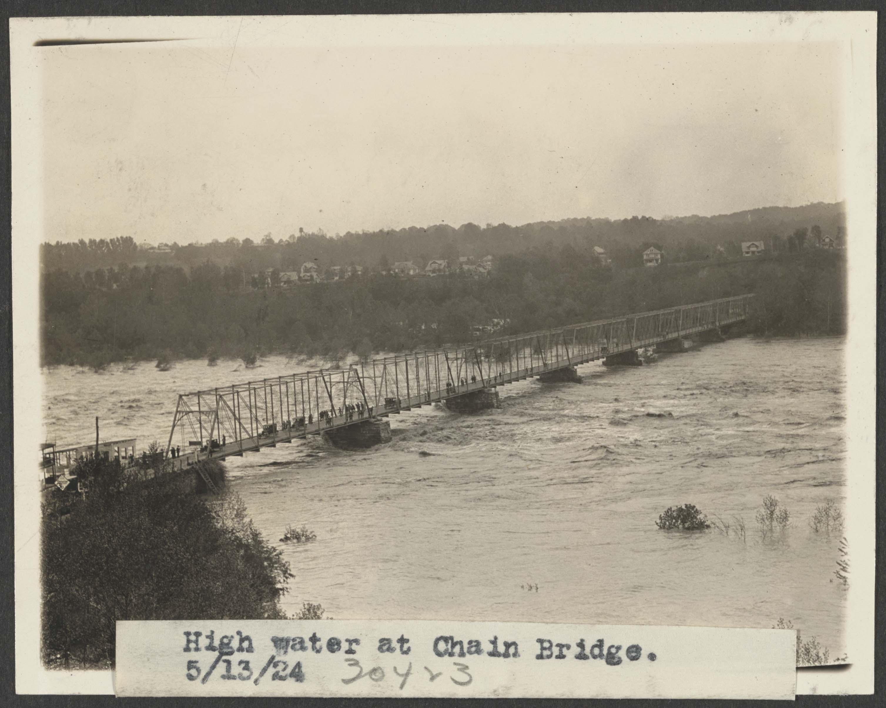
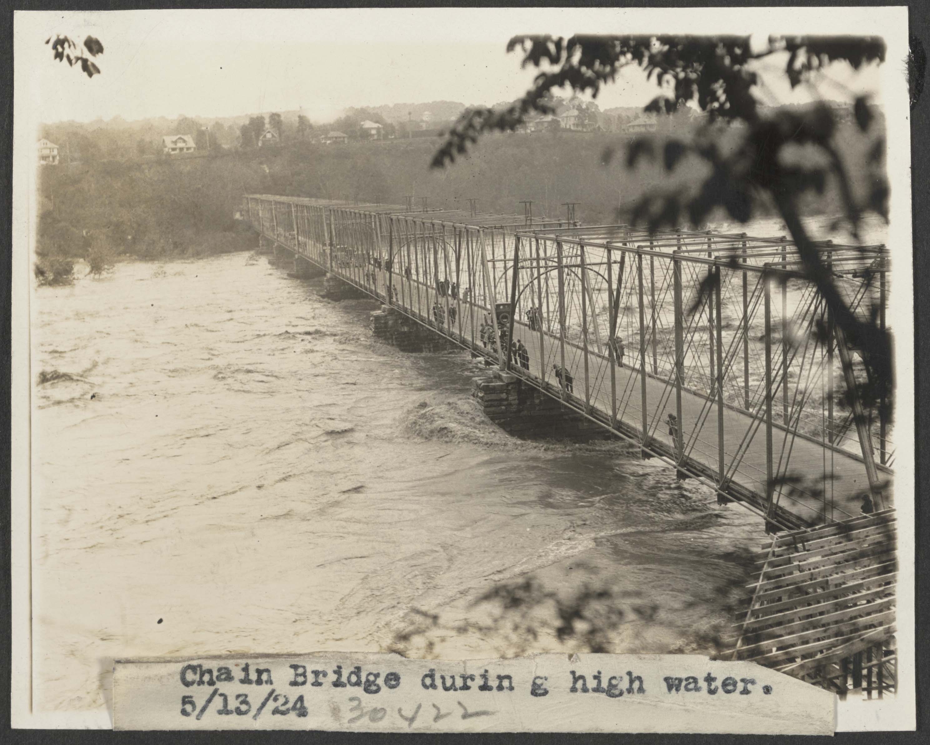
May 13, 1924, Chain Bridge during high water. View from Virginia shore. Georgetown Branch right of way in the distance. Flood. , 1924. Photograph. https://www.loc.gov/item/2016837498/.
There were many historic floods on the Potomac, and many which affected operations on the Georgetown Branch. In fact, in many instances, the flooding dictated the survival of the line – remember famously the engine that was stranded in Georgetown after the devastating flooding from Hurricane Agnes, which toppled the Rock Creek trestle and damaged many waterfront industries. The 1924 flood, in particular, was interesting because afterwards the B&O was finally able to neglect the waterway, performing only minor maintenance on it until selling to the National Park Service in the late 1930s.
I especially like the two B&O and one SCL box cars visible in the new yard. By now the overhead crane had been dismantled and removed. In a few years, the yard would be paved over to become a parking lot.
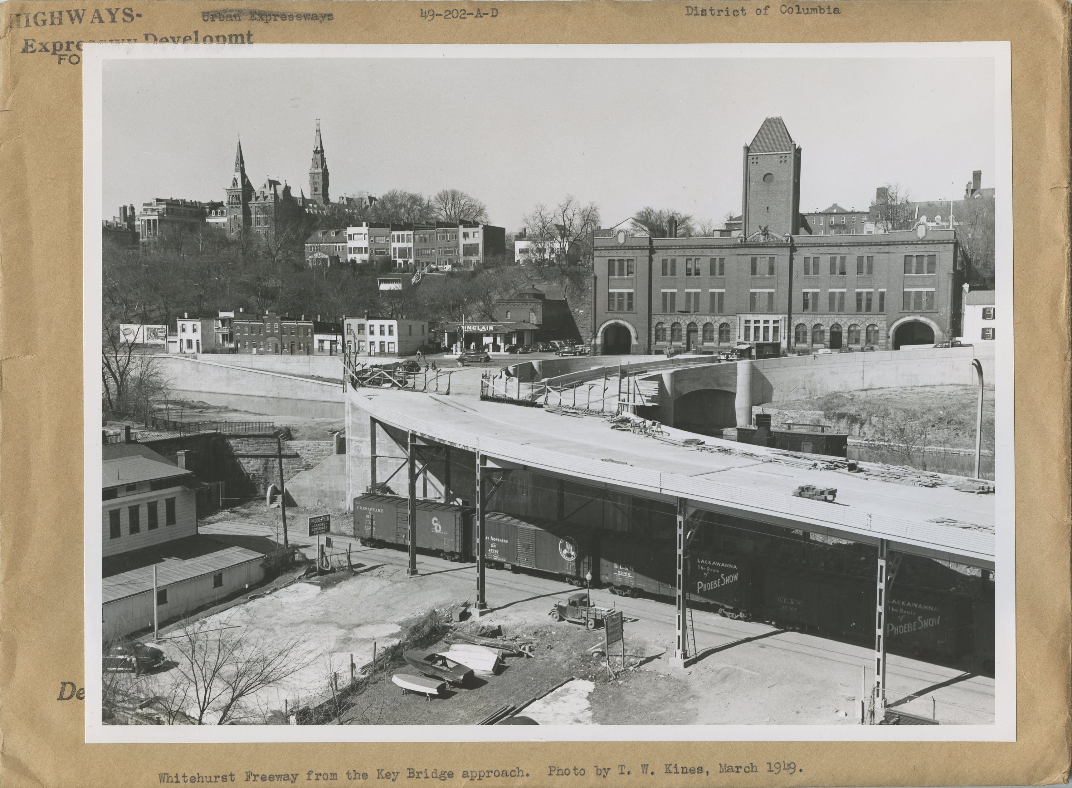
The National Archives has a magnificent set of photos from the construction of the Whitehurst Freeway. Naturally, there are some wonderful trains caught in the shots and I’d like to document them here.
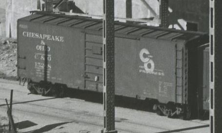
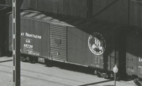
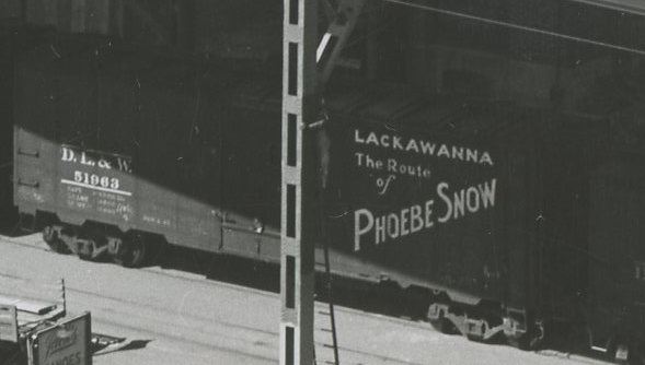
First up is this shot from March, 1949. There are actually a couple prints from this day, showing these and some other freight cars. I imagine the Georgetown switcher was hard at work preparing the train for the Georgetown Turn or perhaps receiving some new cars into the yard. Regardless, it’s a pretty special photo. Before we go on, a huge shout out to the Steam Era Freight Cars group for car data and other info, as well as the various manufacturer pages linked below. Let’s dive in.
Chesapeake & Ohio 152×8
This is a Pullman-Standard Co. built 40′ PS-1 boxcar, lot 5886, C&O series 15000-15999 (1,000 cars), built in Feb 1948. It has 6′, 7-panel Superior doors (evenly spaced, placard mounted to stiffener), Ajax hand brake, Apex Tri-Lok running boards, A3 trucks, 12-panel sides.
Kadee produced a similar model of this car in HO scale, #5023.
Great Northern 49730
In 1940-41 GN received 3,000 cars of this type, built by Pullman Standard, American Car & Foundry and others. This car was built by Pullman-Standard Co. in 1941 in a lot of 500 cars. This 40’6″ car features a 6′ Youngstown door, steel frame, steel ends, wood sheathing. Note that this car has a rare front-facing goat logo, with the slogan: “SEE AMERICA FIRST, GLACIER NATIONAL PARK.” GN specified boxcar red sides with a black roof, ends and underframe.
Resin Car Works produced a similar model of this car in HO scale, Kit 11.01.
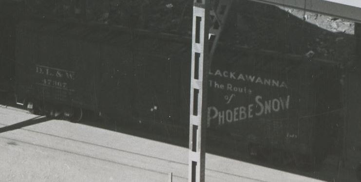
Delaware Lackawanna & Western 51963
This car is an AAR 1937 design boxcar from DL&W series 51750-51999, built Dec 1944 by Magor Car Co. lot W708, a total of 250 cars. The car features 10′ IH, 6′ seven-panel Superior doors, 10-panel riveted sides, 4/5 Dreadnaught ends with round corners and no push-pole sockets. Murphy raised-panel roof, Ajax handbrake, wood running boards, T-Z brake step, 7/7 ladders, double-truss, spring plankless trucks with cast iron wheels. These cars were built between Dec 1944 and Feb 1945.
Between Nov 1929 and Feb 1930 DL&W took delivery of 1,000 of these unusual cars were derived from the USRA standard design. These all-steel boxcars were from series 47000-47699, 700 cars, built by American Car & Foundry, Lot 998, delivered Nov 1929 – Jan 1930. (The other 300 cars, 47700-47999, were produced by Magor Car Co. Lot P-7072, delivered Jan-Feb 1930.) Cars had an insight height of 8’7″, Hutchins Dry Lading roofs and Youngstown doors. After 1940 when cars were outshopped and AB brakes added, many were outfitted with Murphy panel roofs, steel running boards and Superior panel five-panel doors. Cars were delivered in DL&W freight car brown, with standard white freight lettering. Repaints began in 1942 and included the addition of the “Phoebe Snow” slogan design. In 1955 many of these cars were repainted a second time and received the large” “Billboard” road name stenciled and moved to the left side. (Special thanks to Brian Carlson from the Steam Era Freight Car group and Protocraft for some of this info!)
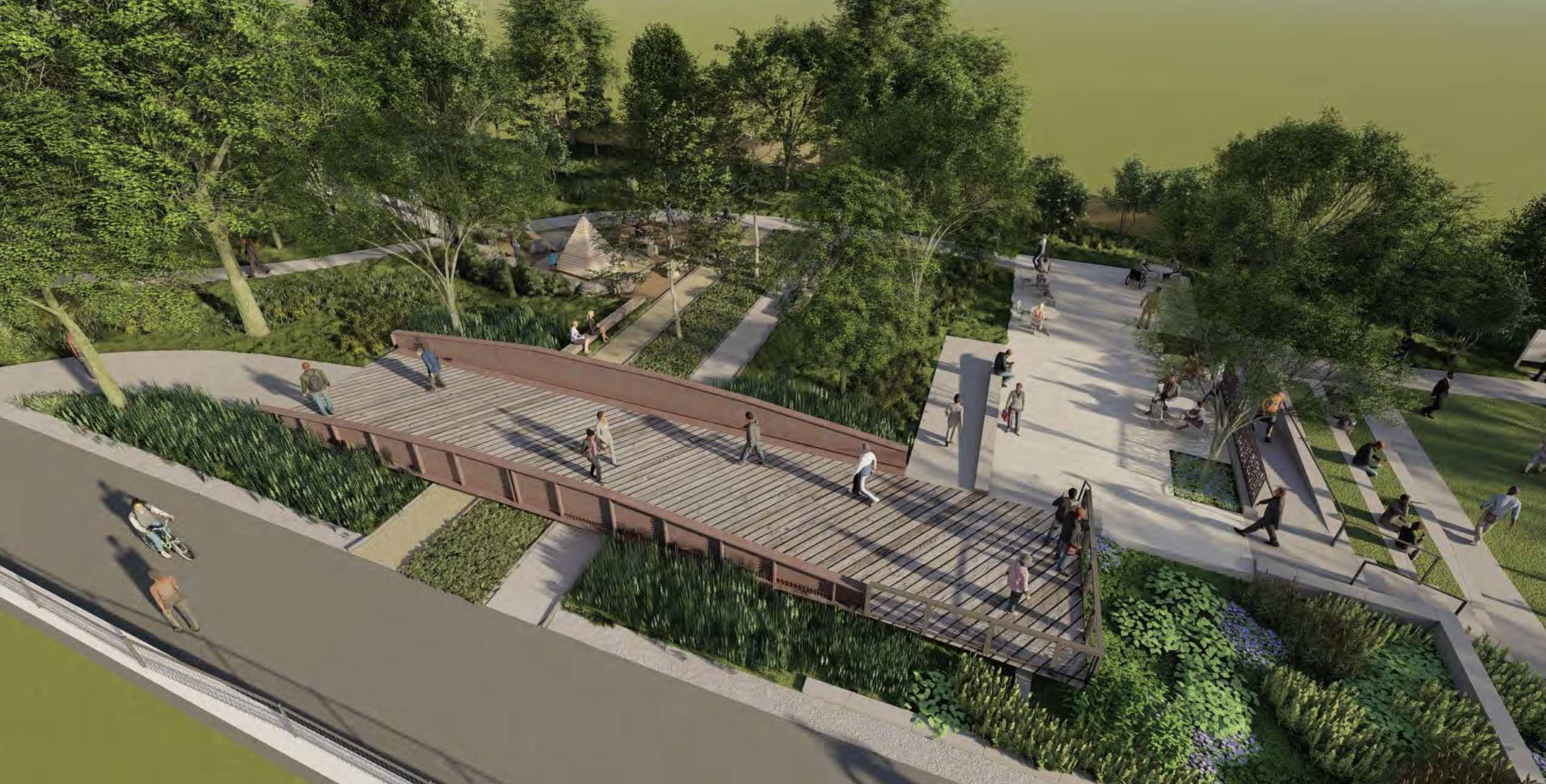
One of the great things from all of the Purple Line destruction/construction is the preservation of the historic Talbot Ave bridge that once spanned the Metropolitan Branch at Georgetown Junction. As you may recall, back in 2019 the bridge was removed in preparation for the installation of the additional two tracks and a new overpass. The County planned to save the bridge for a future installation in a park, and we finally have some renderings of what it may look like.
Lyttonsville Park rendering with the Talbot Ave bridge feature
At the Lyttonsville Park community meeting, a slide presentation outlined the current designs and status. Link to the slide presentation: https://montgomeryparks.org/wp-content/uploads/2020/11/Lyttonsville-community-3-2023-0330-web-r.pdf
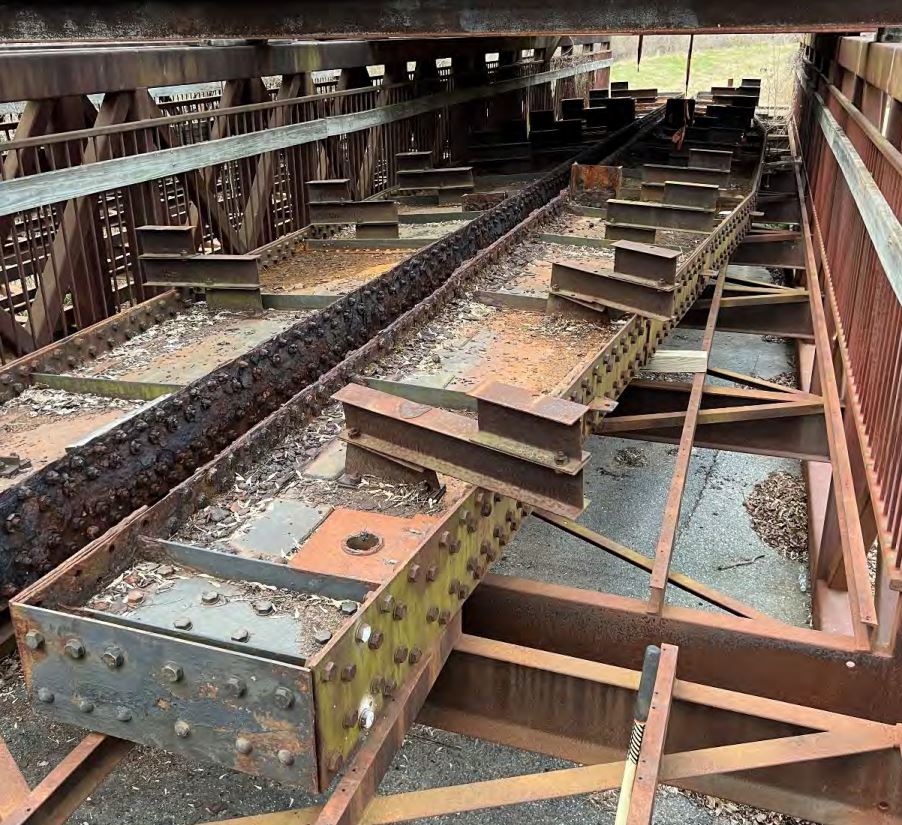
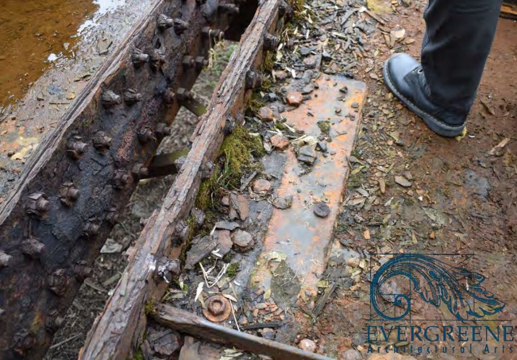
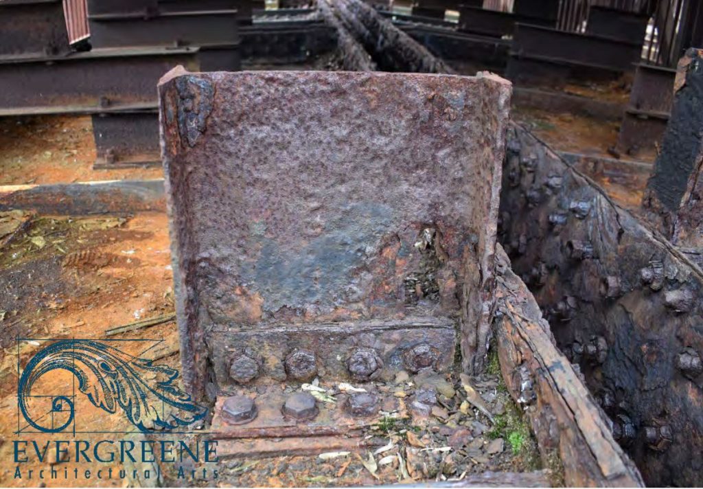
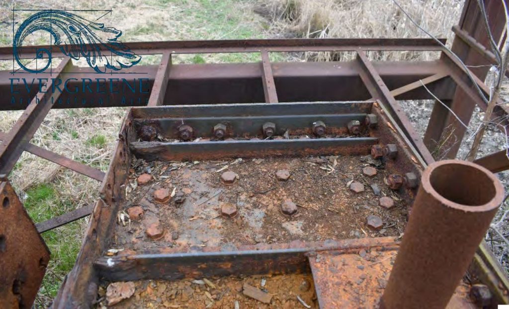
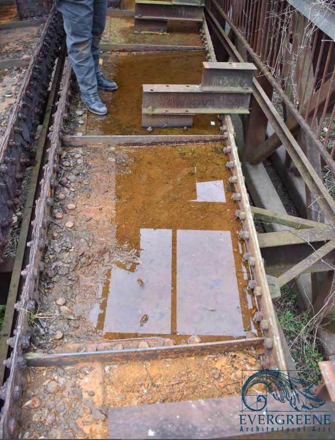
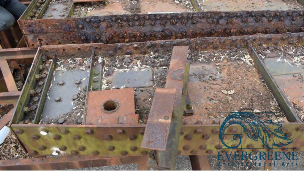
In the presentation are several really neat photos of the current state of the bridge. The girders, one of the only parts of the original 1916 construction, are preserved, sitting atop the pedestrian bridge sections that once topped the Rock Creek trestle. Not sure of the current location; probably in a Purple Line storage yard.
A hundred years of weather, deferred maintenance and punishment has not been kind to the old steel, and it shows. I’m so grateful it will be refurbished and preserved; a small piece of railroad history that will continue to be enjoyed for generations to come. I’ll take it. Plus, I can actually go and get more measurements if I need them! 🙂
Well, this was a special project that I can finally share with everyone. A few months back I was contacted by a Georgetown University graduate student who was putting together a brief documentary on the Georgetown Branch; specifically its history and transformation into a rail trail. We initially shared stories and historic reference material and eventually I was interviewed on-camera at home. I think the project turned out brilliantly and my hats off to Evan, the director, producer, writer – well, everything! He did an awesome job capturing the entire story of the Branch. I hope you enjoy!
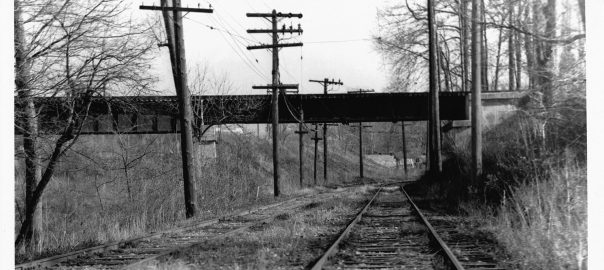
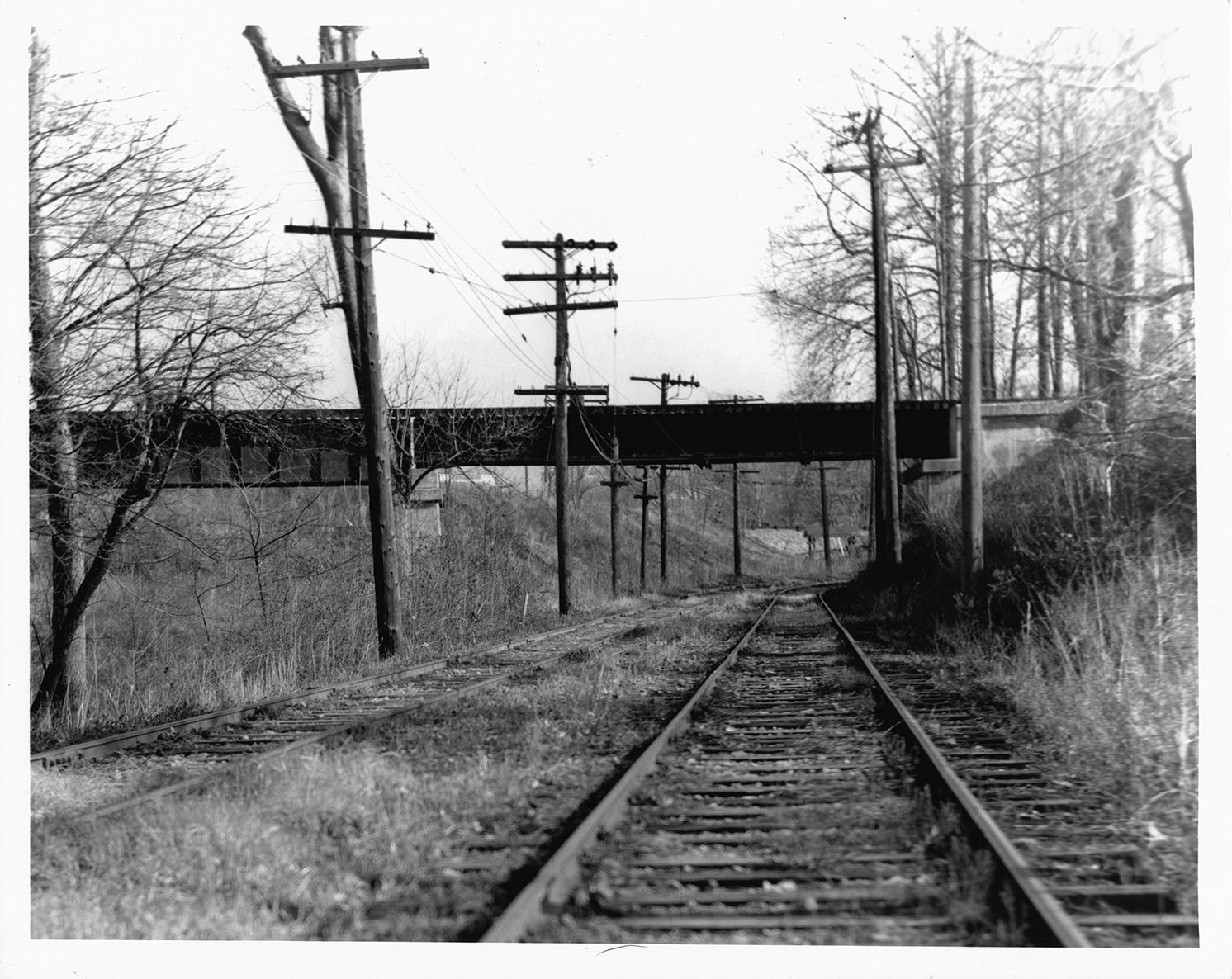
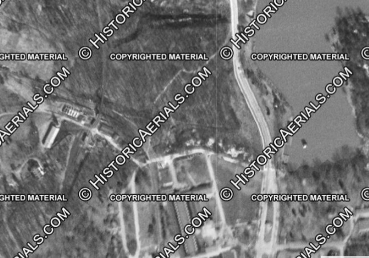
I found this print on eBay recently and am quite pleased to add it to the Georgetown Branch collection. The caption on the back of the 8×10 print reads: “1/59 Washington, DC – Line #20 – B&O RR trestle – crossing over Cabin John line.” The photo was taken from the west side of the trestle, facing to the east.
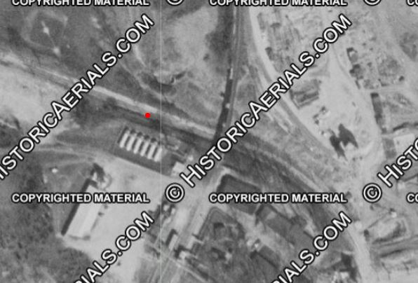
Jan 1959 – B&O trestle crossing Cabin John trolley line. Photographer unknown. Personal collection.Approximate location of the photographer, facing East. Historic Aerials.
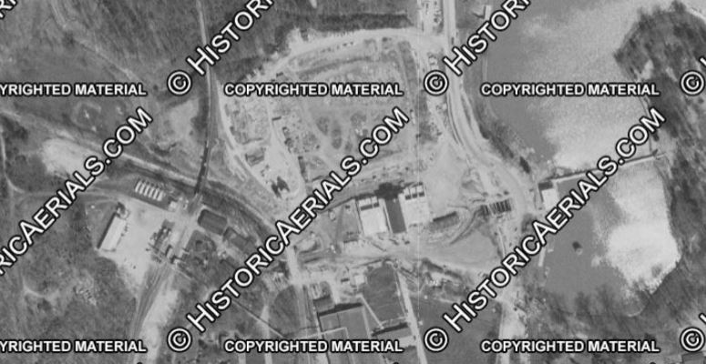
At the time, the Dalecarlia Reservoir was undergoing a massive expansion project. Aerial photos from 1949 and 1957 show the scale of the expansion.
1949. Historic Aerials.1957. Historic Aerials.
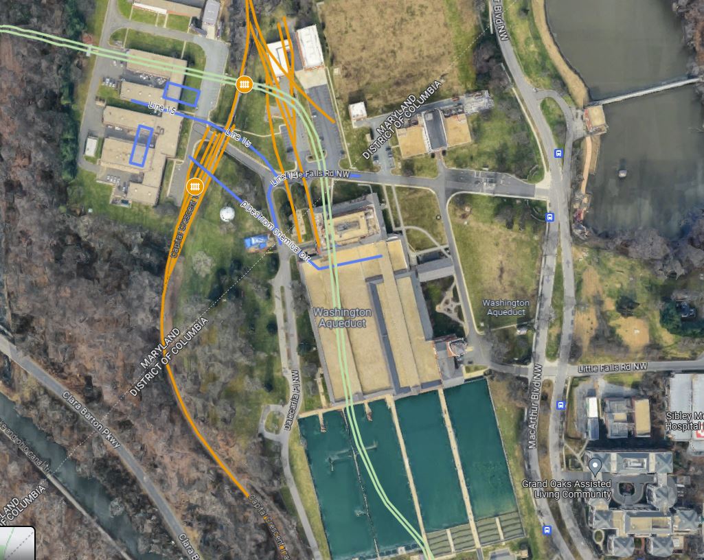
The last trolley on the Cabin John Line was on Jan 3, 1960, and the entire system was fully closed in 1962. Congress revoked its charter in 1956, so likely seeing the writing on the wall, the Dalecarlia reservoir began expansion in the mid 1950s. The right of way was repurposed and is where some major buildings and two of the settling ponds exist today.
The old Cabin John trolley line is outlined in light green on this map. You can see how much has been built on the old right of way.
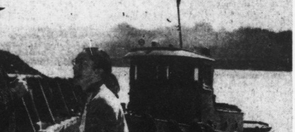
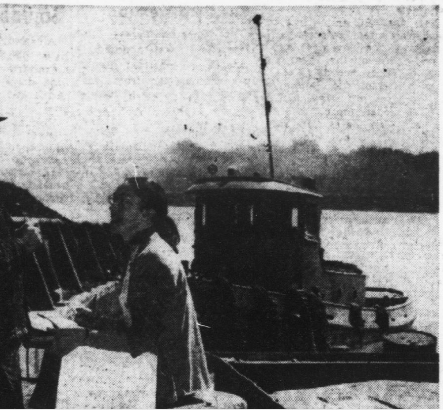
I have long-wondered what type of tug boat operated at the Smoot Sand & Gravel plant in Georgetown. While searching in some old newspaper snippets I saved over the years, I came across the following image from the Washington Evening Star, April 6, 1960, of a census-taker working at the wharf by Smoot. In the background is a nice view of the tug that was working at that time.
April 6, 1960 Washington Evening Star
Here’s a cropped image, a bit zoomed in:
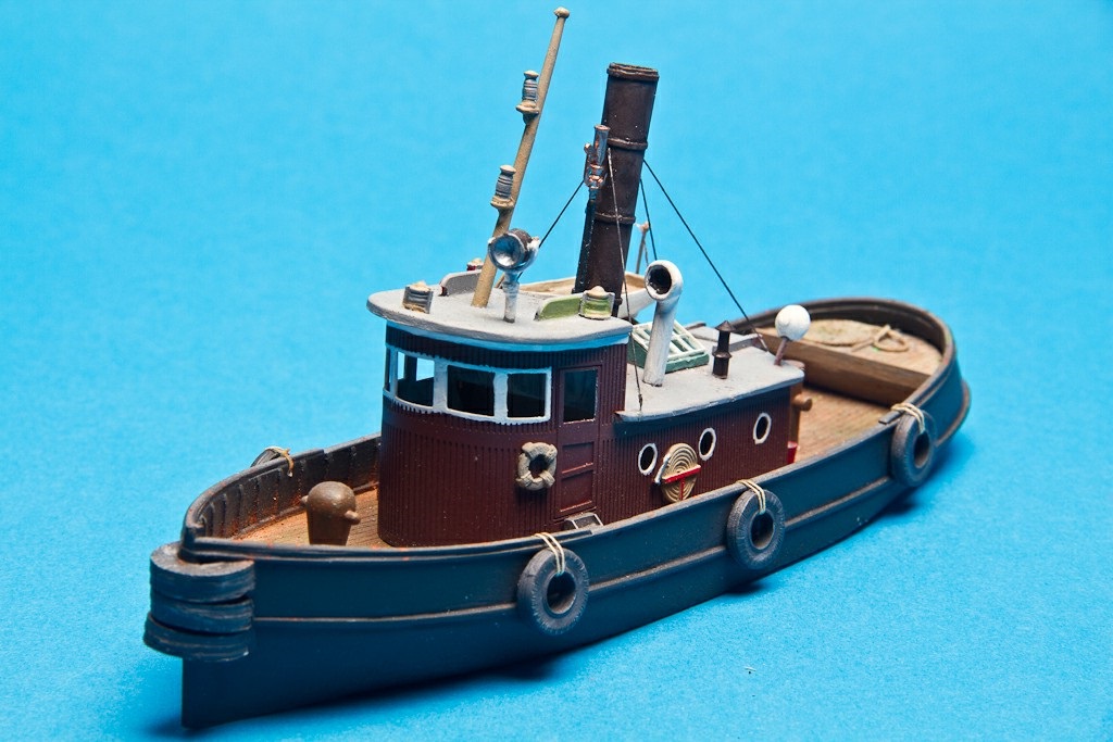
Back in January, at the Amherst Model RR show in Springfield, MA I picked up one of these lovely 53′ Harbor Steam Tug models by Seaport Model Works:
I’d say it’s a pretty good relative match for the one seen in the photo, size and shape-wise. I’ve already got a Sylvan Scale Models HO scale coal barge kit to use with the tug. Should make for a very nice scene.
Al Moran kindly shared these two wonderful photos over on the CSX “Cap, Met, and OML” subs, Railfans Facebook Group of a local servicing Mason-Dixing Recycling, which occupied the old E.C. Keys property for some time. Once the Branch was abandoned, a small amount of track remained near the Junction, servicing the plant.
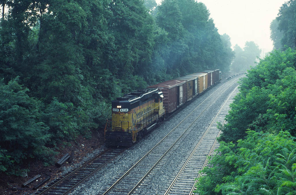
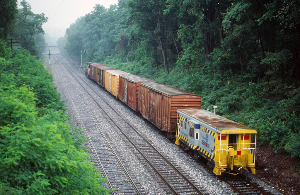
Thank you, Al, for allowing me to share these here on the blog! He writes: B731-08 (possibly D780-08 not sure when the change occurred) with CSX 4234/CSX caboose 904130 at Georgetown Jct after working the last remaining customer on the Georgetown Branch (a recycling place) on 09/08/93. 29 years ago today.
GP30M, CSX 4234 (ex BO GP30 6904, blt 10/1962) heads up the local coming off the branch on 9/8/93. Photo by Al Moran. The photographer is standing on the Talbot Ave. Bridge. Note the new ballast on the branch. Looks like some ties had been recently replaced as well. (Shared with permission from photographer.)C27A Caboose, CSXT 904130 caboose with Operation Lifesaver & Operation RedBlock livery, brings up the rear of the local having just served Mason-Dixon Recycling; the last remining customer on what was the Georgetown Branch. Date is 9/8/93, photo by Al Moran. (Shared with permission from photographer.)

