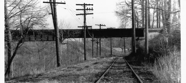
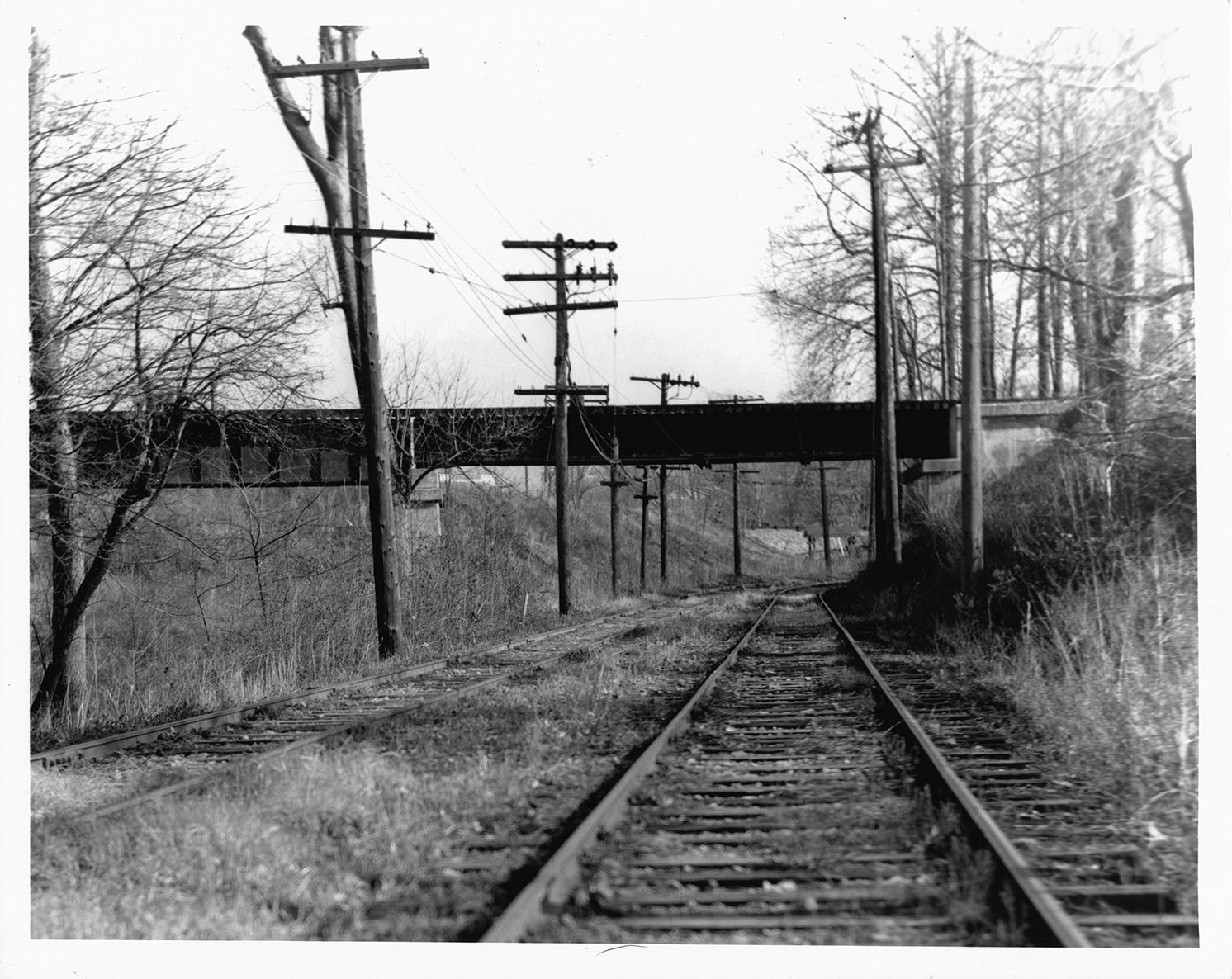
I found this print on eBay recently and am quite pleased to add it to the Georgetown Branch collection. The caption on the back of the 8×10 print reads: “1/59 Washington, DC – Line #20 – B&O RR trestle – crossing over Cabin John line.” The photo was taken from the west side of the trestle, facing to the east.
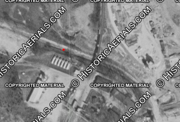
At the time, the Dalecarlia Reservoir was undergoing a massive expansion project. Aerial photos from 1949 and 1957 show the scale of the expansion.
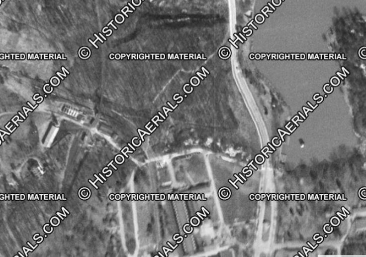
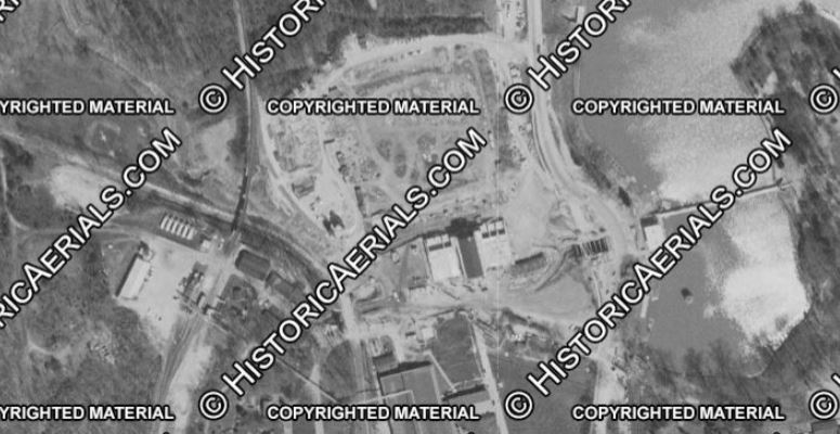
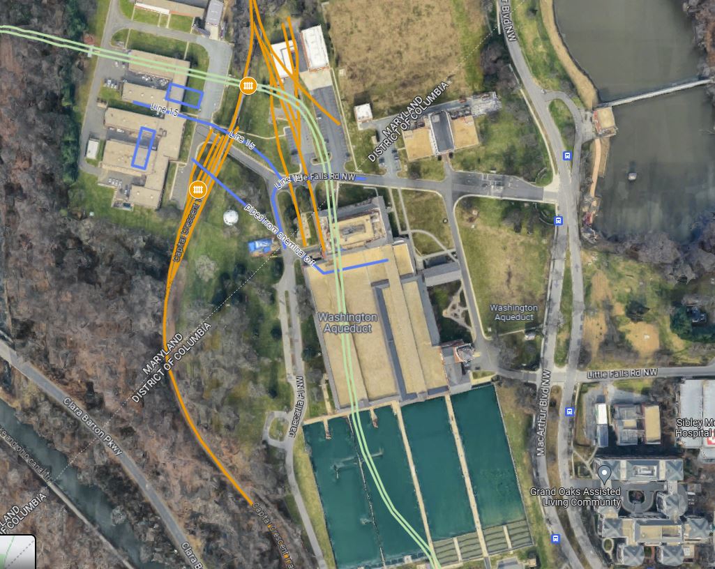
The last trolley on the Cabin John Line was on Jan 3, 1960, and the entire system was fully closed in 1962. Congress revoked its charter in 1956, so likely seeing the writing on the wall, the Dalecarlia reservoir began expansion in the mid 1950s. The right of way was repurposed and is where some major buildings and two of the settling ponds exist today.
A link to my Georgetown Branch Google Map
Hope you enjoy this brief view of the bridges over the trolley line. If only there was a train passing by! 🙂
I grew up within sight of that location. It always amazed me how much it transformed when the trolley right of way was all filled in.
I was given to understand (in the eighties) that the Corps was deliberate in constructing over the right of way in order to stop the line from returning. Not sure of the accuracy of that assertion.
By the seventies the sidings on the south side of the complex were gone, replaced by the network of sidings extending northeast off a single point on the main and covering the trolley right of way. The Northwest most siding was also gone. The two trailing point switchback sidings were for chlorine.
Fascinating! I remember walking through there in 1991 but didn’t pay close attention to any of the left over sidings, etc. I remember thinking how odd it was that I was crossing a bridge that was basically filled in. It was a rainy day, and my friend and I didn’t want to be seen, so we scooted past as we hiked down to the C&O Canal bridges that rainy day. The only time I saw the line when there were tracks. I remember the first time I saw the network of sidings you mentioned that replaced the old ones. Ray Soderberg shared a photo of them and it kinda blew my mind. Didn’t know they were there! Some of that track appears to still be in place, embedded in concrete by the facility – visible in aerial images. Here is the image Ray shared: http://gbblog.sluggyjunx.com/2020/12/20/dalecarlia-water-treatment-plant-ca-1974 — Ben
Looking back over this post and the overlay of the arial photo. You know the one thing not in that map you made was the earthworks that were begun for the bridge over the Potomac River at approximately the DC line. You could see in the woods (in the early/mid-eighties) where the line would have branched off if it was ever built. It was wooded then, but the topography was there, but only if you were quite familiar with the shape of the underlying land. The line would have diverged immediately after the water works sidings.