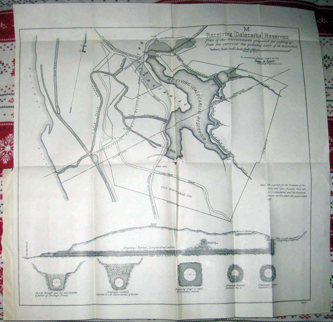
Well, look what I found on eBay! This map, dated 1893 is titled “Receiving [Dalecarlia] Reservoir], Plan of the Improvements proposed for cutting off from the reservoir the polluted water of its watershed. As many faithful Georgetown Branch fans will tell you, the Georgetown Branch originated as three separate entities:
“The Metropolitan Southern Railroad would develop the line from the Metropolitan Branch (the B&O main line at Silver Spring) to the Potomac Palisades. The Metropolitan Western would build the Virginia section of the line from the Potomac River to Quantico. Finally, the Washington & Western Maryland would complete the spur line from Potomac Palisades to Georgetown.” (From http://www.cctrail.org/CCT_history.htm)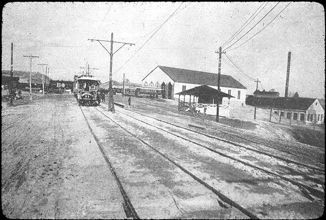
This map covers the area around Dalecarlia Reservoir. At the time the map was made, the Georgetown Branch (or Metropolitan Southern) was still in its early planning stages, having only been completed to the area around Connecticut Ave. in Chevy Chase. (see photo) If you will notice, the line doesn’t even extend toward Georgetown! There is a line crossing the Potomac River and another branch heading North into the reservoir, surely to provide building materials and other freight to the plant. It’s unknown where the line would have led.
In all of my memory, I do not recall an map depicting this crossing actually existing. One might surmise from the map that it did at one point, which of course it did not. It does reinforce, however, that there were plans circulating from the railroad at the time that do portray their goal of having a line that connected the B&O to the South. Of course due to many factors, it never happened and it became a small footnote of grand ideas in the long history of the branch and the B&O railroad, for that matter. I am excited to have a picture into this past.
I just noticed an interesting spur on that map, swinging off as a facing point switch for trains about to cross over the canal. The spur swings around and seems to go off in the direction of the streetcar line. Never build, of course. I wonder what that was about.
Hi Christopher, thank you for your comment! I think sometimes I write these blog posts when I am too excited about stumbling on a discovery like this map. I noticed the line, too, but made a comment about it being for building supplies or something. Looking at it again, i think that it was drawn as a proposed line to maybe service an industry in that area or perhaps a depot that is long gone. Not sure. maybe as a supply line for building an industry that is now gone. Not sure. It really is interesting, though. Good catch!