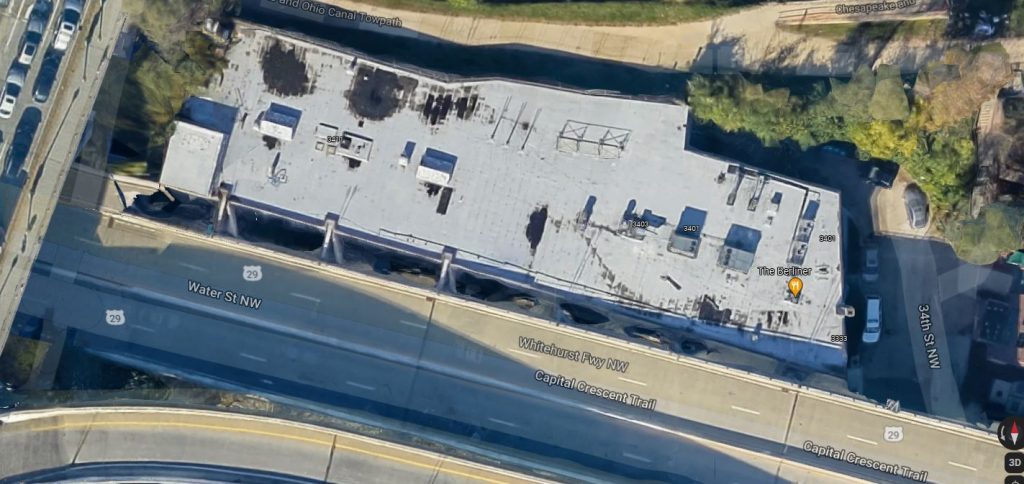
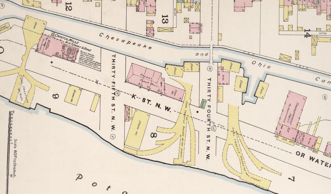
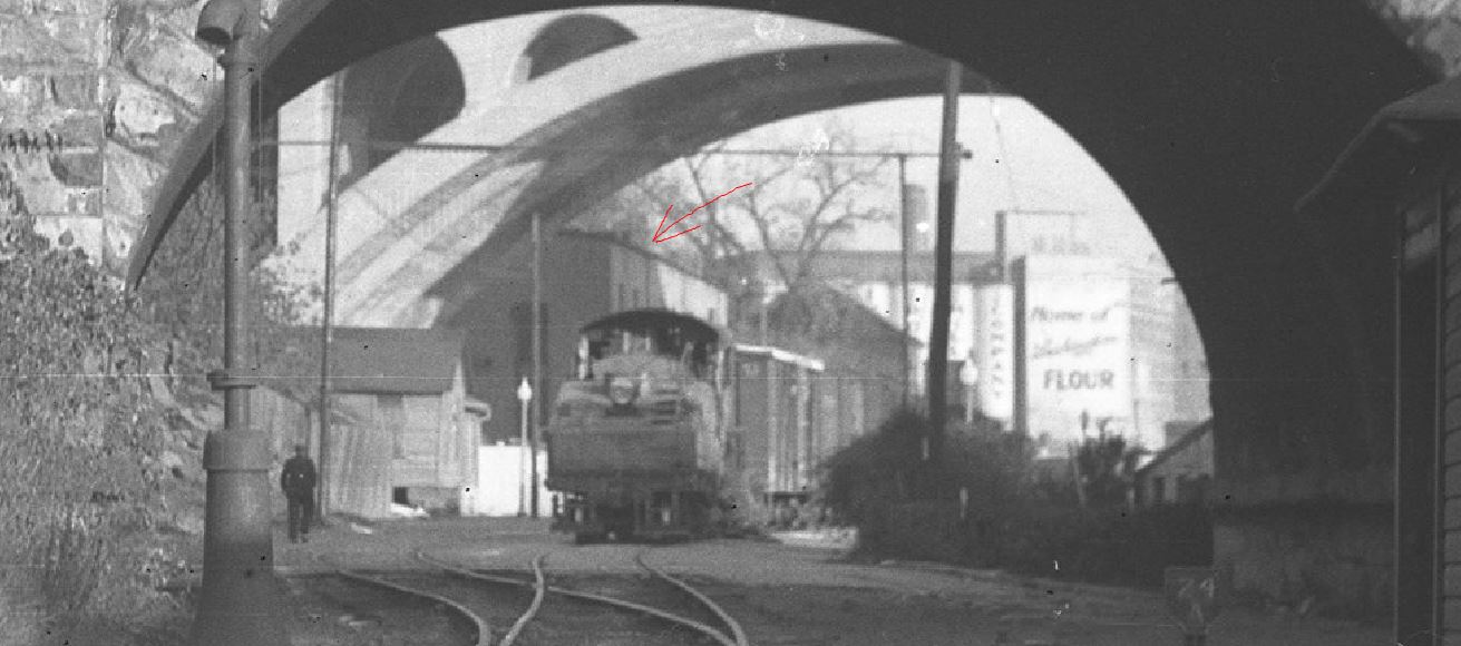
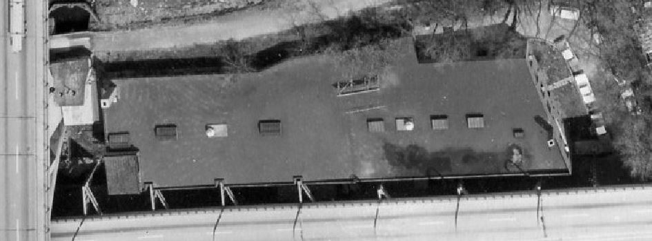
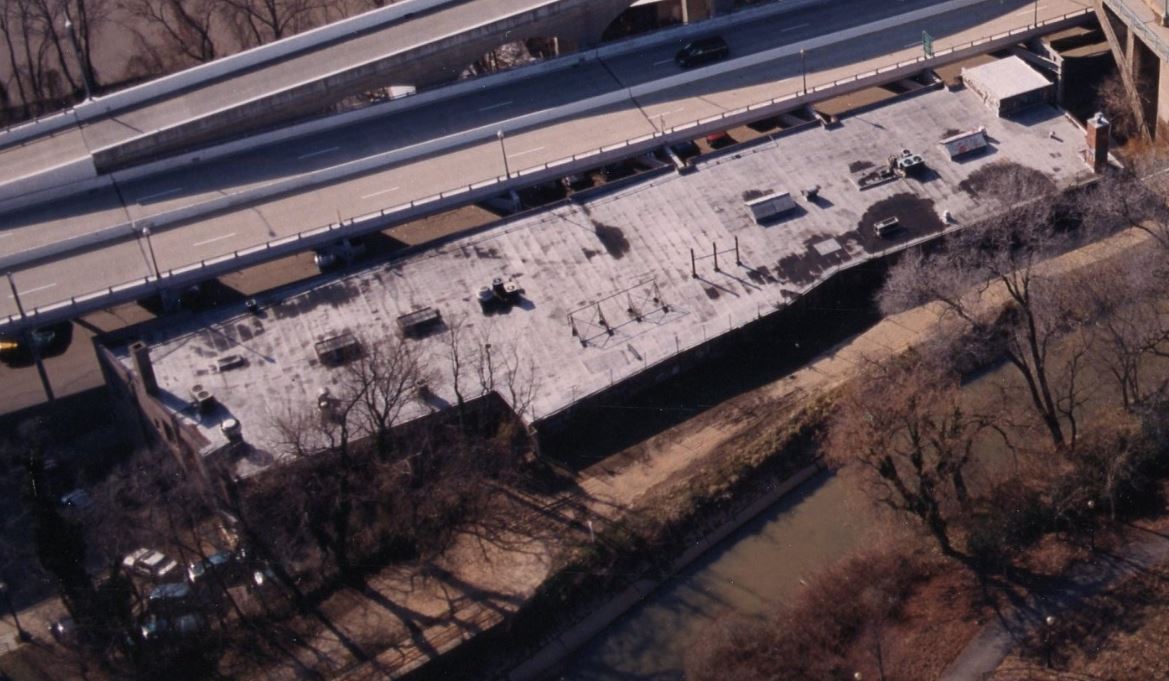
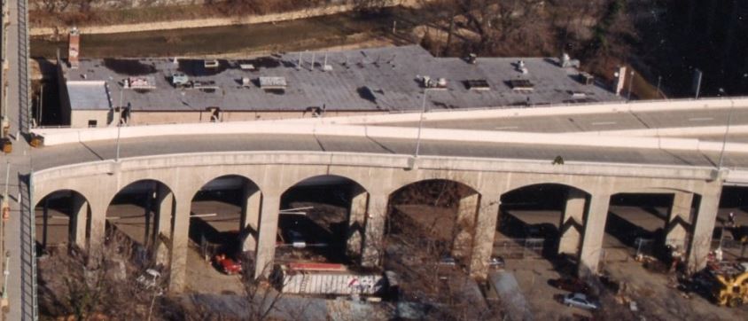
3400 K St., Google Maps, Dec 2021. Note how the three supports for the Whitehurst Freeway extend out and into the wall of the structure. This is where a 4-car siding was located on the Georgetown Branch.
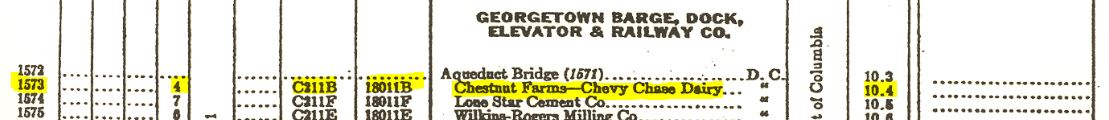
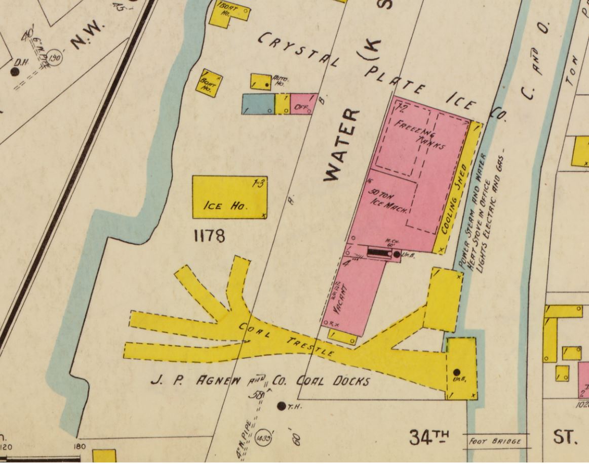
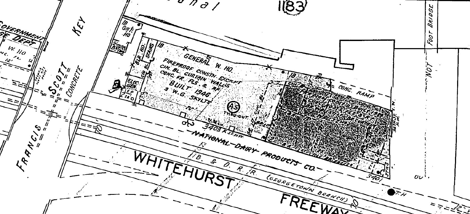
Something that has been a bit of a conundrum for me over the years is what type of business, exactly, was located at 3400 K St during my modeling era, 1945-55 and what exactly the structure looked like. On the 1954 B&O Form 6 (which describes rail customers, siding lengths, freight agents, locations, etc.) it reads “Chestnut Farms-Chevy Chase Dairy”, 4-car length, milepost 10.4. The siding does not appear on the 1941 Form 6.
1954 B&O Form 6 excerptJune 1963, B&O RR Track chart with proposed Potomac River Freeway shows the siding at 3400 K St.
Maps have varying names listed for the industry located at 3400 K St.:
1888 Sanborn: vacant flour mill & coal house
1903 Sanborn: Crystal Plate Ice Co. & vacant
1919 B&O map: no name, just “2 Story Brick“
1921 Baist: American Ice House
1928 Sanborn: Crystal Plate Ice Co.
1954 B&O Form 6: Chestnut Farms-Chevy Chase Dairy
1959 Sanborn: National Dairy Products Co.
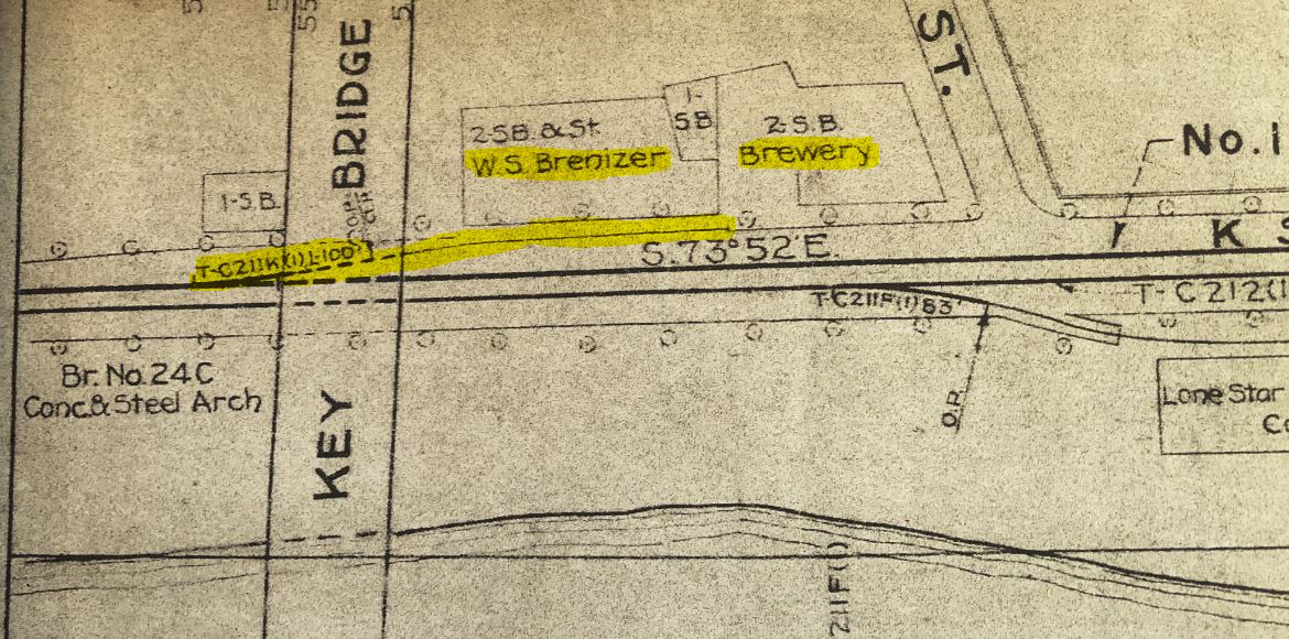
1963 B&O map: W.S. Brenizer and “Brewery” (I suspect it was The Guggenheim Co.)
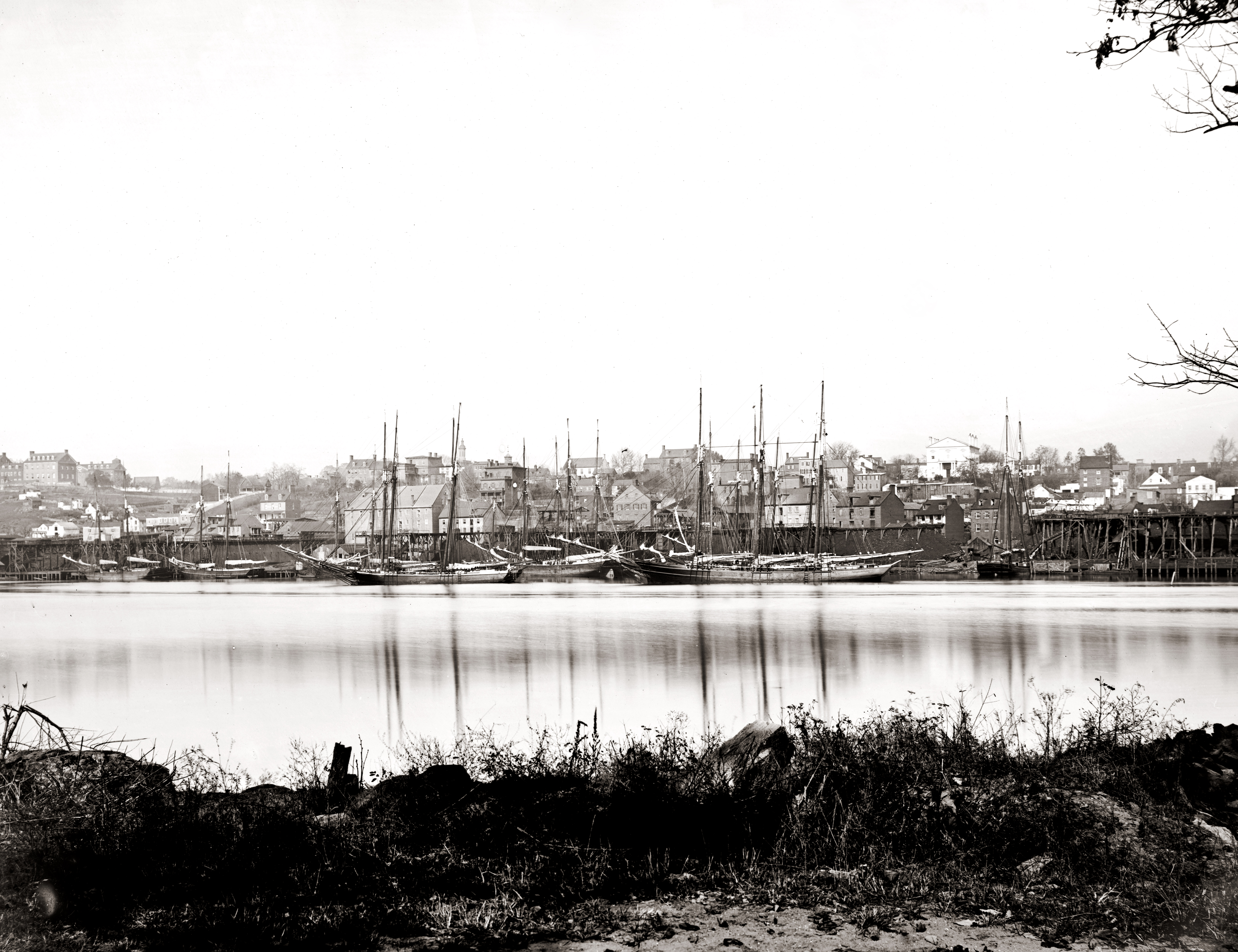
I decided to go back through photos and maps I have in my files to see if I can get an idea of what type of structure existed at this spot over the years. I’m starting way back, long before the railroad came to town because I think the history and background is pretty special. The first image comes from the year the Civil War ended. Georgetown looked pretty different back then than it does now.
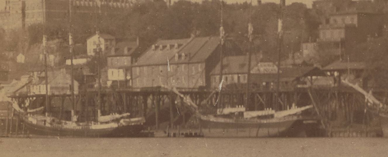
The waterfront in 1865. An image from the Georgetown Metropolitan website. I believe the 3400 block of K St is where that very large four-story warehouse is located, about a third of the way from the left. The Washington Aqueduct bridge is visible on the very far left side. Georgetown Univ. is also visible, top left. Sept 28, 1886. Another view showing some waterfront detail. A few years after the previous photo and the “coal house” structure has a large sign painted on its end. DC Historic Society, Potomac Boat Club collection. http://hdl.handle.net/1961/dcplislandora:29620
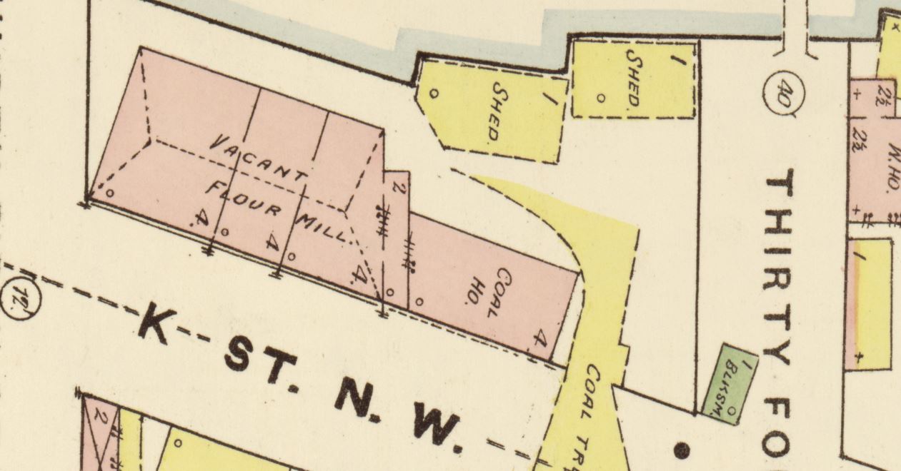
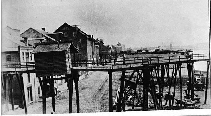
First map reference is a snip from an 1888 Sanborn Map. Note the 3400 K St. location is occupied by a Vacant Flour Mill and a Coal House, visible in the photos above. Also note the prominent overhead coal trestles which were used to transload coal from canal barges on the C&O Canal to ships docked on the Potomac River wharves.
(1888) Sanborn Fire Insurance Map from Washington, District of Columbia, District of Columbia. Sanborn Map Company. [Map] Retrieved from the Library of Congress, https://www.loc.gov/item/sanborn01227_001/.
And here is a detail from the above map:
1888 Sanborn Map, LoC.View down K St, ca 1890. I believe the large mill building in the center occupied the 3400 K St. location. This is an excellent view of the overhead coal trestles. Note what looks like tracks visible in the pavement below. Image from Old Washington, D.C. in Early Photographs, 1846-1932, By: Robert Reed, 0486238695, 1980.
Here is a clip from a Sanborn Map from ca. 1903. Remember this pre-dates the arrival of the B&O (1910), but the Georgetown Barge Dock and Elevated Ry. Co. had been incorporated in 1889.
(1903) Sanborn Fire Insurance Map from Washington, District of Columbia, District of Columbia. Sanborn Map Company, – 1916 Vol. 1. [Map] Retrieved from the Library of Congress, https://www.loc.gov/item/sanborn01227_002/.
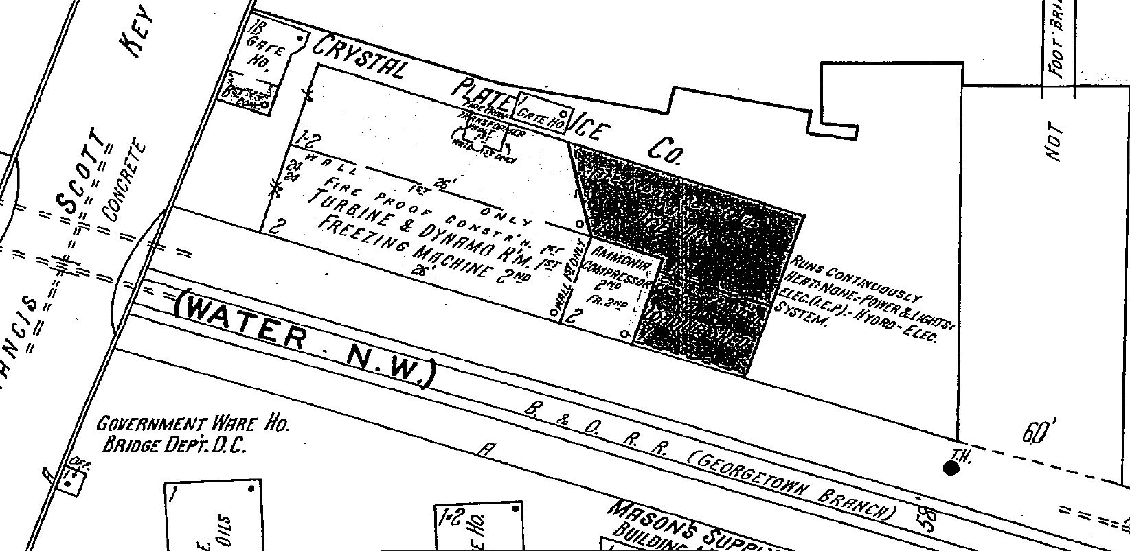
The business is listed as Crystal Plate Ice Co. Within the warehouse are “Freezing Tanks” and “50 Ton Ice Machinery” and an attached “Cooling Shed.”
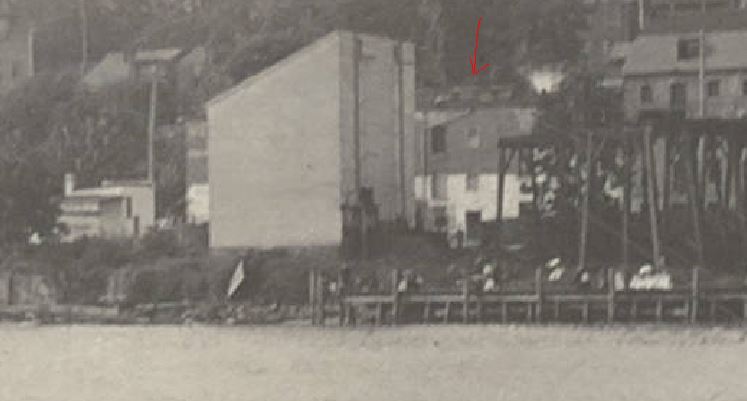
August 14, 1904. Note the presence of the tall coal trestles extending to the wharves. DC Historic Society, Potomac Boat Club collection. http://hdl.handle.net/1961/dcplislandora:29662 August 14, 1904. Another nearly identical view from the same collection. DC Historic Society, Potomac Boat Club collection. http://hdl.handle.net/1961/dcplislandora:29660 A few years later, 3400 K St, ca 1911-18. HABS collection. https://www.loc.gov/pictures/item/dc0048.photos.025822p/ (1920) Key Bridge under const. United States Washington D.C. District of Columbia Washington D.C, 1920. [Photograph] Retrieved from the Library of Congress, https://www.loc.gov/item/2016826863/. 1921, “Airscapes” of American and Foreign Areas, 1917 – 1964, National Archives https://catalog.archives.gov/id/68144007 Note the “coal house” structure to the right has been razed. Ca. 1920s, “Airscapes” of American and Foreign Areas, 1917 – 1964, National Archives https://catalog.archives.gov/id/68144007 Aug, 1927, “Airscapes” of American and Foreign Areas, 1917 – 1964, National Archives https://catalog.archives.gov/id/68144007 Ca. 1920s. A view from the other direction. “Airscapes” of American and Foreign Areas, 1917 – 1964, National Archives https://catalog.archives.gov/id/68144007 1928 Sanborn Map.
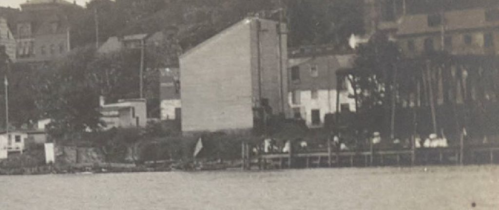
A photo by Theodor Horydczak shows the site ca 1920s, likely the late 20s. Note that the building appears to have been either been razed, rebuilt or heavily renovated and the Key Bridge is now complete.
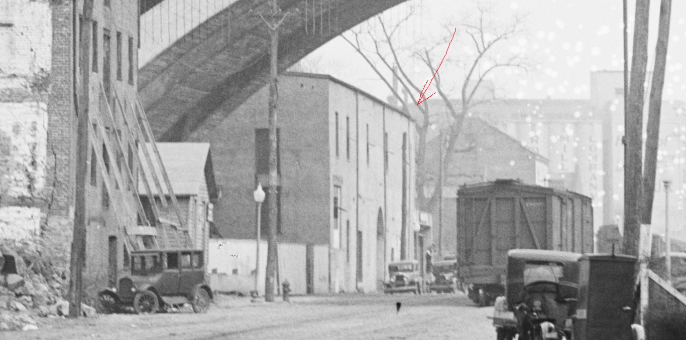
Horydczak, T., photographer. Lone Star Cement Co. Lone Star Cement Co. and negative of adjacent property. Washington D.C, None. ca. 1920-ca. 1950. [Photograph] Retrieved from the Library of Congress, https://www.loc.gov/item/2019673071/. 1931. “Airscapes” of American and Foreign Areas, 1917 – 1964, National Archives https://catalog.archives.gov/id/68144007 June, 1931. “Airscapes” of American and Foreign Areas, 1917 – 1964, National Archives https://catalog.archives.gov/id/68144007 July 1931, “Airscapes” of American and Foreign Areas, 1917 – 1964, National Archives https://catalog.archives.gov/id/68144007 July 1931, “Airscapes” of American and Foreign Areas, 1917 – 1964, National Archives https://catalog.archives.gov/id/68144007 A view down K St. October 28, 1936, from the Barriger Collection. https://www.flickr.com/photos/barrigerlibrary/12230291546/Harris & Ewing, photographer. (1930) Train tracks near Potomac River, Washington, D.C. United States Washington D.C. District of Columbia Washington D.C, 1930. [April] [Photograph] Retrieved from the Library of Congress, https://www.loc.gov/item/2016889645/.
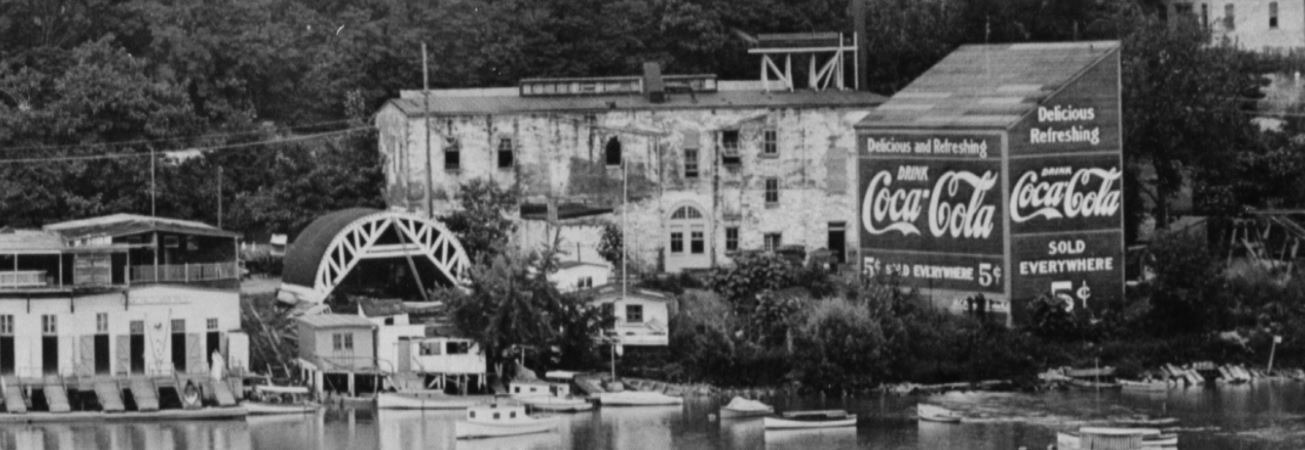
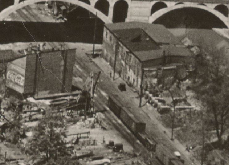
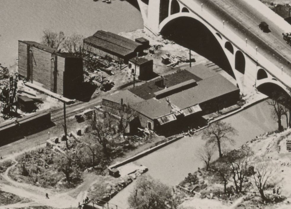
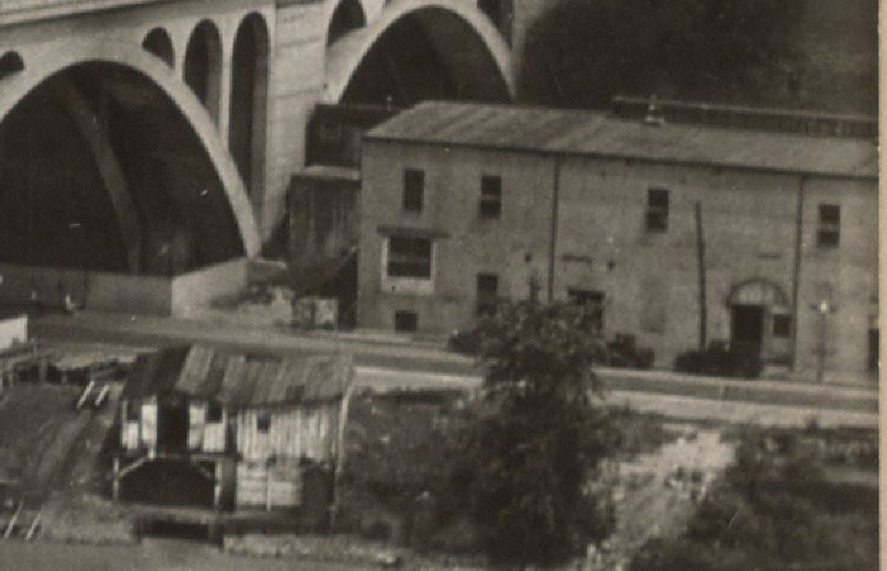
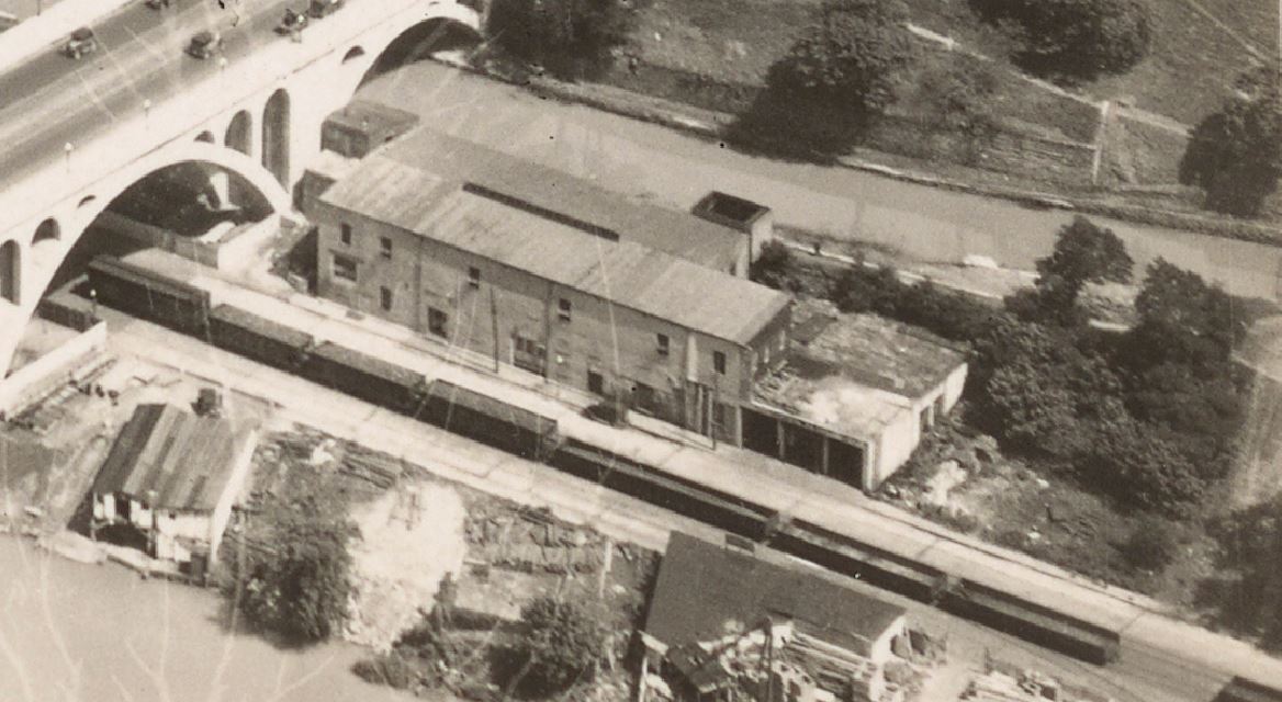
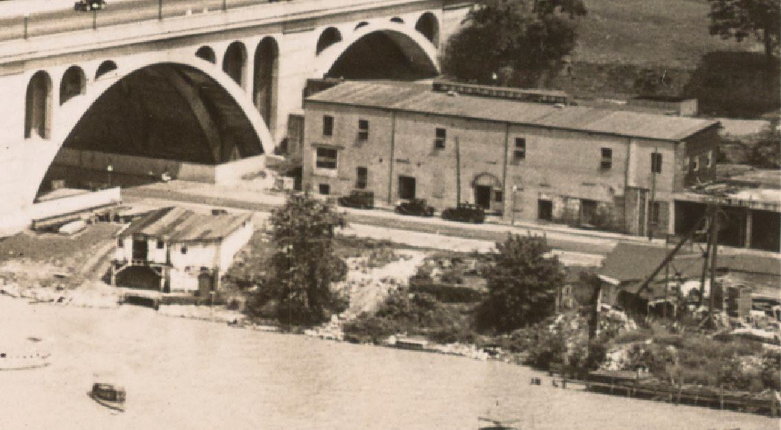
It appears that in the 1940s an addition was made on the east end of the block. I believe sections of the older structure (from the 1920s era) remain, but it seems that some of the structures were replaced.
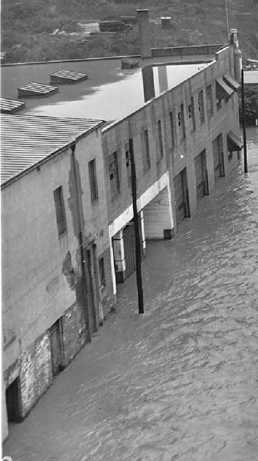
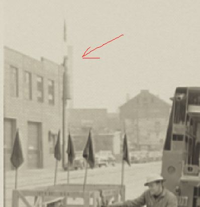
Note the large “bottle” sign at the top right corner of the building, facing away from the photographer. A neat detail. If only I could see the front of it! Oct 17, 1942, 3400 K St. – flooding. Credit: Acme Photo. eBay purchase, personal collection. A promotional photo by Theodore Horydczak captured a portion of the “new” structure, with the bottle sign clearly visible. Horydczak, T., photographer. Potomac Electric Power Co. miscellaneous. Manhole crew and truck I. Washington D.C, None. ca. 1920-ca. 1950. [Photograph] Retrieved from the Library of Congress, https://www.loc.gov/item/2019672478/.
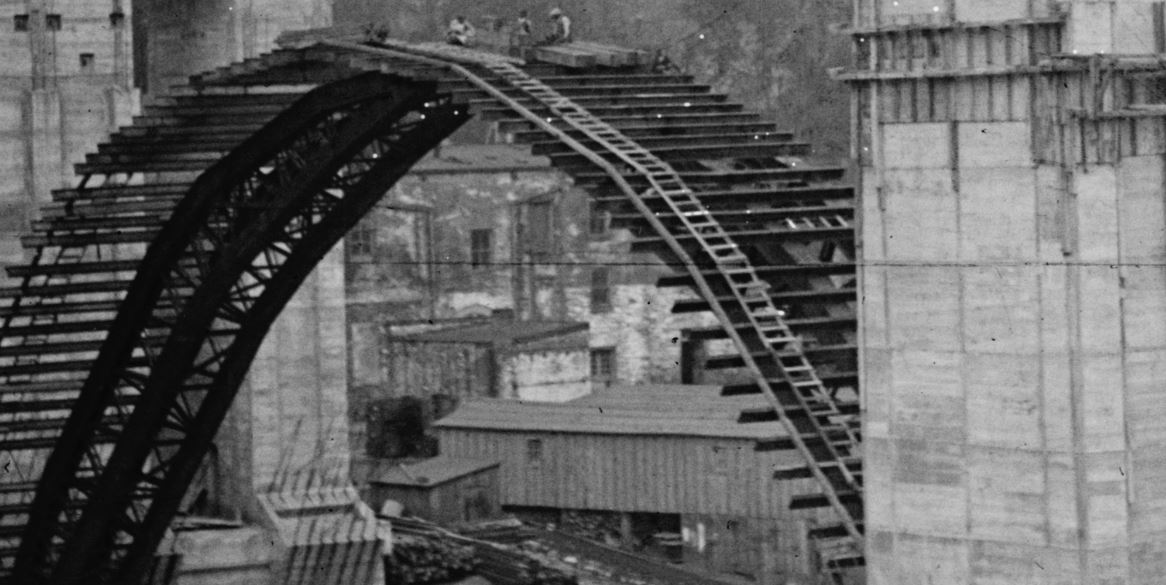
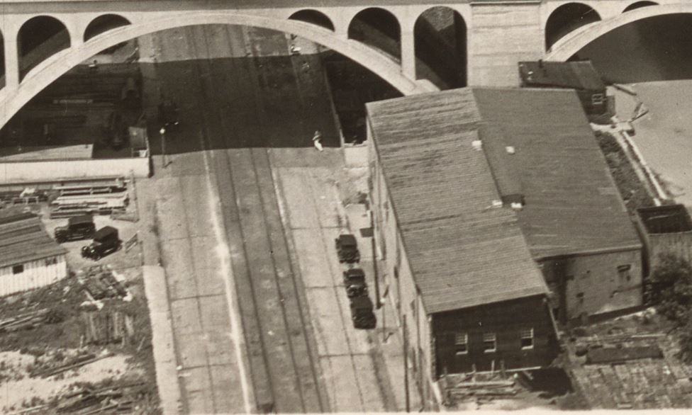
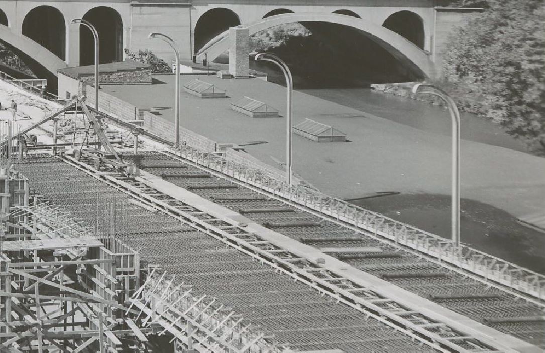
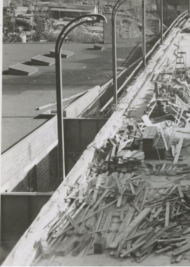
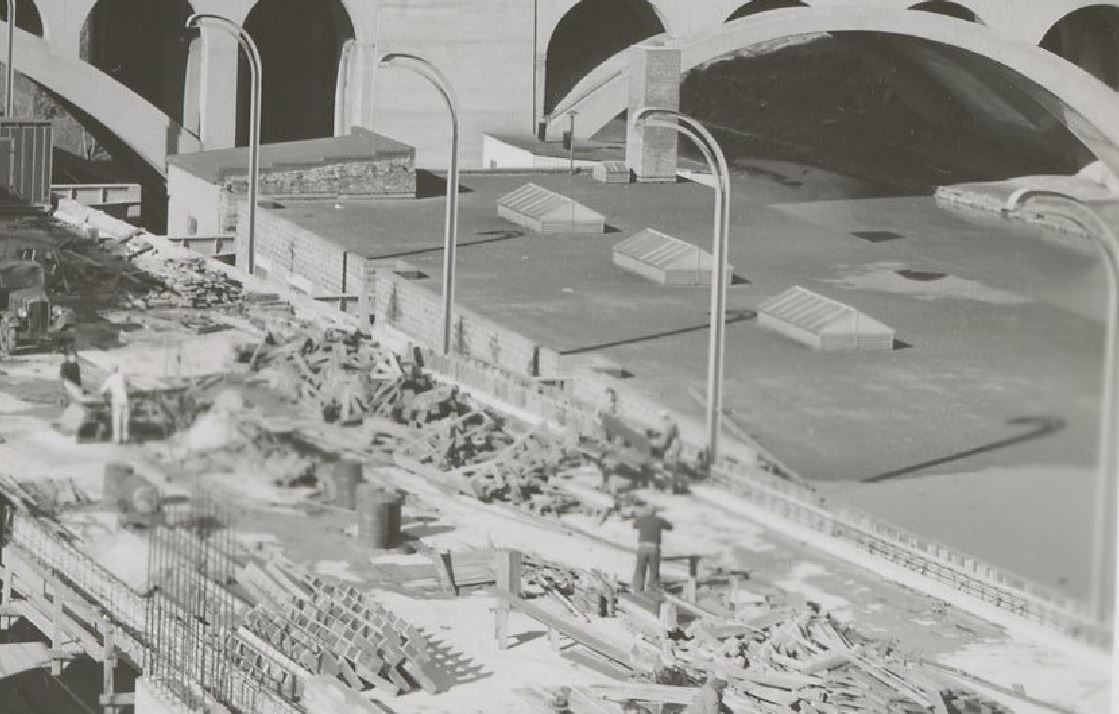
It is likely the structure was changed when the Whitehurst Freeway was being constructed, ca 1946:
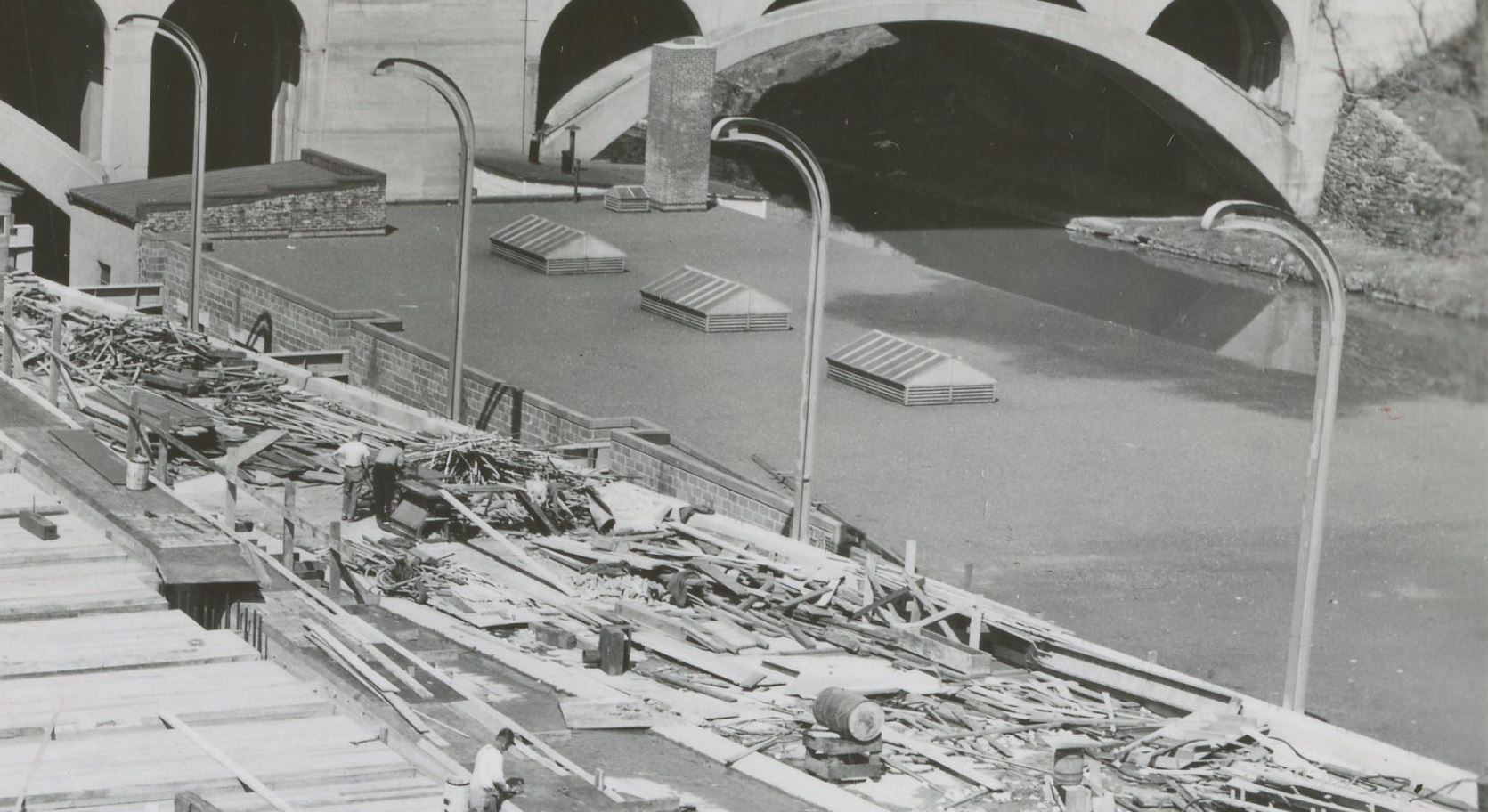
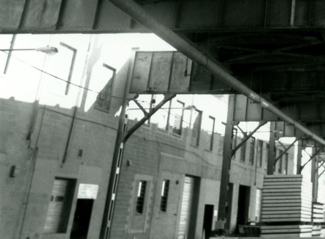
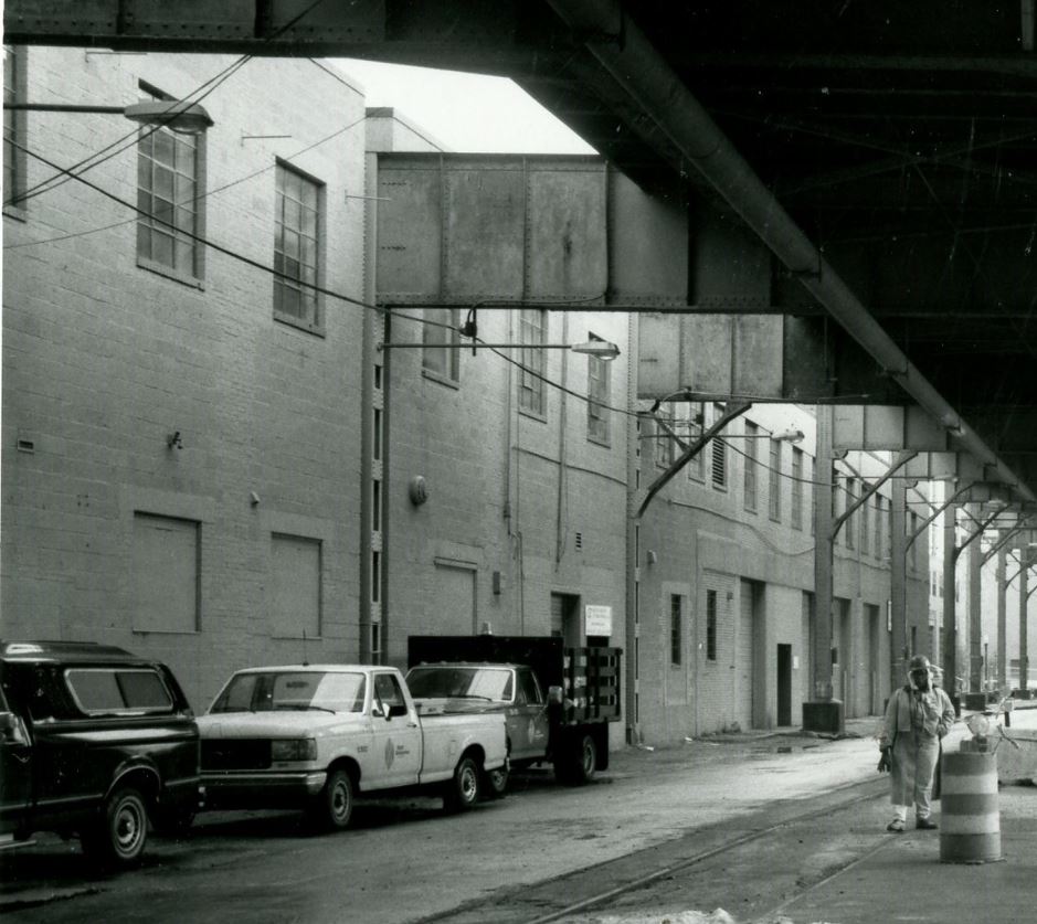
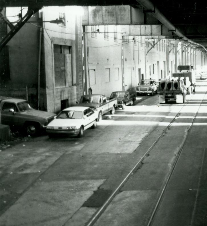
1958 Sanborn Map. Note that the structure now reads “Built 1946”. I suspect that in the mid-40s, or perhaps when the Whitehurst was being built in 1947, the old structure was razed and a new on built in its place to accommodate the new freeway structure. 1948. Whitehurst Freeway construction showing the roof of the new 3400 K St. structure. https://ddotlibrary.omeka.net/ 1948. Whitehurst Freeway construction showing the roof of the new 3400 K St. structure. https://ddotlibrary.omeka.net/ 1948. Whitehurst Freeway construction showing the roof of the new 3400 K St. structure. https://ddotlibrary.omeka.net/ 1948. Whitehurst Freeway construction showing the roof of the new 3400 K St. structure. https://ddotlibrary.omeka.net/ 1963, DDOT DC.1972, Hurricane Agnes. DDOT DC. 1972, Hurricane Agnes. DDOT DC. 1991, DDOT DC 1991, DDOT DC 1991, DDOT DC 1991, DDOT DC 1997, DDOT DC1997, DDOT DC
I hope you enjoyed this photo tour of the 3400 K St. location. I commuted from Bethesda to Rosslyn by bicycle for a few years and every morning and evening I walked up and down 34th St past this location from K St to the bridge over the C&O Canal and on up and over Key Bridge. Often I would ponder the history of the building and what came before. When I was commuting, it was a fitness center / gym and various professional offices. No doubt more research is in order to get more details on the businesses that operated here, but this is a good start. When I have more information, I will post an update.