A couple weeks ago Kelly R. & I spent a day hunting the Georgetown Branch. It dawned on me that the Rock Creek trestle was either gone or not long for this world. I knew that with the Purple Line construction plowing ahead (literally) much of the Georgetown Branch right of way is either gone or soon-to-be gone forever, or forever changed. So, we finally nailed down a time and made a day trip of it. (*Note – if you’d like to see all of my photos from the outing, you can visit my Gallery HERE.)
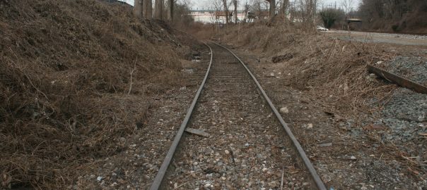
We started at the Junction (naturally) to document what was there. This was one of the more delightful spots, as much of the Junction is untouched and actually opened up due to some recent brush clearing by CSX and MDOT. You can see that they have topped many of the large trees at the Junction along Talbot Ave. The Talbot Ave bridge still stands (yay!) and is open to pedestrian traffic. We managed to locate the old team track switches (wow!) still in place in the original rails. VERY cool. We walked down the Branch and found the switch lead for the E.C. Keys (now T.W. Perry) siding. Too bad they don’t still take deliveries!
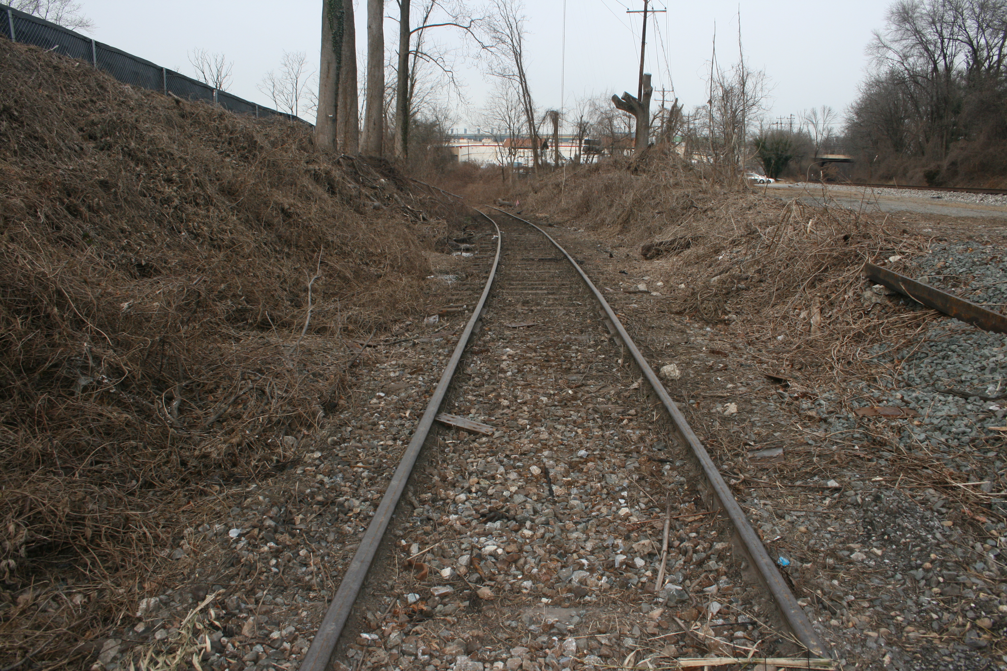
We visited several of the Branch crossings between the Junction and Rock Creek, but there just isn’t much to see besides the new Lyttonsville Rd. bridge (which had opened the day before we arrived) as well as the massive brush-clearing they have done. It was neat to see the RoW in a state closest to the original 1890’s appearance for one last time.
But then we arrived at Jones Mill Rd. and got our first taste of sadness:
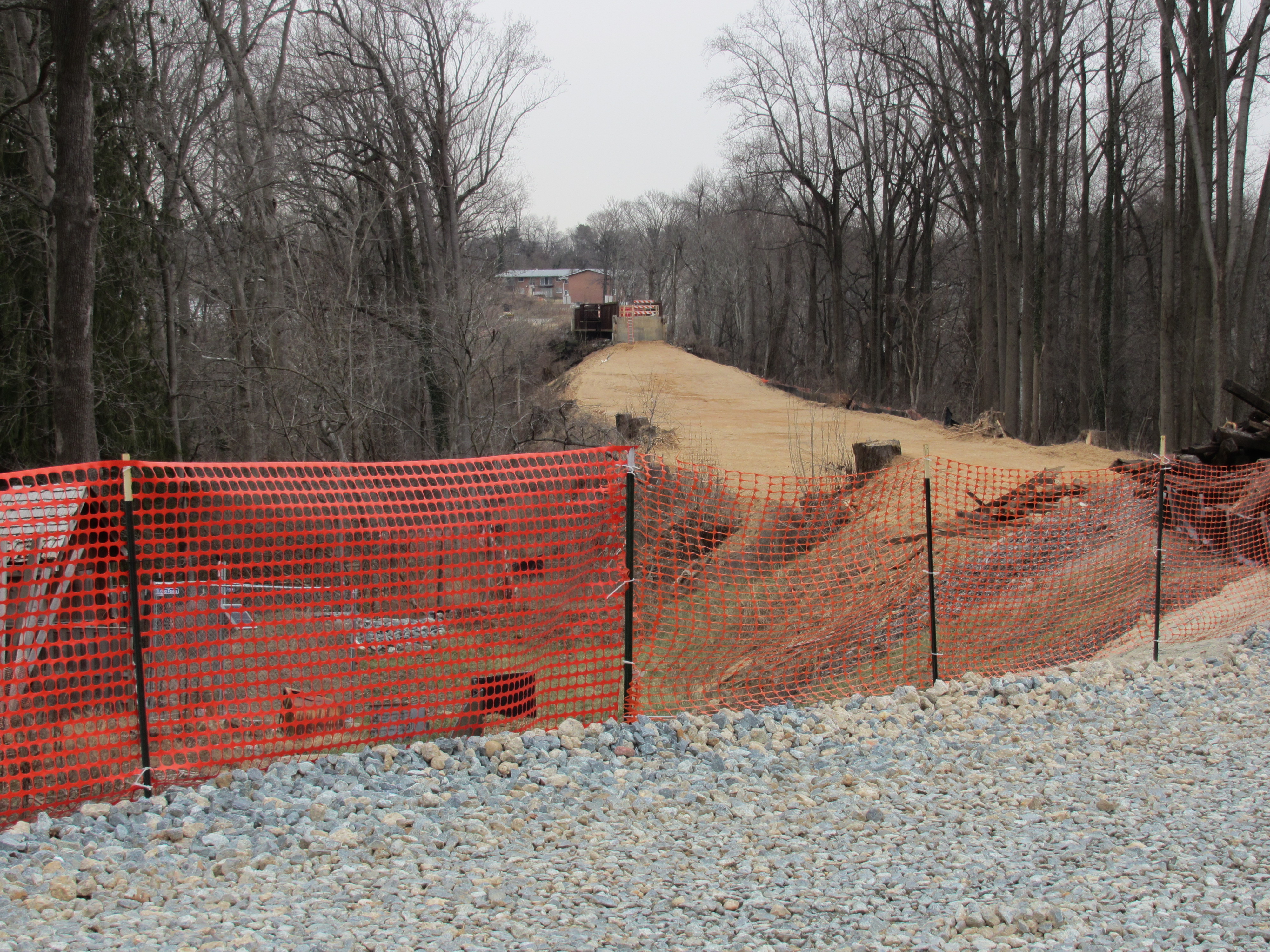
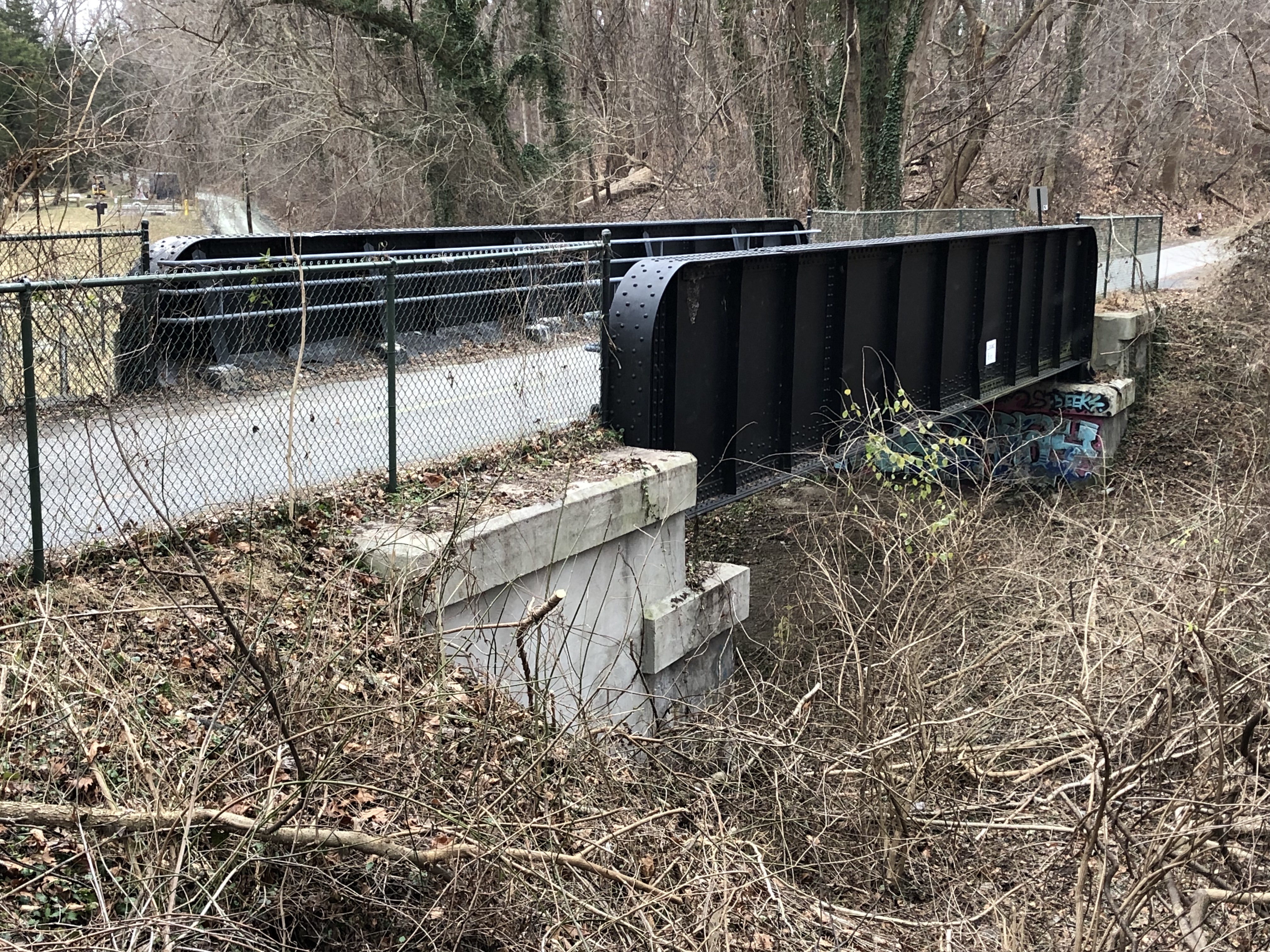
They have gutted the right of way. For reference, the tracks used to sit atop that concrete abutment and continued to the level I was standing on. All of the dirt you see in this picture is fresh. It’s as if they sliced the top of the fill off. And they’re just getting started. The Rock Creek trestle (in the distance) is not long for this world. It’s already in the process of being demolished when this photo was taken.

Here is the trestle, or what’s left of it for now. The missing section on the right has been removed already and MDOT will be taking the pedestrian bridge off of the top and re-using it elsewhere. Then, the rest of the trestle will be disassembled and removed in preparation for the new Purple Line bridge and pedestrian bridge. So sad to see the end of an era that spans over 130 years in this location. (pun intended) 🙂
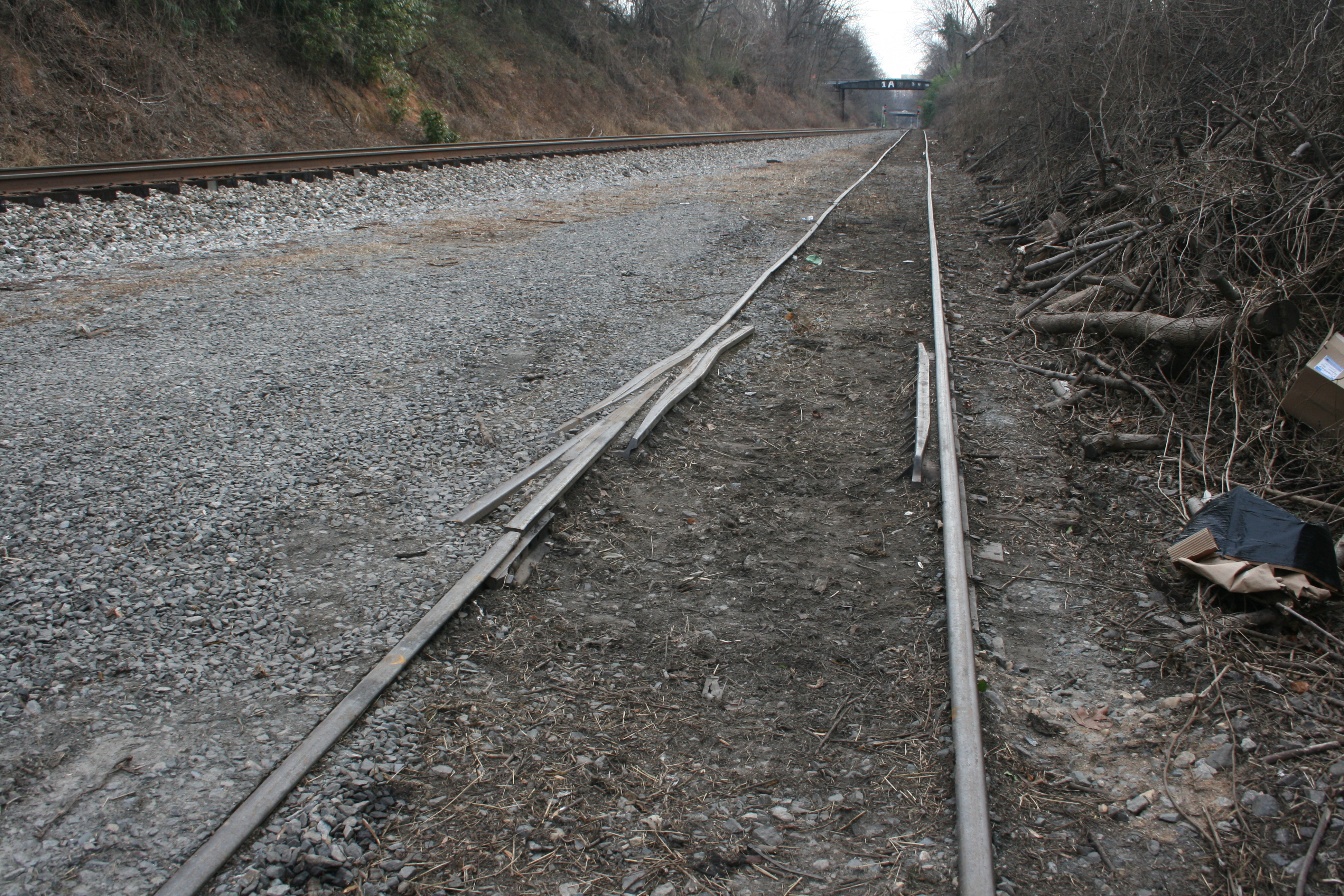
We then hopped in the car and visited Connecticut Ave. The carnage here is massive and I didn’t feel like taking photos or getting out due to the hostile construction zone. MDOT has set up cameras and guards in these areas to protect the NEW equipment they bought, no doubt. (wow!) I can report that the old T.W. Perry property has been gutted and is being leveled. The old bridge just South of T.W. Perry has been completely removed and nothing but a dip in the ground remains. Sad!
Our next stop was Bethesda where we drove through town on our way to lunch. Bethesda was very busy and we chose not to stop in the downtown area, as with all the construction it is particularly difficult to get park. There’s not much left to see there, anyway, as it has REALLY become so built up over the last several years. We drove across the Little Falls crossing, then to River Road where we parked and hit McDonalds to refuel. We met a Penn Central hat-wearing railfan there who was dining with family. We shared some stories about the GB and some photos of a PC box car at Conn. Ave. which he enjoyed!
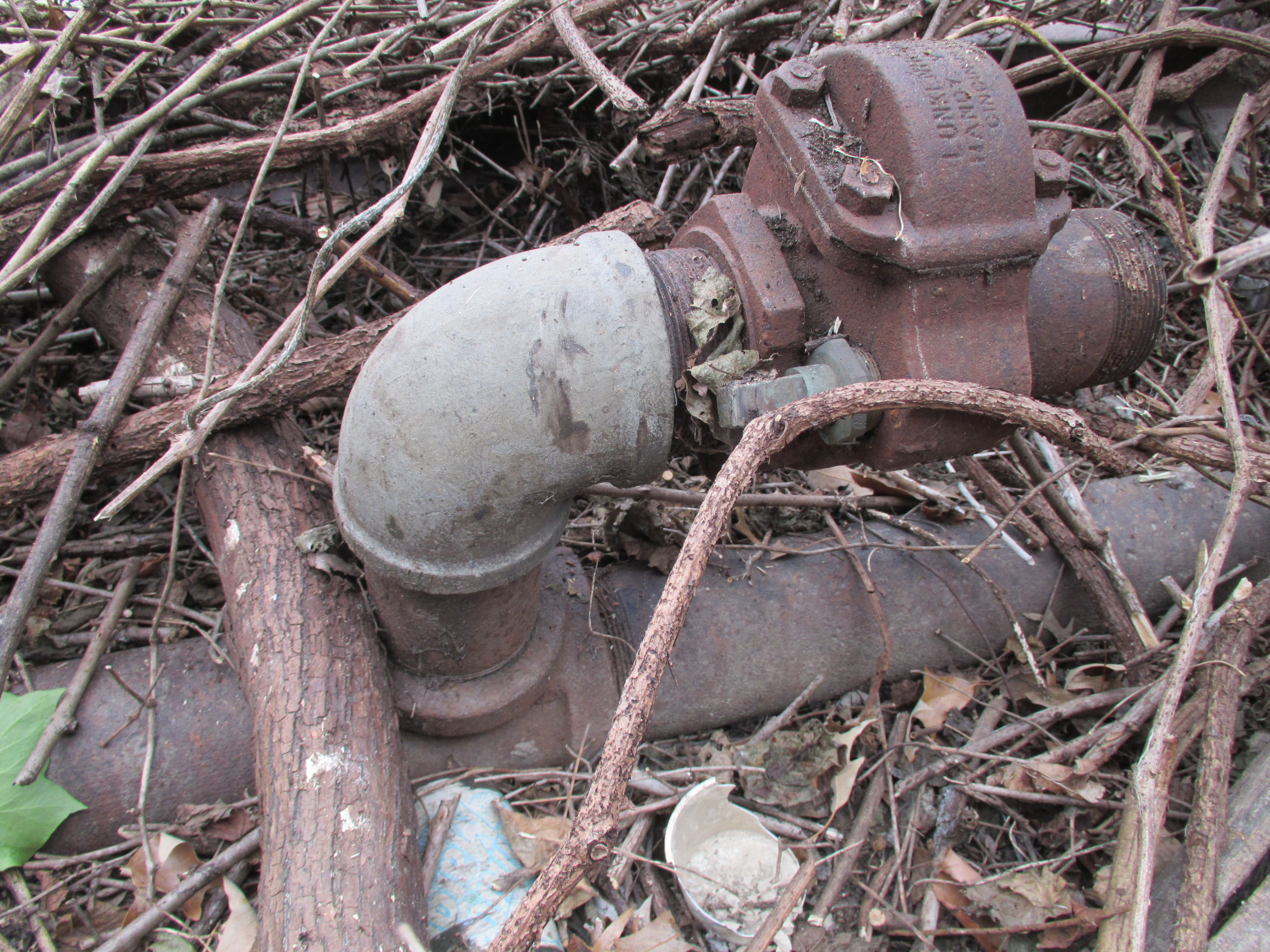
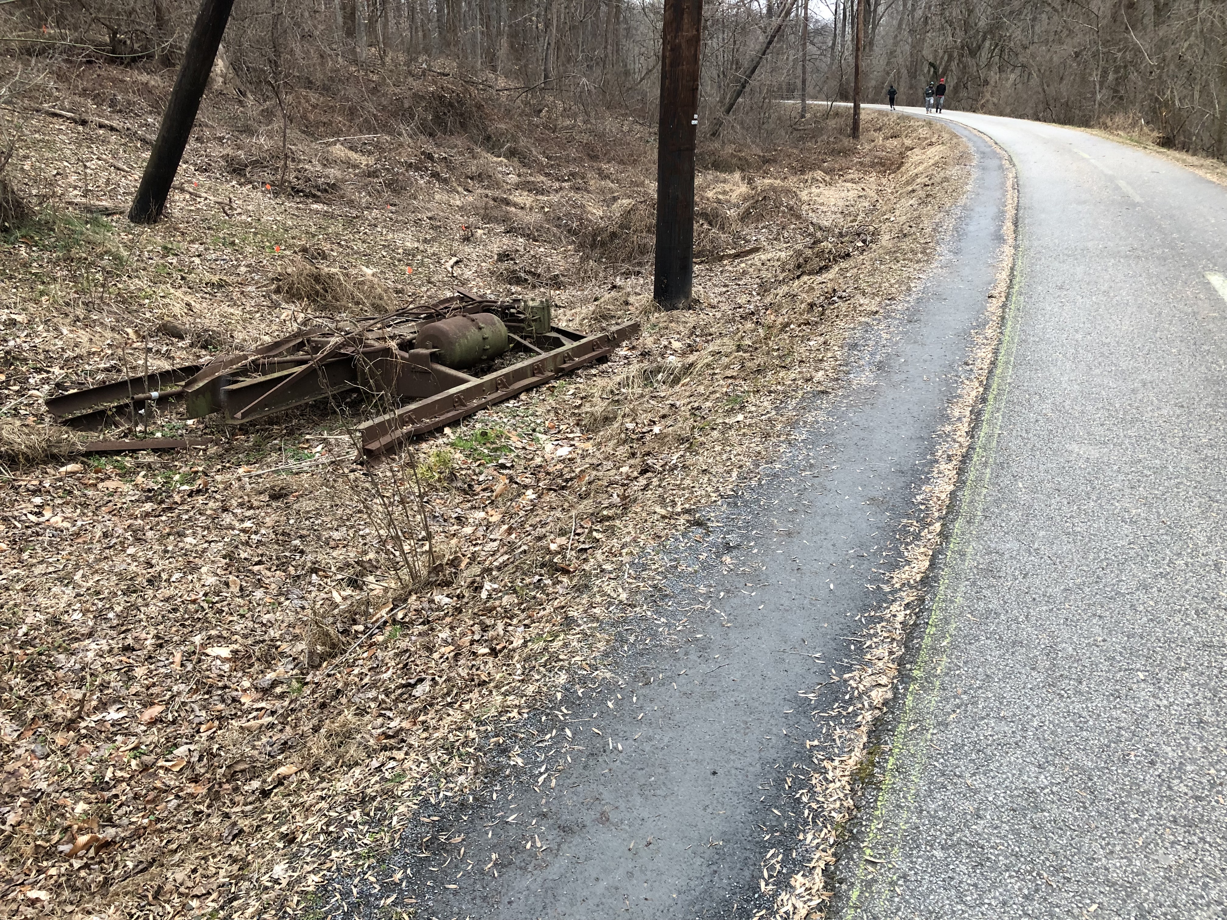
We parked at River Road on the South side of the crossing there. We discovered many old remnants of the branch, which was truly exciting! Probably the neatest find was the old Metropolitan Fuel Co. siding tracks which R. Pearlman had shown me photos of from last Fall. The REALLY neat thing is we discovered the old unloading valves and apparatus which still sits in the dirt by the siding. The siding would take loaded tank cars which would be hooked up to the unloading pipes. Valves would be opened, allowing the fuel to gravity-feed down, under the GB track and down hill to tanks below at the fuel depot. Much of the remains of this operation are still in place, buried in the brush. VERY cool to find and photograph. Who knows how long this relic will be there. I think it’s pretty special!
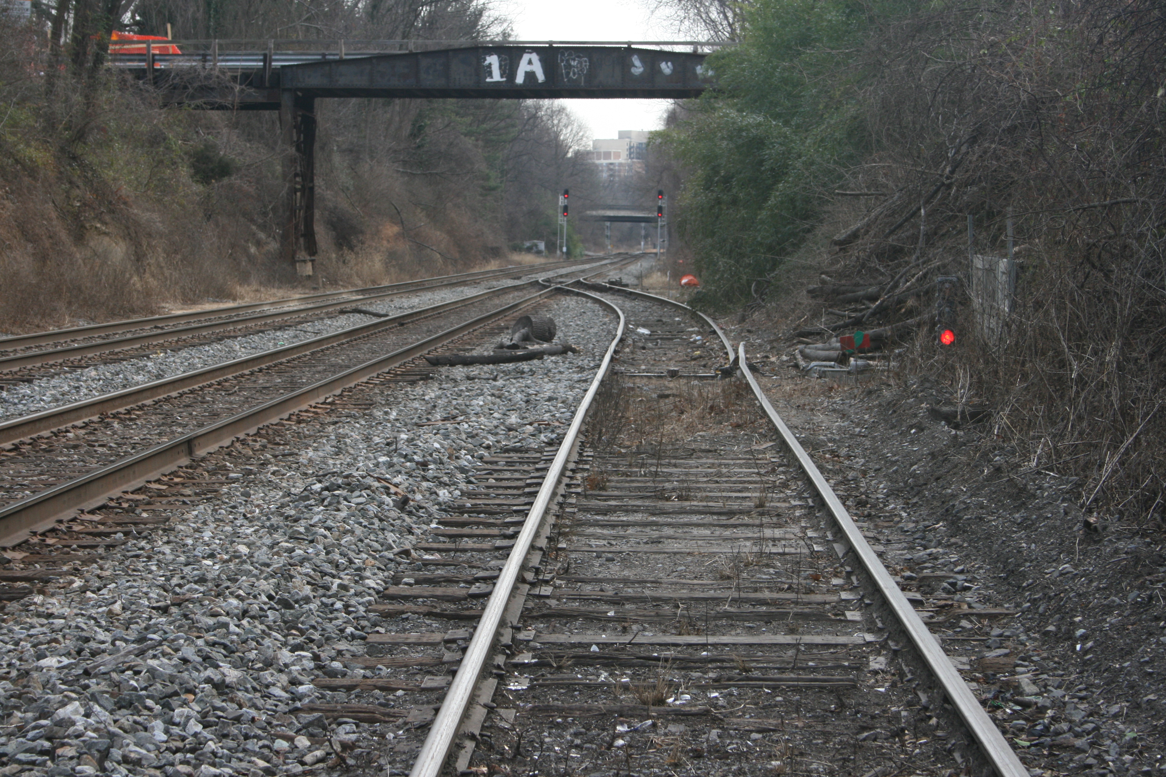
We departed Bethesda, crossed under the Branch at Mass Ave, hooked a Left and followed the Branch through the neighborhoods that back up to the RoW. We arrived at the Dalecarlia Tunnel and hopped out to hike around the area. What fun! First stop was the “bridge over nothing” at the Reservoir.
We then walked down to the Tunnel, which is always a treat. I will have to figure out how I am going to model those large brick abutments!

Through the tunnel, past the Army Map siding and at the location where the Capital Traction Co. / DC Transit “Cabin John” branch passed beneath the GB we came to the original bridges, still in place, carrying the Capital Crescent Trail up and over a vehicle access road.
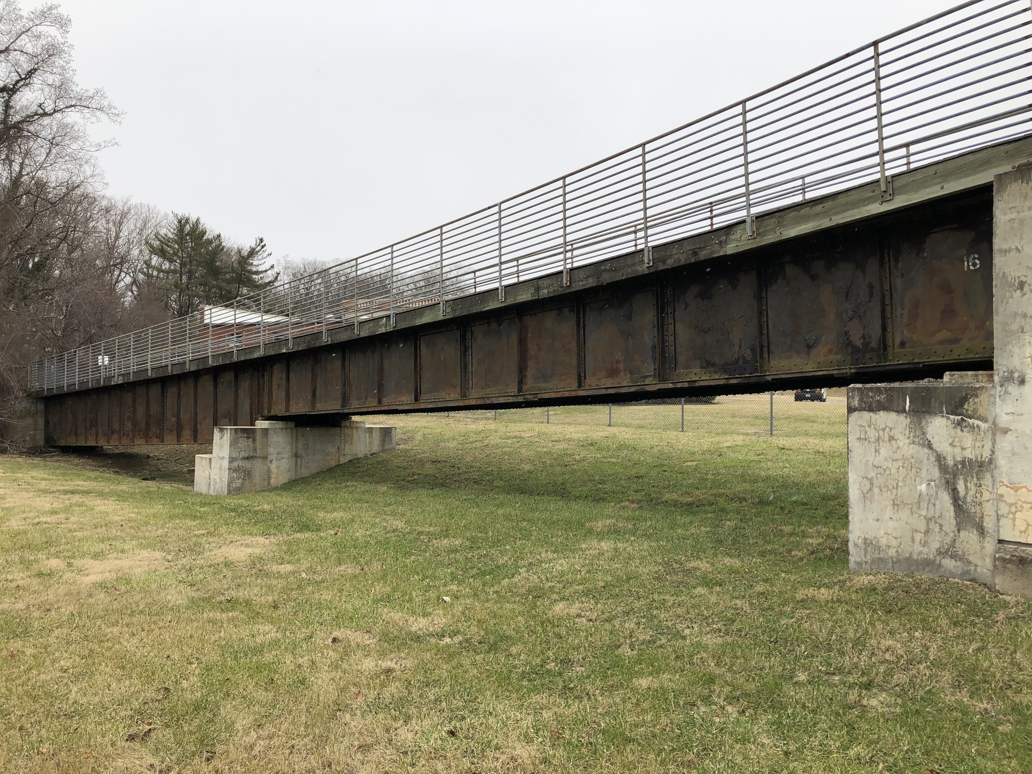
The bridge on the left is massive – a good 9-10′ height! The shorter bridge is the one that spanned the DCT trolley line.
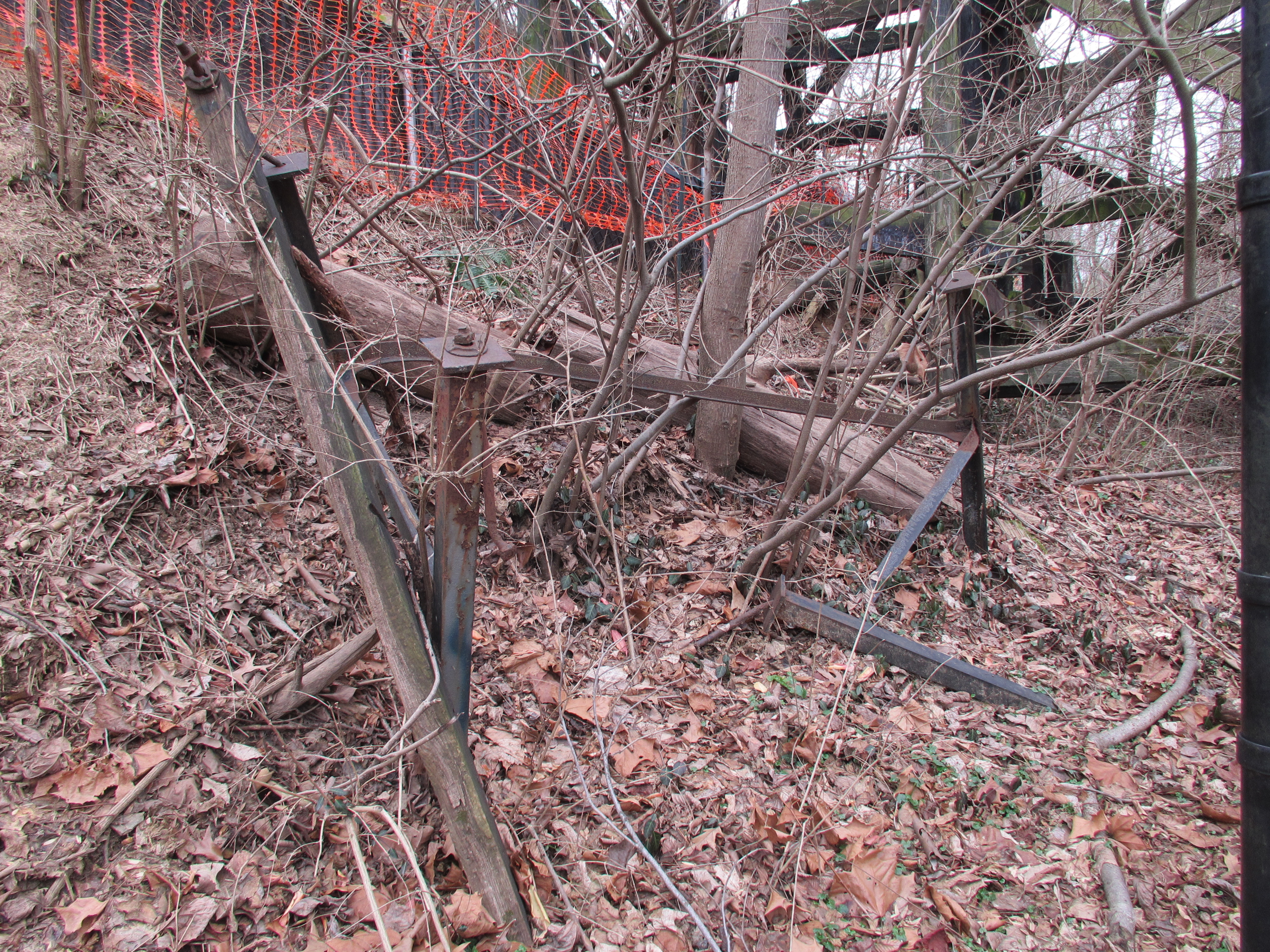
We walked back up to the “bridge over nothing” and I remembered that there were some old freight car remains just about a half mile up the line. So we started walking. My “abandoned rails” eyes caught something out of the corner… an old right of way! We’re not sure what this was for, but best we can tell it was an old unloading trestle that spanned a small creek. There were remains of abutments, ties and roadbed. There were some concrete blocks and posts in the ground down below, perhaps for pipes or conveyors of some kind. Remember, the Reservoir project was massive and involved lots of concrete for the various ponds. I’m not entirely sure but that’s my best guess!
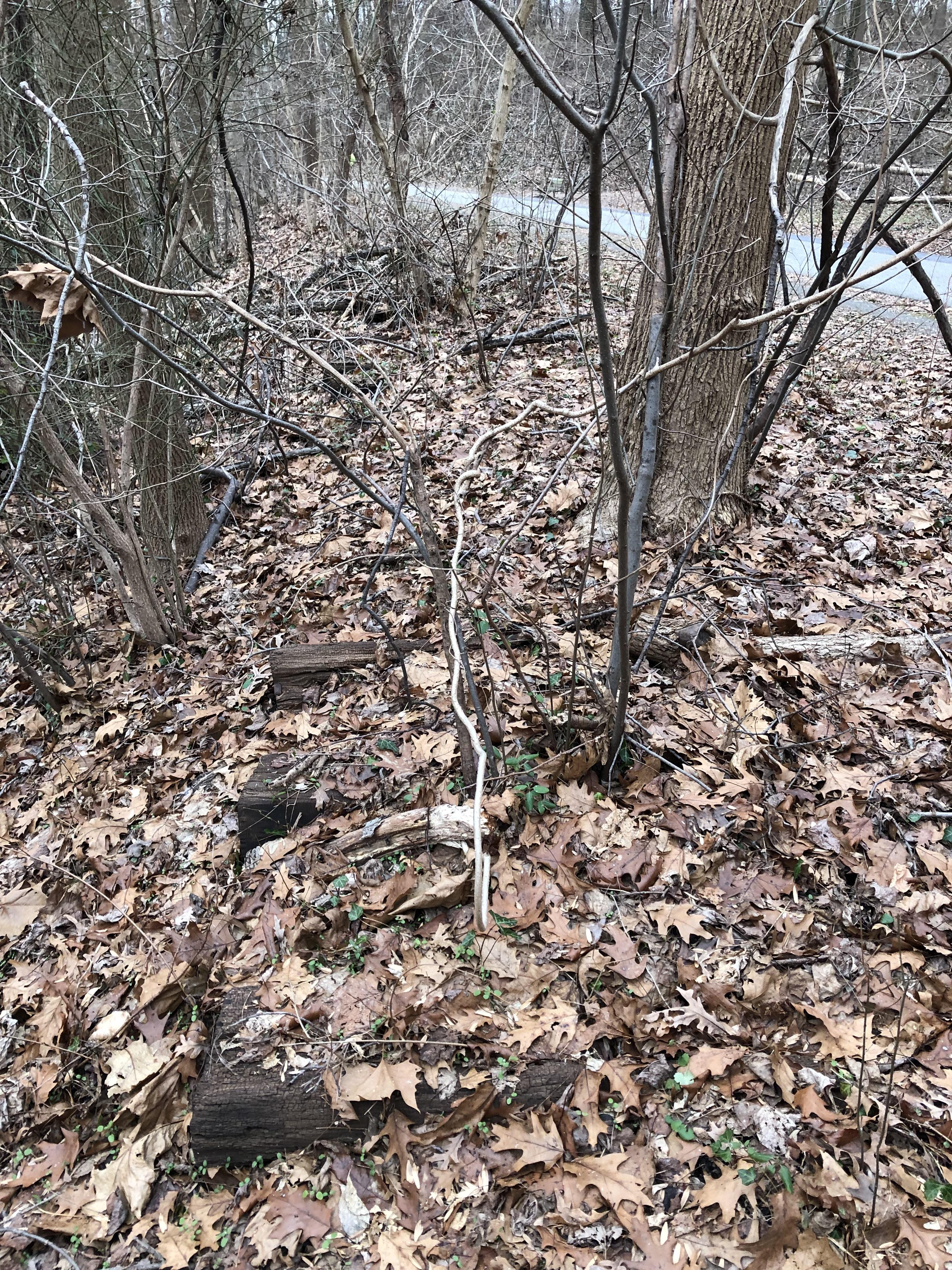
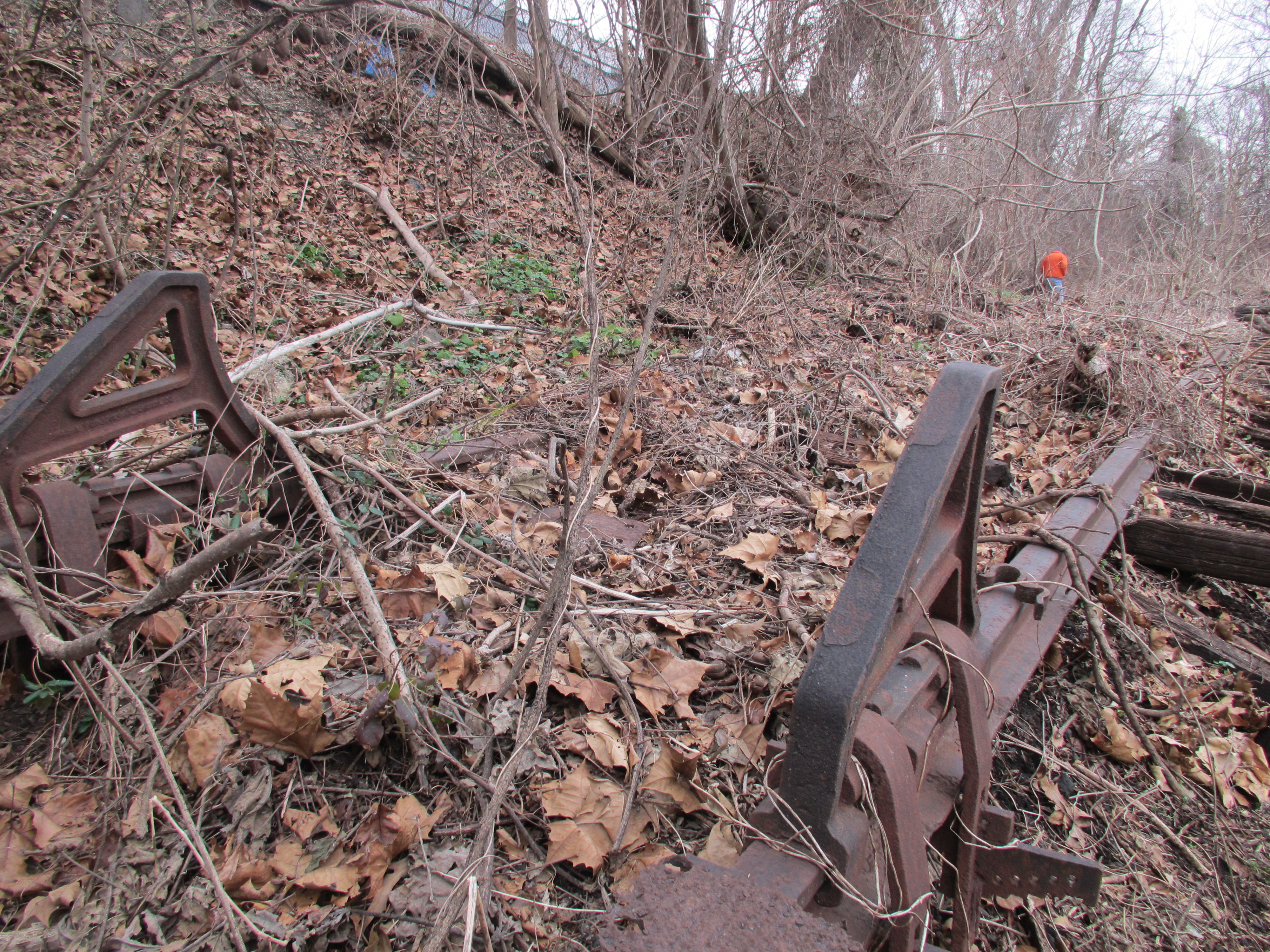
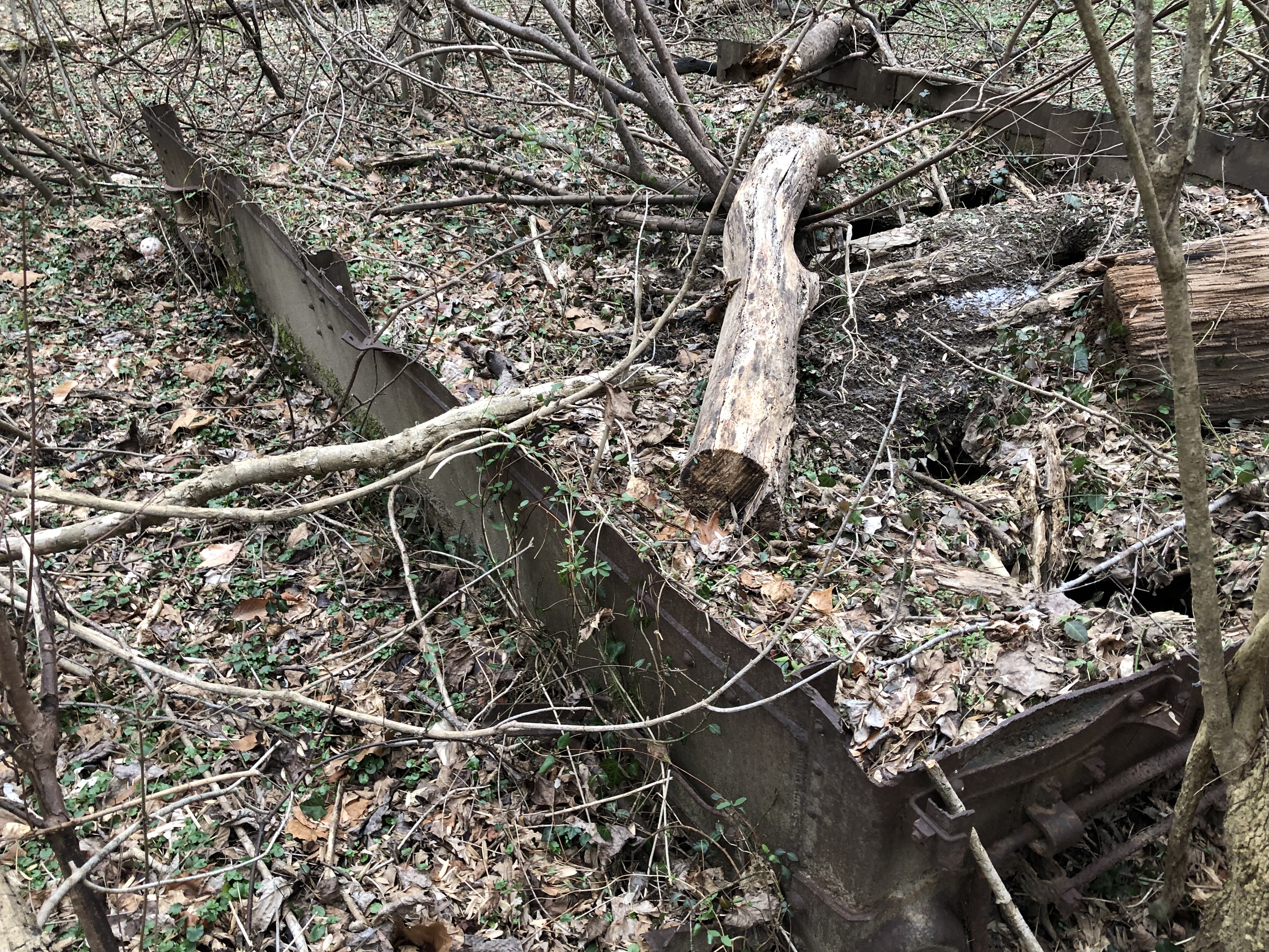
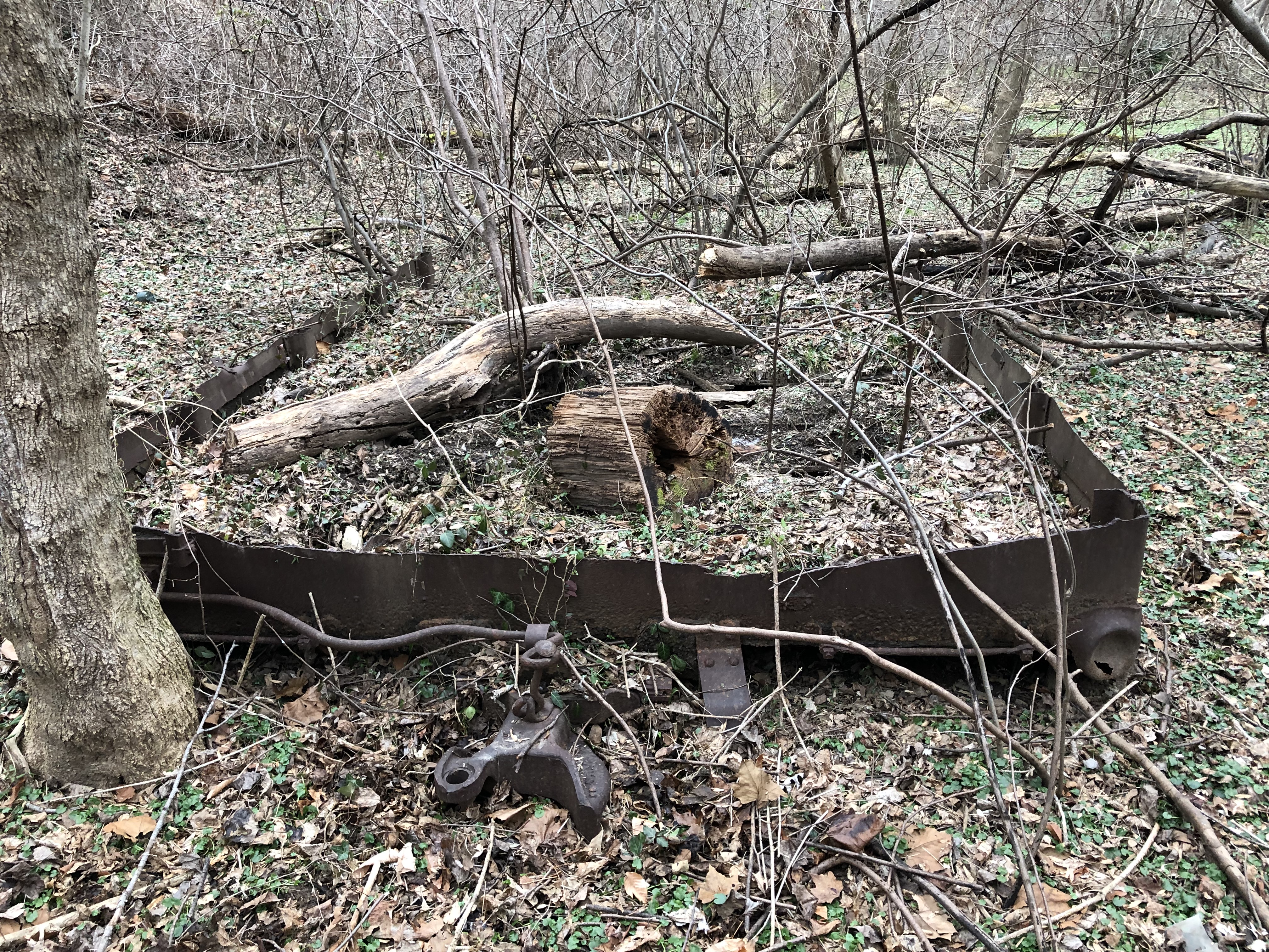
Walking a bit further up the Branch we came to the abandoned box car. This carcass appears to be from a wreck and exists in three pieces. The underframe and two ends. Parts of the couplers and much of the frame are all there. Even decking from the floor are still in place. My best guess is that this car was damaged in a flood down near the River at some point in the 40s. (or maybe earlier) The RR cut the car up, loaded it on a flat car and dumped it for some reason. Not sure why they didn’t just transport the entire thing back to the yard, but maybe someone out there knows. Also, we looked for more cars in the weeds but didn’t find any.
We drove a bit further and took a peek at the C&O Canal bridges but did not stop. By then it was getting late, it had started snowing (we ended up getting 14″ up in Brookeville!) and we were tired. But, wow, what a journey. We had a blast. It was bittersweet, though, to see all of the old areas being demolished and changed forever. It’s been a special part of me for the last 20 years, this line. Seeing it destroyed is a bit melancholy for me. But, rest assured, when the Purple Line opens, I will be in line for a ticket to experience the Georgetown Branch as I never was able to; a passenger. It’s the closest I’ll get! 🙂
The tracks at Georgetown junction are still in place?! I thought for sure they’d been taken out
Hayden, they are. Barely. It’s really neat to see, right? They will be gone soon, as they are right in the path of the Purple Line right of way.
It is def neat to see, I actually made a trip of my own down to the junction a few days ago! The first day I went (around Tues or Weds last week I think) I got some pretty great pics of the construction process as well as what’s left of the Talbot bridge; I’ll send those along shortly. The second day though was unfortunately a bust as they were doing construction that day and I had a somewhat grumpy looking foreman escort me away from the area while they were working, nonetheless progress is fairly slow but sure.