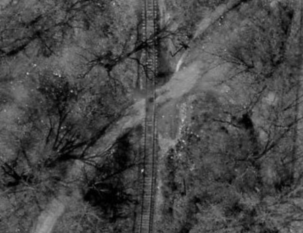
While poking around on the DDOT archives, I came across some wonderful aerial images showing the west end of Georgetown yard. This area is particularly interesting, as there were some features there that are long gone and would add lots of flavor to the model railroad. In particular, there were many small shanties and docks along the waterfront for leisure. There is a tunnel under M St/C&O Canal here that gave access to this area from the Foundry Branch valley. I believe this tunnel probably dates back to the canal’s construction, but that’s a research topic for another time. Anyway, a little itty bitty tiny detail that I noticed while looking closely at the photo is the presence of a B&O crossbuck, visible on both sides of the crossing here. Now, had the sun been at a higher position, I may have never noticed it, but they are clearly visible when this photo was taken. Very cool!

Very interesting! So this is coming right out of the yard at Georgetown? Do we know what year?
April 3, 1963 appears to be the date the aerials were shot. Yep, just west of the long Georgetown Passing siding. And a side note, the YARD LIMIT sign was located just a bit further west (about the length of a train on this passing siding) where the track rounds a sharp curve right at the waters edge, next to Three Sisters islands. Here is a photo from 1966: http://gbblog.sluggyjunx.com/2015/07/29/georgetown-yard-limit-1966
Coolio, though for as many times as I’ve treked or cycled the GB, I can’t seem to recall this particular bit, is that crossing still visible? I’m still waiting though for the NRHS to cough up that alleged video they have of their excursion trip!
The crossing is likely not that visible unless you specifically knew where it is. That entire area is overgrown with scrub brush and I believe there are some homeless folks living in the area where the boat houses used to be. I’d like to explore back there, but I also don’t like getting stabbed. Maybe some day.
Hmm, all the times I’ve been there I’ve never had any problems like that, though I personally would avoid the area pretty much between there and river road after dark since it is the more isolated half. As I said, I’m just hoping that the NRHS video, if it exists turns up at some point.
I haven’t either, and I’m not saying it’s an unsafe area, but with homeless living in the woods for many, many years; if I go poking around, they may not like it. Better safe than sorry. I, too, hope that film surfaces. I’ve contacted their archives and had no luck. They don’t seem to have record of it, even though there are references to it in their own publications. Frustrating.
Very. There’s probably still more pics waiting to turn up though, but I find it hard to believe that with all the attention the branch drew and the photos it garnered that not one person ever managed to capture some video footage of it, apart from that one film that shows the Bradley Boulevard bridge.