While perusing eBay for possible Georgetown Branch related imagery, I came across this photo, which is sourced from the Library of Congress:
Something New in Postal Facilities. [Between 1919 and 1932] Photograph. Retrieved from the Library of Congress, <www.loc.gov/item/96501487/>.The caption reads:
Postal service employee meeting train in Georgetown, D.C. to collect shipment of mail arriving from Rockville, Maryland.
My understanding is that passenger service never existed on the GB apart from a few legendary troop trains and excursions. This makes sense, as there were really no platforms or stations along the route to properly serve passengers. Mail, well, that could be another story. A mail train to Georgetown could make sense, as it’s really just a type of freight. If anyone has any chops for identifying that passenger (mail?) car in the background of this image, or that sign (possibly advertising the new mail service) I would be most appreciative. I’m fascinated!
Oct 1921 – Concrete Magazine article on Rosslyn Steel & Cement
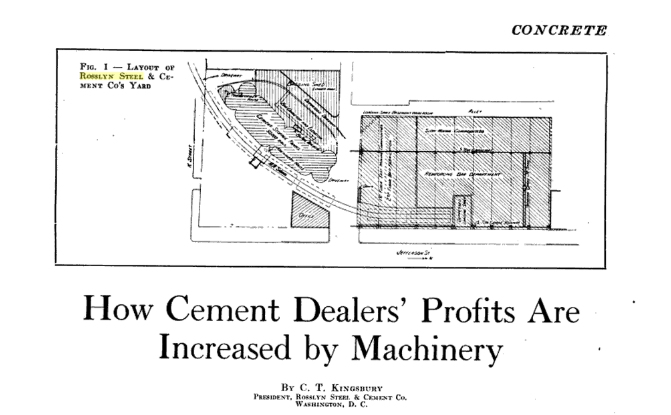
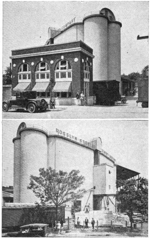
While searching for documents, I stumbled on this article from Concrete magazine, published in October 1921 and scanned by Google. The Rosslyn Steel & Cement Co. property has always been of interest to me, as it was served by the B&O in Georgetown. There was a siding that came off the B&O’s Water St. tracks and curved into the RS&C property, past the large concrete cement elevator and into their massive steel fabrication facility. A quite large and long shed housed the steel operation where they produced re-bar and other steel assemblies for use in their construction projects.
The special thing about this article is that it shows very detailed plans for the RS&C plant and a couple wonderful photographs! They also detail the operations of the cement elevator and the mechanical function of the loaders and unloaders. Really neat stuff! These images and the article text finally give a detailed look at how this plant appeared and was laid out on the site. I’m planning on modeling at least part of it, if I can figure out how to fit it into my layout.
Rosslyn Steel & Cement plant in Georgetown, ca 1921
I stumbled on this really fascinating article about quarrying on the Potomac River, something that I had never heard of. I knew that Smoot Sand & Gravel, a major customer for the B&O’s Georgetown Branch, did dredging in the Potomac River for sand and gravel, but I did not know they did quarrying, and to such a large scale! Apparently there were many, many quarries located on the Potomac shores which were all abandoned some time in the late 1930s/early 1940s. This article outlines some of those details and shows the location of one such quarry with equipment still left behind. Amazing. I will have to go!
Once again, J. Shriver has graciously shared another truly magnificent collection of photos. This time it’s a nice slice of images spanning over 13 years focusing on the DC Transit’s Cabin John line where it passed beneath the B&O’s Georgetown Branch. The photos so wonderfully depict the details of the DCT right of way that I have NEVER seen and so much yearned to see in detail! The images depict several fan trips and excursions, from best I can tell, as well as a few explorations and other journeys. Photographers vary. Enjoy! To view, click here.
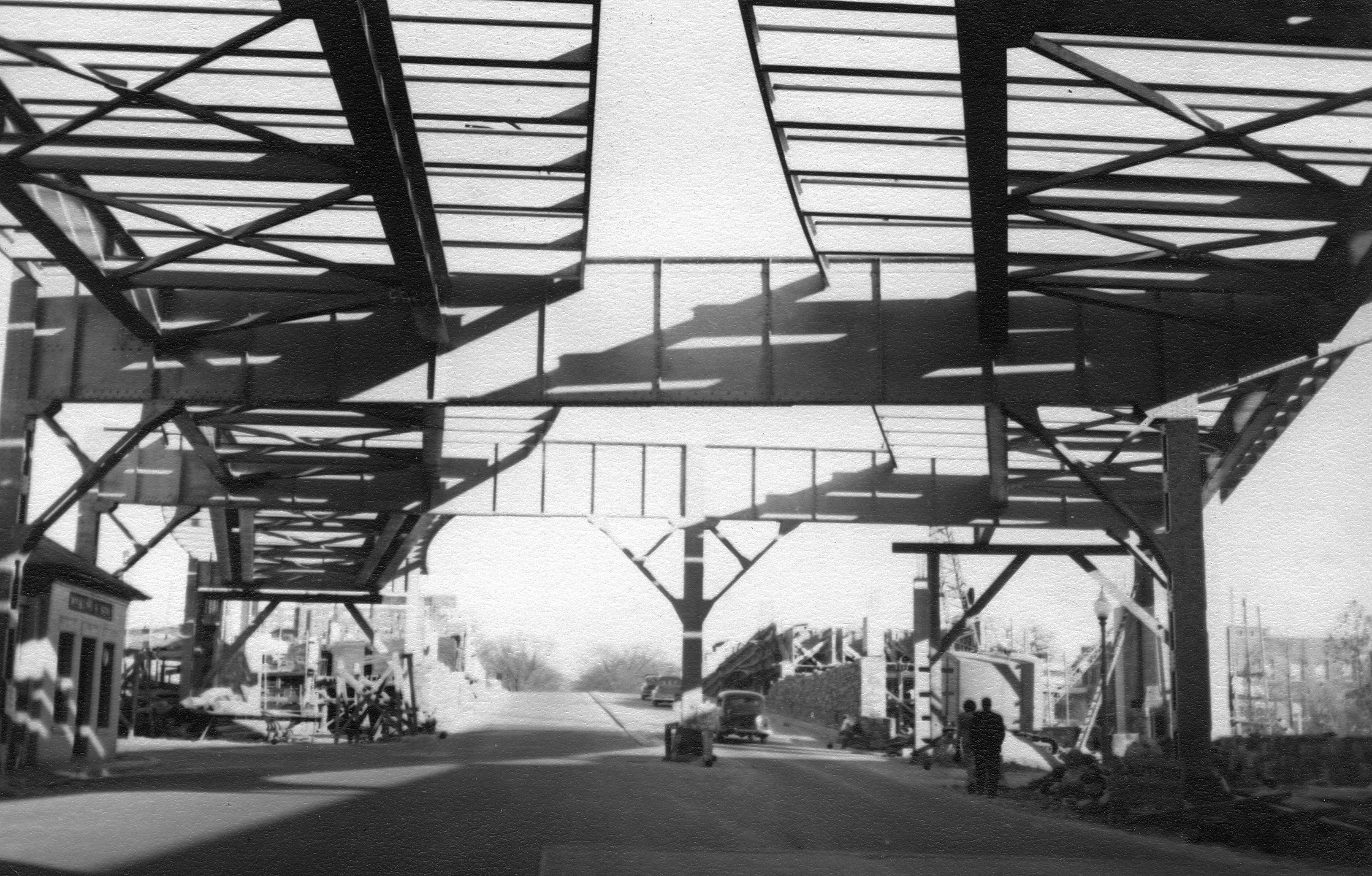
View is East at the end of Water St, looking at the tail end of the Whitehurst Fwy. construction. On the left is the King Coal Co.
J. Shriver shared a handful of other really neat photos he has in his collection showing construction of the Whitehurst Freeway back in 1948. The photographer was Charles Murphy. The photos are rich with detail including the King Coal Co. as well as the Rosslyn Steel & Cement silos in the background. Check the photos out here.
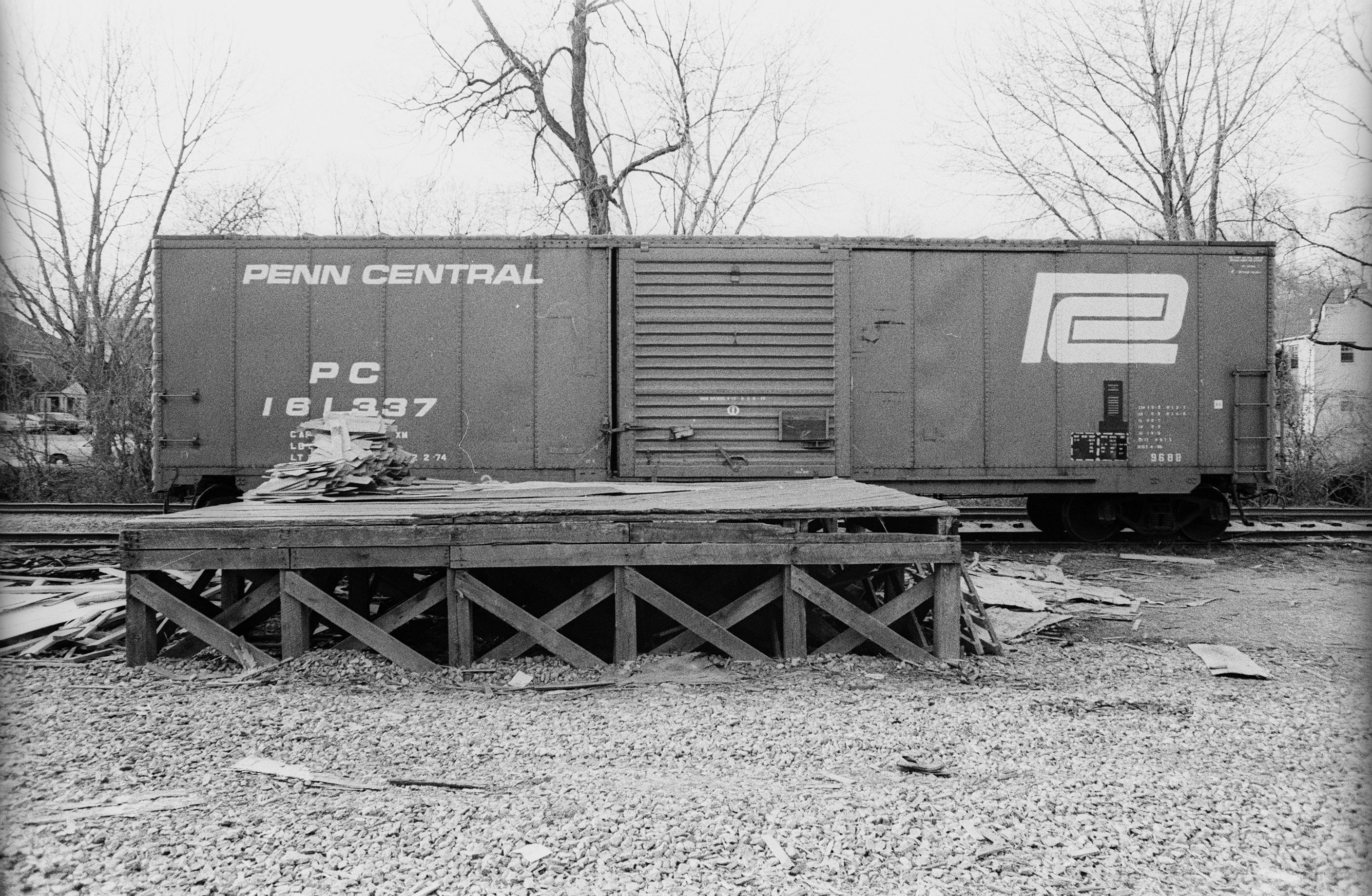
A gentleman named J. Shriver contacted me via email and shared some wonderful photos (Click link to view the whole Gallery!) he shot himself back around 1976 of a Penn Central box car spotted on the passing siding at Connecticut Ave. At this point in time, the team track (which was just behind the photographer) was probably out of use and the passing siding had been designated for unloading at the freight platform. At one point, there was a gantry crane here but it appears to have been removed. I’m not sure how far back this platform itself dates, but I would wager some time in the 1940s or 1950s.
PC 161337 is an ex NYC Class 968B, “Class 968B was constructed between 1965-68 at the NYC’s Beech Grove, IN shops by stretching older 40′ cars into “new” 50′ boxcars.” (More info here: http://conrailphotos.thecrhs.org/node/21883) Note all of the discarded packing material that was likely from whatever was inside the car, strewn about on the ground and the loading dock.
A couple weeks ago Kelly R. & I spent a day hunting the Georgetown Branch. It dawned on me that the Rock Creek trestle was either gone or not long for this world. I knew that with the Purple Line construction plowing ahead (literally) much of the Georgetown Branch right of way is either gone or soon-to-be gone forever, or forever changed. So, we finally nailed down a time and made a day trip of it. (*Note – if you’d like to see all of my photos from the outing, you can visit my Gallery HERE.)
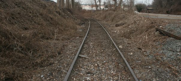
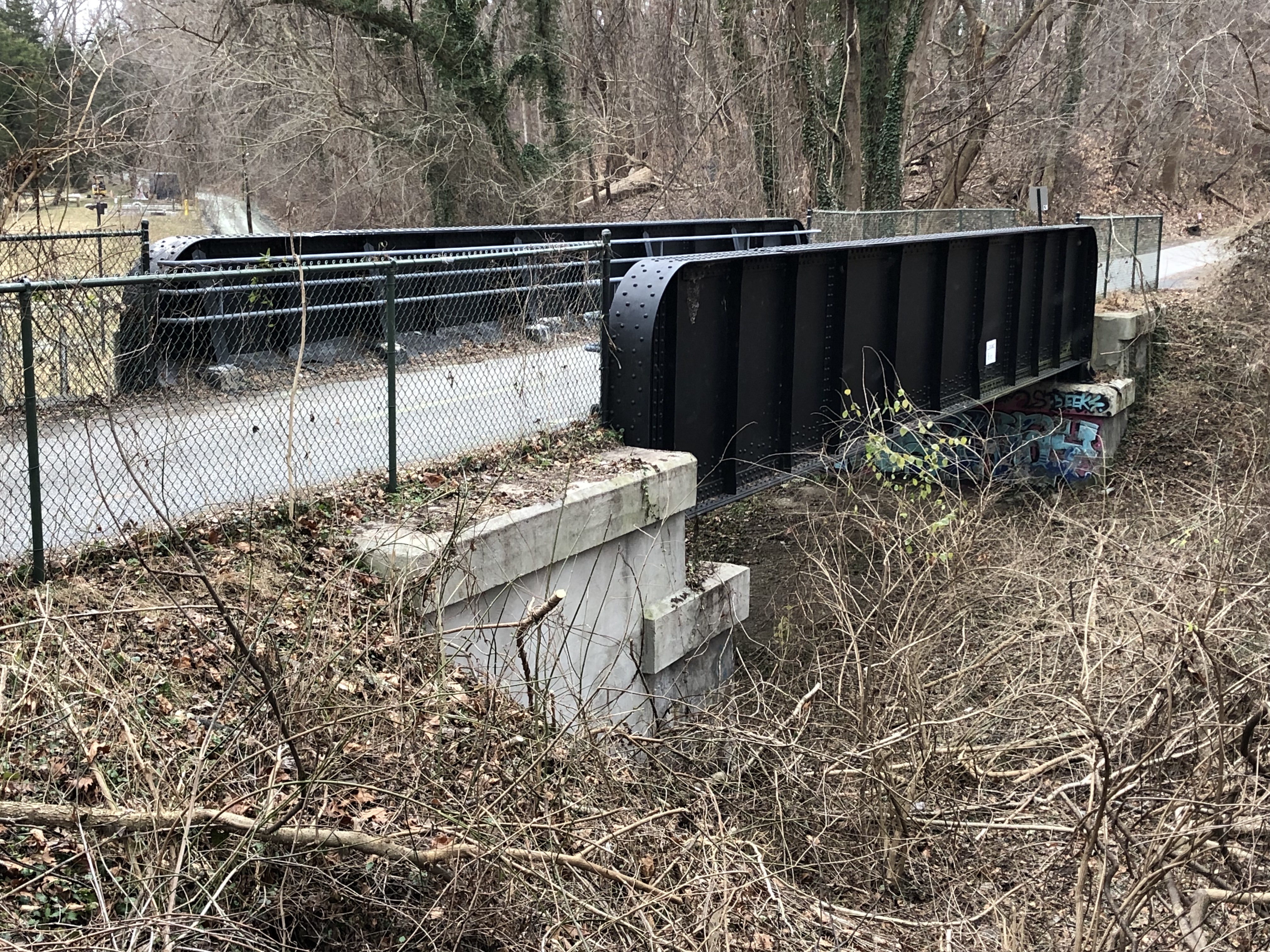
We started at the Junction (naturally) to document what was there. This was one of the more delightful spots, as much of the Junction is untouched and actually opened up due to some recent brush clearing by CSX and MDOT. You can see that they have topped many of the large trees at the Junction along Talbot Ave. The Talbot Ave bridge still stands (yay!) and is open to pedestrian traffic. We managed to locate the old team track switches (wow!) still in place in the original rails. VERY cool. We walked down the Branch and found the switch lead for the E.C. Keys (now T.W. Perry) siding. Too bad they don’t still take deliveries!
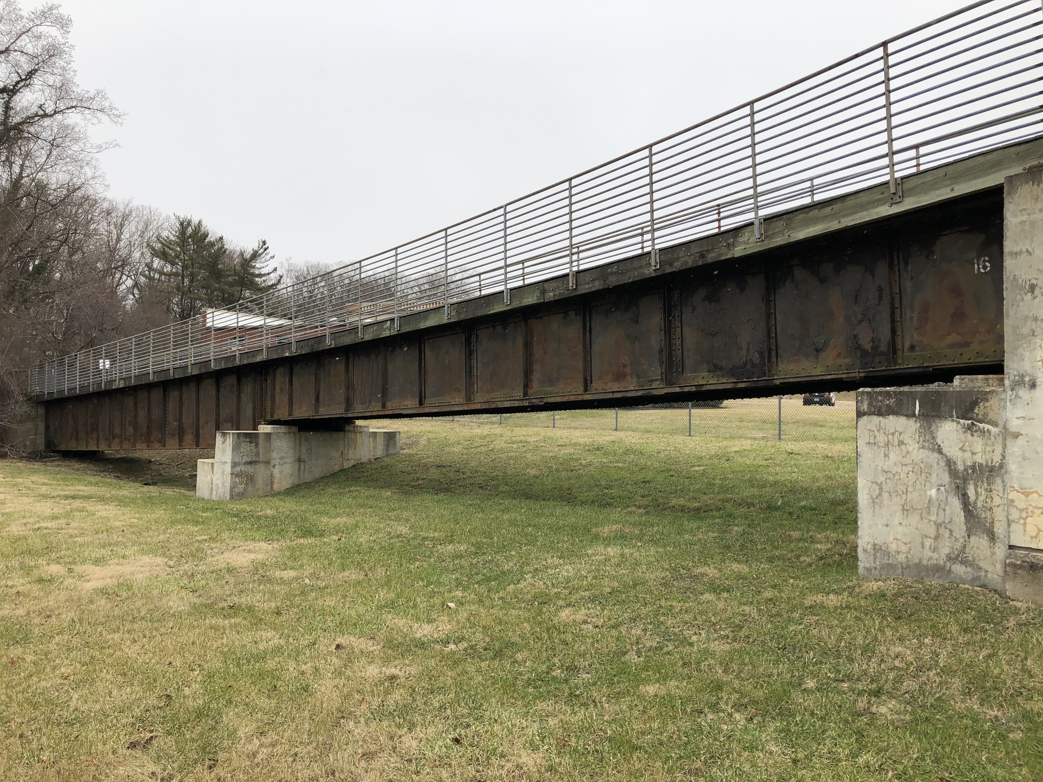
Georgetown Branch lead at Georgetown JunctionFrog and guard rail for team track turnout at JunctionHere we stand at the end of the Georgetown Branch. Originally, the branch extended all the way down to where the 16th St. bridge crosses in the distance. In Feb 1996 this was the site of the rail disaster where an EB commuter train collided with the WB Capitol Limited, resulting in 8 deaths and 26 injured. The lead for the GB was never rebuilt to its original length and instead was shortened to where it is now, near the Talbot Ave. bridge.
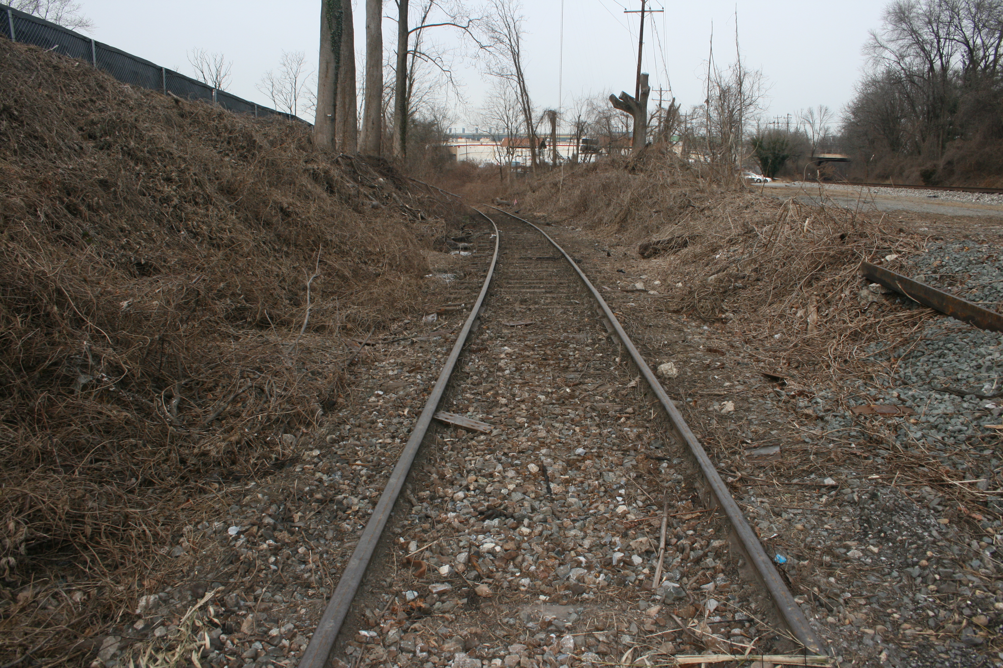
We visited several of the Branch crossings between the Junction and Rock Creek, but there just isn’t much to see besides the new Lyttonsville Rd. bridge (which had opened the day before we arrived) as well as the massive brush-clearing they have done. It was neat to see the RoW in a state closest to the original 1890’s appearance for one last time.
But then we arrived at Jones Mill Rd. and got our first taste of sadness:
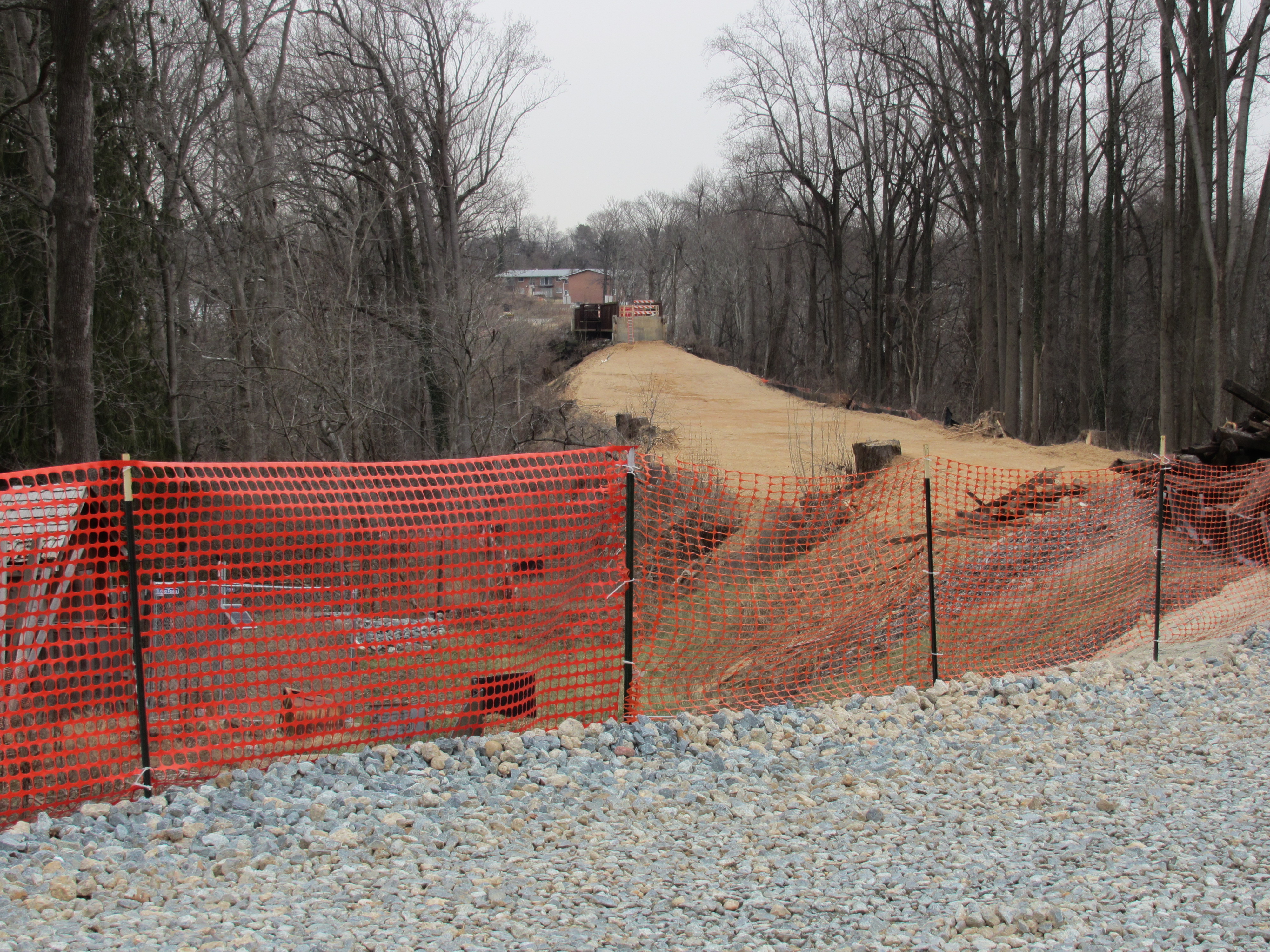
The Western approach to the Rock Creek trestle has been forever changed, as MDOT removes much of the fill to allow for the new Purple Line right of way. Here, at Rock Creek, the line will go *under* Jones Mill rd. and proceed across the Creek at a much lower level than the current trestle does. The trestle is being demolished.
They have gutted the right of way. For reference, the tracks used to sit atop that concrete abutment and continued to the level I was standing on. All of the dirt you see in this picture is fresh. It’s as if they sliced the top of the fill off. And they’re just getting started. The Rock Creek trestle (in the distance) is not long for this world. It’s already in the process of being demolished when this photo was taken.
Not long for this world. The Trestle, build in 1928 and modified over the years due to fire and flood damage, still stands. A section of the trestle has already been demolished, visible to the right. MDOT will be removing the pedestrian deck from the top and then demolishing the rest of the trestle in the near future.
Here is the trestle, or what’s left of it for now. The missing section on the right has been removed already and MDOT will be taking the pedestrian bridge off of the top and re-using it elsewhere. Then, the rest of the trestle will be disassembled and removed in preparation for the new Purple Line bridge and pedestrian bridge. So sad to see the end of an era that spans over 130 years in this location. (pun intended) 🙂
While I was taking pictures, I noticed I happened to be standing next to the twisted wreckage of the old escape platform for the East end of the trestle. This small platform is made of steel and timber and closely resembles a standard plan I found in a B&O plans book. Pretty neat!
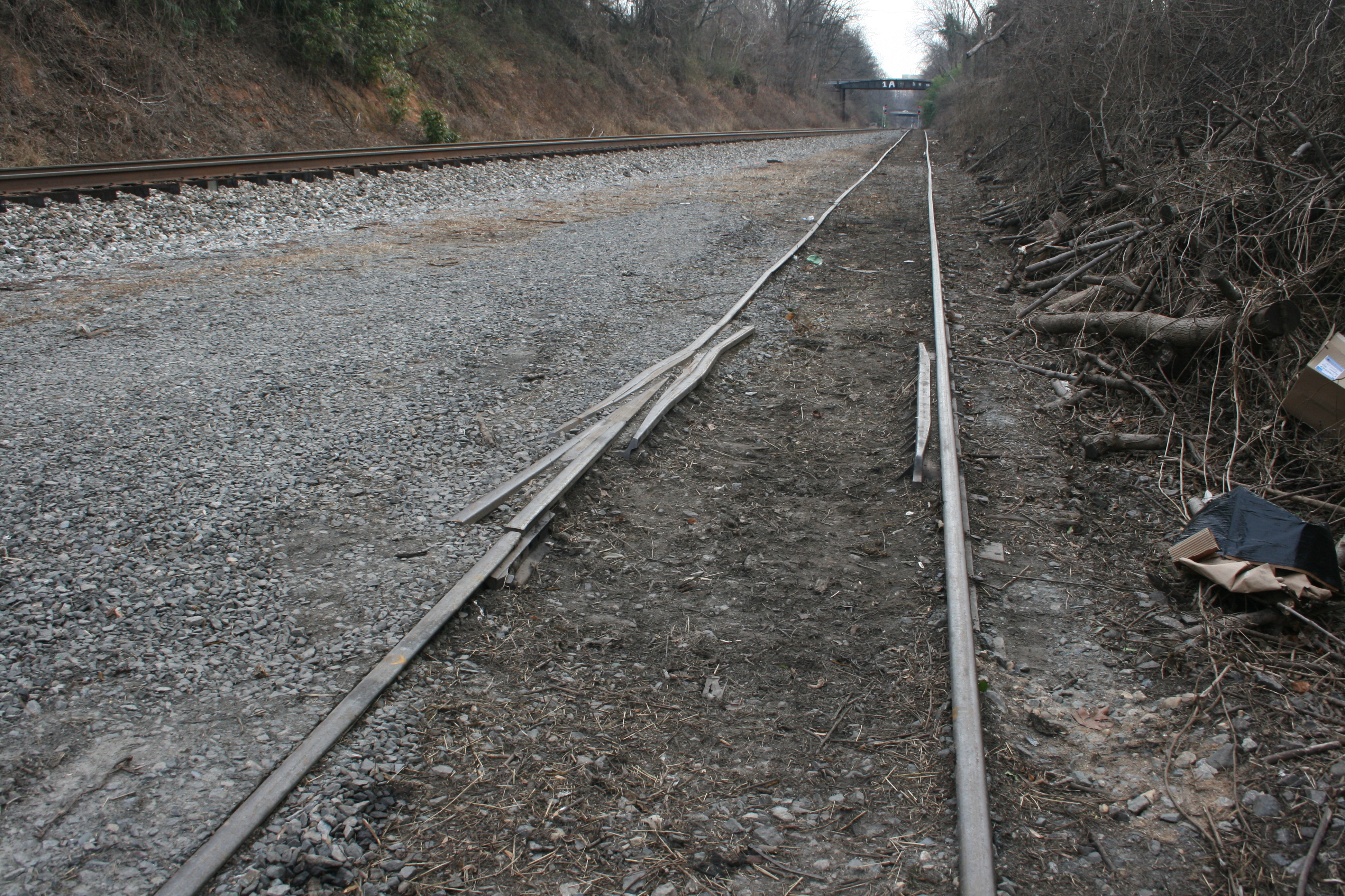
We then hopped in the car and visited Connecticut Ave. The carnage here is massive and I didn’t feel like taking photos or getting out due to the hostile construction zone. MDOT has set up cameras and guards in these areas to protect the NEW equipment they bought, no doubt. (wow!) I can report that the old T.W. Perry property has been gutted and is being leveled. The old bridge just South of T.W. Perry has been completely removed and nothing but a dip in the ground remains. Sad!
Our next stop was Bethesda where we drove through town on our way to lunch. Bethesda was very busy and we chose not to stop in the downtown area, as with all the construction it is particularly difficult to get park. There’s not much left to see there, anyway, as it has REALLY become so built up over the last several years. We drove across the Little Falls crossing, then to River Road where we parked and hit McDonalds to refuel. We met a Penn Central hat-wearing railfan there who was dining with family. We shared some stories about the GB and some photos of a PC box car at Conn. Ave. which he enjoyed!
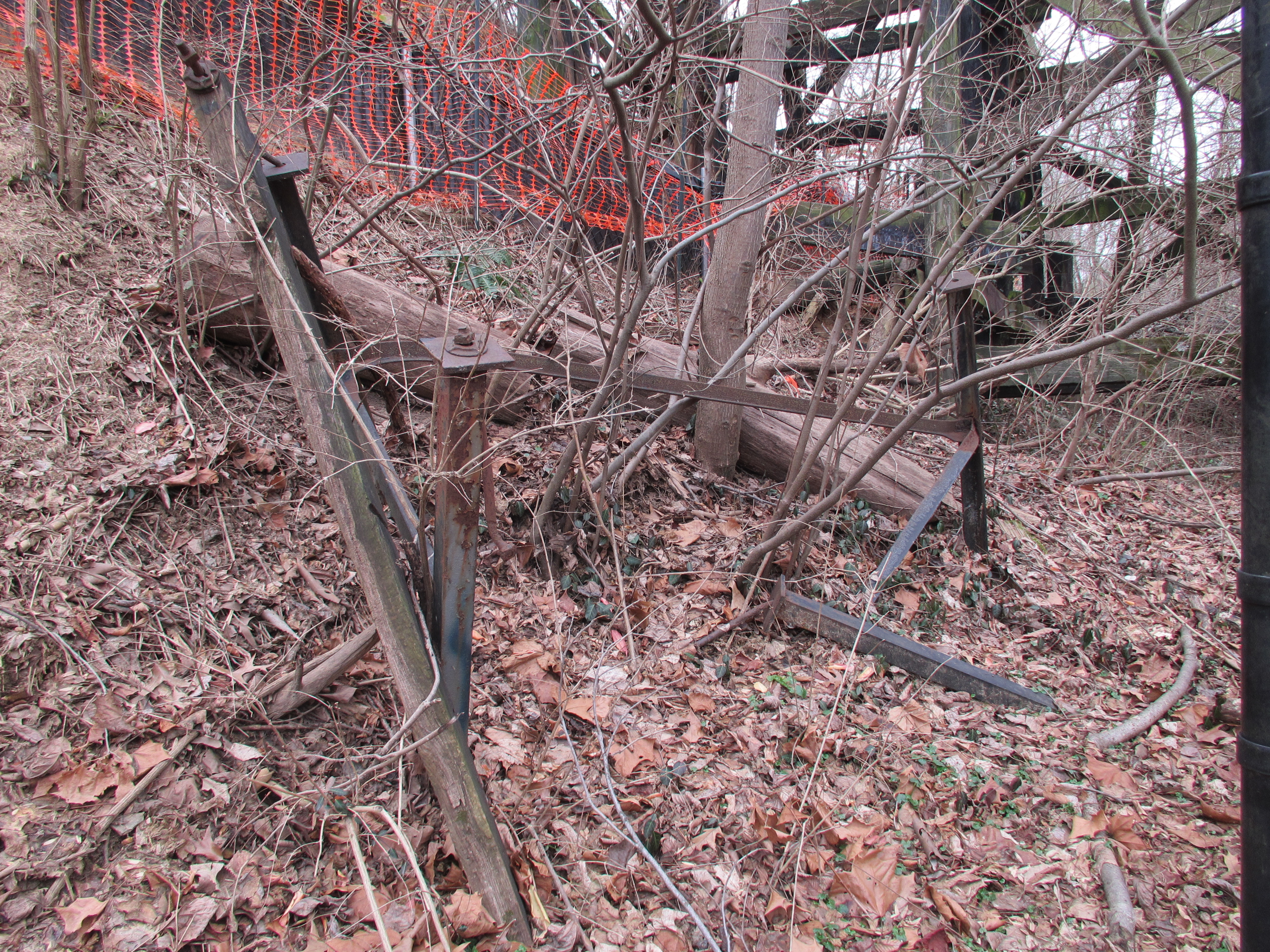
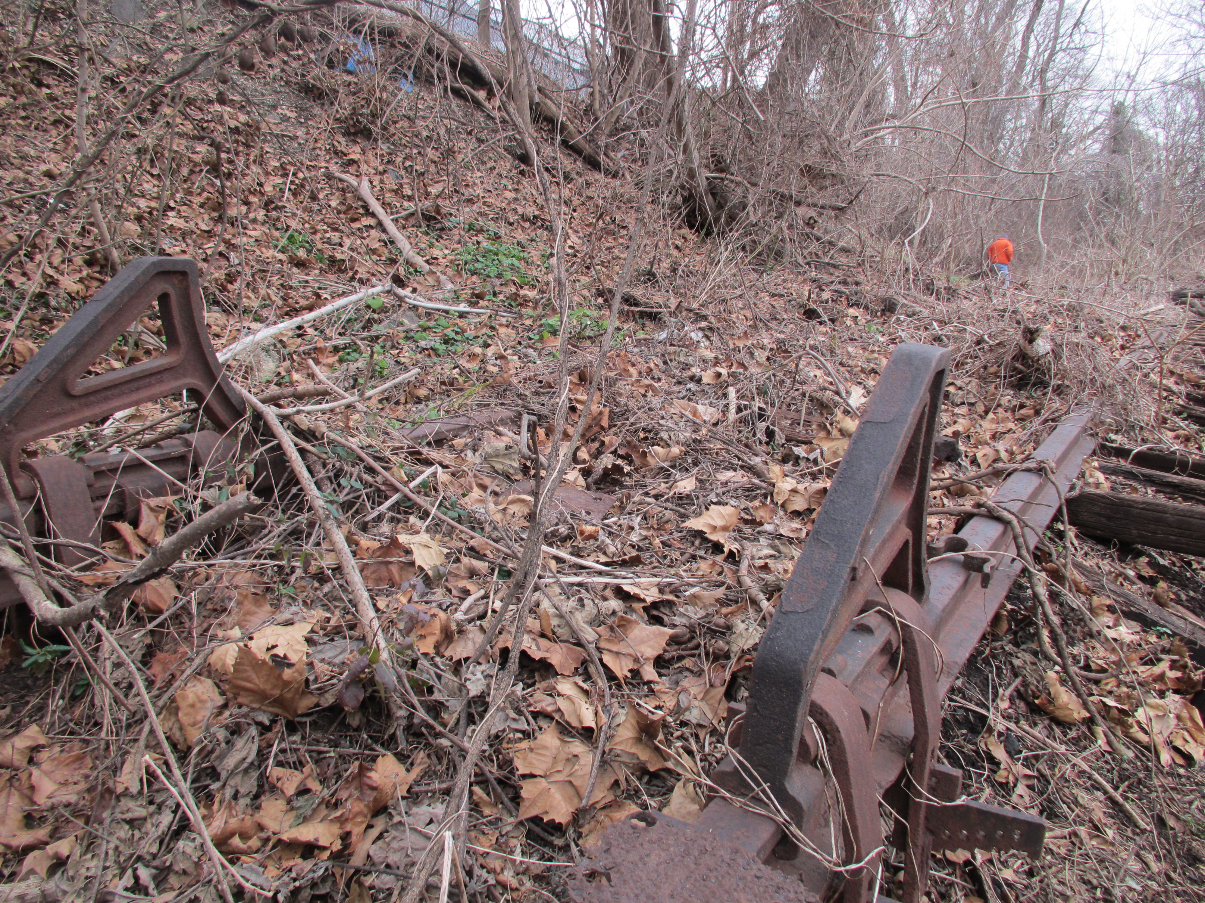
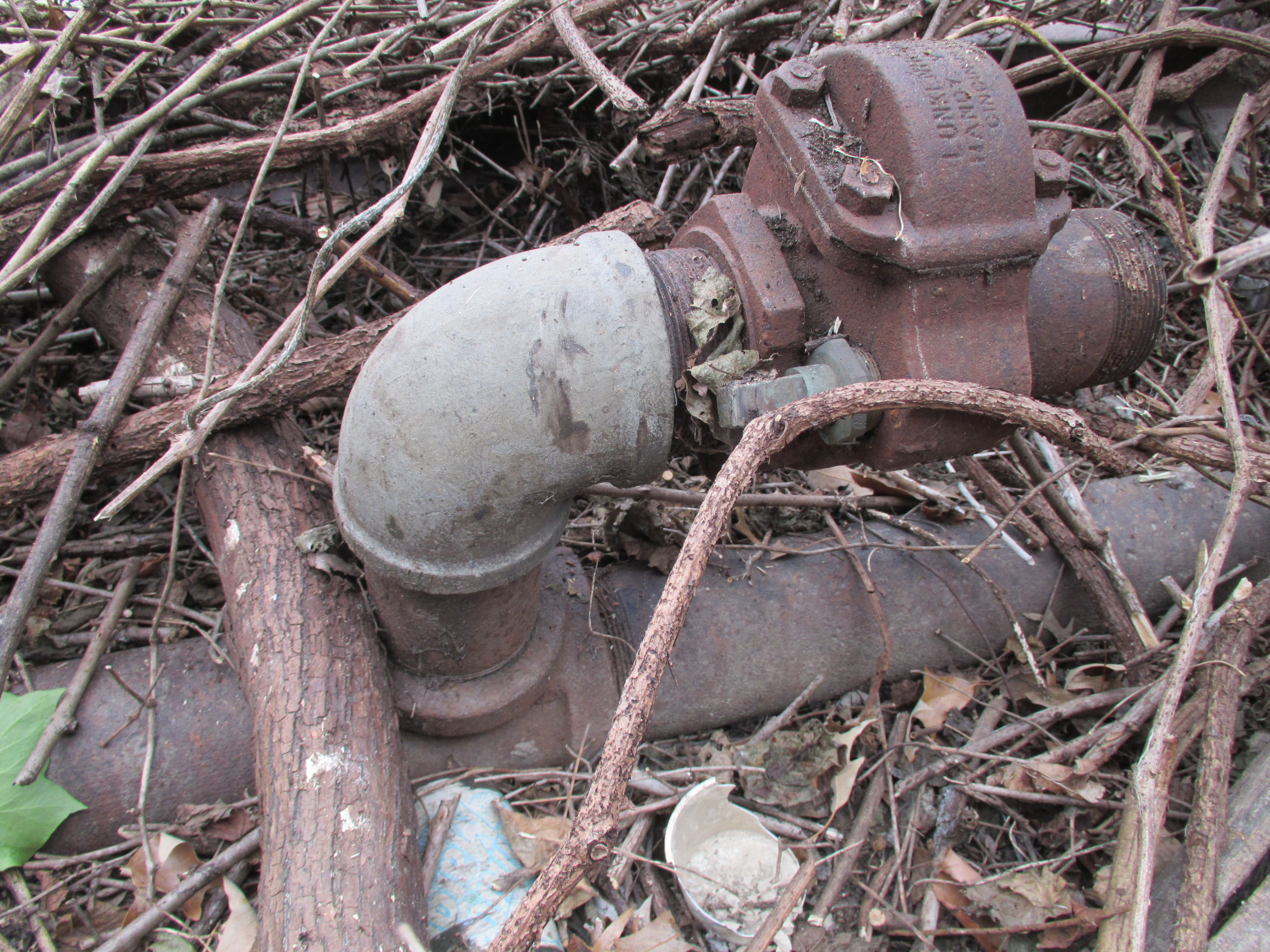
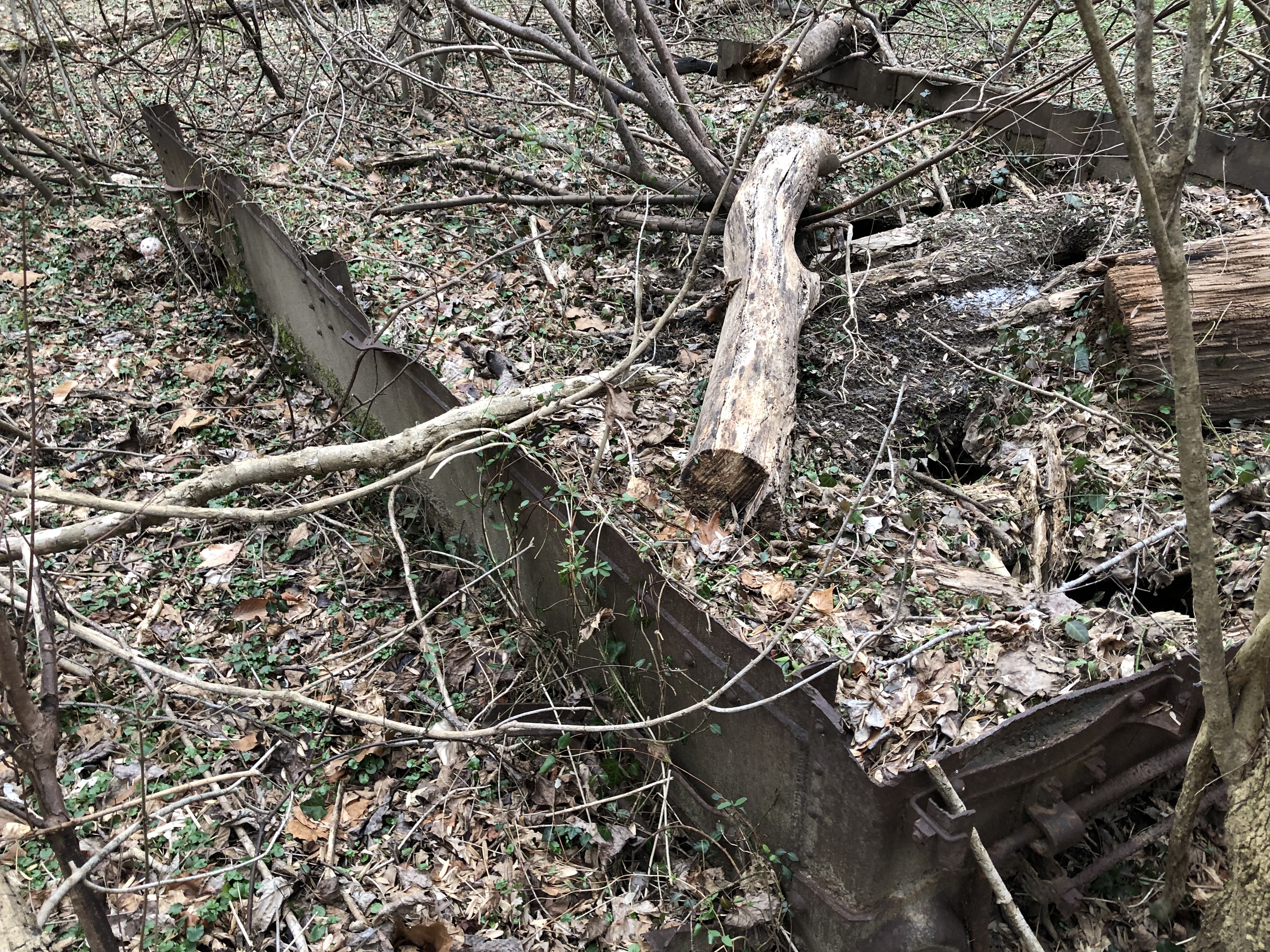
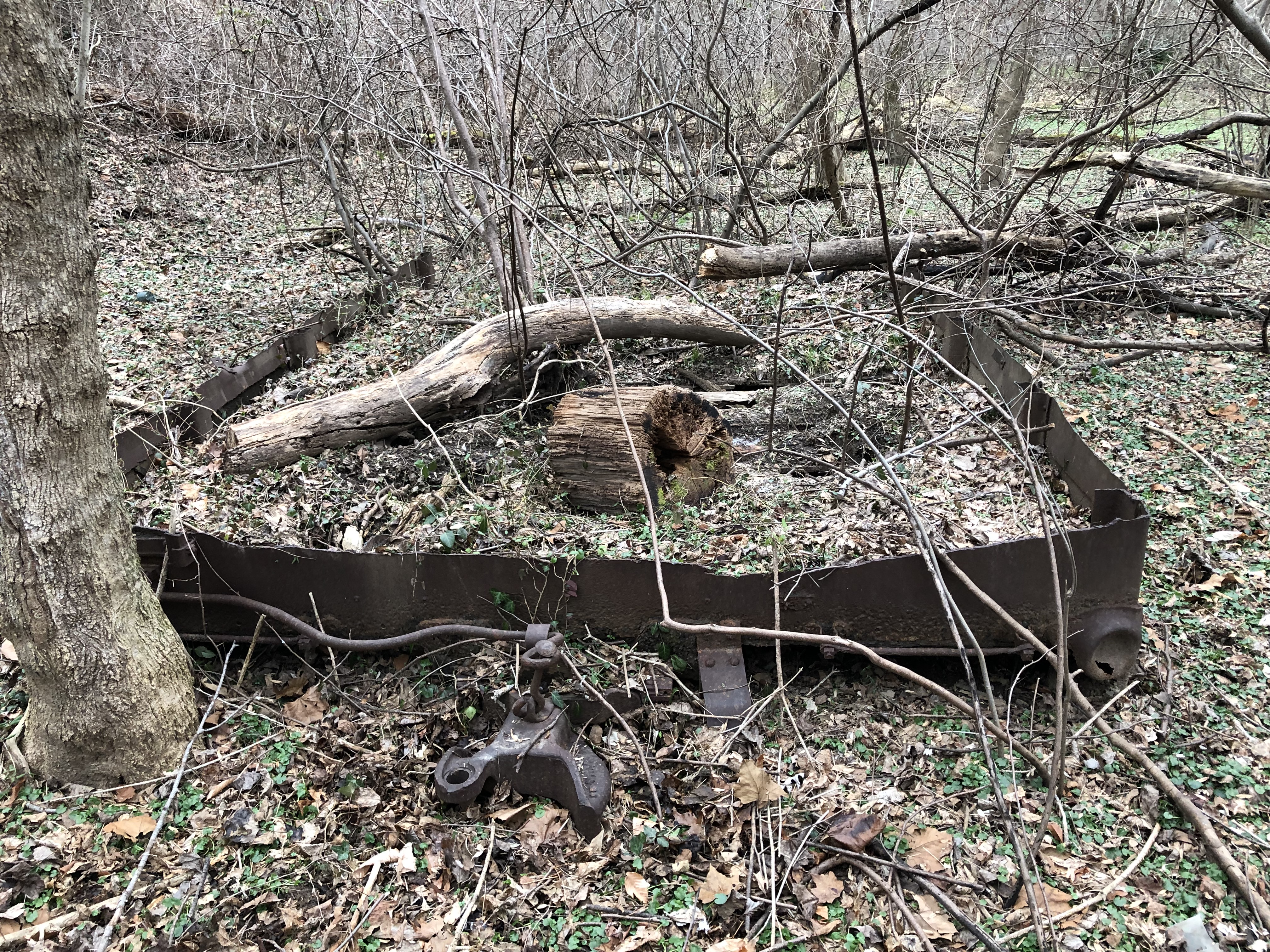
We parked at River Road on the South side of the crossing there. We discovered many old remnants of the branch, which was truly exciting! Probably the neatest find was the old Metropolitan Fuel Co. siding tracks which R. Pearlman had shown me photos of from last Fall. The REALLY neat thing is we discovered the old unloading valves and apparatus which still sits in the dirt by the siding. The siding would take loaded tank cars which would be hooked up to the unloading pipes. Valves would be opened, allowing the fuel to gravity-feed down, under the GB track and down hill to tanks below at the fuel depot. Much of the remains of this operation are still in place, buried in the brush. VERY cool to find and photograph. Who knows how long this relic will be there. I think it’s pretty special!
A survivor – this siding, which once served the Metropolitan Fuel Co., is still there. Even the stops at the end of the rails survive! Tank cars were spotted here and unloaded using hoses and pipes which ran down the siding and under the Branch mainline to tanks downhill on the other side of the tracks.In Bethesda at the Metropolitan Fuel Co siding, one of the valves which was connected to the tank cars survives! In fact, we found two of them still in place, along with all the piping. Really special to find these parts there today!
We departed Bethesda, crossed under the Branch at Mass Ave, hooked a Left and followed the Branch through the neighborhoods that back up to the RoW. We arrived at the Dalecarlia Tunnel and hopped out to hike around the area. What fun! First stop was the “bridge over nothing” at the Reservoir.
But we all know it’s actually the bridge laid in around 1908 which spans the old stone aqueduct feeder for the Dalecarlia Reservoir, which is just out of view to the left.
We then walked down to the Tunnel, which is always a treat. I will have to figure out how I am going to model those large brick abutments!
The ornate North portal which reads “DALECARLIA” and “19” and “10”. This portal was built to B&O standards and includes interesting brick abutments/buttresses (?)
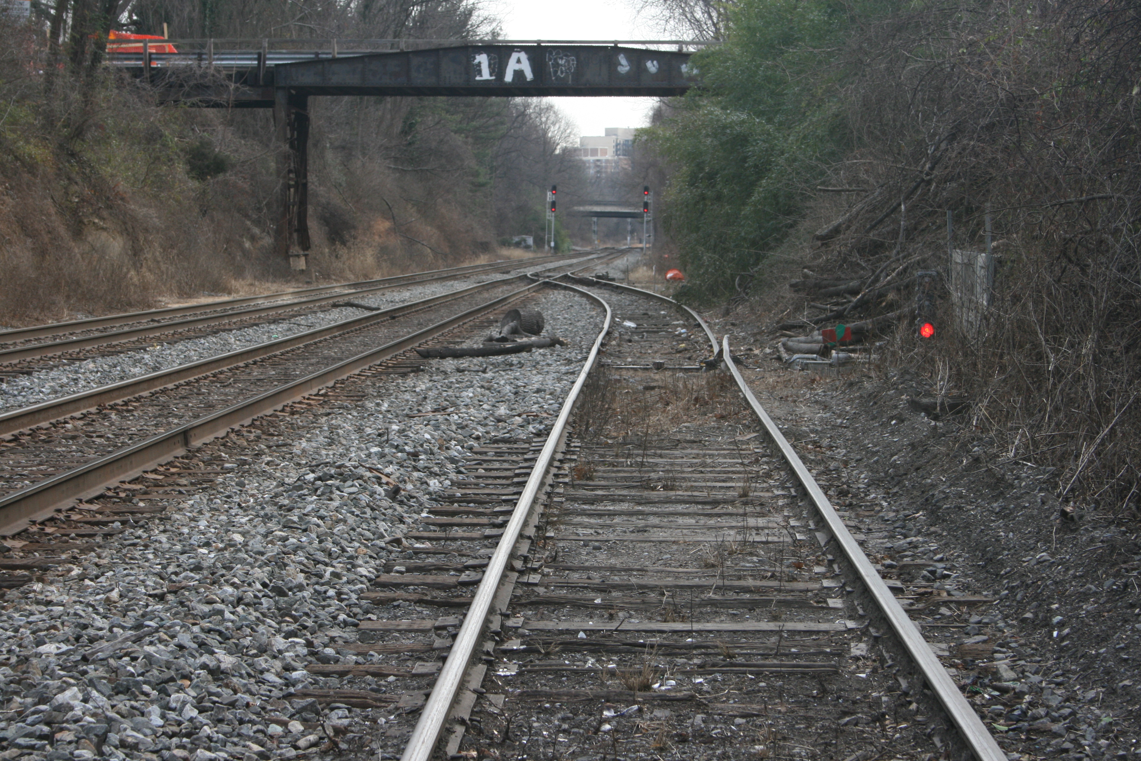
Through the tunnel, past the Army Map siding and at the location where the Capital Traction Co. / DC Transit “Cabin John” branch passed beneath the GB we came to the original bridges, still in place, carrying the Capital Crescent Trail up and over a vehicle access road.
These two bridges once spanned the Capital Traction Co./DC Transit double track Cabin John trolley line and a feeder line for the Dalecarlia Reservoir. They are still in use today, carrying the Capital Crescent Trail traffic up and over a vehicle access road. They are on a slightly different alignment.
The bridge on the left is massive – a good 9-10′ height! The shorter bridge is the one that spanned the DCT trolley line.
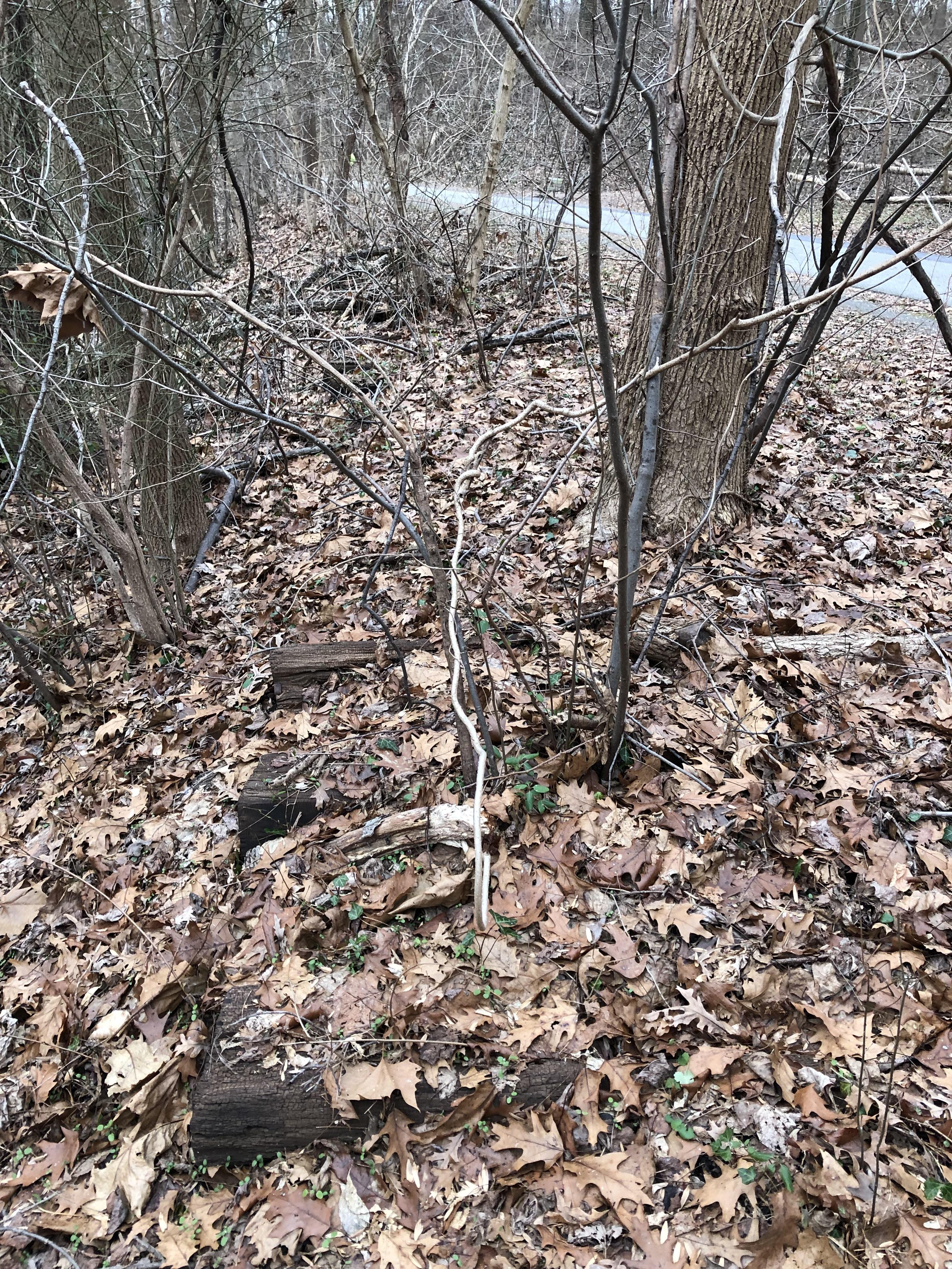
We walked back up to the “bridge over nothing” and I remembered that there were some old freight car remains just about a half mile up the line. So we started walking. My “abandoned rails” eyes caught something out of the corner… an old right of way! We’re not sure what this was for, but best we can tell it was an old unloading trestle that spanned a small creek. There were remains of abutments, ties and roadbed. There were some concrete blocks and posts in the ground down below, perhaps for pipes or conveyors of some kind. Remember, the Reservoir project was massive and involved lots of concrete for the various ponds. I’m not entirely sure but that’s my best guess!
This was probably the coolest thing we found. While poking around near the Reservoir, we found the remains of a siding and trestle that I had never seen before, either in person or on maps. The siding was located right next to the Reservoir and appears to be either an old alignment or perhaps a spot for delivering goods to the Reservoir construction project. Mystery!
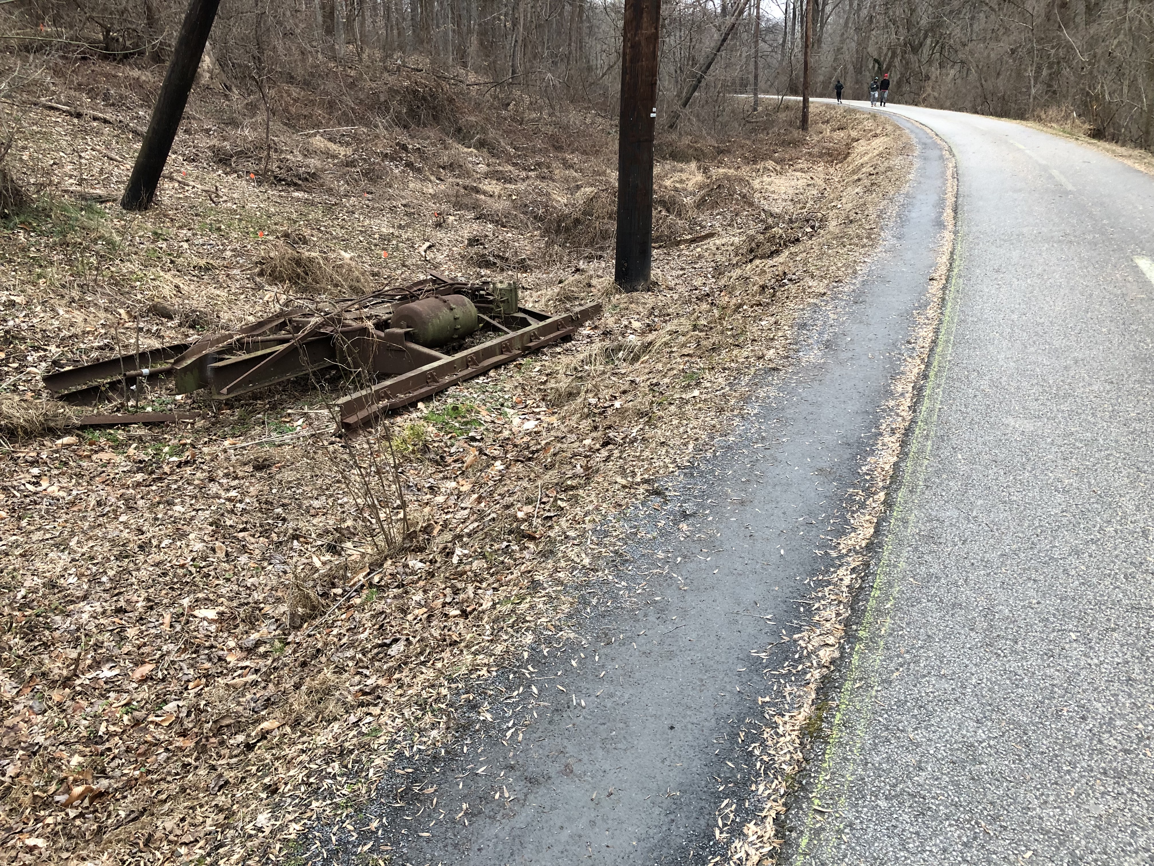
Walking a bit further up the Branch we came to the abandoned box car. This carcass appears to be from a wreck and exists in three pieces. The underframe and two ends. Parts of the couplers and much of the frame are all there. Even decking from the floor are still in place. My best guess is that this car was damaged in a flood down near the River at some point in the 40s. (or maybe earlier) The RR cut the car up, loaded it on a flat car and dumped it for some reason. Not sure why they didn’t just transport the entire thing back to the yard, but maybe someone out there knows. Also, we looked for more cars in the weeds but didn’t find any.
This box car was cut up and dumped off the side of the right of way. Best guess is that it was damaged in one of the floods and dumped here after being stripped of useful materials.This box car was cut up and dumped off the side of the right of way. Best guess is that it was damaged in one of the floods and dumped here after being stripped of useful materials.
This box car was cut up and dumped off the side of the right of way. Best guess is that it was damaged in one of the floods and dumped here after being stripped of useful materials.
We drove a bit further and took a peek at the C&O Canal bridges but did not stop. By then it was getting late, it had started snowing (we ended up getting 14″ up in Brookeville!) and we were tired. But, wow, what a journey. We had a blast. It was bittersweet, though, to see all of the old areas being demolished and changed forever. It’s been a special part of me for the last 20 years, this line. Seeing it destroyed is a bit melancholy for me. But, rest assured, when the Purple Line opens, I will be in line for a ticket to experience the Georgetown Branch as I never was able to; a passenger. It’s the closest I’ll get! 🙂
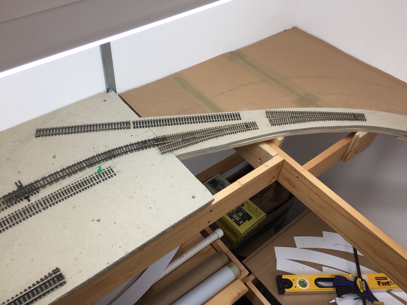
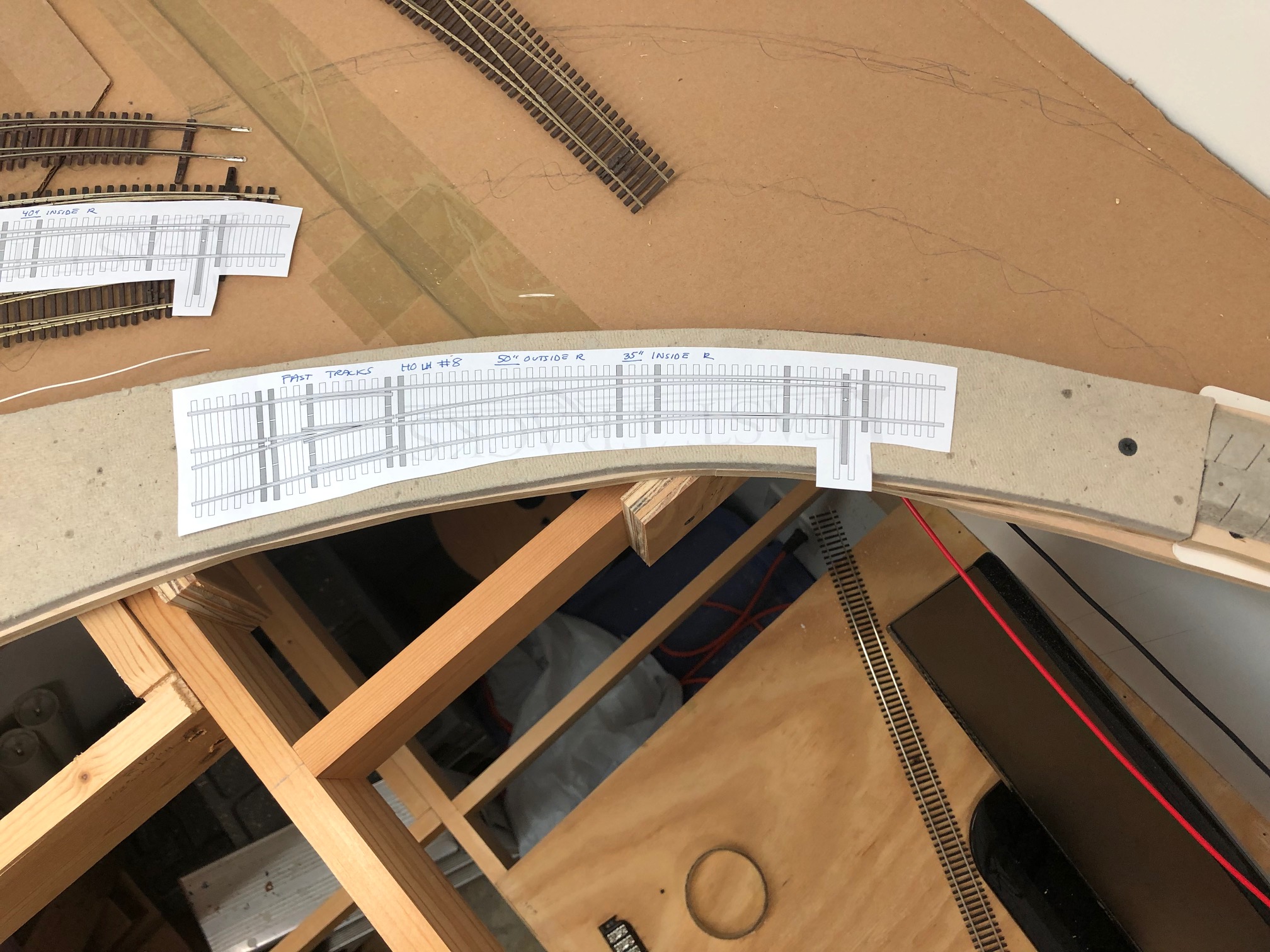
Happy New Year! I’m catching up on a LOT of updates for this site. I’ve got tons to share and just trying to find the time to get it all online. I had a great work session with Matt R. where we disconnected the DCC system and hooked up a regular power pack to the layout so I could run some of my non-DCC-equipped trains. This served a couple purposes. One, it was cool! Two, it gave me a chance to see how the “biggest” steam engine I have (a B&O Q1c Mikado) did going around the curves of the layout. What did I learn? Well, some of the curves, especially at the Junction are WAY too tight for the Mike. But, I also had some great brainstorming, realizing that I had laid out the track at the Junction in a way that wasn’t prototypical and could be done better to ease the curve and allow for a more prototypical arrangement. I’ve ripped out about 80% of the track I need to remove and am in the process of redoing the roadbed and arranging the tracks. I need to test fit a couple #8 RH turnouts, so that is the next step.
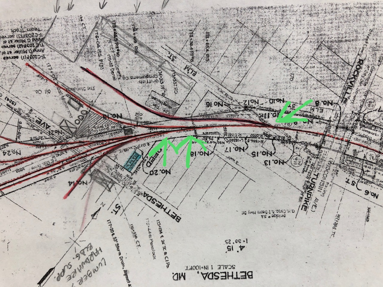
But, the big thing is that I’ve laid track all the way to Bethesda! (yay!) The bad news, I hit a snag. The curve coming into Bethesda is a broad compound curve. On the prototype there were three turnouts. From right to left, a turnout that served Griffith Fuel & Oil and included a long coal trestle. Next is another siding. I’m not certain what this served. The third turnout is the lead for the passing siding, which also led to more sidings serving Maloney Concrete, Frito-Lay and some team tracks among others.
I had originally planned on using some modified Micro Engineering and Walthers #6 turnouts (webbing removed to allow minor “curving” of the turnouts). See here, from last Feb:
But, upon closer inspection, and now that I actually have a lead into Bethesda, I realized these just do not work for me. The #6’s are way too abrupt. The “main” would become the “diverging” route on the turnouts. This looks way too wonky to me. The curve of the #6 is very sharp and it doesn’t flow well, even with bending. I tried some of the broadest curved turnouts that Walthers/Shinohara offers and they are too tight. So what’s left? Are you hearing that? It’s the call of the old-school model railroader… that’s right; Hand laying track!
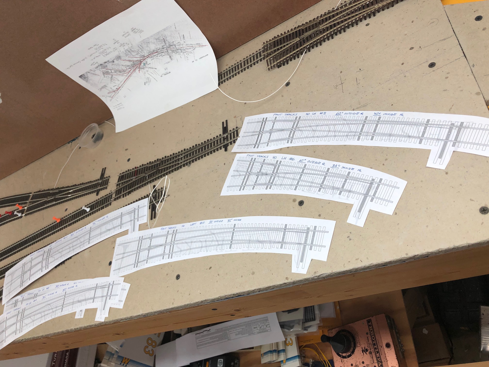
FastTracks is a modern supplier of tools, jigs, and supplies for hand laying track. They have just about anything you could imagine in this realm. I have seen their stuff before and it’s very nice, but also very pricey. I can’t afford to buy a few of the CNC-cut jigs, but I will use their free templates as guides to get my turnouts close to what I need. I printed out about every template that was close to what I am looking for and test-fitted them on the layout. A few of them come close to what I need. Matt and I used a piece of spline to draw a nice curve from the existing track on into Bethesda. This gives me a baseline for the curve of the turnout I need to build. To give you an idea, here is the overall ROUGH arrangement of the tracks in Bethesda:
Next steps: Now that I’ve got the curve drawn on the roadbed, I’m going to cut and remove the roadbed section where the curves are and mount it to a small piece of plywood. This will allow me to take it to the workbench and work there versus on the layout itself. I then need to start test fitting ties and figure out the layout of the turnouts themselves. Alternatively, I may just build three turnouts of the same size and then place them together like sectional track. This will also allow for simplicity, but I won’t be able to achieve the nice compound curve I am following. Either way, I have my work cut out for me this weekend.
As a final note, next weekend (Feb 2-3) will be the Great Scale Model Train Show at Timonium, MD. I will be there and will have some table space to sell some old equipment. If you are going, drop me a line so we can meet up and say hello!
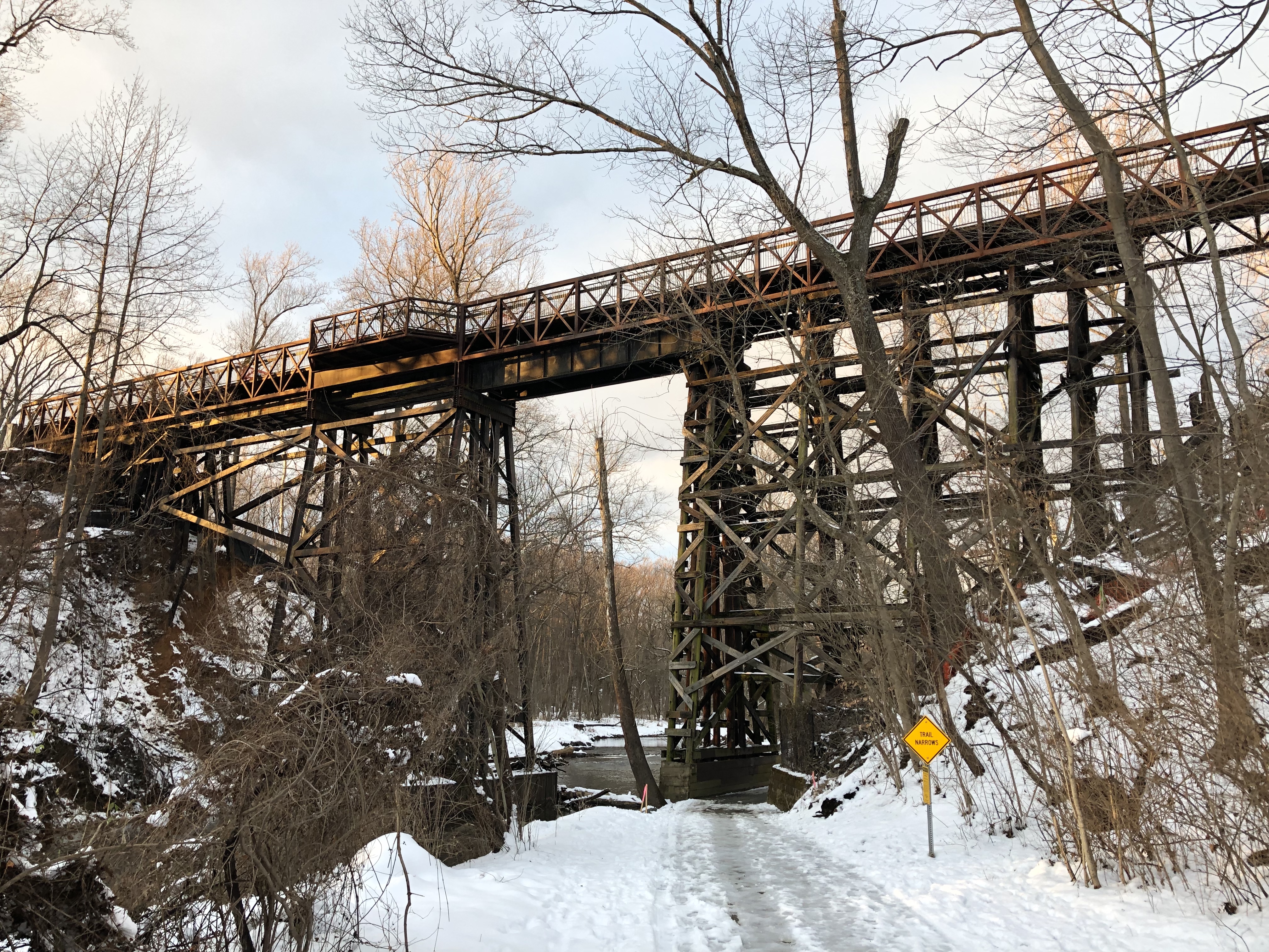
The Rock Creek Trestle, as it stands on January 16, 2019. The trestle is currently in the process of being demolished.
I spent all day Saturday visiting the Georgetown Branch to see some of the construction changes. It was a glorious day. Kelly R. and I found some amazing things. I took hundreds of photos. I’m planning many future blog posts.
The impetus for the journey was that I remembered that the Rock Creek trestle was going to be demolished to make way for a new grade for the purple line. I had no idea if it was already down, but Kelly and I headed over to the site. Much to my joy, it is still partially standing, although about 8 of the trestle bents are gone from the East end.
The venerable structure is not long for this world. Massive mobile cranes are staging nearby to remove the pedestrian path atop the trestle and on the west end, well, the original right of way has been completely decimated. It’s heartbreaking for me to see. This trestle has stood the test of time. Survived fire, flood, hurricane and countless storms and seasons. Since it’s original incarnation as a long wood trestle to what it is today, a bridge has spanned this valley since the early 1890s. It’s a beautiful structure and is showing its age, with rot starting to really take its toll.
I visited today after work to take some final measurements and as many photos as I could snag with the limited sunlight I had. It’s a special bridge for me. Something of wonder. If it’s of any consolation, it will live on in model form on my layout as best as I can manage.
![Something New in Postal Facilities. [Between 1919 and 1932] Photograph. Retrieved from the Library of Congress, <www.loc.gov/item/96501487/>.](http://gbblog.sluggyjunx.com/files/2019/01/1919-1932-Georgetown-DC-Something-New-in-Postal-Facilities-11223-RU-Underwood-and-Underwood.jpg)