This post is sort of a mental dump from several months ago regarding a curiosity I discovered while doing research on the Rock Creek trestle for the model I’m constructing. Good photos of the trestle are very rare. Doubly so for older photos from the 1940s and earlier. The trestle was located in an area with a decent amount of vegetation and was a bit out of the way. I only have a few images of the trestle that date from the timeframe in the 1940s-1950s that I model, and they are mediocre shots at best. It was a difficult structure to photograph! But, they are like gold to me. They are all I have! They are the only visual representations of something that was very special and existed in various arrangements over time due to rebuilds, strengthening, vandalism/fire and flooding damages.
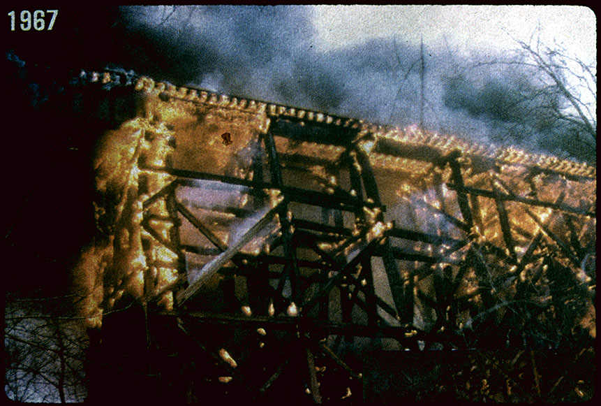
Ca. 1967. Photog unknown. Collection of W. Duvall. An arsonist’s fire gutted the trestle five years before Agnes would destroy half of it in the major flooding of Rock Creek. Note the diagonal supports on the outside of the trestle. So which side of the trestle was this photo taken from?! North or South?
Because there are no strikingly significant differences between the North and the South side of the trestle, I have always struggled to determine what I was actually looking at in the photos; North or South side? The small refuge bays that jutted out a few feet at the top were offset on each side in the same relative place, so if you stood on the ground below the trestle and snapped a photo, it would look nearly the same from either side. I had to find a way to figure out which side was which when looking at photos taken from the ground! But how?
Anyone else remember this moment from It’s a Mad Mad Mad Mad Mad World? This was me moments before figuring out how to identify the North and South side of the trestle.
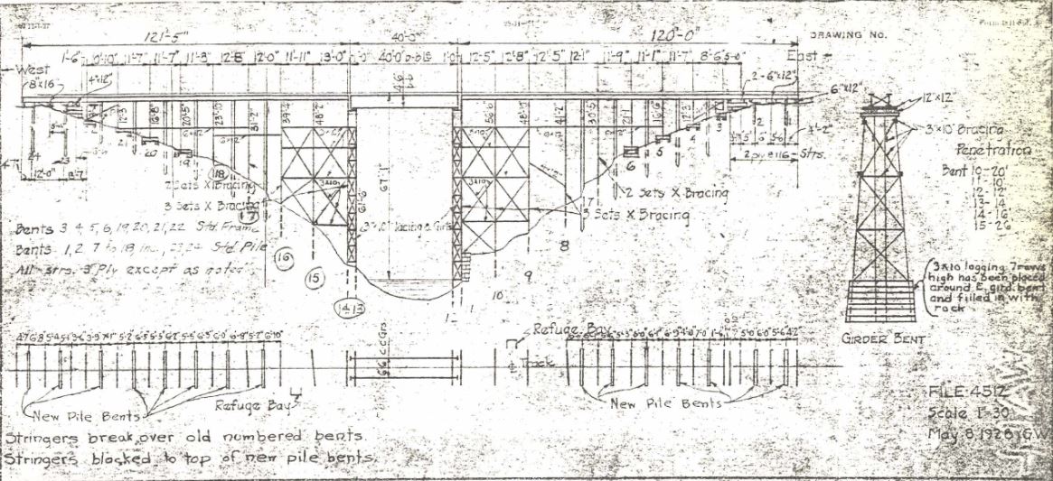
First let’s take a look at the bridge sketch. This view would be standing on the south side, facing north.
Bridge Sketch, B&ORRHS. Ca 1959, shows bridge after reinforcements were added.
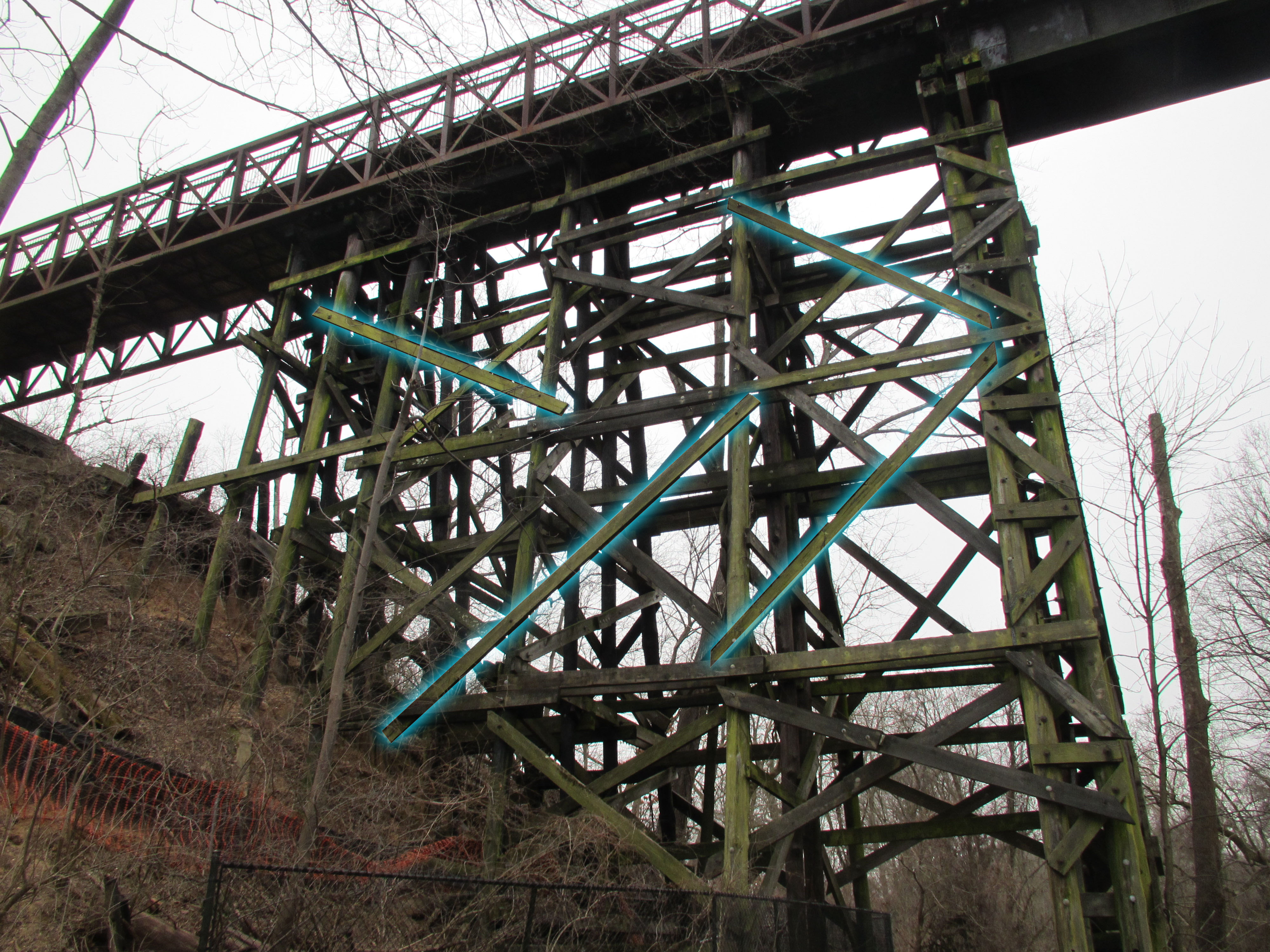
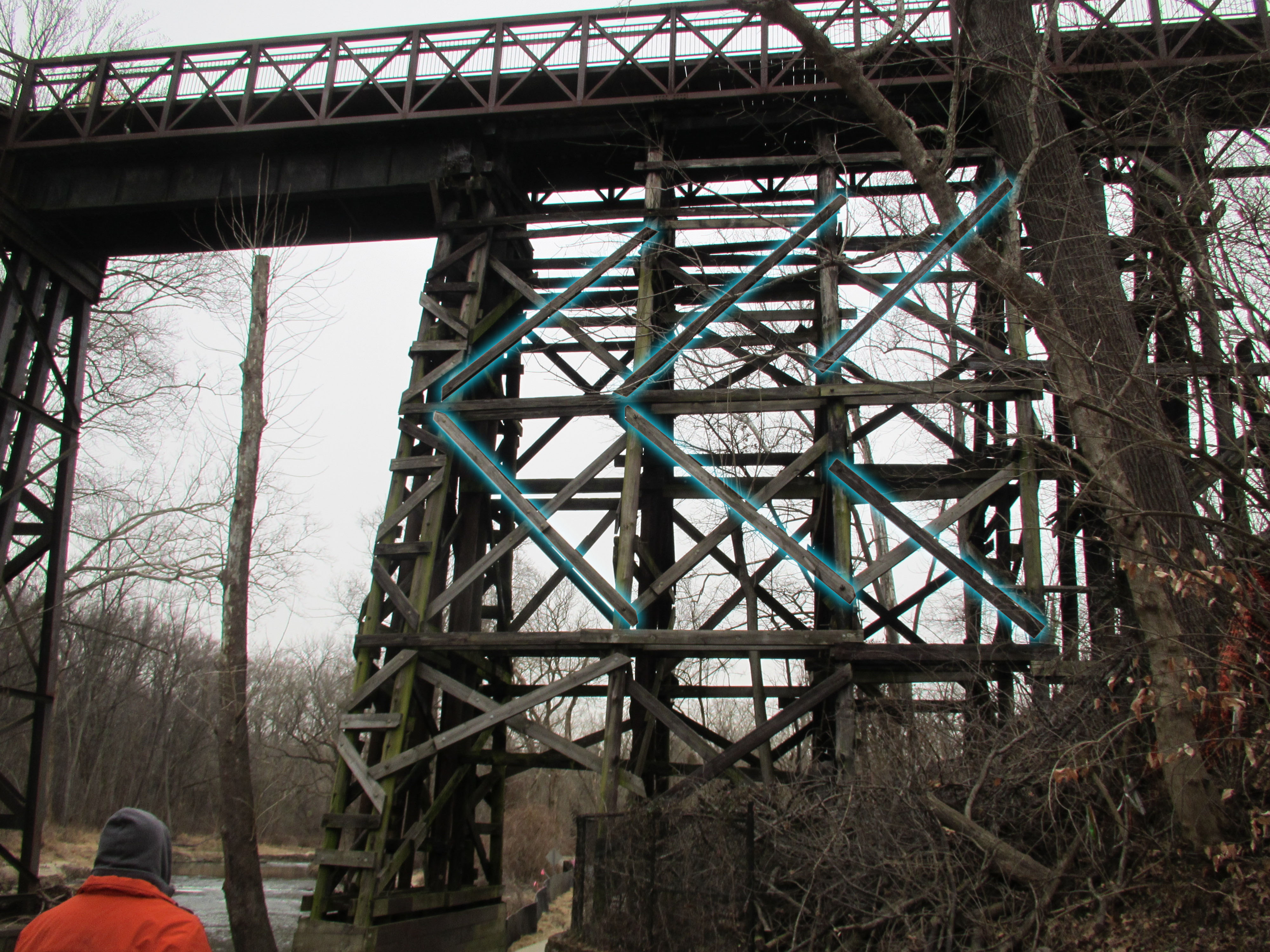
As I studied photos there was one thing that stood out to me. The large diagonal OUTER cross braces seemed to form an arrow that pointed toward the west. I first took a look at a few known photos that I shot of the East end of the trestle to see if there was something to this. Here is a view from the North side, facing South:
11/12/2019, North side, East end. Outer braces highlighted in blue.
And here is a view on the South side, facing North, of the East end as well; the other side from the above image:
11/12/2019, South side, East end. Outer braces highlighted in blue.
And there it is. My “W” moment. The cross braces form “arrows” which always point West. Looking at some images in my collection which I previously could not determine the side confirmed my suspicion. Here is an image from ca 1946:
A view from below, ca 1946 or 1948. I have highlighted the outermost cross braces. I now know this shows the locomotive facing a westerly direction.
Note the side bracing, which I have highlighted in blue, pointing to the West! I have a few other images that I unfortunately don’t have permission to share here, which further confirm my suspicion. So, for anyone who is attempting to identify an old image of the Trestle, if you are curious which side you are looking at, just look for the outer bracing to “point” you the way. 🙂
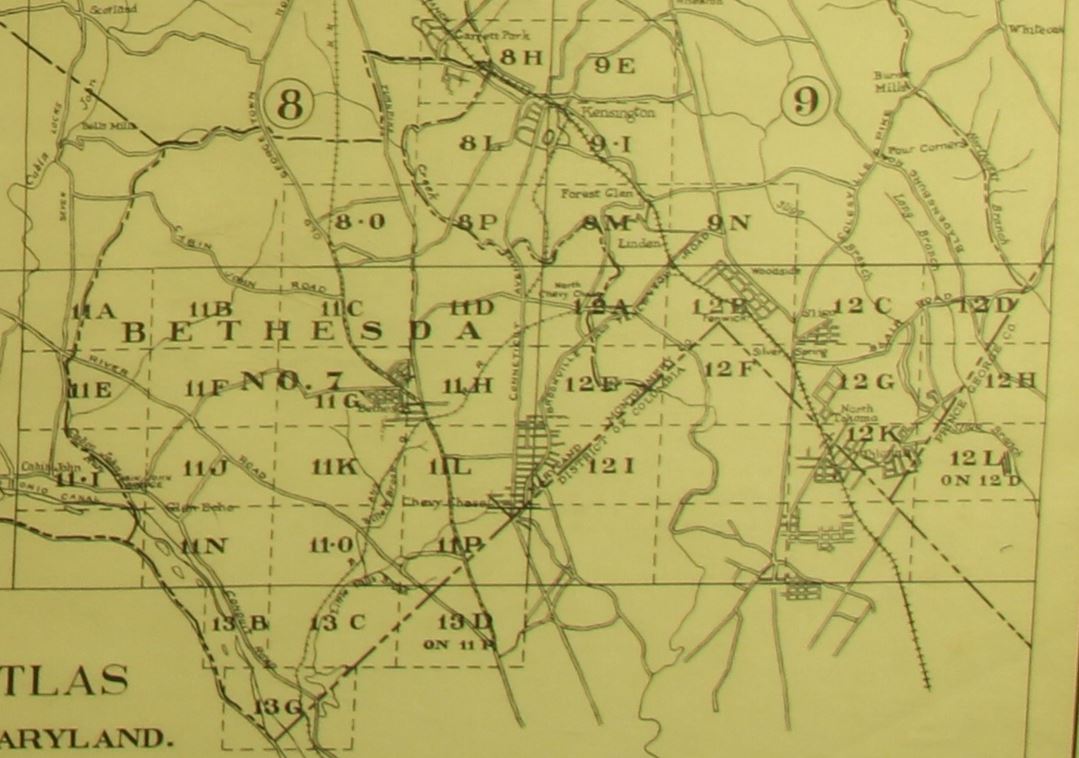
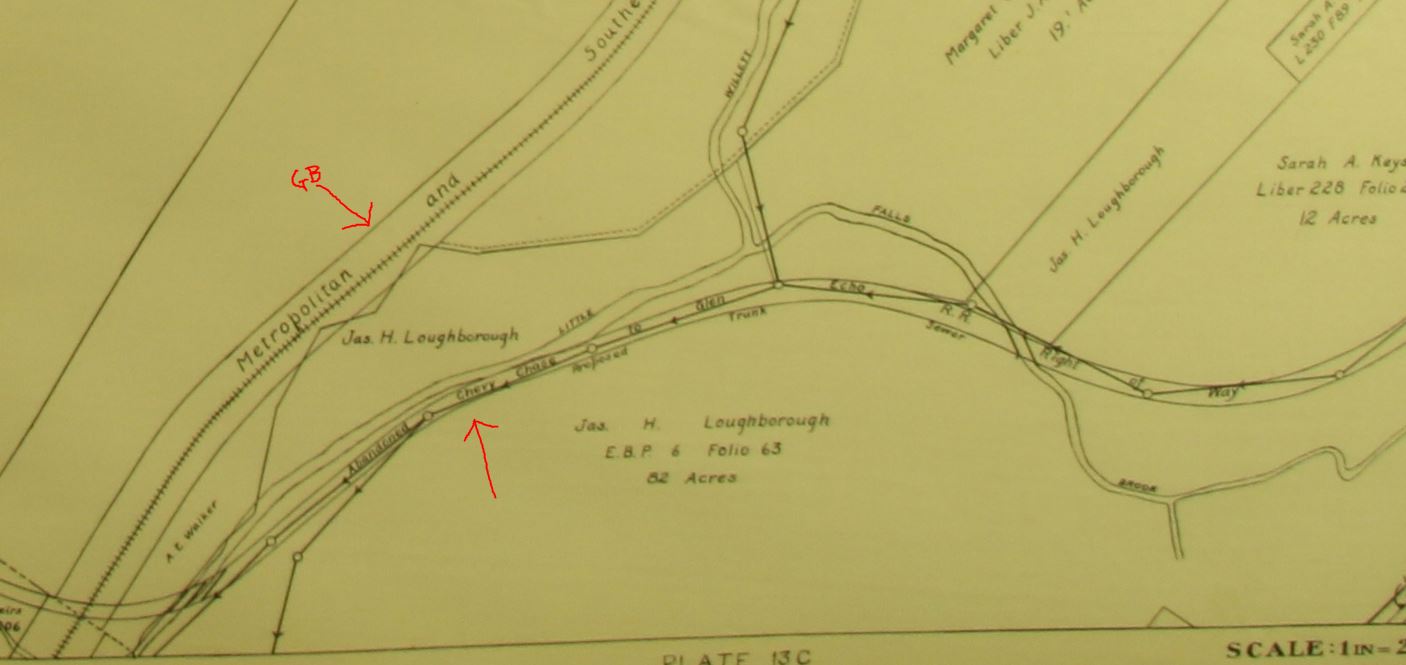
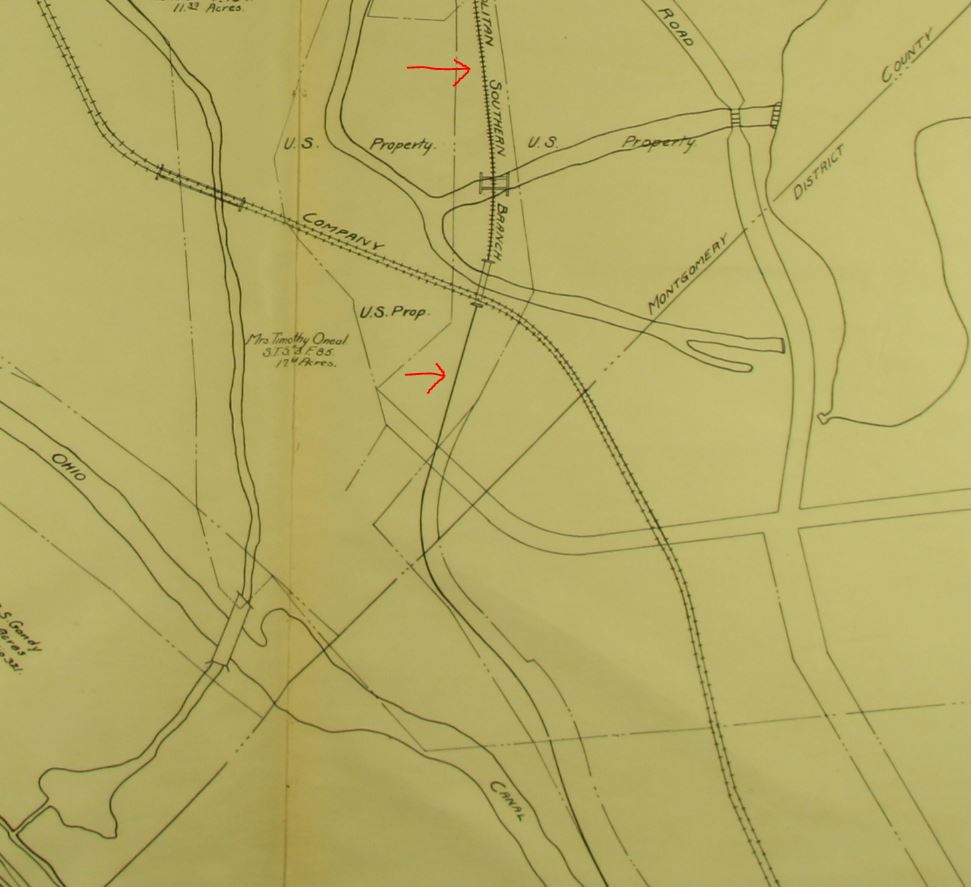
Thanks to J. Shriver for the tip on this! A link to the “Real Estate Atlas of the Part of Montgomery County Adjacent to the District of Columbia” by Deets and Maddox at Johns Hopkins. (unfortunately the images are in JPEG2000 format and will require either a Mac (Safari or Preview) or a program like Photoshop to open.) I don’t have a whole lot of background on this atlas, but it is really neat. Apparently it covers the land in Montgomery county in several volumes, this one focusing on the area just North of DC and includes the entirety of the Georgetown Branch in Montgomery County, MD. Here is an overview of the plates:
The GB begins at the Junction on plate 12B and continues through 12A, 11D, 11H, 11L, 11K, 11O, 13C and 13G. Early history sources for the GB are rare so this atlas is particularly special. The Branch had only been completed about seven years prior and was very much in its infancy with the extension to Georgetown. Many of the towns along the route had not yet bloomed and as such there is not a lot to see as far as trackage. What you do see are some of the extinct transit lines that crossed the GB at various spots like Connecticut Ave., Wisconsin Ave., Bradley Blvd., and Dalecarlia. Here are a few highlights:
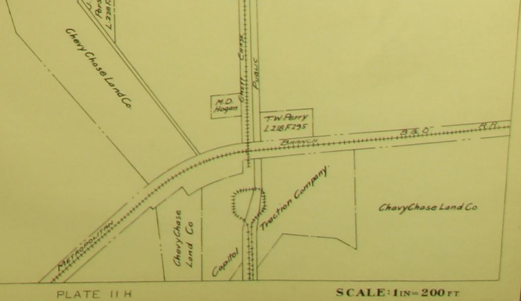
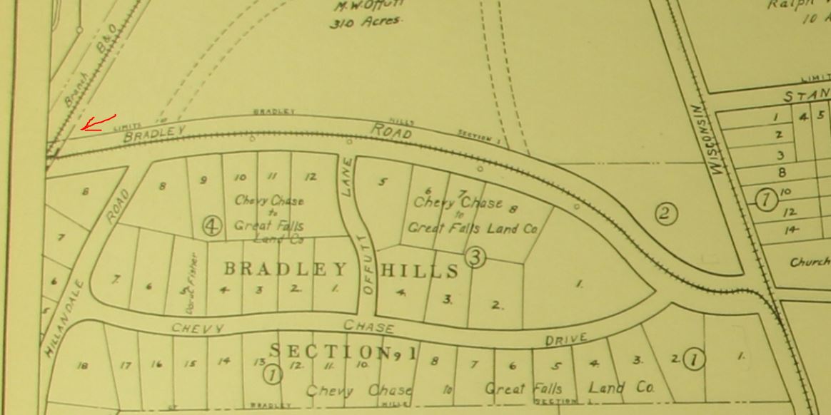
An example: Here we see Chevy Chase, MD with Connecticut Ave. running north-south. The GB runs east-west. The Chevy Chase & Kensington Electric Ry. begins just south of the GB and runs up toward Kensington. The Capitol Traction Co. had a car barn and loop here. This line never crossed the GB. Here we see the Washington and Great Falls Railway and Power Company (1913-1921) line which crossed below the GB at Bradley Blvd. The narrow underpass was quite small, being only one lane wide. In 1959 the bridge was removed and the crossing widened to what you see today. Another view, on the West side of the tracks. Note the GB is still labeled “Metropolitan Southern Branch B&O” because that is what it was named prior to it being considered the Georgetown Branch. A bit further south, just past River Rd, the line passes near the abandoned right of way for the Glen Echo Railroad (this section, ca 1891-1902) which pre-existed the GB by some time. I don’t believe the rails ever crossed each other. This area would be the current day Mass. Ave. & Little Falls Pkwy.Finally, the line continues to the Dalecarlia Reservoir area. Here we see the Capitol Traction Co. double track Cabin John line passing beneath the GB on an east-west trajectory. Of interest, note that the GB track is marked with hash marks to the North of the crossing and has no hash marks to the South. It may indicate that the line was not updated and shown as a surveyed line, or it may have just been an oversight by the cartographers. Interesting.
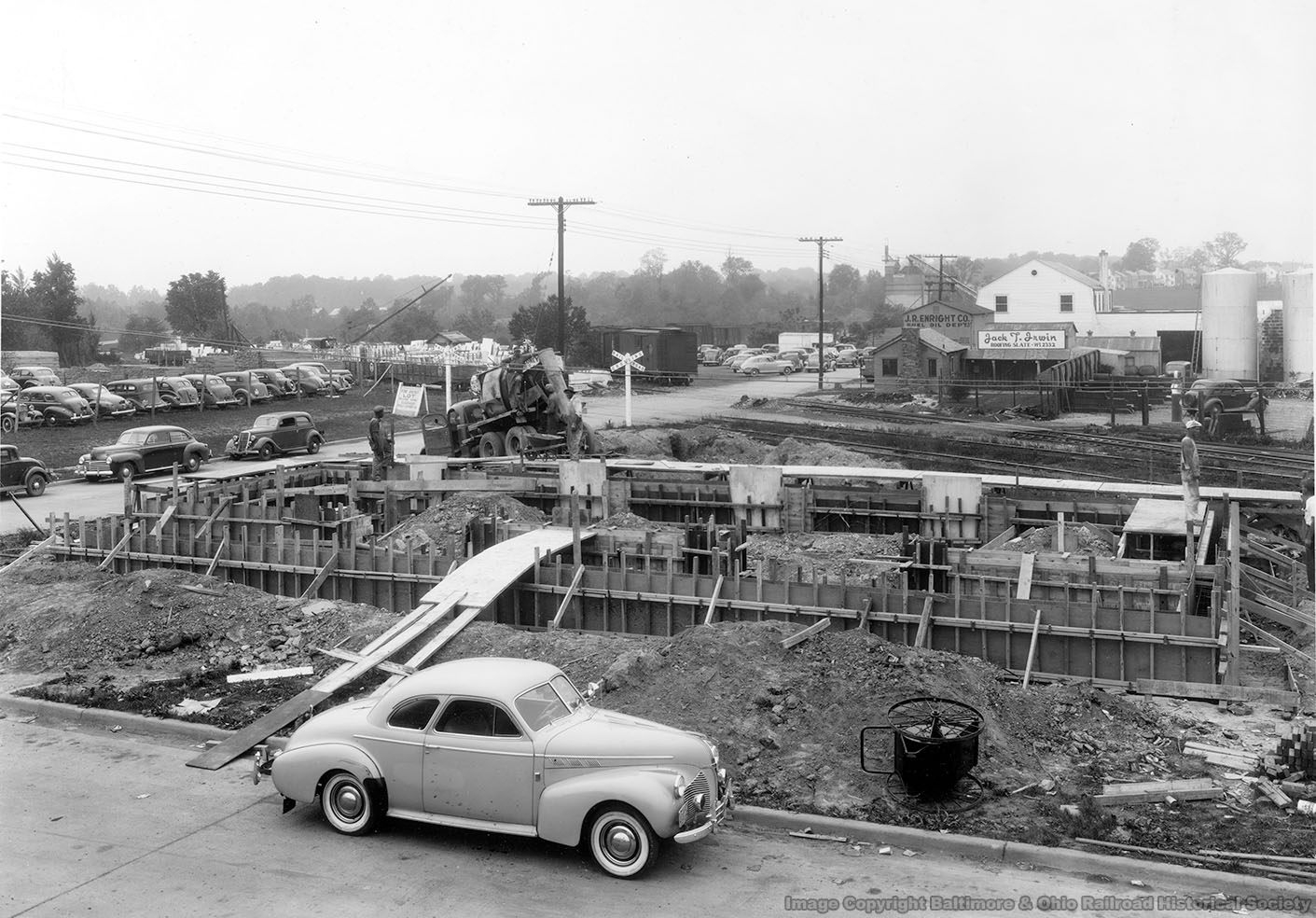
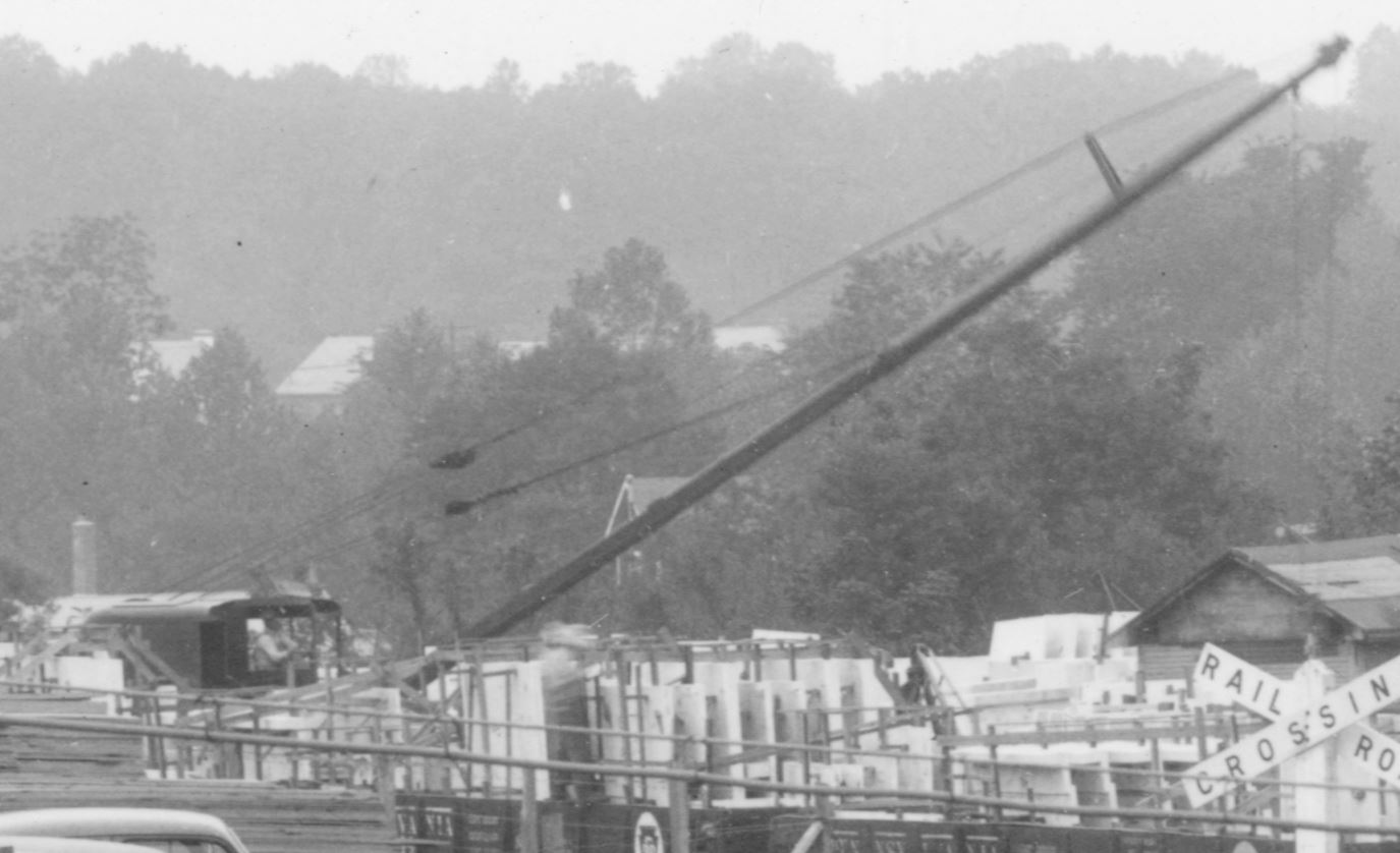
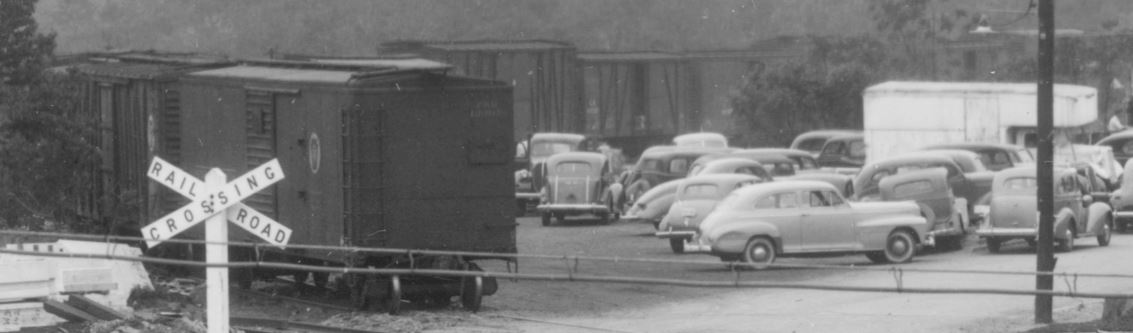
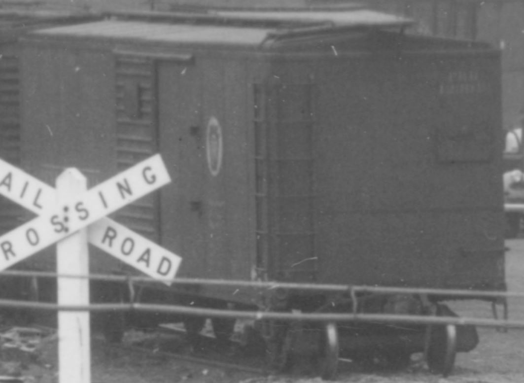
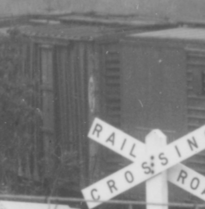
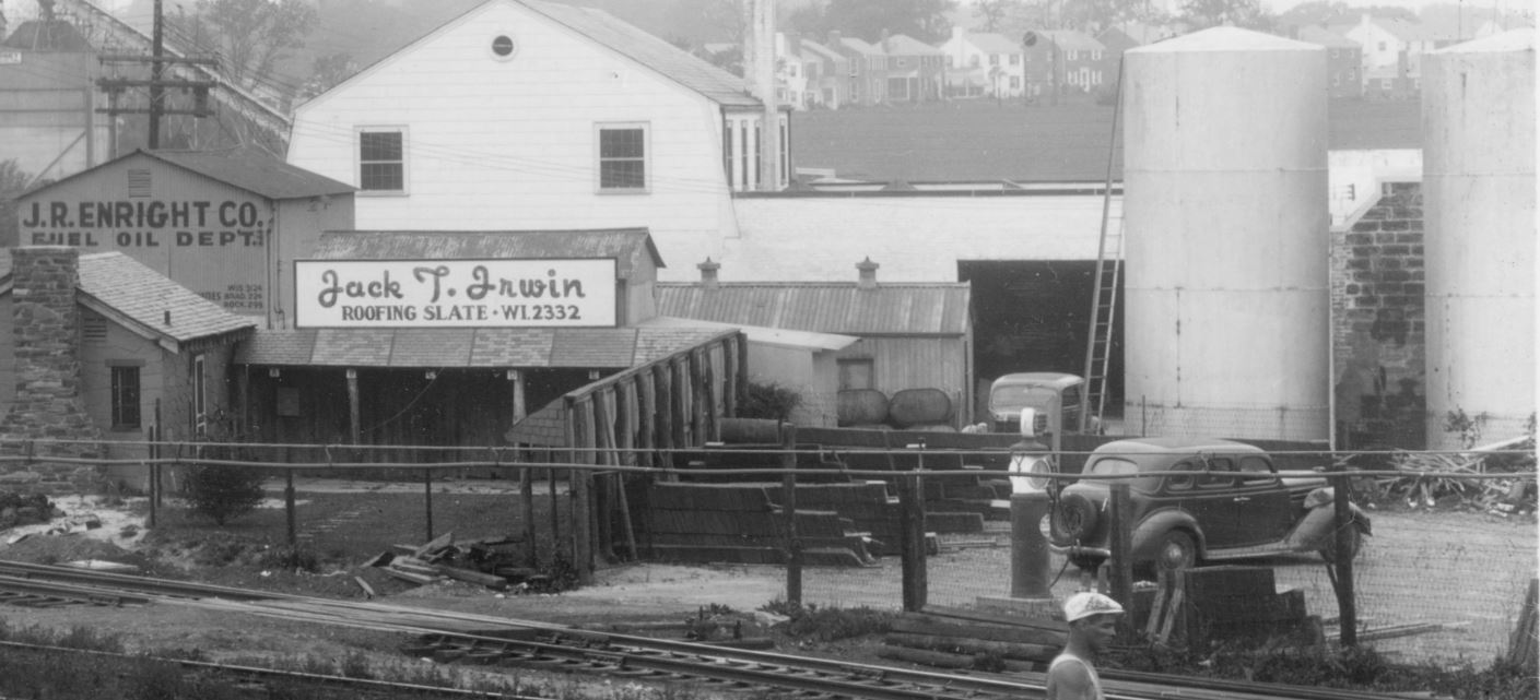
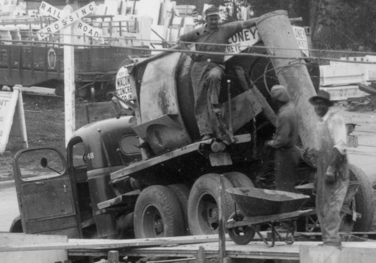
Well folks, this one’s a doozy. A friend, Brian R., who regularly volunteers at the B&ORRHS just sent me one heck of an image. You may recall a few months back he sent me a couple images of the Bethesda Freight House under construction. Well, here is one more that was shot weeks prior to the other one and shows a WHOLE LOT of the surrounding area. I get pretty excited when I get really nice photos of Georgetown Branch subjects, but this one is really very special and so chock-full of details, it’s hard to know where to begin. Let’s dig in. First, here is the full image:
Freight House Construction, Bethesda, MD, May, 1941. Photo courtesy B&ORR Historical Society. Depicts early construction of the freight house with footings being poured. Of note are surrounding yard and town area.
So there’s a lot in the image and what is funny to me is the construction of the freight house is not the primary interest. I picked out several things of interest. Let’s take a tour around the photo. First up is the yard area, largely visible behind the Maloney Concrete cement mixer. The yard is choc-a-block full of what appears to be marble or limestone. I have references to stone being delivered to Chevy Chase for the Washington National Cathedral and of course the extension of the line in Georgetown to serve construction of the Lincoln Memorial, but I have never heard of any stone deposited in Bethesda on a scale such as this! Have a closer look:
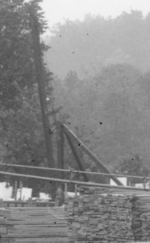
As far as the eye can see, stacks and racks and car loads of stone. Impressive! There are even two unloading devices; one, a stiff leg derrick visible to the left and a crane of some sort, likely an early Burro Type 15 or 20, similar to this one seen here.
Stiff leg derrick.Small crane. Note, the “smoke stack” seen to the left is actually from a building in the distance, not the crane. Note that the crane is facing almost perpendicular to the photographer. Also note the position of the operator in the open cab, with what appears to be the drum and hoist mechanism opening to his right. The crane is quite short in length, which steers me to think it’s an early Burro Type 15 or 20. Another image of the Type 20 patent design.
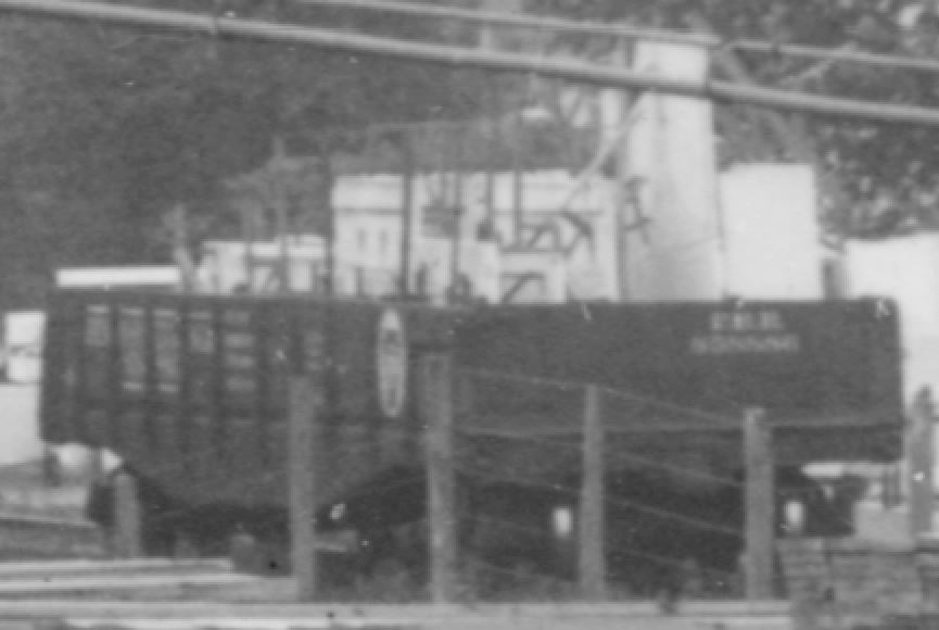
Getting a bit closer to the nearest gondola, I can see that it’s a PRR gon, and the number looks to me like 368270. A quick search in the 1943 ORER shows that this falls into the PRR GB class GRA, constructed around 1916 and modified from the GR class by adding 3′ to the overall length. These cars were somewhat plentiful in 1943 with 590 listed in the ORER. (By 1953 this number had dropped to only 31!) Thankfully, Westerfield offers a resin kit of this car, for anyone interested in modeling it.
PRR GB GRA class gondola, number 368270.
There are other GRA class gons in the yard, identifiable by the slightly stretched space between the middle braces.
Another PRR GRA gondola.
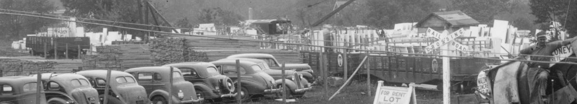
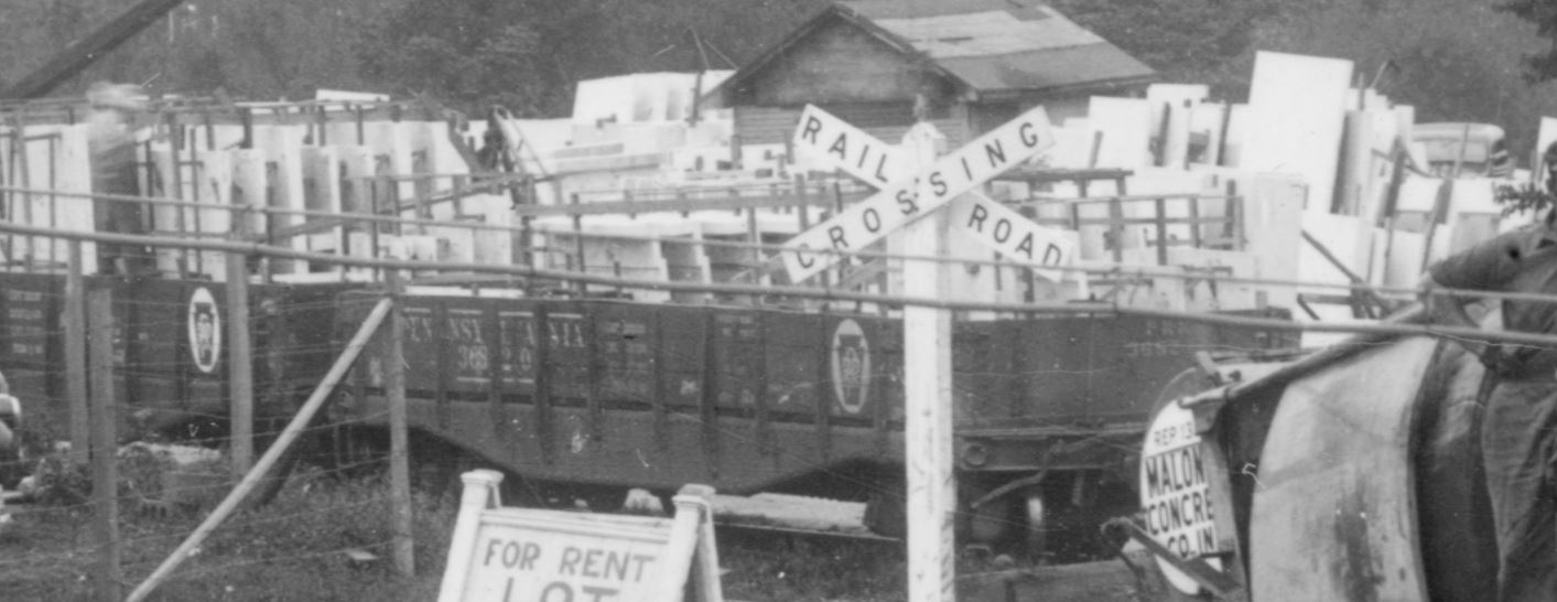
Let’s look at the other freight cars visible in the photo:
A long string of freight cars, all apparently boxcars, stretching on the siding toward Maloney Concrete.
The first one is obviously a PRR car and appears to me after some careful study to be numbered something close to 123951 – my confidence is medium, here. If this is accurate, and based on the overall design I think it is, this would be a class X28a boxcar, rebuilt from door-and-a-half X28 class cars in 1933 and of which there were 4957 listed in the ORER in 1943. (In 1953 there were still 3676 listed.) Some info here. Thankfully, Funaro & Camerlengo offers a resin kit of this car if you’d like to model it in HO. Decals here.
PRR X28a boxcar.
The next car appears to be another PRR car, but there’s much less to go on. My guess based on the panels and bracing is something similar to an X26 class boxcar, as they were plentiful; in 1943 the PRR had over 6000-some listed. Again, Funaro & Camerlengo offers a resin kit of this car as well as Westerfield.
Likely PRR class X26 boxcar.
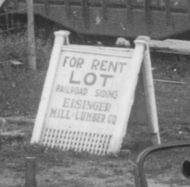
The rest of the cars are so far away it’s very hard for me to discern. Perhaps some of the steam era freight car gurus can pick them out. 🙂 Next up, check out the lumber in the Einsinger lumber yard:
Einsinger Lumber; partially a parking lot.
The siding is past those stacks of lumber. It’s interesting; at some point in the next few years, Einsinger would build more structures in this area to expand the lot. The cars occupy a space which would be the site of a long lumber shed. Photos from the late 40s and 50s will show the yard expansion. Oddly enough, in later years, the yard would once again be a parking lot and eventually a residential building. There was a curious sign off to the right, next to those cars:
Eisinger Lumber sign.
Would love to know the story behind that sign. Heading back over to the right is the Irwin Roofing shop. This is a particularly interesting spot, as it’s a showroom of sorts and there is SO much to see.
Looking closely, I see a well-maintained front lawn with a short walkway up to the small shop and a nice decorative sign hanging out front. The shop itself is adorned with stone all around. Coming out into the back yard, there is a small courtyard with an overhang, the roof of which features various types of slate roofing, each labeled with a letter; A, B, C and so on. A really neat detail! Irwin Stone is still in business today! Behind Irwin Roofing is Enright Oil:
Enright Oil.
Enright is interesting. I would imagine they unloaded from the second siding coming off the main, which would be just to the right of their plant. Unfortunately the photo cuts off there but we get some idea of their storage yard to the right. A couple storage tanks are visible as well as some bins (coal?) and a nifty gas pump which may or may not be in use there in the yard. Perhaps to fuel up their delivery trucks. I plan on modeling part of this on my layout. Obituary for J.R. Enright Jr. Also of interest here is the access to the yard with the small crossing over the yard tracks. In the distance is Maloney Concrete:
Maloney Concrete, barely visible in the distance.
Speaking of Maloney Concrete, here is its mixer pouring ready-mix for the B&O freight station footers:
Maloney Concrete, truck no 48. If only someone would offer an HO scale model of this style mixer, I would be a happy camper!
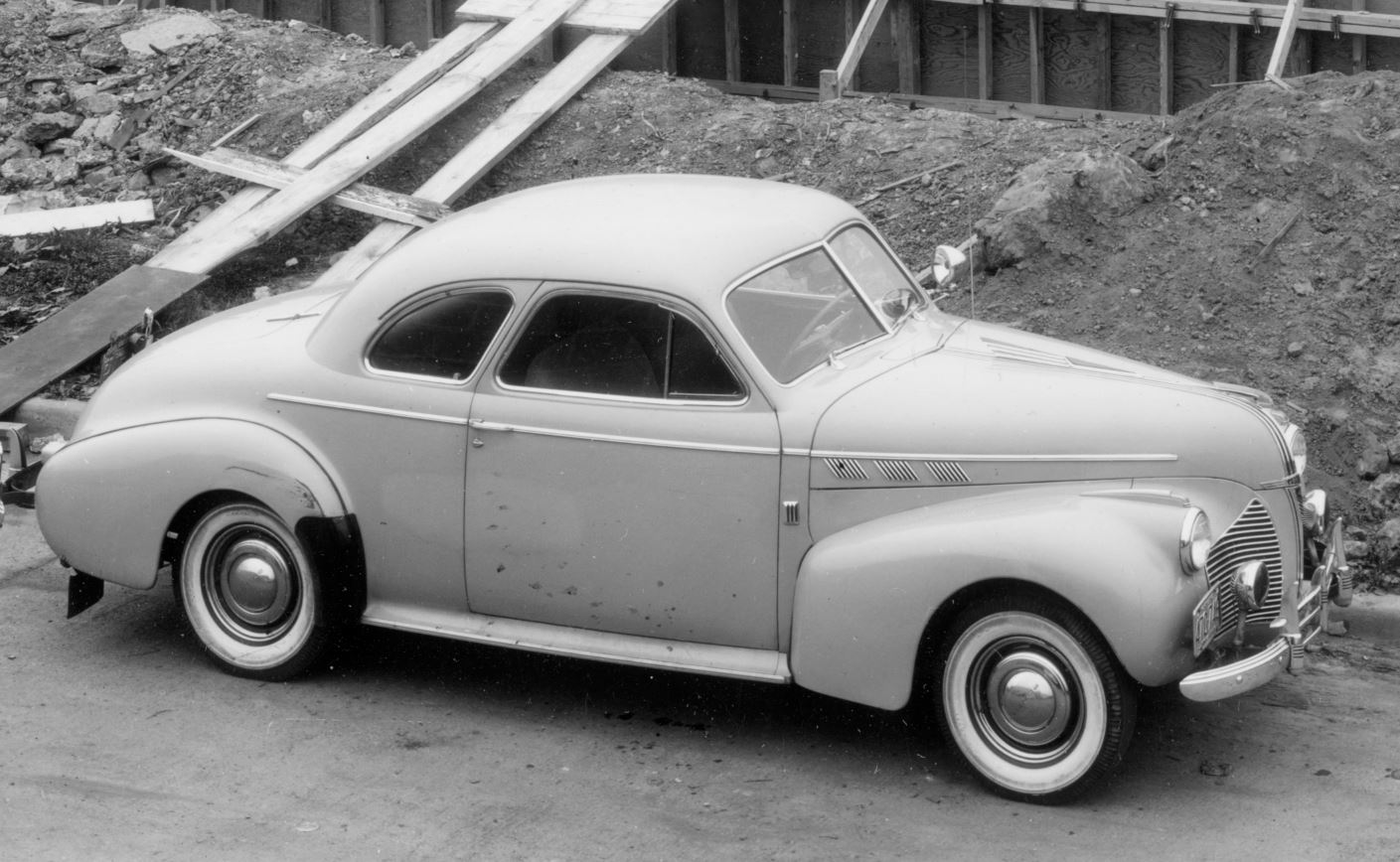
And lastly, it’s hard to ignore all of those lovely late 30s – early 40s automobiles, but since I’m no expert, I’ll focus on just one. The up front and center 1940 Pontiac Torpedo Coupe:
Well, I hope you enjoyed the photo and the details herein. What are some of your favorite finds? What did I miss?! I have many questions such as what was all the stone for? What cranes were in the yard and during what years? How did Enright Oil receive their fuel? When did Eisinger Lumber expand and who were they renting the yard to? Also of note, the buildings along “Bethesda Row” had yet to be built. And to think, roughly seven months after this photo was taken, the USA would enter into WWII, further pushing the area to develop and grow. And yet, still no one has explained the greatest mystery of all; why did the Bethesda freight house never have rail service? The design is a curious one, with a garage for storage yet no rail service. That’s a discussion for another time.


