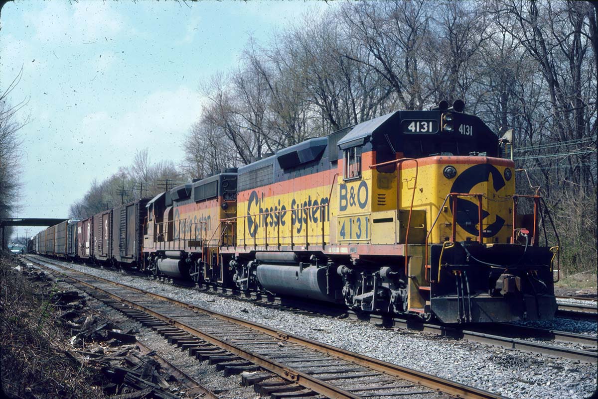
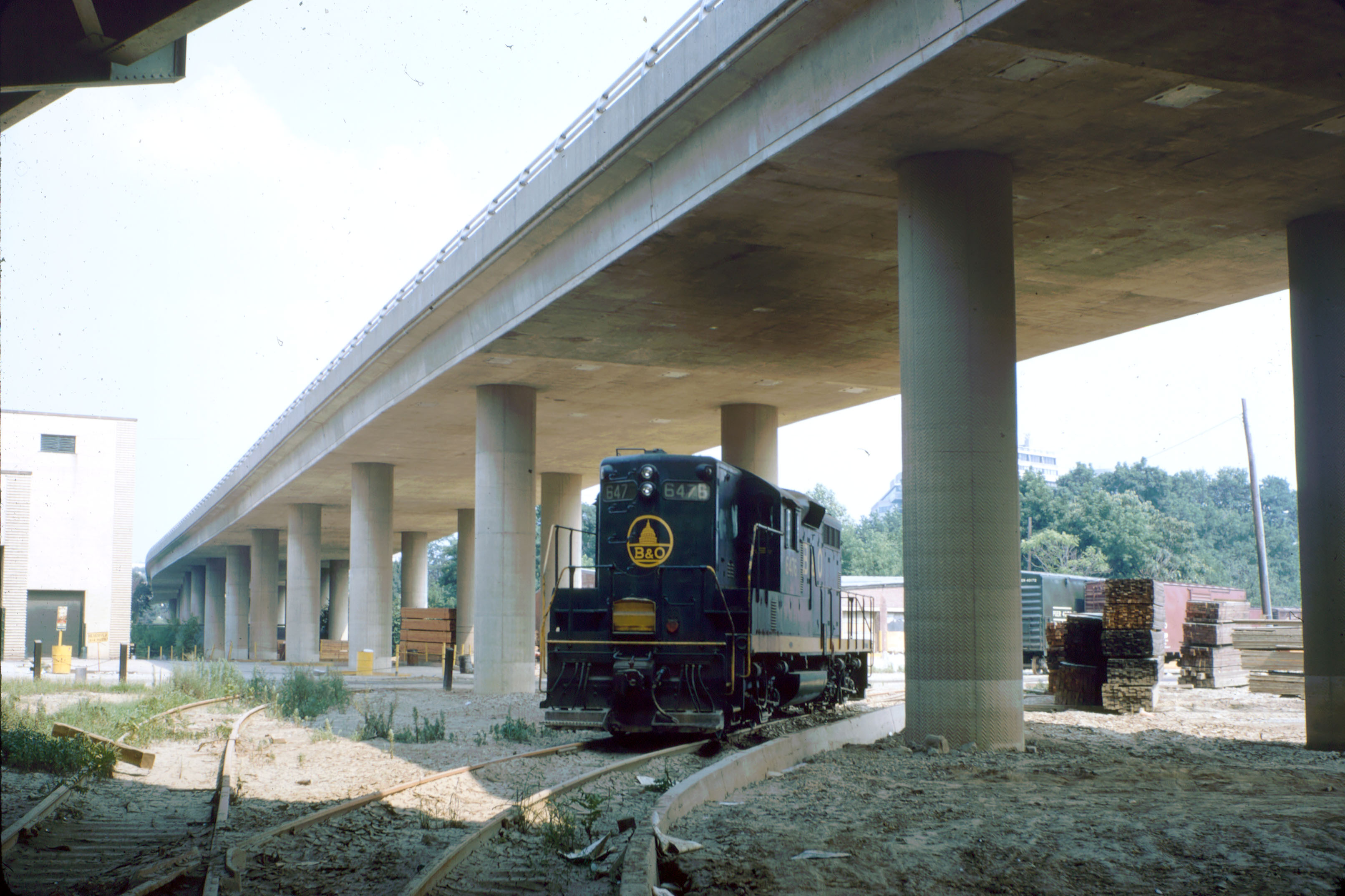
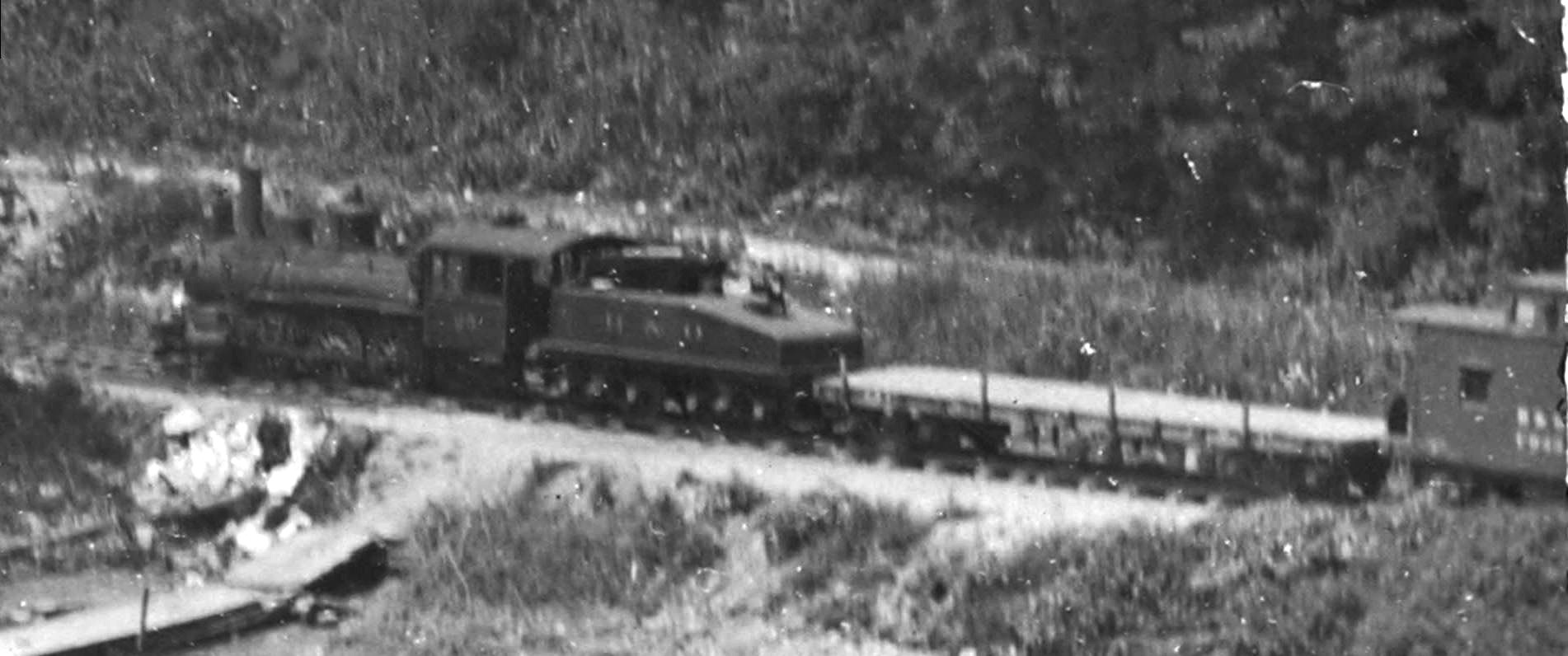
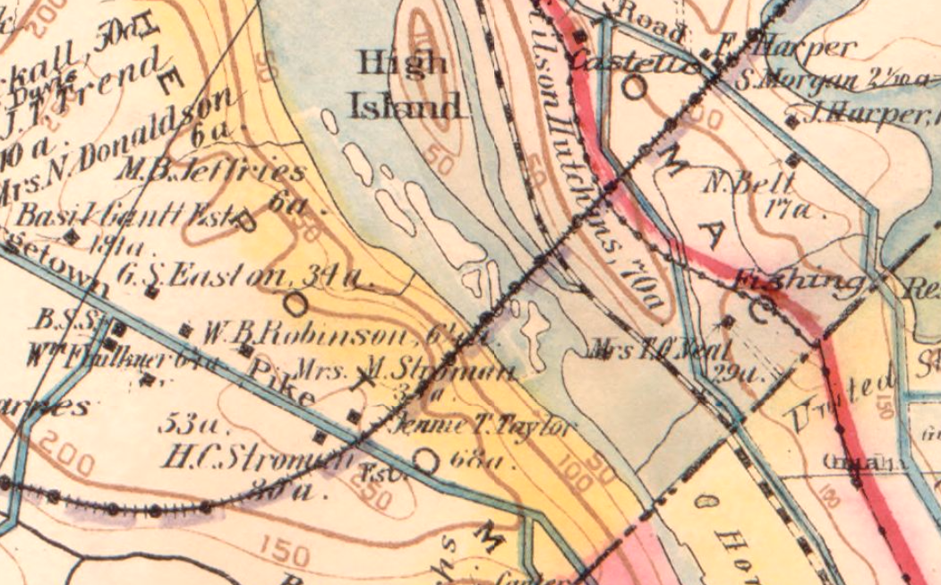
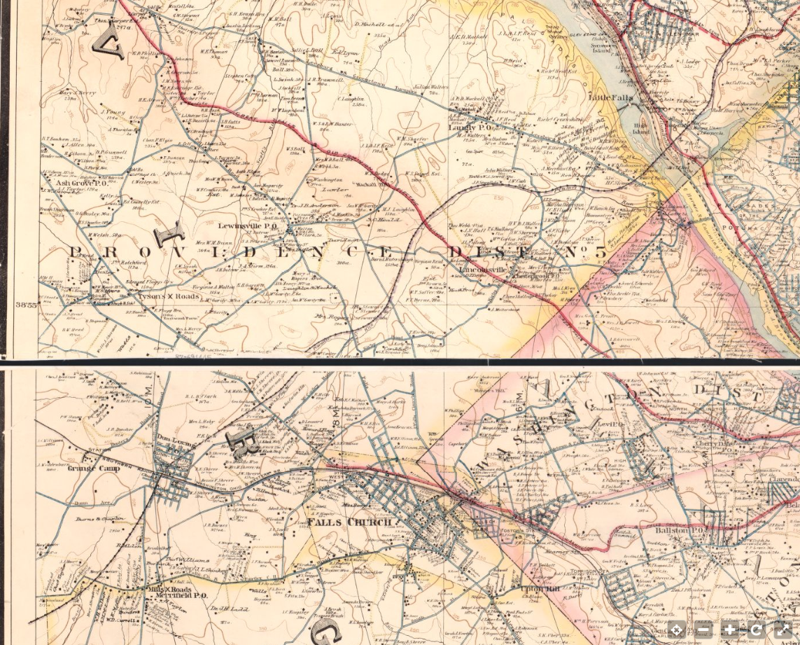
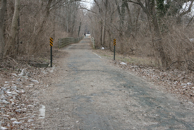
All posts by bsullivan

Photo of Work Train in Georgetown, ca 1910

ca 1910, Georgetown Waterfront, B&O D-2 #25 0-6-0
B&O #25 0-6-0 D2 engine with work train parked in Georgetown, ca 1910

I found this photo on the DCDIG website a few weeks back. It’s a very nice photo of the waterfront, showing a few of the boathouses which line the shore West of the aqueduct bridge, which this photo was taken from. Of particular interest is the B&O engine (#25 I believe), flat car and caboose parked on the Georgetown Branch main. How cool is that? It gets even cooler.

ca 1910, Georgetown Waterfront, B&O D-2 #25 0-6-0
Closeup, B&O #25 0-6-0 D2 engine with work train parked in Georgetown, ca 1910

I believe this engine, car and caboose is the work train that was sent down the newly-opened Branch to complete a very special project; the widening of the Aqueduct Bridge arch, to allow trains to pass beneath. In a couple photos shared to Facebook a year or so ago a Mr. Ulles posted a couple photos of his ancestor who was part of the team who completed the work on the arch. The photos are really windows into the past that I never thought I’d see. Based on the number on the engine (which I believe is #25), the configuration of the engine (0-6-0, class D2), the train consist (flat car + caboose) and the general surroundings, I do believe this is the work train. This would put the photo at some point in the spring/summer of 1910 and paints more of the picture of what Georgetown looked like when the B&O finally arrived.

Montgomery County Historical Image Viewer

Montgomery County Historical Image Viewer

I just came across this link via Facebook and it’s pretty cool. The Montgomery County MD Geographic Information Systems (GIS) map viewer. There are many maps available on the site, but this historic aerial collection is particularly interesting. The resolution is not that great, but it suffices. The earliest images are from 1951, and show the Georgetown Branch route quite well. Have a look for yourself!

Talbot Avenue Bridge is Closed Indefinitely

December 28, 1959. B&O E-7A #1415 heads up a race track special, headed Westbound for Charleston, WV. The photographer stands on the front of the Georgetown local, doing its switching before heading down the line to Georgetown. Photographer: Ray Mumford.

A sad day, indeed. This has been coming for a while, but is nonetheless tough to swallow. The iconic Talbot Avenue bridge, which has spanned the Metropolitan & Georgetown Branches of the B&O for so many years is closed indefinitely after failing a safety inspection. The bridge has been on the chopping block for a while now, being in the way of the Purple Line construction which is on hold while a lawsuit is reconciled.

I, for one, am most sad to see the bridge go because it is so iconic in all of the photos I have collected and seen showing action at Georgetown Junction. The bridge is always there, in the background, off in the distance in the shots of B&O trains switching the Branch or screaming off East or West, hauling passengers or commuters. The bridge witnessed the 1996 tragedy and remained. The bridge has been rebuild after most of the iron rotted away from years and years of salt and weather corroded the supports to frail remnants.

It will be a sad day when they finally remove the bridge and there is a hole where it once was. There is a grassroots effort to preserve the bridge as a symbol of the legacy of segregation in the local area; let’s hope they are successful. Read more here:

https://www.washingtonpost.com/local/trafficandcommuting/historic-maryland-bridge-is-closed-after-failing-inspection/2017/05/02/90f6ba70-2f71-11e7-8674-437ddb6e813e_story.html

What’s in a Map? (repost)

* Note: this post was originally made on 7/9/2015 but seems to have disappeared into the ether. I’m reposting it from memory b/c it’s a VERY interesting map, not just for Georgetown Branch research, but for the DC area. Enjoy!

Baist's map of the vicinity of Washington D.C.
This “Baist’s map of the vicinity of Washington D.C.” shows the proposed extension across the Potomac into VA. ca 1904. From the Library of Congress

Maps are so often used to base opinions when it comes to historic interpretation. The B&O planned on extending the Metropolitan Southern branch all the way into Northern VA to connect with the Southern RR and points South. At the time, the B&O was in some financial stress and the plan was never realized. They did, however, connect with the port of Georgetown, consolidating three railroads into one. (Metropolitan Southern, Washington & Western Maryland and the Georgetown Barge, Dock and Elevated Ry Co.) This became the Georgetown Branch of the B&O after 1908.

Read more about this history here on the Capital Crescent Trail website: http://www.cctrail.org/history_georgetown_branch

The plan to continue across the Potomac was a serious plan by the B&O. So serious, in fact, that it appears on many maps and documents that I have come across, including official B&O track maps! (there is one hanging on the wall at the B&ORRHS Archives in Eldersburg that shows this very thing) I came across this Baist map of DC and the extension is very clearly shown. So much so, the line continues on into VA for quite a while.

Take a minute to visit the Library of Congress website and see this for yourself. It’s a stunning map with lots of history to explore. Enjoy!

https://www.loc.gov/item/87691445/

You can view the map on this page or you can download the original. They even have a .TIF file that is nearly 1GB in size! Here’s a wide view to give you an idea:

Baist map showing B&O line through VA
This Baist map shows the proposed B&O line crossing the Potomac and traversing Northern VA. The line was, of course, never built.

B&O 9035 Switching in Georgetown

I just picked up this original slide image depicting a chilly winter afternoon with the Georgetown switcher doing its thing downtown. The date indicated on the slide is Jan, 1965 and the location is the “new  yard” at the intersection of Wisconsin Ave. & Water St. B&O Alco S2 9035 is about 20 some years old, having been built between 1943-48 by Alco. The unit has been repainted our of the classic serif “BALTIMORE & OHIO” into the more modern, sans serif “B & O” scheme and appears to be resting on this cold day. The slide is an eBay find and the photographer is unknown.

Jan 1965, B&O 9035 at Georgetown, Washington, DC
Jan, 1965, B&O Alco S2 9035 at Georgetown, Washington, DC. Photographer unknown. (eBay purchase)

Purple Line Funding in Question After WH Budget Released

It looks like the funding for the Purple Line construction is in jeopardy after the release of the White House budget this morning. As many of you know, the Purple Line will connect Bethesda with Silver Spring (and beyond) and will be built on the Georgetown Branch right-of-way between Bethesda and Georgetown Junction.

The state will likely miss a March 31 deadline for clearing trees before the migratory bird nesting season begins. That will delay by another five months any major construction from starting on most of the trail.

https://www.washingtonpost.com/local/trafficandcommuting/federal-money-to-build-purple-line-in-question-under-trump-budget-plan/2017/03/16/d9023ab4-09ac-11e7-b77c-0047d15a24e0_story.html

Aerial Photos of Georgetown from the 40s and 50s

Aerial photo of Georgetown from 1940s

I scanned these eleven images, which are 11″x14″ B&W photos, which were originally part of the H. Smith collection. They now reside in the B&O RR Historical Society Archives in Eldersburg, MD. These photos are housed in an old photo album and are completely unmarked. I’m not sure of their original purpose but I suspect it has something to do with development along the Waterfront including the Whitehurst Freeway. If you are interested in the industrial area of Georgetown, these are a treasure trove of information. For me, they answer many questions about track alignment, industries and the state of the city during the time frame I am modeling. Jackpot! Enjoy!

http://gallery.sluggyjunx.com/railroad_and_industrial/georgetownbranch/gb_prototype_photos/March-6-2017-Georgetown-Aerials

Custom Google Map of the Georgetown Branch

Another project I’ve been working on is creating a custom Google map that shows the route and history of the Georgetown branch. Here is what I’ve come up with:

This is very much a work in progress. It’s not complete, and I’m aware of the shifting nature of various structures, track placement and equipment placement that changed over the many years the Branch was in service. There are many labels that are incorrect or missing. It’s meant to be a nice reference point, so that if you are curious just where the track crossed the streets of Bethesda, or maybe where that yard was in Georgetown, you can have a look and see. I’ve used multiple sources for this project including B&O Valuation maps, photographs, historic aerial imagery and maps. I hope to update it more (photographs would be nice!) when I have the opportunity. Enjoy!

Georgetown Jct Update: Brush Clearing for MoW Access

A recent brush clearing effort has revealed some of the original Georgetown Branch trackage and switch leading up to the E.C. Keys / recycling plant siding at Georgetown Jct. According to folks on the CSX “Cap, Met, and OML” subs, Railfans Facebook Group the clearing is being done for MoW equipment which will be utilizing the trackage. It’s neat to see tracks reappear after so long! Here is a photo taken by Janusz Mrozek showing the recent clearing. Thanks, Janusz!

Brush Clearing at Georgetown Jct. - Janusz Mrozek

Brush Clearing at Georgetown Jct. – © Janusz Mrozek

Here are a couple photos of the same general area, nearly 48 years ago to the day! The first is looking back at the Jct, from where Janusz took his photo and the other from about the same spot. Two photos © Ray Mumford.

GB, looking toward Geo. Jct.
Approaching Geo. Jct., Feb 22, 1958. © R. Mumford photo.
Switching at Geo. Jct.
Making the train for the trip back down to Georgetown. Feb 22, 1958. © R. Mumford photo.