Looks like we have a date for the demolition of the historic Talbot Avenue bridge. If you would like to experience this historic structure, time is of the essence. It will survive for only a few more weeks. Thankfully the main beams of the bridge (perhaps the only part of it original to the 1918 structure) are slated to be preserved and placed along the Capital Crescent Trail.
The Rock Creek Hiker-Biker Trail near Ray's Meadow Local Park and Jones Mill Road will experience intermittent closures Monday, April 15, through Thursday, May 2, while the Purple Line Project completes demolition of the train trestle and bridge. pic.twitter.com/FbDKYst2XE
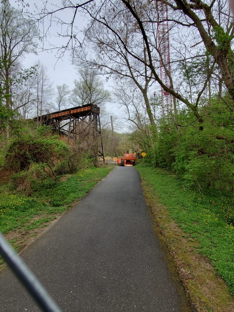
Greg C. visited the Rock Creek site this past Tuesday morning and witnessed the missing wooden trestle. It’s gone! :'( This marks the end of an era, the bridge having stood since 1892 has finally gone down. A new pair of bridges will replace this one, carrying the Purple Line rapid transit and the Capital Crescent Trail across the valley at about half the height of the original trestle. RIP.
4/9/19 – the wooden trestle is no more. The steel 1972 rebuilt section of the west end still stands, for now. Photo courtesy Greg C.
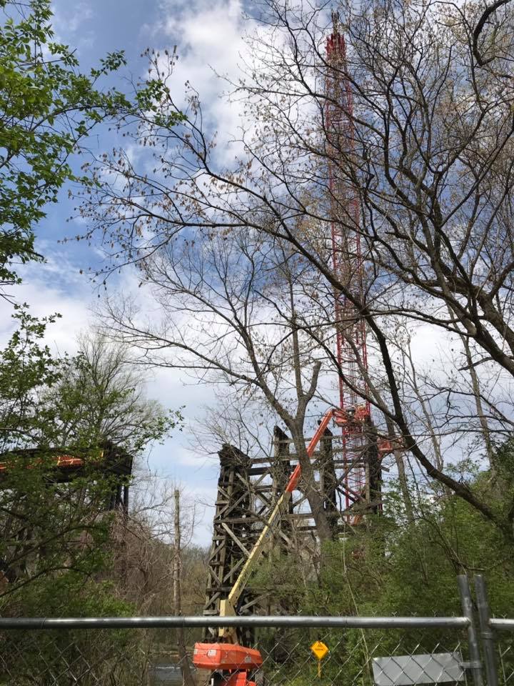
A photo from the Friends of Forest Glen Facebook group shows the demolition in progress. If only I could have gotten up there to measure those timbers. :'(
I was unable to find anything Georgetown Branch related at this time, but I will be checking back and will update this post when I do. Could you find anything interesting on there? I hope so! The collection really is fantastic.
UPDATE: It’s Jan 14th, 2020 and I revisited the National Archives collection to see if there are any new images. I found two:
Valuation Section 24.1, Sheet 1 Published June 30, 1918. This covers Georgetown Jct. to Connecticut Ave. There is a ton of new info on this map! No sidings at the junction, sidings at Rock Creek Bridge (at each end) and a lot of detail at Chevy Chase! Wow!
Valuation Section 24.1 Published May, 1938. Also covers the area around Georgetown Jct. Not sure about this map. It shows a much wider perspective and has some markings near Silver Spring, probably regarding land ownership.
Here’s hoping they publish more in the future. Let me know if you see any!
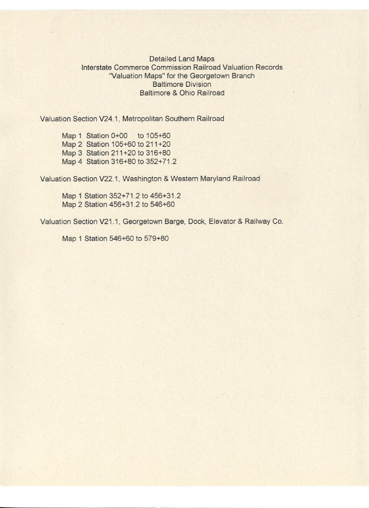
Here is a list of the valuation maps that pertain to the GB.
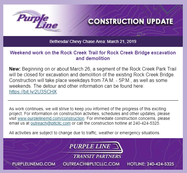
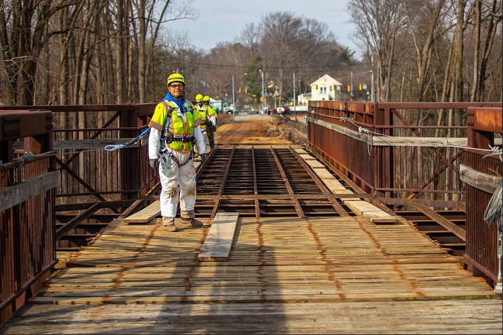
The bell is tolling for the Rock Creek trestle. The Purple Line has announced that beginning on March 26, demolition will begin as they remove the path across the top and then begin demolishing the trestle itself. Already the wood planking atop the trestle is being removed.
Photo from @PurpleLineMD
I am hoping to visit the site to witness some of the demolition. It’s heartbreaking to read about. RIP.
A bit of housekeeping: I’ve added a large set of photos from an exploration trip I did with Kelly R. on the GB back in 2015 to my Gallery. These photos were previously up on my Flickr page only but now you can view them in my Gallery. Enjoy!
This newsreel footage has some really neat, yet very brief shots of Georgetown taken from the Memorial Bridge. You have to look hard, but you get a few really cool views of the dusty, smoky, dirty section of town off in the distance. Awesome find!
Memorial Bridge in 1932 with views of Georgetown in a few spots.
This photo had to have been taken around 1964, as I believe the Air Rights building (visible under construction in the distance) was completed in 1966. S2 9023 was built between 1943-48. I’m not sure of its original three digit number. The B&O Freight Station is visible to the left of the cab and the engine is sitting on the main, just past Bethesda Ave. I stumbled on this photo while looking at the B&O Diesel Roster on North East Rails. Photo by Bud Laws.
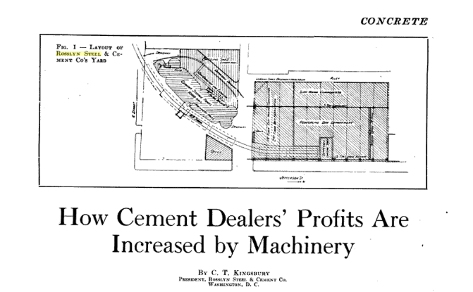
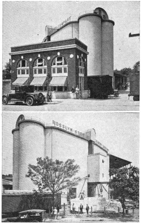
Oct 1921 – Concrete Magazine article on Rosslyn Steel & Cement
While searching for documents, I stumbled on this article from Concrete magazine, published in October 1921 and scanned by Google. The Rosslyn Steel & Cement Co. property has always been of interest to me, as it was served by the B&O in Georgetown. There was a siding that came off the B&O’s Water St. tracks and curved into the RS&C property, past the large concrete cement elevator and into their massive steel fabrication facility. A quite large and long shed housed the steel operation where they produced re-bar and other steel assemblies for use in their construction projects.
The special thing about this article is that it shows very detailed plans for the RS&C plant and a couple wonderful photographs! They also detail the operations of the cement elevator and the mechanical function of the loaders and unloaders. Really neat stuff! These images and the article text finally give a detailed look at how this plant appeared and was laid out on the site. I’m planning on modeling at least part of it, if I can figure out how to fit it into my layout.
Rosslyn Steel & Cement plant in Georgetown, ca 1921