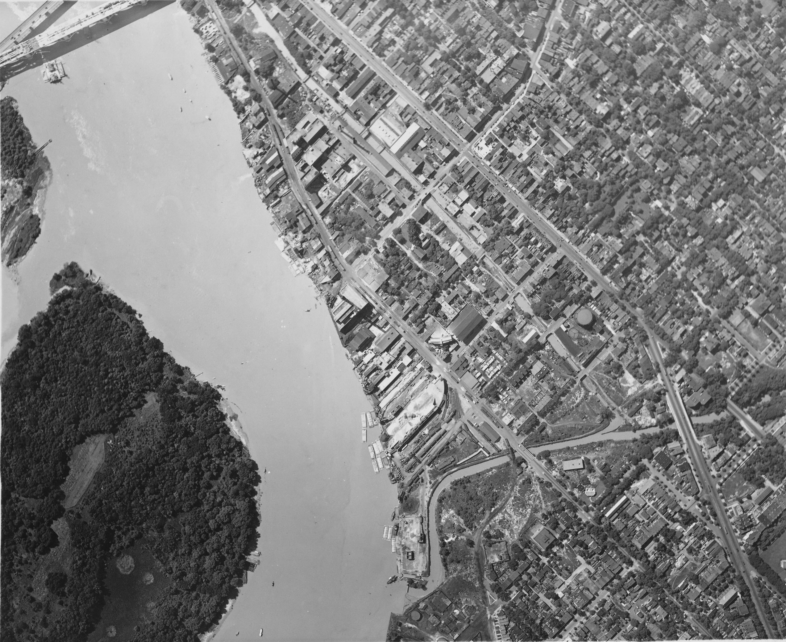
Another magnificent find from the National Archives. This one is a straight-down view of the heart of Georgetown. There are SO many things to take in here. Let’s have a look:
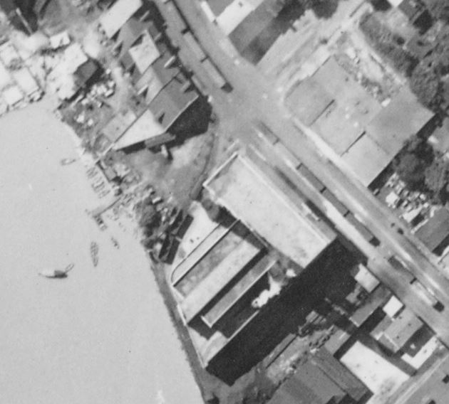
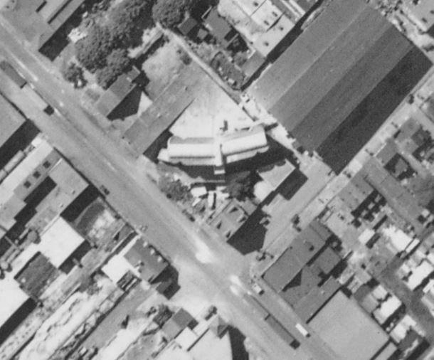
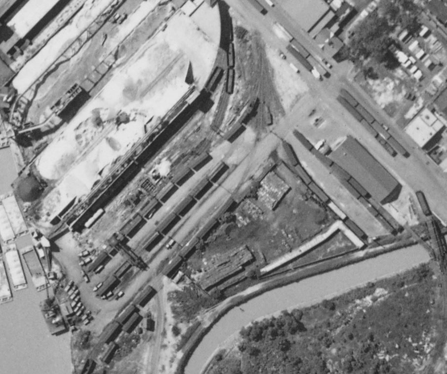
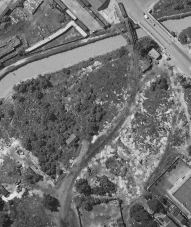
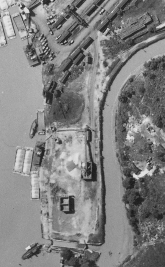
Ca. 1927-1928, Georgetown Waterfront, Washington, DC. National Archives Identifier: 68152327 https://catalog.archives.gov/id/68152327The Capital Traction Co. power plant. Note the two empty and one loaded hopper to the left on the short lead track which swung around the back of the plant, and switched back into the plant along the curved corner wall. The Rosslyn Steel & Cement plant. This curved tower design was somewhat special in its day. It was featured in an issue of Concrete Magazine, which you can read on Google. The track followed the contour of the building and on into that very long shed where steel was unloaded. The “old yard” was busy! Note the Georgetown Switcher locomotive was sitting just above the center of the image, facing the River, as always. The freight house is to the right. The stables for the mules used on the C&O Canal is still there, along Rock Creek toward the bottom. And what’s that I see on the far right? A special find. The siding built around 1914 to support construction of the Lincoln Memorial, which was completed in 1922. I imagine it was a low priority to remove at that point and they just left it as a stub to handle additional cars, as you can see here. Hard to tell if the tracks were still in place further down, but neat nonetheless. And finally, it’s really cool to see the industry located on this small tract of land near the mouth of Rock Creek and the old C&O canal watergate. (visible at the bottom, which allowed canal boats to enter and exit the canal system here.) There was another stone processing plant here, similar to Smoot Sand & Gravel, that dredged the river and processed the sand and stone here. It’s really cool to see the various freight cars in use here, as well as the maritime components.
Hope you enjoyed this one. It’s a real rabbit hole! I have many more to share and will over the coming months. Would love to hear what you think of this awesome image!
2 thoughts on “From the National Archives: ca 1927-1928 Georgetown Aerial”
Another wow
Sure were a lot of cars in the street
The industry by the Rock Creek watergate was Columbia Sand & Gravel if my recall of the Sanborn plat maps is correct. I recall seeing more tracks on the maps than seen in this photo.
Ben: Another great pic! Perhaps I should leave grammatically coherent comments this time… Interesting to note barges (or some sort of watercraft) on the C&O canal just northwest of Wisconsin Avenue; these indicate vestigial activity post-dating the canal’s 1924 demise, at least in this remnant. Plentiful rail stock, river barges, and trucks on the Georgetown waterfront indicate substantial intermodal transshipment infrastructure long before “intermodal” was part of the vernacular. On the bottom left we see Theodore Roosevelt Island (a.k.a. “Analostan” at one time). Then, as now, it was an anomaly of green – albeit today in form of kudzu. Folks with the time and inclination to do so might want to compare this photo with similar selections on http://www.historicaerials.com, which offers time series images from 1947 onward.