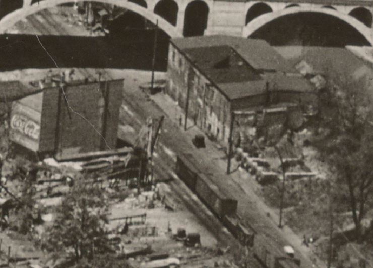
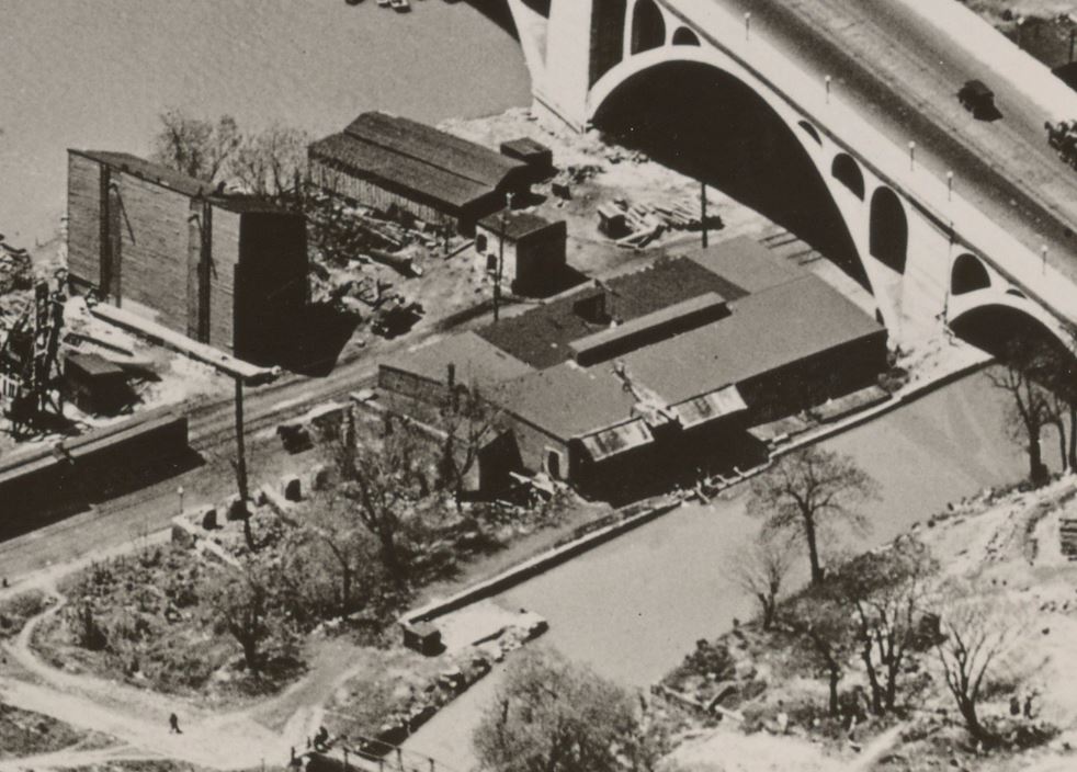
Over the years, I’ve shared a few photos I’ve come across depicting the National Christmas Tree resting in the B&O yard in Georgetown. (one, two, three) Beginning in 1954, the “Community Tree” would make its trek cross-country on a flat car or gondola; blocked, braced, packed and tied-up like a Christmas ham, the tree would arrive in DC to be transloaded onto a flatbed trailer and trucked through Washington to the National Mall where it would be craned into place, decorated and illuminated as the star attraction in the Pageant of Peace.
I was recently contacted via email by a member of the Forest History Society who so generously shared some photos (and a video!) related to Christmas trees in Georgetown. These images are REALLY cool and show some views that I’d never seen before. I am always really excited whenever I get to see new things related to the Branch! You can see all of their National Christmas Tree related images in their archives, here. They recently published a wonderful article on the journey the 1961 National Christmas Tree made from forest to the National Mall.
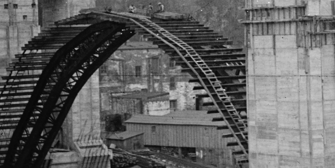
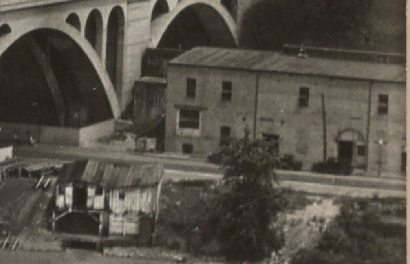
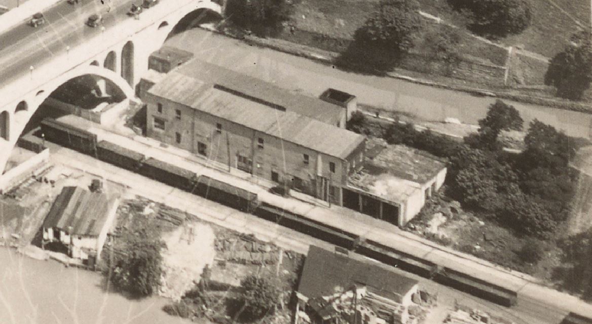
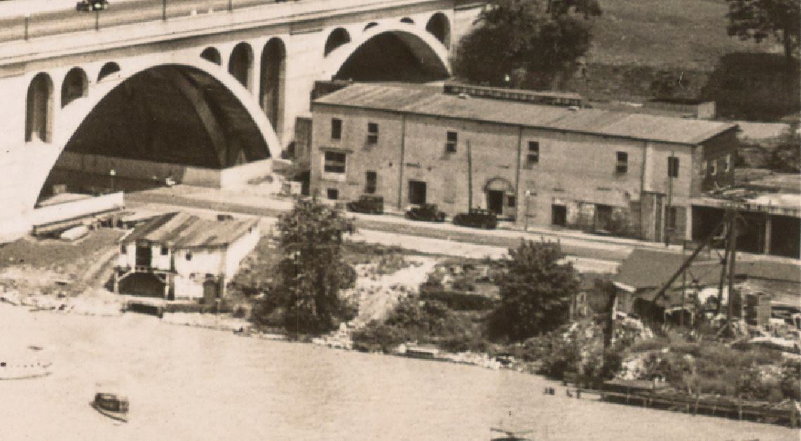
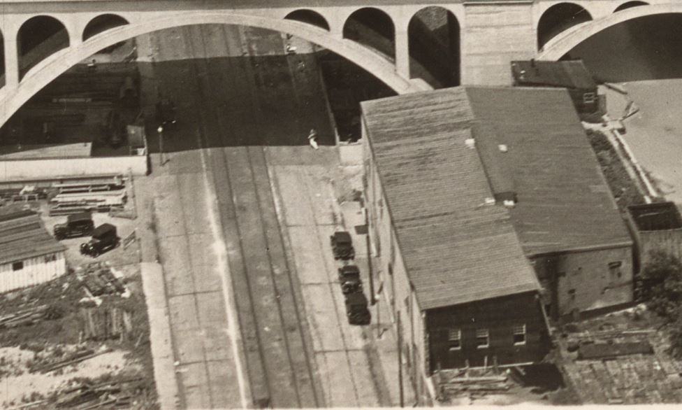
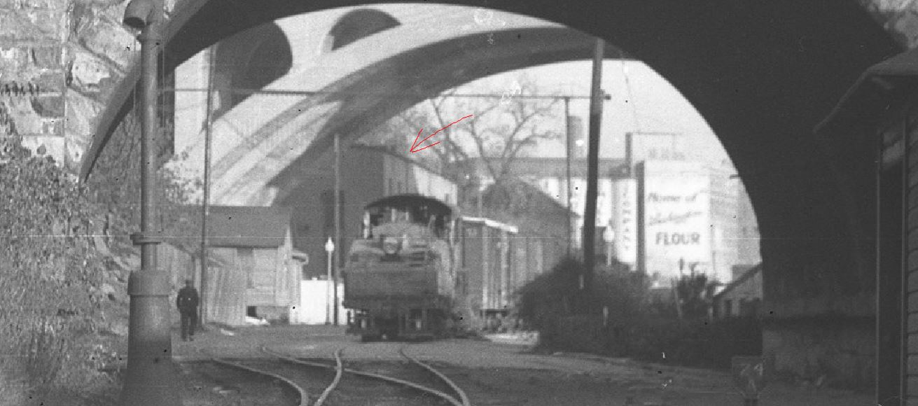
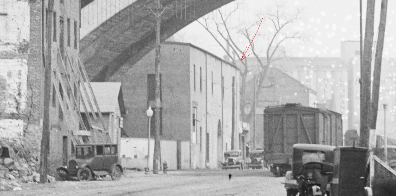
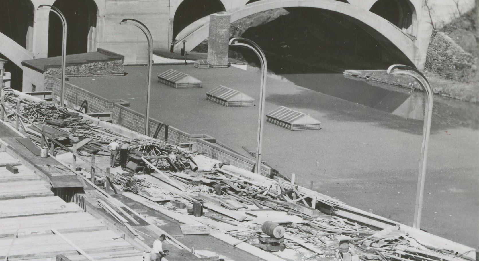
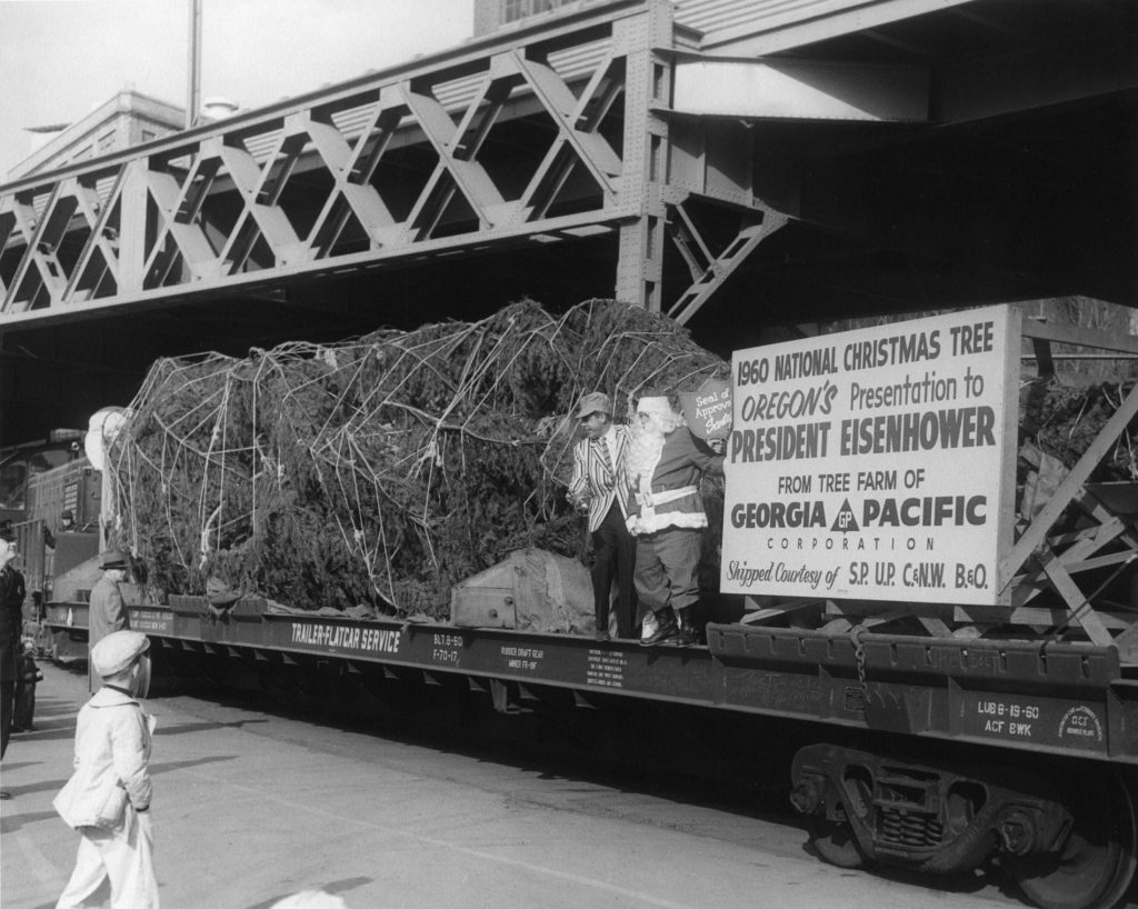
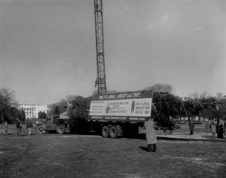
In these photos from FHS we see the 1960 tree having arrived in Georgetown being tended to by some staff members. This tree was cut in Oregon and traveled via SP/UP/CNW/B&O on an SP F-70-17 85′ flat car. In the first photo we see what must have been an arrival ceremony and even Santa has climbed on board and is wielding a “Seal of Approval” sign. In the next images we can see a large box surrounding the end of the tree, no doubt to protect it and keep it wet. We then see the tree being prepared for transloading to the adjacent flatbed trailer. Bonus video footage of the tree being prepared in Oregon for its voyage across the Country. The final images are the 1961 tree which came from Grays Harbor County, WA via NP/CB&Q/B&O on a TTX flatcar. All photos are courtesy of the Forest History Society, Durham, N.C.
Christmas tree arrival from Oregon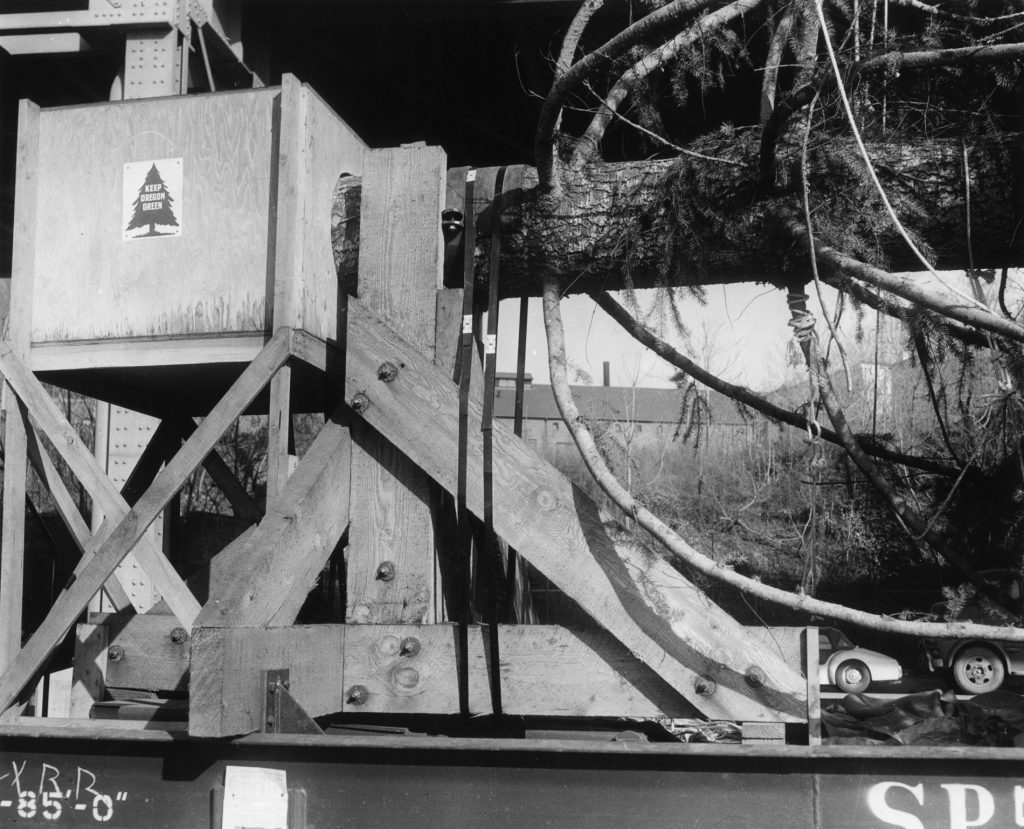
G-P 1960 National Christmas Tree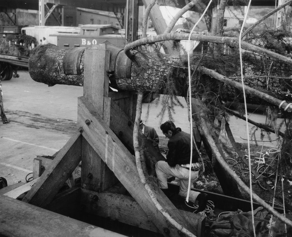
G-P 1960 National Christmas Tree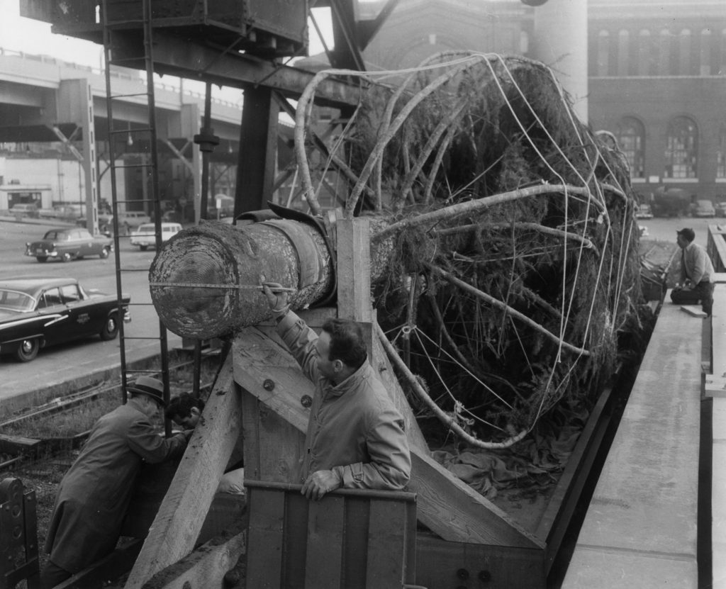
G-P 1960 National Christmas Tree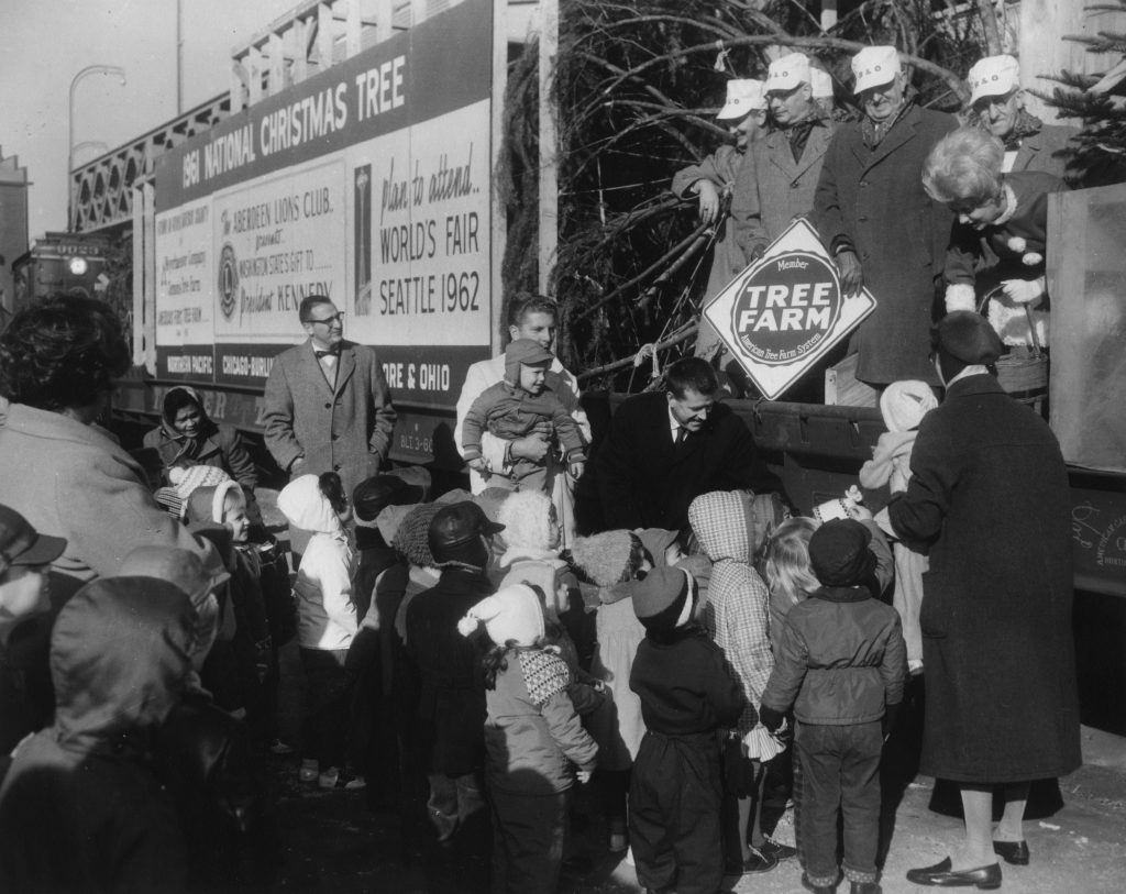
Arrival of 1961 National Xmas Tree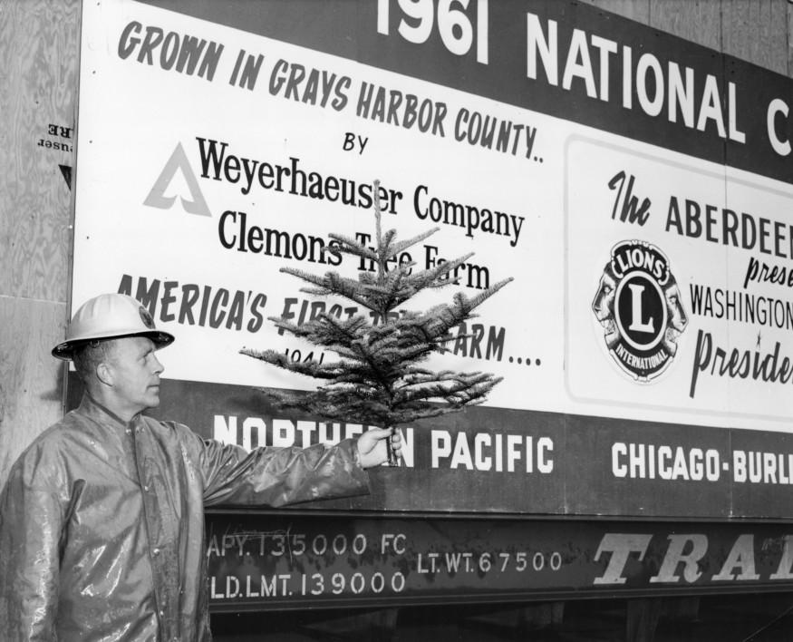
1961 National Xmas Tree shipment
Film footage of cutting of 1961 National Christmas Tree (film has no sound). The 1961 National Christmas Tree was a 75 foot Douglas fir grown on Weyerhaeuser Company’s Clemons Tree Farm in Washington State. The tree was shipped by rail to Washington, DC, where it was erected and displayed on the Ellipse. This film footage shows cutting of the tree in November 1961, and the ceremony at rail yard prior to shipment. Film is from the Weyerhaeuser Company Records held at the Forest History Society: https://foresthistory.org/research-ex…
The National Christmas Tree tradition stretches back to 1923 but in 1954 the decision was made to do something more extravagant and impactful to woo more tourists to the area and do something really special. The Pageant of Peace was born, a celebration of the holiday season that included music, art, and lights, with the centerpiece being what was being called “the National Community Christmas Tree”, culled from the great forests of America and erected on the National Mall where the Pageant and “Pathway of Peace” display would be located. There were national displays, international exhibits, participation from civic and religious organizations and all sorts of activities for children and adults alike. Over the years, the Pageant transformed and changed with the times. Some years it reflected a more somber national situation; in 1963, after the assignation of Pres. Kennedy, the lighting of the tree was delayed for several days to allow for a period of mourning and a more somber ceremony followed. Some years it was befallen by delays and problems. In 1970, the tree came from Nemo, South Dakota and along the way it derailed twice; once near Beemer, NE and again near Pittsburgh, PA. The tree was thankfully undamaged. The tree then laid over for a few days at the Army Map Agency siding near Dalecarlia Reservoir, apparently so the soldiers could keep souvenir-hunters away from stealing branches off the tree in Georgetown.
But at the center of each Pageant was the tree itself. A symbol of pride for whatever region it came from, there was often a good bit of pomp and circumstance at each end of its journey from forest to the National Mall. Ceremonies were held when the tree was cut, when it departed on rail car and when it arrived in Washington DC. Sometimes Santa or Mrs. Claus would make an appearance. And always, officials from the home town, suppliers, as well as the railroads that transported the tree would be present to get every P.R. dime out of the occasion. I dug around for a few hours and tried to gather all the info I could using newspaper clippings, photos and other articles online to figure out details of what years the tree traveled by rail, what route it took and what cars were involved. (I am a model railroader, after all.)
Here is a link to my spreadsheet, a work in progress.
From what I can gather, the tree traveling by railroad began in 1954 (from MI) and ended in 1972 (from WY). There were a few years in-between where the tree traveled by truck and not by rail. I also could not find definitive data for several years but the fact that the tree came from far away, one can assume it traveled by rail. In at least one of the years, the final leg of the Tree’s journey was on the PRR. I’m not sure if this was because the Pennsy wanted a piece of the P.R. pie or logistics. In 1973, after pressure from environmental groups, the committee decided to use a living tree. The same tree was used for several years until it was damaged and needed replacing. In 1977 a dead tree was again used, but in 1978 they went back to using a live tree. I stopped tracking in 1985, as that is when trains stopped running on the Georgetown Branch and at that point they were still using the living tree.
I am obviously most interested in the 1945-55 timeframe as that is the era I am modeling. In 1954 the tree came to DC from Michigan on two Soo Line flat cars. (more on this in a future article.) In 1955, the tree traveled from the Black Hills of South Dakota to Georgetown in a CB&Q 65’6″ 70 ton mill gon, likely class GM-3A or GM-3B. I do plan on modeling both of these trees for my layout, but I first need to find acceptable freight cars that fit the bill. The CB&Q mill gondola will be particularly challenging as I have yet to find a suitable HO scale model. Maybe I will have to build one! Well, that’s it for now. Hope everyone had a Merry Christmas and here’s to a Happy New Year!
Arrival of 1961 National Xmas Tree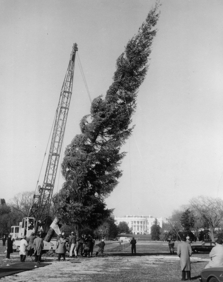
Erecting Christmas Tree on Ellipse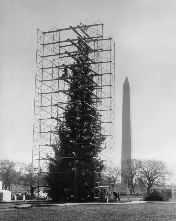
Decorating Christmas Tree on Ellipse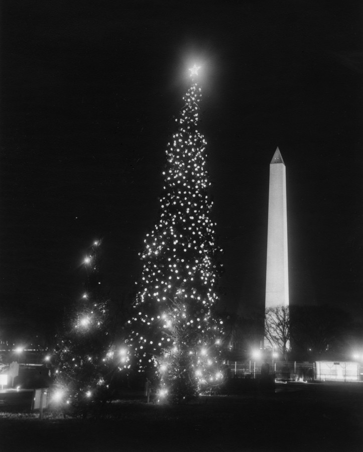
National Christmas Tree at night