Category Archives: History

Items of historical interest and relevance.

A Most Interesting Tidbit – Valuation Map Surprise

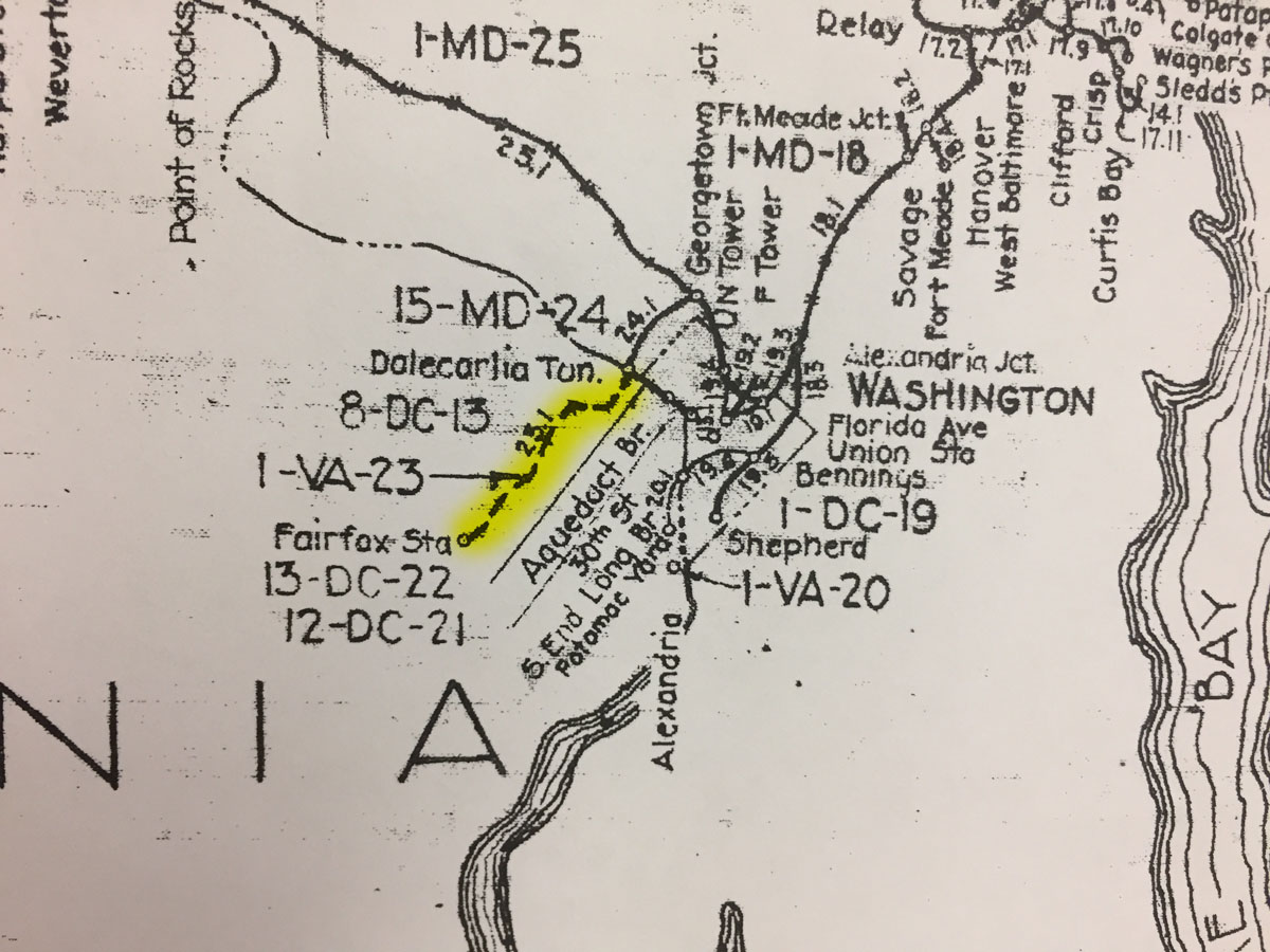
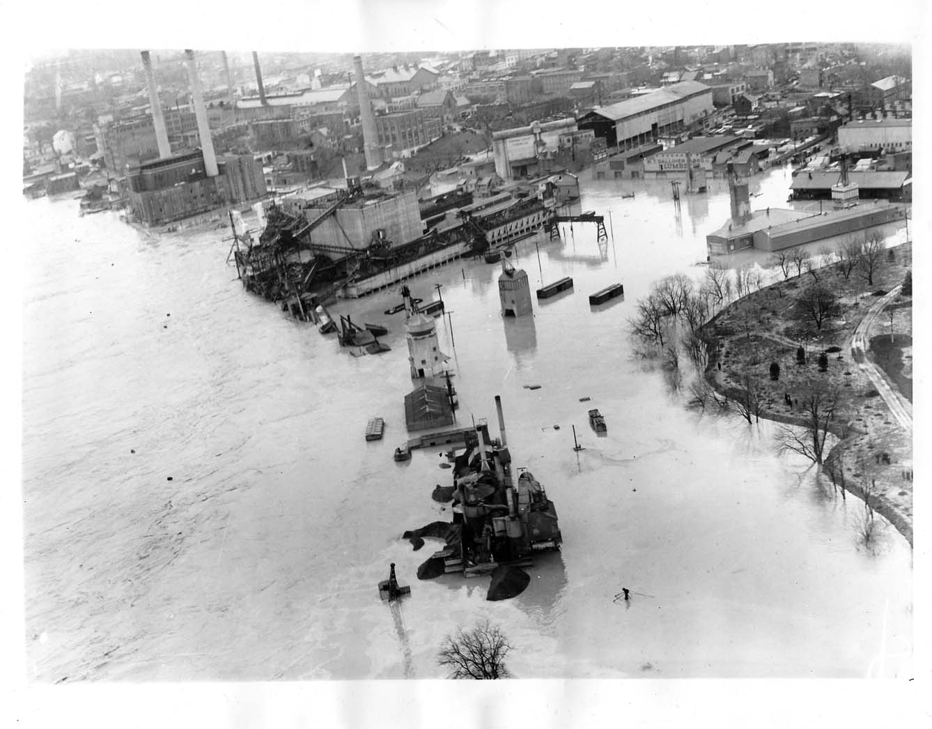
While visiting the B&ORRHS Archives building in Eldersburg, MD today I noticed an interesting depiction on the large Valuation Map “key” hanging on the wall in the collections room. This is a comprehensive view of the entire B&O RR system, with indications for major sections, distances and locations. On the map, the Georgetown Branch is indicated. However, there is a junction point at “Dalecarlia Tun.” where the Branch continues on down along the Potomac River into Georgetown. However, at the junction, there is also a dashed line that proceeds across the Potomac River and on into Virginia, terminating at “Fairfax Sta.” I have highlighted it in yellow on the photo I snapped with my phone, below.

I have researched this proposed line before, in fact I purchased a map off of eBay that showed the same proposed line and shared it on this blog. The curious thing to me is that the proposed line, which was one of the early visions/purposes for the “Georgetown Branch” was never actually built. But, it is indicated on this map, which means there are likely official Valuation maps associated with this right of way. Looking at the map, I see 8-DC-13, 1-VA-23, 13-DC-22 and 12-DC-21. I believe those are all references to maps and will have to check with the Archives to see what they have on hand. Onward…

B&O Val Map with Extension
B&O Valuation Map which shows planned VA extension

Georgetown Junction After “The Wreck”

I picked up this photo via eBay a couple years ago and finally got around to scanning and posting it here. The photo caption (on the back) reads: “Cap Ltd Georgetown Junction, Eastbound, after wreck.” I don’t have a date so any input would be much appreciated. My best guess is some time from the teens to the thirties. Any guesses? Note the Talbot Ave bridge in the distant background as well as the track crew hard at work repairing the fill on the far side of the rails.

1917 Cap Ltd at Georgetown Jct EB after wreck front
The B&O Capitol Limited passes by the site of an earlier wreck as a track gang repairs the damage. Location is Georgetown Junction, MD.

The Famous Talbot Ave Bridge is Slated for Demolition

Talbot Ave bridge, 2/7/2015. © Ben Sullivan

A sad, sad day indeed. A couple of weeks ago I learned about the eminent demise of the famous Talbot Ave bridge which has spanned the Metropolitan Branch and Georgetown Branch of the B&O for nearly 100 years. The bridge was built back in 1918 and is somewhat of a special legend among railfans being that the girders appear to be sourced from an old turntable, giving it the distinctive profile. This shape is recognizable in so many photos shot over the ages at the Junction. I, myself, have visited the bridge many times, shooting photos of it and from it and enjoying it as a landmark. I’m terribly sad to hear of its eminent demise and will miss seeing it at the Junction as it altered forever with the Purple Line destruction not far off. At least it will live on in my basement, as I plan on modeling it on my railroad. Here are a couple links covering its history:

Talbot Avenue: a bridge in black and white

A Montgomery bridge that linked black and white neighborhoods during segregation soon will be lost to history

On February 7, 2015 I visited the area and took many detail photos of the bridge. You can find them here on my Flickr page. (Scroll down a ways, they begin around IMG_6582)

Talbot Ave Bridge in the distance as a CSX freight approaches
Talbot Ave Bridge in the distance as a CSX freight approaches. © Ben Sullivan

The Georgetown Branch in Train Simulator 2017

I was contacted by a really nice gentleman named Mark V. via the B&O Yahoo Group who indicated he had some photos of the GB that he had shot ages ago (more on that later). What really piqued my curiosity is that he mentioned he is working on a model of the GB for Train Simulator 2017! We exchanged a couple emails and he sent me a link to a video showcasing his progress. Wow! This is incredible. I will update more when I get it. Have a look for yourself here:

So far he has completed from the Junction with the Met all the way down to the crossing over Rock Creek. The details are fantastic. The track layout is a more modern arrangement, what existed near the end of the branches life. I am really excited to follow his progress and see more of the development! I may have to pick up a copy of Train Simulator 2017 myself! If you’d like to contact Mark V., you can reach him at straypacket@gmail.com.

Interesting 1958 Rockville Wreck Video


Saw this video this morning, posted to the CSX “Cap, Met, and OML” subs, Railfans group on Facebook. I know it’s not Georgetown Branch related, specifically, but it’s hyper-local and shows some amazing detail shots of the track and some equipment in the 1950s. I don’t have many details about the wreck, only what’s found in the description. Anyone got more info? Post it here in the comments. Also, note all the people on the live tracks! Nowadays that would never happen.

Georgetown Yard Limit, 1966

A really wonderful photos was posted to the Maryland Division Railfans group on Facebook. The photo was taken in July 1966 at the west end of Georgetown yard, along the Potomac, and is one from a location that I have never seen before; at the end of the passing siding/yard track at the west end of Georgetown. There is a “YARD LIMIT” sign placed at this location that I never new existed. I’m so thankful as it provides a peek at something I never would have known had I not seen the photo. When I model this area on my layout, I will be sure to add that sign! Thanks so much, Guy Span!

July 1966, B&O GP9 6503 appears to be heading west (RR East) out of Georgetown as it passes the yard limit. The caboose is tucked behind the locomotive, per RR practice. Guy Span photo.

Rock Creek mystery photo

I just stumbled across this really neat photo from the GWU Special Collections showing the mule stables located along the Rock Creek. What’s interesting from a B&O perspective is that just behind it you can see the terminus of the Georgetown Branch as well as what may be the extension of the line built to serve the construction of the Lincoln Memorial.

Rock Creek, C&O Canal mule stables, B&O RR
Rock Creek, C&O Canal mule stables, B&O RR (Photo from Special Collections Research Center GWU)

In the foreground we see a canal boat, docked next to the mule stables. Not sure if the railroad ever provided any service here, but perhaps they brought new animals in stock cars and perhaps feed for them. In some very old Sanborn maps I have, there are stock pens indicated in this location.

Behind the pens, to the left, you can see a few box cars. One has a circular logo. Look carefully for the roof lines. Above and behind them, you will see the roof of the old B&O RR freight station, which was in service until the late 40s when they tore it down and built the coal and ash house which stood until 2006 when it was torn down to make way for the Swedish embassy expansion. The original freight house was a wooden timber affair, built to the B&O Standard Plan.

What interests me most is the prospect that the bridge in the background is the one which was built to serve the Lincoln Memorial construction. The Georgetown branch was completed to Georgetown in 1908-1910. The C&O Canal stopped service some time around 1924. The Lincoln Memorial was constructed between 1914-1922. Being that the bridge appears to be a heavy duty type, and the smaller connecting section to the right appears to have ties and rail on it, and no railing for pedestrian safety, I’d say it’s a good chance. If you look carefully you can see a second bridge, just beyond the first one, behind the light-colored house to the right. This one appears to have sides. I have some other photos of the area that I will have to study more carefully. Enjoy!

Georgetown Waterfront, 1939

Alert reader Christopher R. emailed me to share this wonderful view of the waterfront in 1939. Probably the most interesting thing in the photo is the B&O Georgetown local switcher, at work! If you look above the Aqueduct Bridge abutment, you will see the smoke pouring from the smoke stack of the venerable 0-6-0. It appears to be reversing and has just passed the scale house and is passing beneath the footbridge to the Washington Canoe Club. There is a long passing siding that begins  just behind the Club. Other items of interest are the buildings lining the waterfront, beyond the boathouses, Canal Rd./M St., and the old pilings for the Aqueduct Bridge, now gone. About ten years later the pilings would be demolished by the Army Corps of Engineers.

Georgetown Waterfront, 1939

* interesting note: About ten years ago I found this very same photo in the LoC online collection “American Memory” and gleefully posted a zoomed in view of the lower res image from the site: http://gallery.sluggyjunx.com/railroad_and_industrial/georgetownbranch/gb_prototype_photos/g-town_steam_switcher-wide

Very short film clip of Georgetown in the 50s

I’m a complete sucker for media showing the Georgetown Branch in its heyday, and get pretty excited when it’s of the film/video variety. There are simply not that many films in existence which depict the branch in service! There are fabled copies of a film showing the fan trip down the line in the late 40s held by the NRHS but I haven’t even been able to get a reply from them on this.
Anyway, in this film which is a snippet of a collection of aerial footage of DC in 1954 shows the Georgetown waterfront area for the first 23 seconds. Not that great, it’s wobbly, but it’s there. Note the aqueduct bridge footings, still in place in the river (Army Corps of Engineers had yet to demolish them), the Lone Star cement factory standing tall and the Hopfmaier rendering plant smoking away across from the Wilkins Rogers mill. The power plant is still standing and the coal steam plant can be seen in the background near the end of the line. Very cool!
http://www.criticalpast.com/video/65675050411_Potomac-River_Lincoln-Memorial_Jefferson-Memorial_National-Airport_Key-Bridge

Some eBay finds, including an interesting building feature.

I hope you find these photos I recently purchased on eBay as interesting as I do!

May 15, 1947, Fatal Bus Accident
“BETHESDA, MD- Three persons were reported killed and at least five injured when a B&O freight train struck a private bus at a grade crossing here today (5/14). One of the victims is shown being removed from the wreckage. ACME TELEPHOTO” 

I wrote about this previously here.

March 19, 1936, Potomac Floods Capital Area
“POTOMAC FLOODS CAPITAL AREA, An aerial view of Georgetown, Historic spot of Washington, D.C., Submerged in flood waters of the swollen Potomac. The building with the two smoke stacks is the city’s gas plant which probably will be out of commission soon, thus leaving the city without gas. 3/19/1936”
I’m curious if that power plant was ever gas powered. I always thought it was coal-fired. Hmm…
March 19, 1936, Georgetown Flooded
“GEORGETOWN FLOODED, A view from the air of Georgetown, in the District of Columbia, several feet under water due to the rising waters of the Potomac. It is estimated that the Potomac has left $5,000,000 property damage in its wake. 3/19/1936”

Interesting to note the rail cars left in the yard as well as the buildings along Water Street. Also note the trails of stains in the water from the industrial area.

October 17, 1942, District of Columbia Flooded
“DISTRICT OF COLUMBIA FLOODED, Washington, D.C. – “K” street in Georgetown, D.C., was submerged by the flood waters of the Potomac today. The river can be seen at upper right. 10/17/1942″ 

Note the giant beer bottle sign on the corner of the building at left. Also the Lone Star cement plant to the right and the Wilkins Rogers milling building in the distance. My favorite has to be the big beer bottle advertisement on the corner of the building in the lower-left hand corner of the bottom image. This was most likely for Brenizer Brewing Co. which maps indicate was located on this site.