Exactly one month since my last update and I’ve made some great progress on the Rock Creek trestle model that I’d like to share.
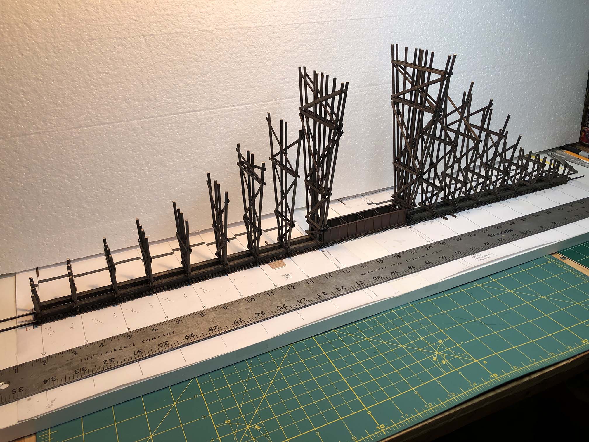
All bents are installed and the model is ready for bracing and stringers to be installed.
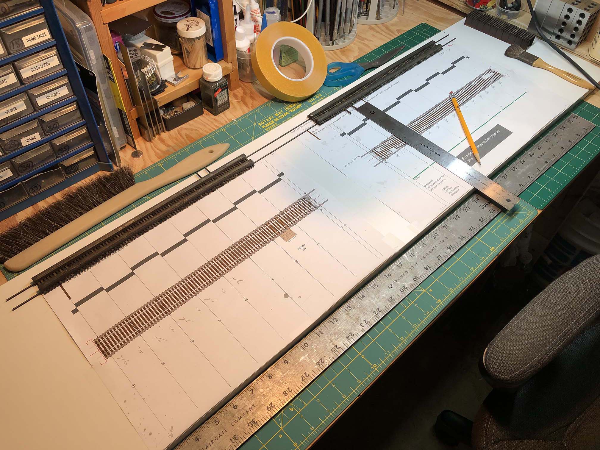
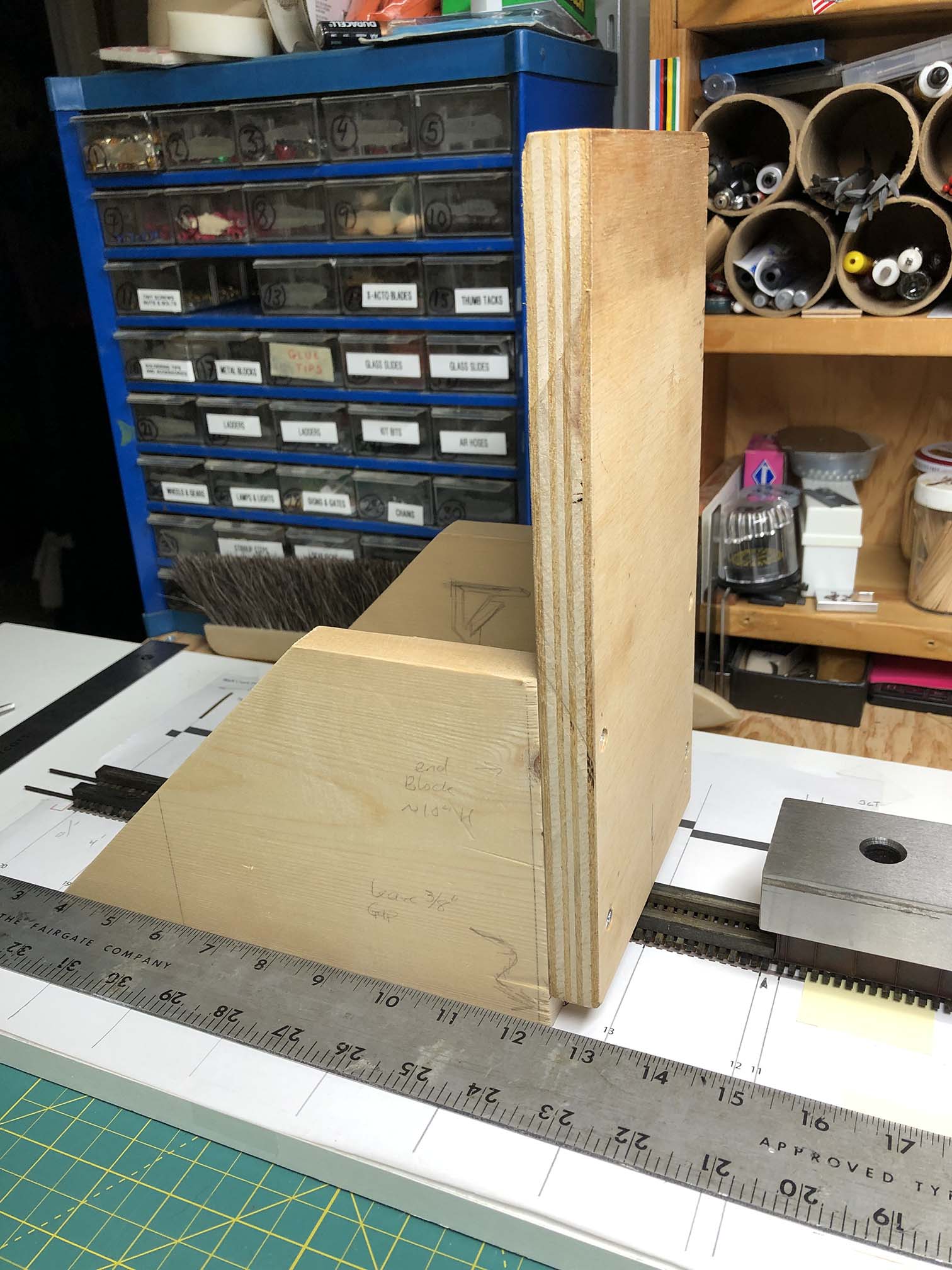
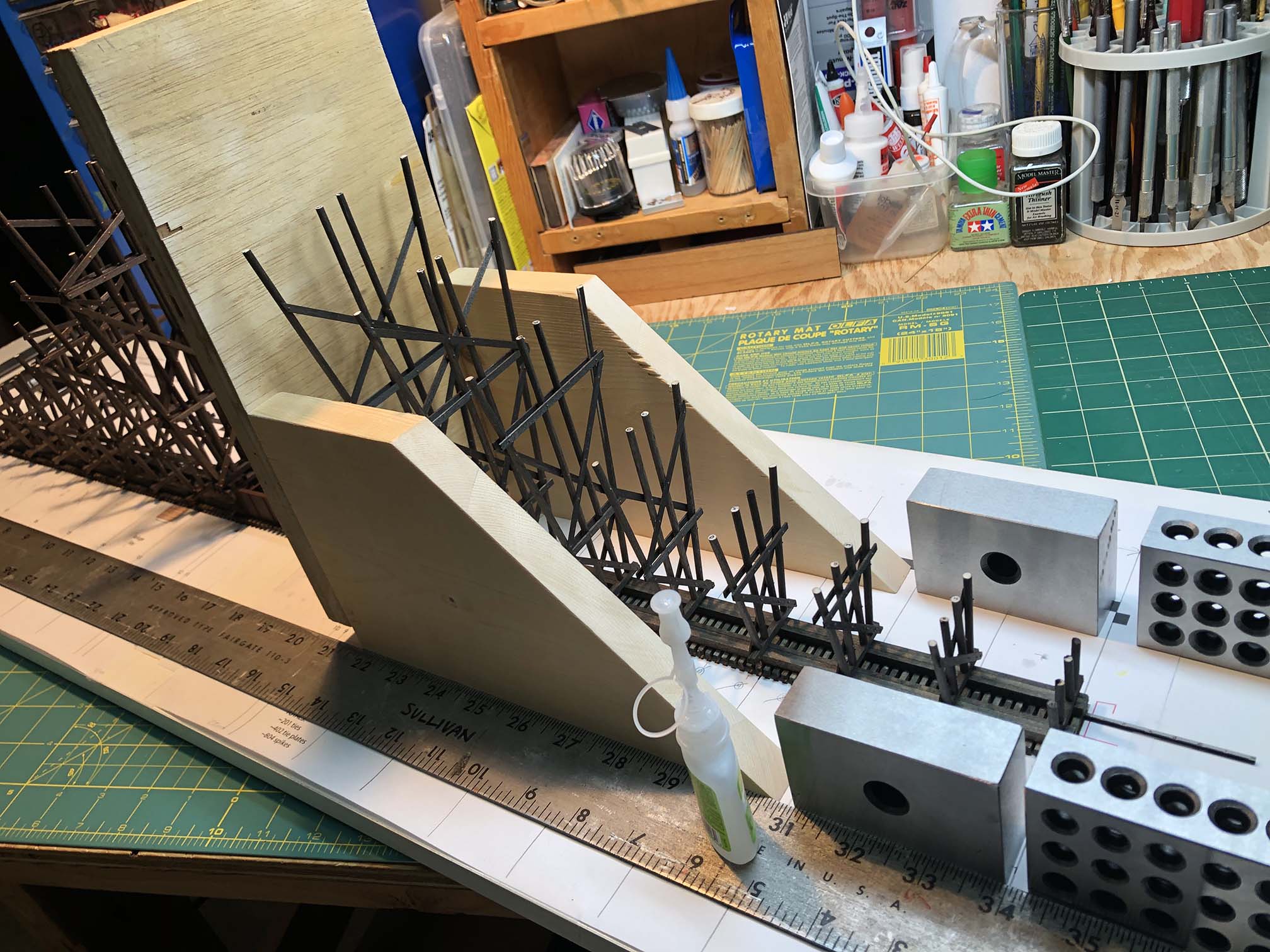
On Friday I built a sled/jig thing to facilitate installing the bents perpendicular and square. More on this in a moment. First up, I needed to flip the top of the bridge over, as it was mounted with track side up. I then took the opportunity to extend the lines that indicated where the bents would be installed, as this would guide my sled/jig later. I also measured where I wanted the straight edge to be and installed it with double-sided tape.
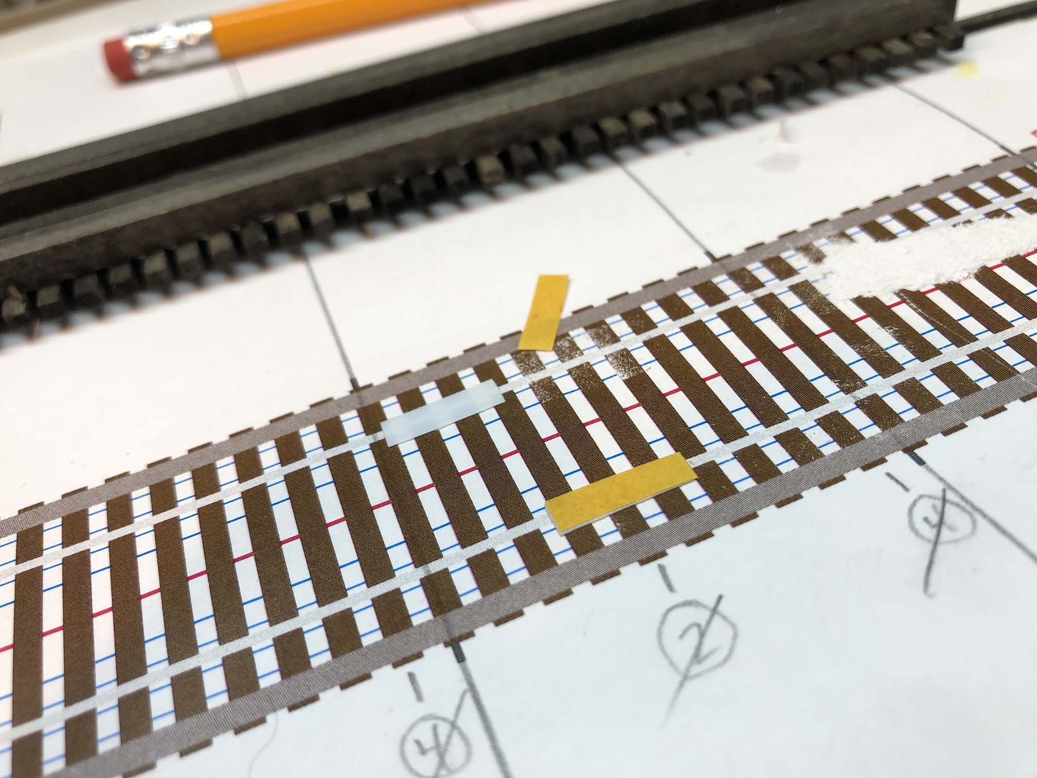
I placed small rectangles of double-sided tape where the rails would lay. Aligned the rails to the plans and pressed gently to set in place over the plans.
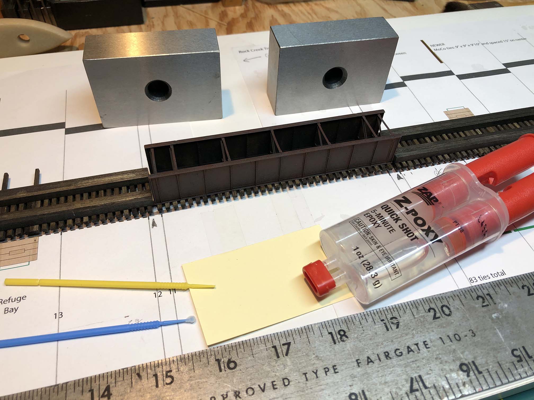
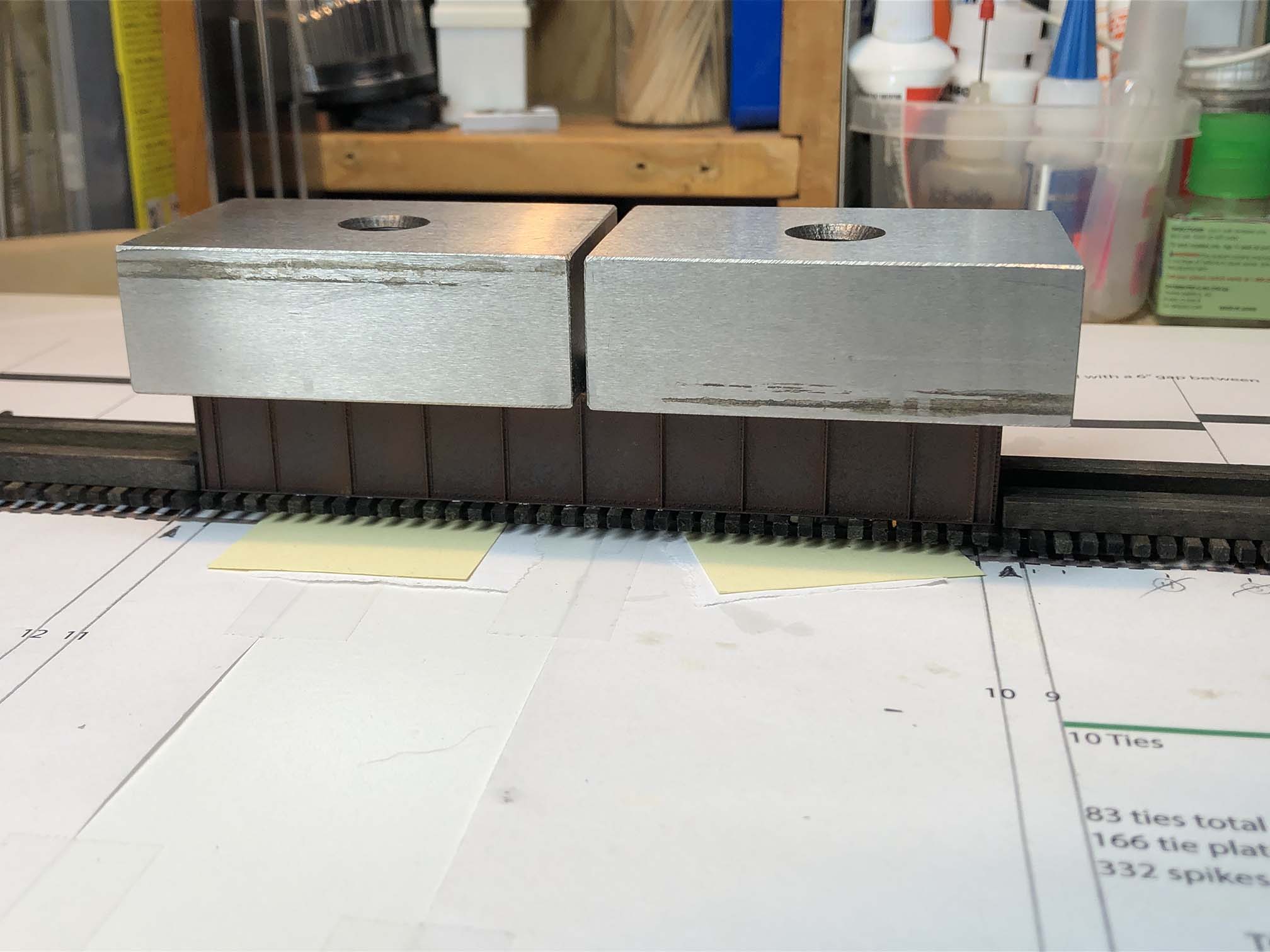
Next it was time to install the center deck girder section (which I had previously built, painted, weathered and installed ties and tie plates). I prepared some 5-min epoxy and lightly brushed it to the back side of the rails. I carefully positioned the bridge in place and weighed it down while the glue dried.
Getting ready to fasten deck girder to rails with epoxy.Weights holding deck girder center section down on the rails while glue dries.
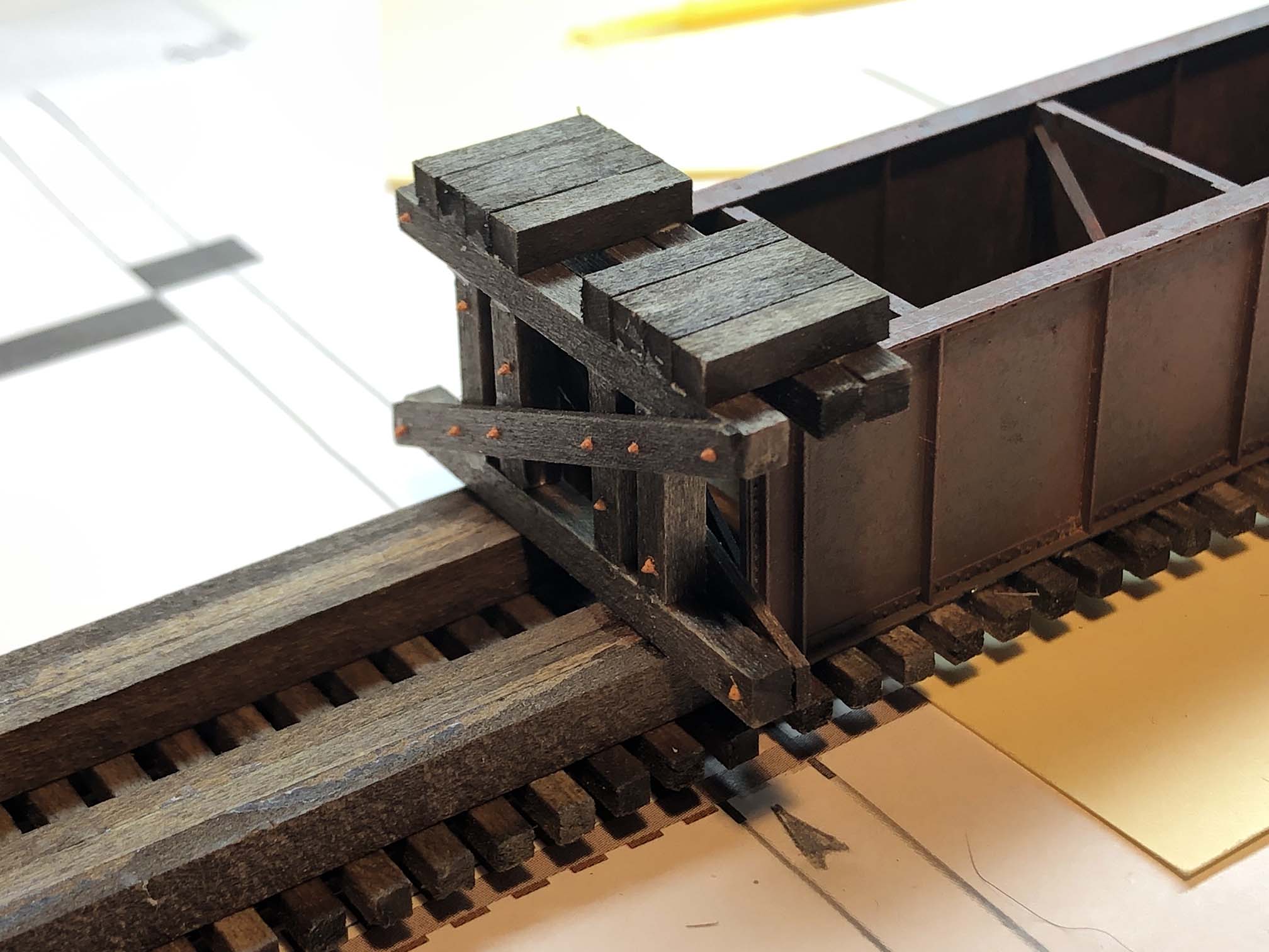
I then completed the blocking around the deck girder.
Close up of the blocking around the deck girder bridge section.
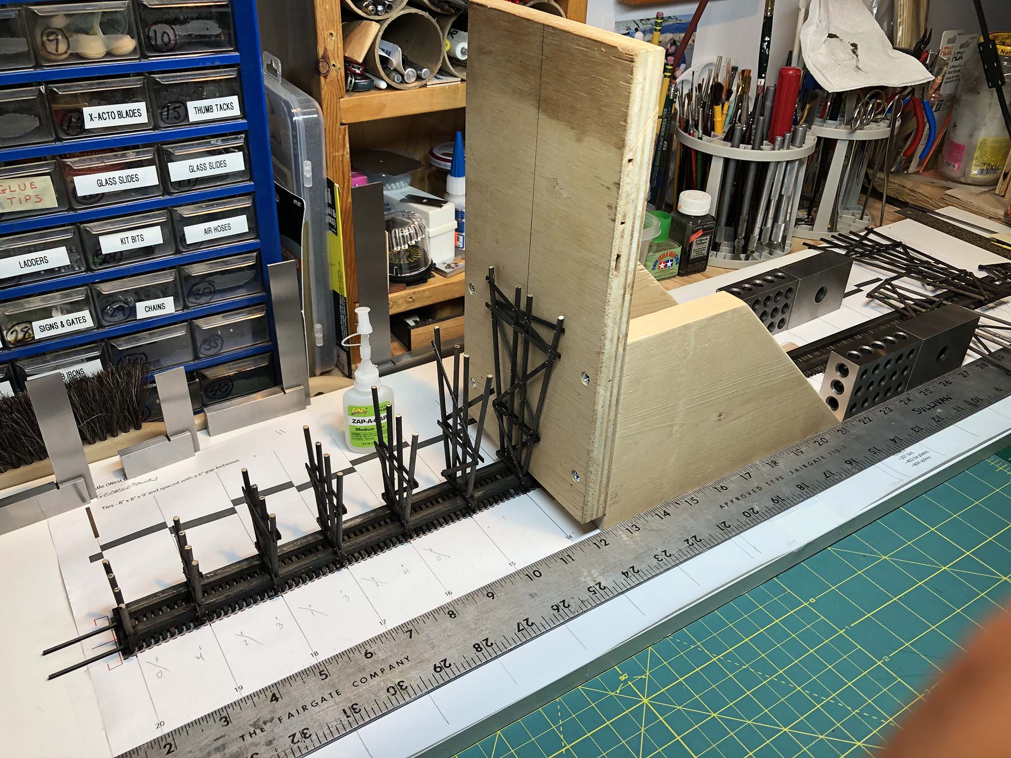
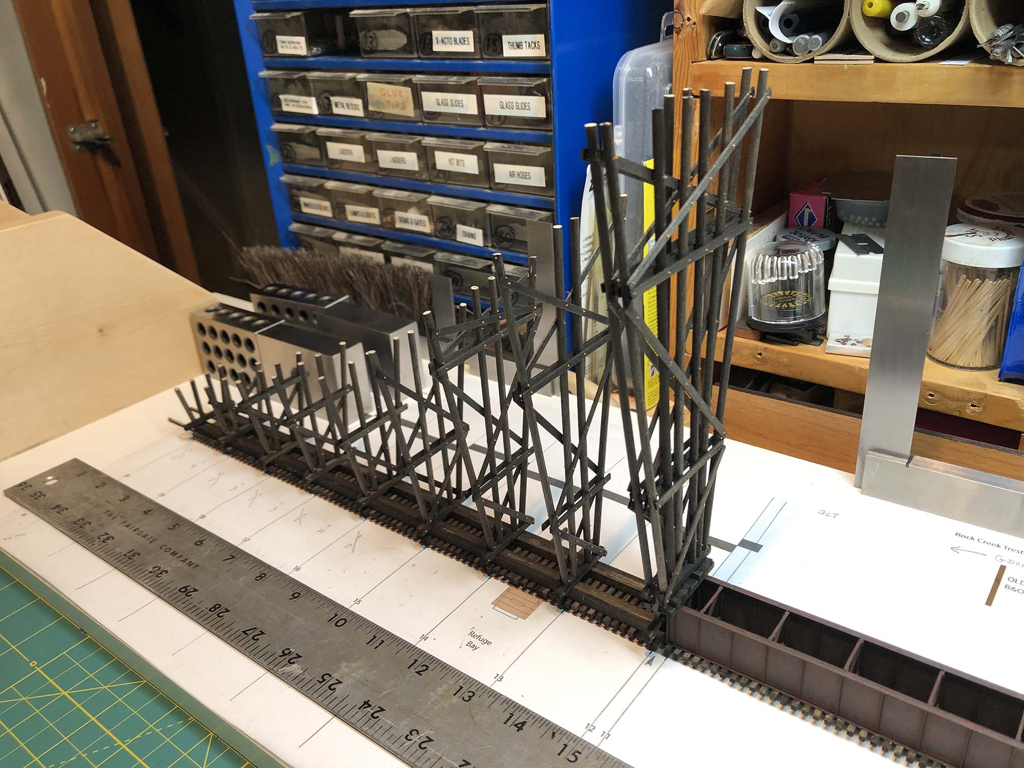
The sled/jig allowed for me to install the bents perpendicular and square to the base. This took a bit of finagling to get set up properly but made the job go fast once the system was in place.
Sled for aligning bents. Rides along straight edge. Overall view of sled and plans. Sled in action, installing bents.
Halfway there!
Nearly done with the East end. When I reached the center, I flipped the sled around and faced the center section to install the two bents at the end.
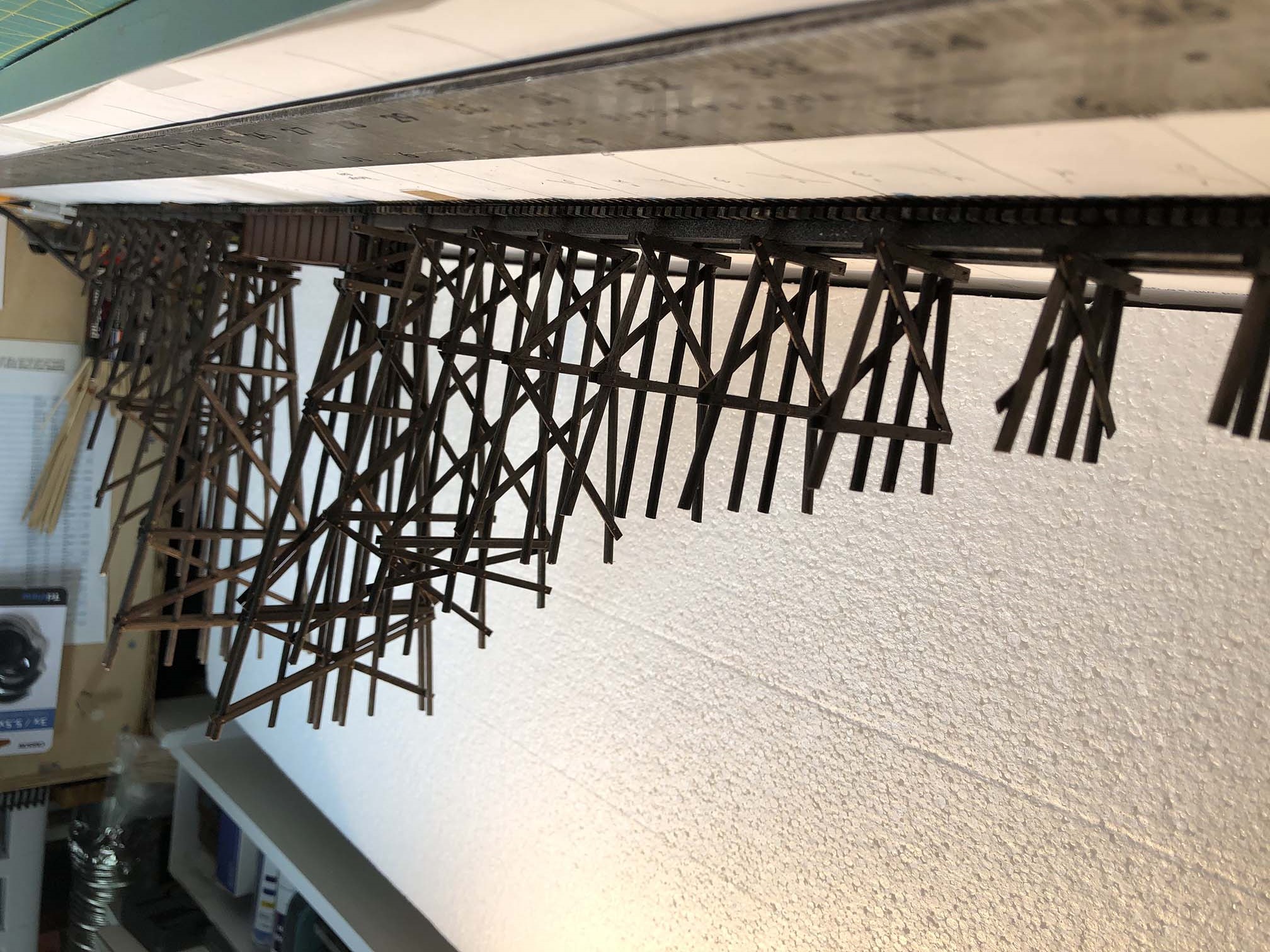
And here we are with the completed bents. It’s looking pretty good!
If you flip over the photo you can sort of get a feel for what the completed model will look like.
Ok – that’s all for now. I’m very pleased with how this is coming along and up next I’ll be installing all of the stringers and girts to get this over the finish line! Stay tuned…
I’ll take what I can get. Here’s a very brief shot of Georgetown, looking toward the Smoot Sand & Gravel plant and Key Bridge. Pretty cool! (Fast forward to 2:56 if it doesn’t begin at that mark.)
And here’s another from the 1940s: (Starts at 4:42)
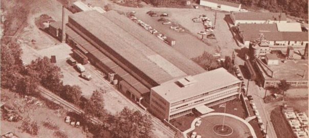
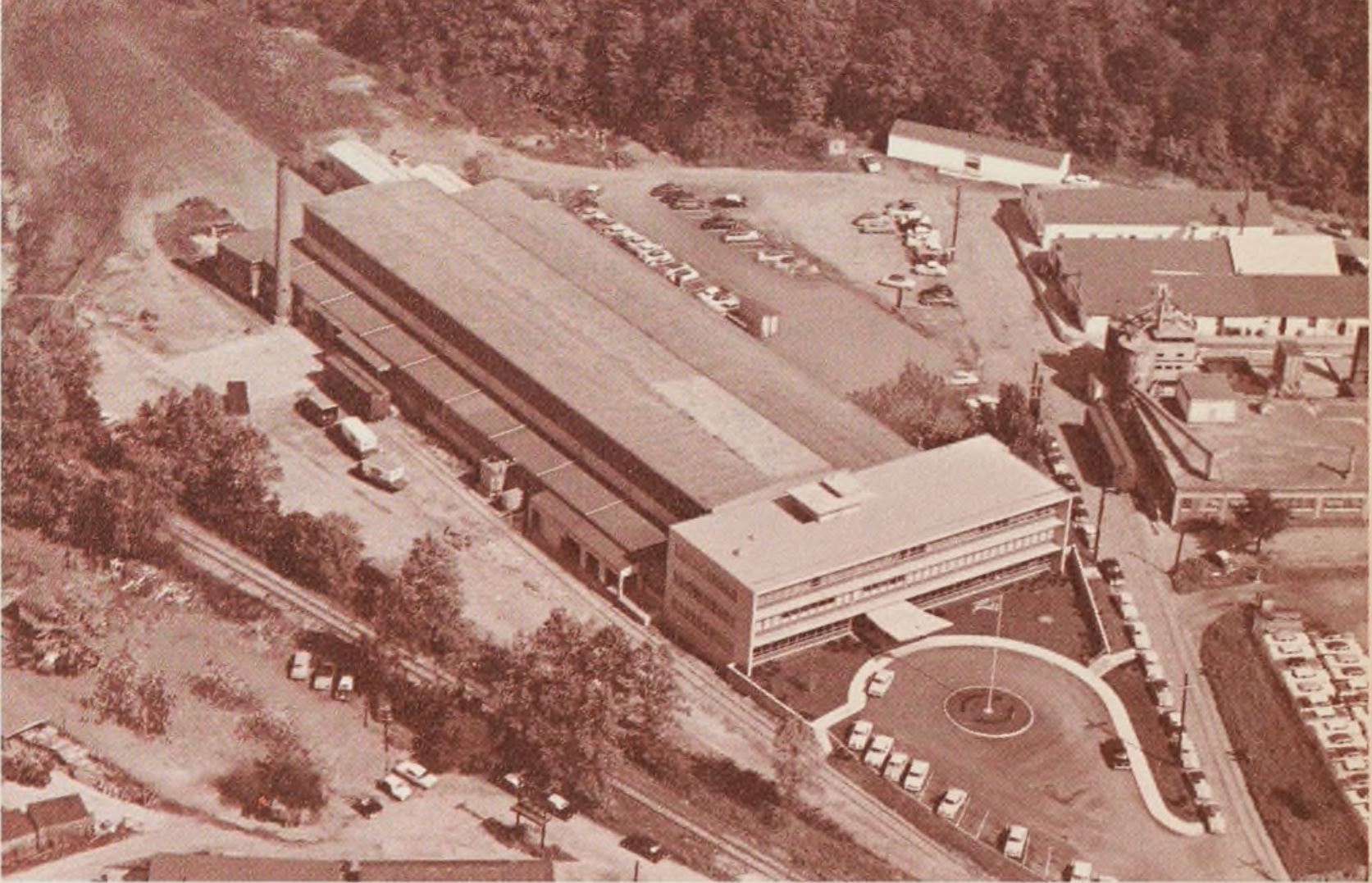
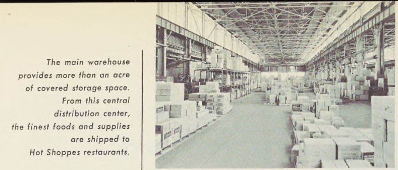
Hot Shoppes warehouse (center), Briggs Filtration Co. factory (right), from the 1955 Hot Shoppes Annual Report, Univ. of Houston Library
In my seemingly never ending quest to discover and decipher industries that were served by the B&O on the Georgetown Branch I have often had to put pins in things until more information comes to light or I have the time to delve deeper into said customers. A few months back a chance photo on Facebook did just such a thing; opened the door to some brand new views of industries that I know very little about.
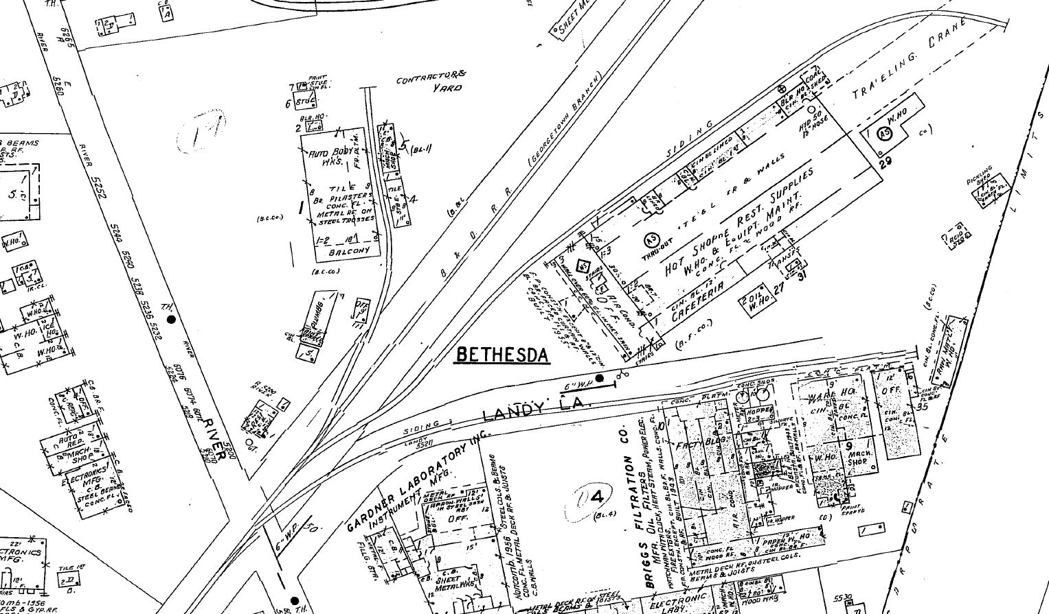
We’re going to take a look at two industries; The Briggs Filtration Co. (aka Briggs Clarifier Co.) and Hot Shoppes (which eventually became Marriott Corp.) which were located next door to one another in Bethesda, MD at River Road, yet were served by completely separate sidings. Let’s start with an overhead view from Historic Aerials, ca 1949:
Hot Shoppes in the center, Briggs Filtration Co. to the right. Ca 1949. Historic Aerials
Briggs Clarifier / Briggs Filtration Co.
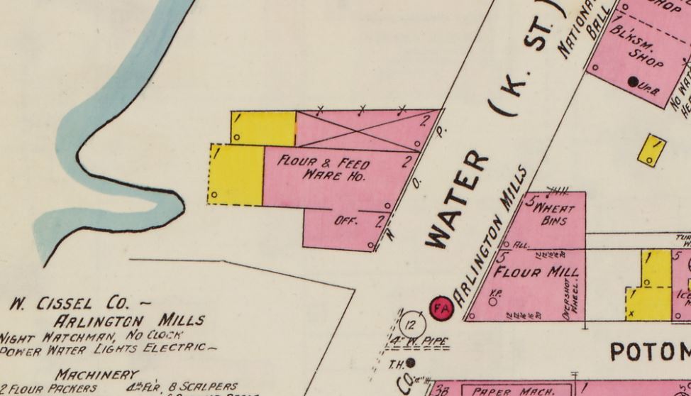
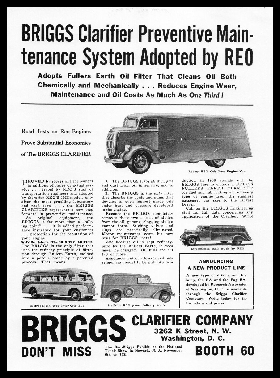
Briggs produced valves, hot water heating boilers and oil filters. A simple Google search will turn up various patents (1) and law suit filings, along with some trade catalogs and maybe even an advertisement. A bit of a digression to Georgetown: while I don’t have a detailed history worked up, what I can gather is that their office was located in Georgetown at 3262 K St, right across the street from Wilkins-Rogers Milling Co. The 1916 Sanborn map reads “Flour & Feed Ware Ho” located at 3262 K St.:
Sanborn Map, 1903-1916. LoC.gov
The 1927 Sanborn Map:
Sanborn map, 1927.
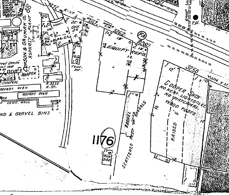
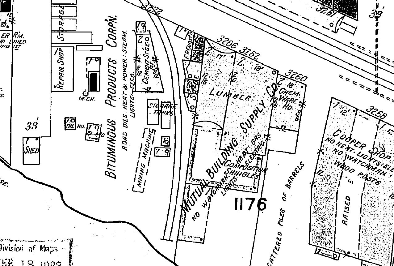
I checked a Sanborn map that has a 1932 date and it does not show Briggs Clarifier listed, but rather Mutual Building Supply Co.:
Sanborn map, 1932. A 1938 Briggs Clarifier Co. advertisement. Via eBay.
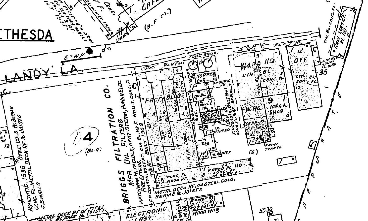
Ok, back to Bethesda. At some point they either moved or expanded (or perhaps were co-located) to a location in Bethesda at River Rd. off of Landy Ln. This fairly large facility, on the East side of Landy Ln. included several warehouse / manufacturing structures. Here is the Sanborn Map ca 1957:
Sanborn Map, 1927-1957.
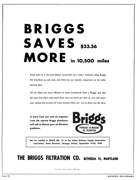
As you can see from the map, the B&O siding ran down Landy Ln, passing alongside the factory complex. Later advertising shows the name changed to The Briggs Filtration Co. and also had a Bethesda, MD address:
September, 1949 – Modern Railroads magazine. Briggs Filtration Co. advertisement. Google Books.
Hot Shoppes / Marriott Corp.
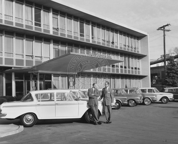
I’m not going to go into detail on the history of Hot Shoppes & Marriott because it’s been done before in lots of detail and with great imagery! The Streets of Washington blog did a great post on it some years back. Check that out to get a feel for the background of this local DC institution. I posted this photo last April of the Hot Shoppes HQ located at 5161 River Rd, with the Briggs Filtration Co just off to the right.
J. Willard Marriott and George Romney standing in front of the offices of Hot Shoppes, Inc. , 1959. Multimedia Archives, Special Collections, J. Willard Marriott Library, University of Utah, P0164 J. Willard and Alice Sheets Marriott Photograph Collection https://collections.lib.utah.edu/ark:/87278/s6029bvz Area around Hot Shoppes. Note the siding passing behind the building and serving an overhead crane, for unloading heavy items. Also note the coal house & boiler room in the far North corner. Sanborn Map, 1927-1957. Hot Shoppes warehouse (interior). I believe the view is facing North, with the railroad siding outside the structure on the left side. From the 1955 Hot Shoppes Annual Report, Univ. of Houston Library
Judging from the photo, it’s obvious that Hot Shoppes would receive all sorts of perishables related to the bustling restaurant industry. Machinery, furniture and other supplies related to the expansion of the business would also probably pass through the warehouse. There was also a coal house & boiler room at the north end of the building.
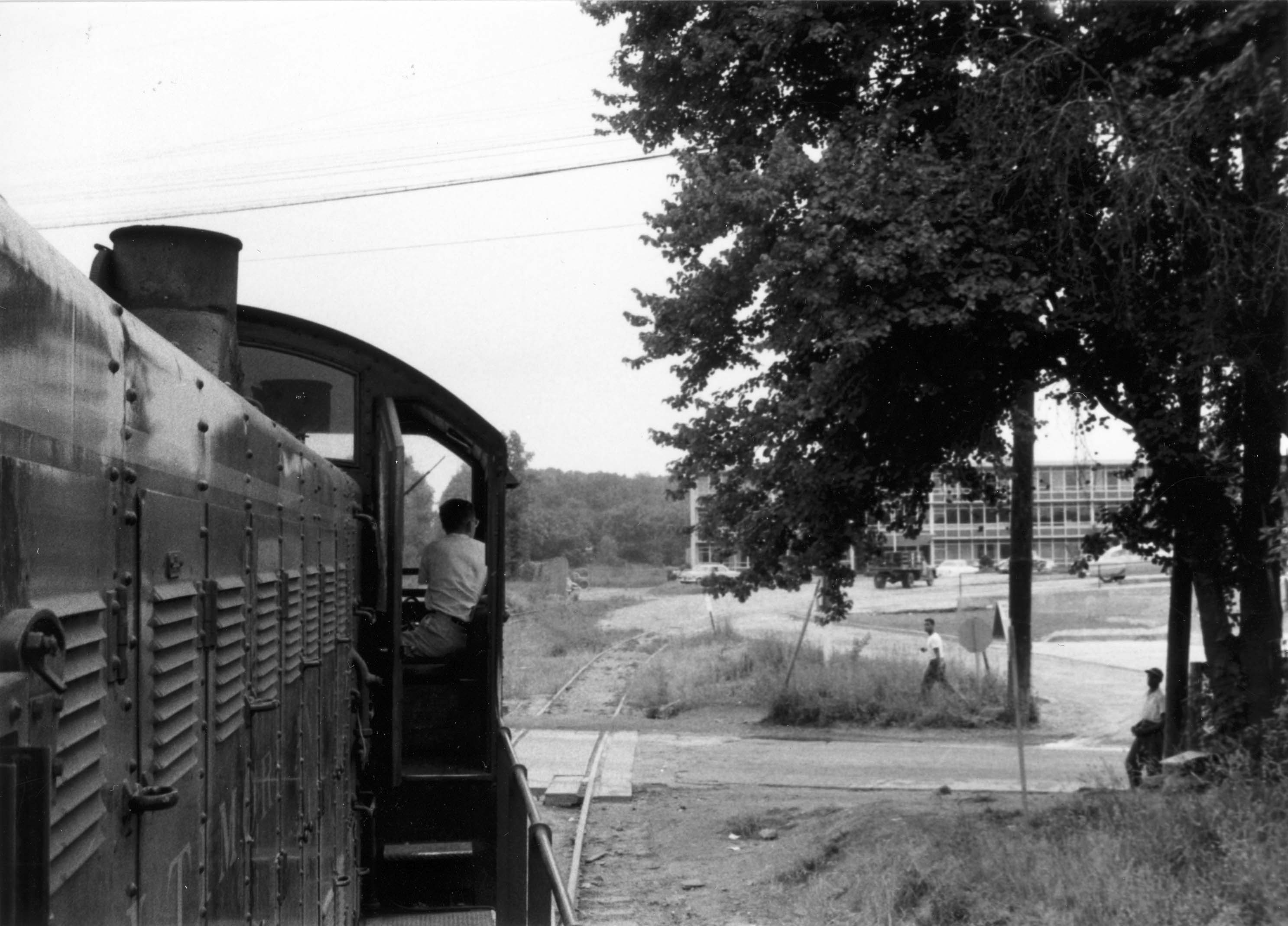
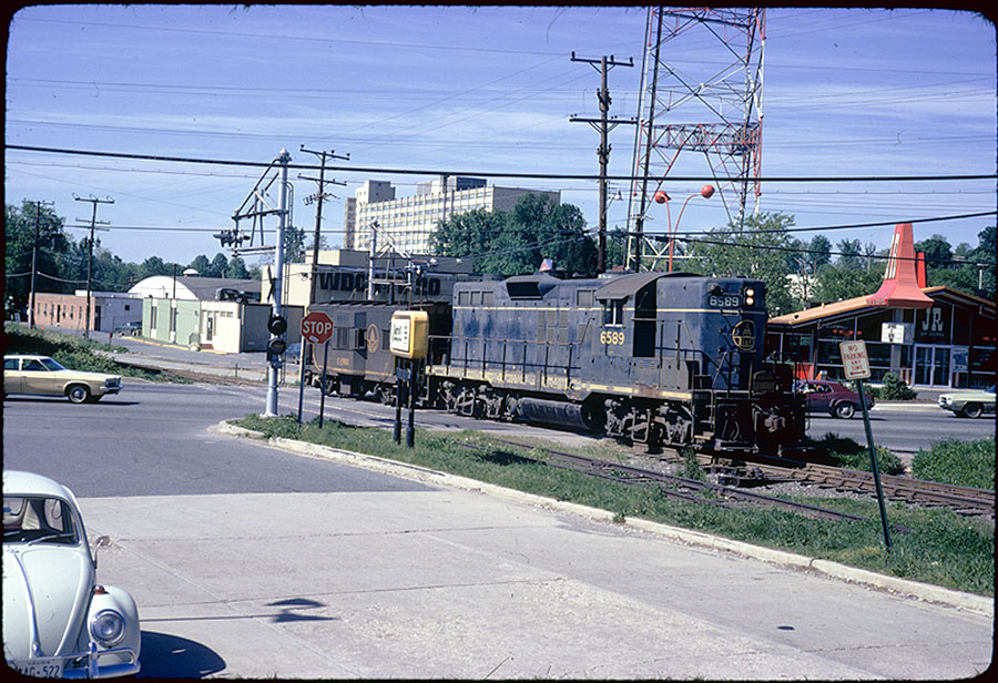
May 30, 1956. B&O switcher crossing River Rd. In the background, the Hot Shoppes warehouse is visible. Note the lead for Landy Ln just off to the right side of the loco. Photo by R. Mumford, B&ORRHS Collection. May 1973 – B&O EMD GP9 6589 (blt 1958) is Crossing River Rd heading East toward downtown Bethesda.Photo by Wm. Duvall.
In this fantastic photo from Mr. Bill Duvall there’s a lot to see. The view is facing away from the Marriott warehouse, standing on Landy Ln. The yellow & white sign next to the loco reads “Marriott Corporation, 5161 River Road.” The fast food restaurant behind the loco is none other than a JR Hot Shoppes restaurant. The slogan reads “Happiness is Eating Here.”
As a side note, I attended Fourth Presbyterian Church throughout my teen years. We would go to Roy Rogers (which succeeded JR Hot Shoppes) every Sunday after church with friends. It is now a McDonald’s. Note the WDCA20 studio and tower in the background. I may or may not have some friends who climbed to the top of that tower one hot summer about twenty years ago.
BONUS: If we look to the other direction from the photo of the two gentlemen above, we see additional industries just out of view that were also served by rail. There was an auto body/repair shop and more. The siding went between the larger structure and the two smaller sheds, spanning the entire length of the buildings.
Facing the other direction as the above photo, looking West. The GB “main line” was just behind and along that chain-link fence. From the 1955 Hot Shoppes Annual Report, Univ. of Houston Library
Back in 2003, when I went on my first Georgetown Branch exploration, we stumbled across rails embedded in the ground here where the auto repair shop was once located. We also walked around the area near Hot Shoppes / Briggs Clarifier. You can view the photos in the Gallery, here. I hope you’ve enjoyed a bit more insight into the Briggs Filtration Co. & Hot Shoppes warehouses in Bethesda.
Epilog
The Hot Shoppes facility is still standing. It now houses the Washington Episcopal School. They have modified much of the facility but the overall structure can still be observed today.
The Briggs Filtration facility is now gone, having been razed and turned into a soccer field for the adjacent school. However, for the time being you can still view the old structure on Google Street View! (Until they update it.)
And as one final gasp for the old Georgetown Branch, tracks are still visible embedded in Landy Ln. Go visit them when you can.
If you have any additional information, maps, photos or stories about these industries, I’d love to hear about them!
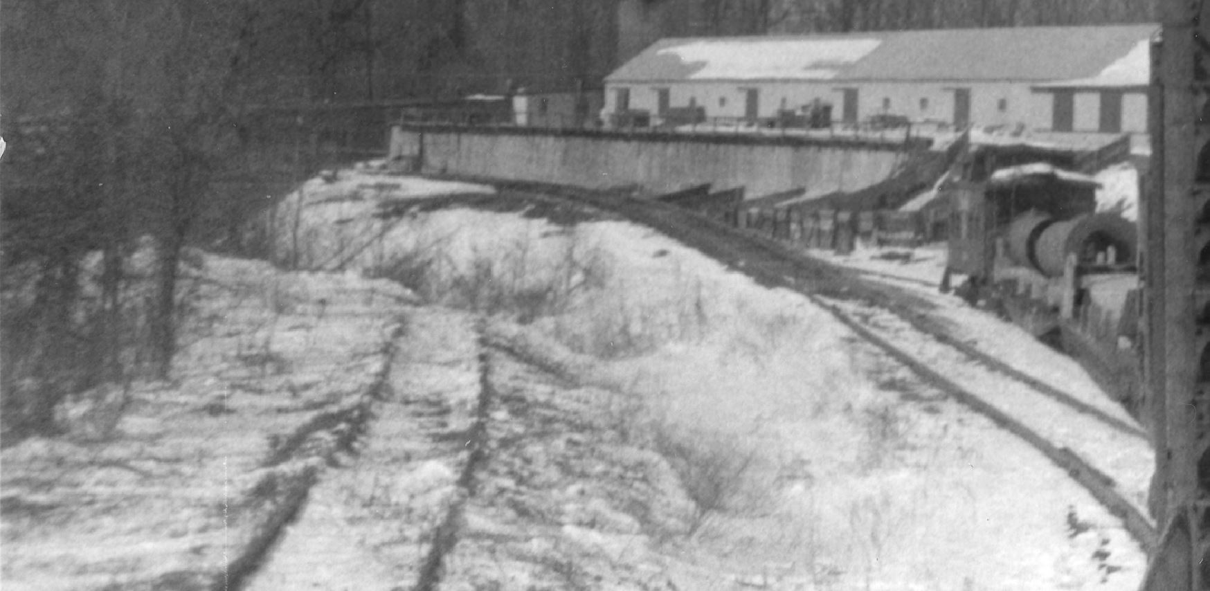
April 2, 1956. Heading west down the Branch from the Junction. On the right is the long E.C. Keys warehouse atop the retaining wall. To the left of the train is the coal trestle lead track. The old B&O MOW X-358? M-15 boxcar is sitting on a storage track. Photo by R. Mumford. B&ORRHS Collection.
(NOTE: UPDATED DRAWING TO v2 BELOW 7/3/2022) Just about a hundred yards west of Georgetown Junction was the Enos C. Keys & Sons company that sold building materials, aggregates, merchandise, coal and fuel oil from 1889 until 1978 when it finally went out of business. On the North side of the Georgetown Branch track, a turnout branched off and climbed up a steep embankment and sat atop a high retaining wall where it served a warehouse for building materials. Aggregates would be unloaded over the side of the retaining wall via chutes, down into large sorting bins below. On the south side of the GB tracks, a turnout diverged, rose slightly, and then out on a coal trestle that was approximately 227′ long (based on aerial images). This trestle also served as an unloading platform for fuel oil. In the very far northwest corner of the property, at the intersection of Brookville Rd & Stewart Av was the scale house, which was torn down recently. In a strange twist of fate, a fellow GB-served industry, T.W. Perry, is now occupying the E.C. Keys space atop the retaining wall. The lower area where the coal dock was is now a long warehouse building. Much of this will likely (or already has) change once the Purple Line construction is completed.
Feb 22, 1958. Heading to Georgetown. Another view of the trestle lead and warehouse/retaining wall. This is the BEST photo I have of the coal trestle… and it’s not even in the photo! yep! Photo by R. Mumford. B&ORRHS Collection.
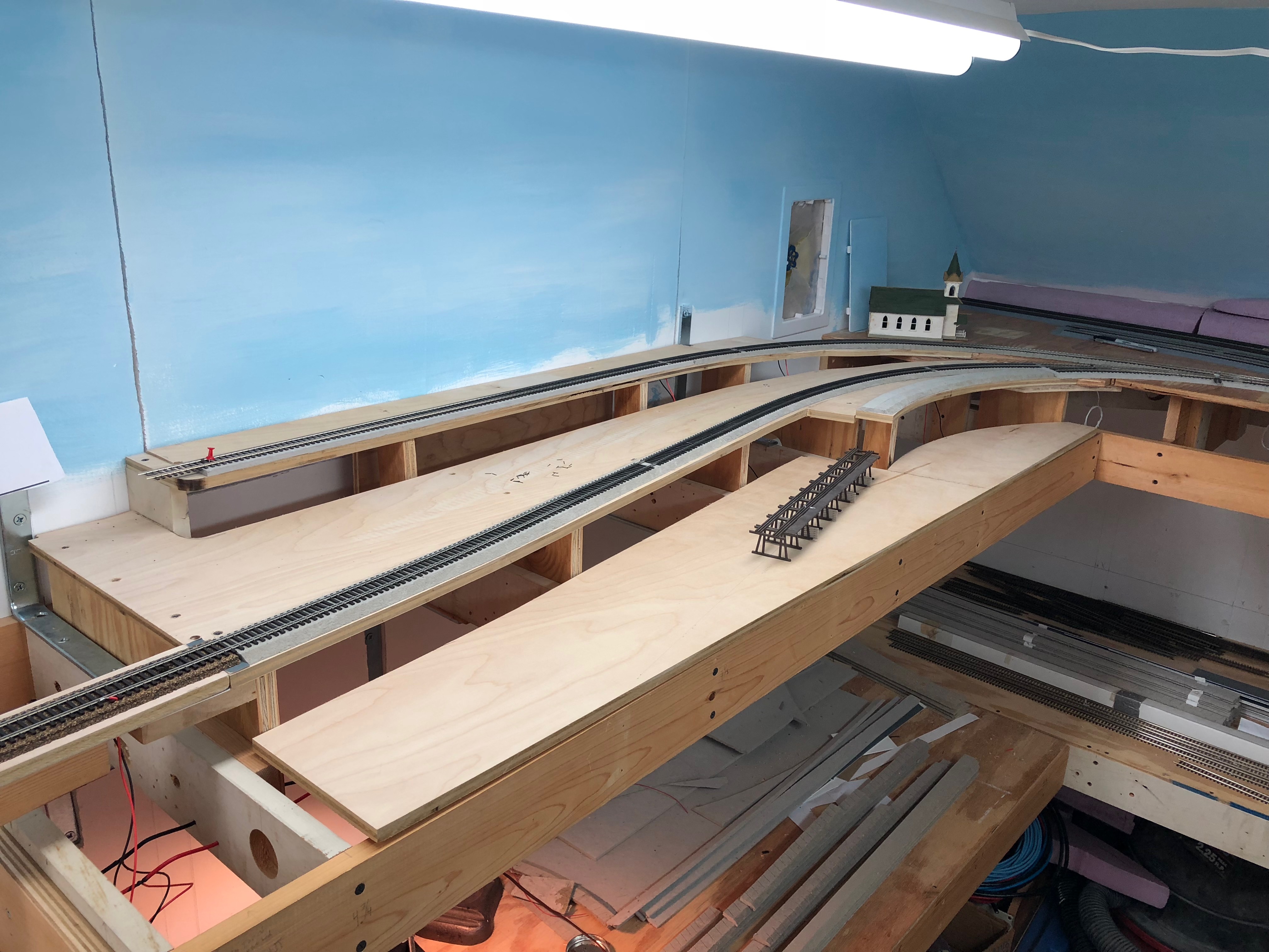
For my model railroad, I am modeling the coal trestle, retaining wall and siding, and the long lumber warehouse.
This view of the layout should give you an idea of where things will go. The coal trestle is going where the small trestle is in this photo, the retaining wall will be along the high siding.
I decided to spend some time studying the site and develop a plan for my model of the trestle.
A snip of the 1957 aerial view from Historic Aerials. Note the fuel storage tanks to the southeast. The scale house was up in the upper left hand corner. Also note the boxcar sitting on the end of the retaining wall siding next to the lumber shed.
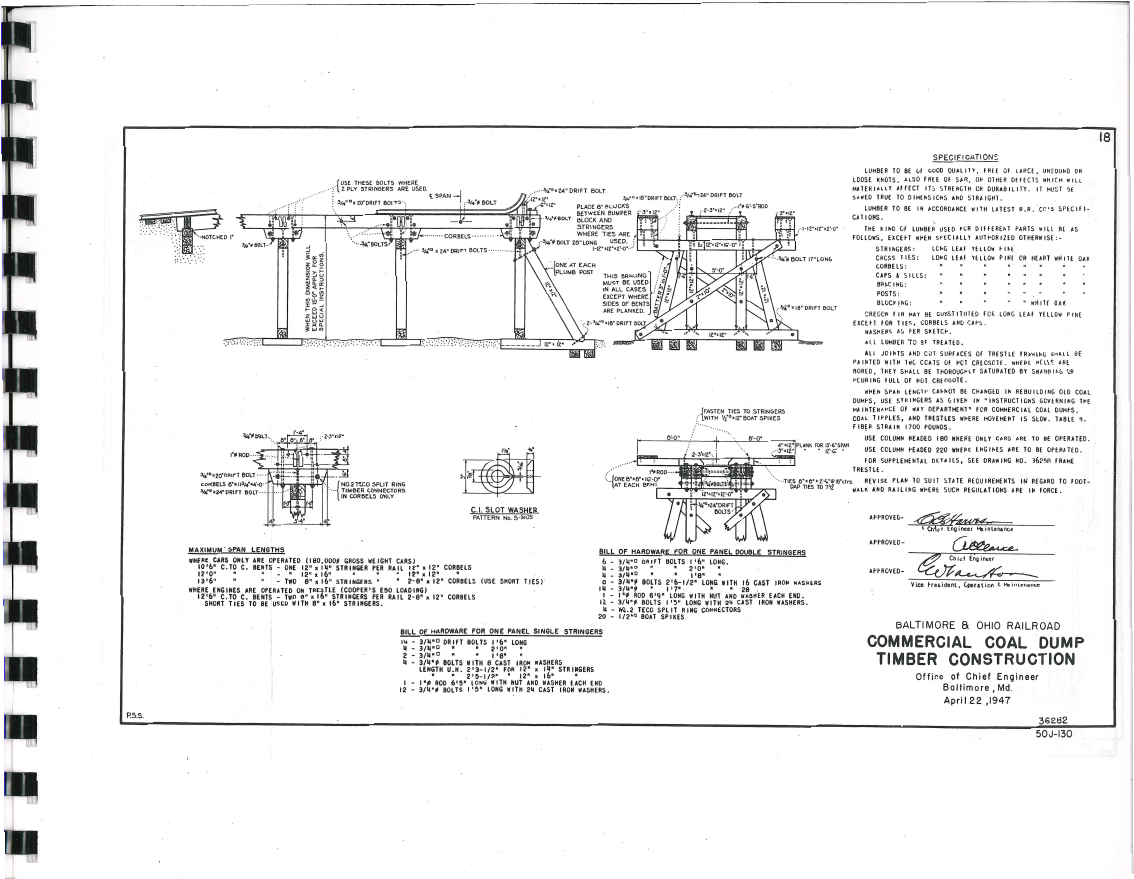
Using the scale tools available on the Historic Aerials site I was able to get basic measurements of the trestle. Approximately 227′ long, 15′ wide, bents (bins) about 15′ apart. This was enough to get me going, along with other details in the coal yard that I could observe. I now needed to figure out what sort of prototype to go after. Of course, without a photo I have no idea what the design of this trestle was derived from, but a good starting place was with the B&O Standard Plans book. I happened to have one that covers such things:
B&O Railroad, Roadway and Track Standards, 1945 (rev 1948); Commercial Coal Dump, Timber Construction. Book available from B&ORRHS, item 72047.
This fantastic reference book is available through the B&ORRHS Company Store, now in digital format. I highly recommend it! After some mocking up on my model railroad I realized that I wouldn’t be able to model a whole 227′ trestle and needed to reduce the size. I settled on a nice 135′ which will allow three 40′ cars, two less than the prototype would have held. This would work nicely for my small layout and even at this small size would still be a formidable structure. (I sure am building a lot of trestles on this layout… sheesh. I’ve got about four more to go, but that’s for another day!)
So, using Adobe Illustrator, the B&O plans and some photos I found online of similar structures & models, here is what I came up with:
So the image is quite wide – click for a larger view. I hope this gives you an idea of the design I’m after. I tried to stick as close as possible to the B&O design, but added a few modifications that I felt were necessary. One was the inclusion of additional supports for the walkway, a wider walkway, along with a railing. I also made some slight height adjustments but stayed within the requirements laid out in the B&O plan. All in all, I think it’s a good representation of the trestle and will make a very nice model. If you’d like a copy of the vector file, it’s below as a PDF for your own personal use. (NOTE: UPDATED to V2 7/3/2022)
The E.C. Keys facility will be a key scene on my layout. It’s a fascinating area to switch and this coal trestle will be a centerpiece of the small industrial area. Now to finish the Rock Creek trestle so I can get on with building this!
I know, I know, the trestle has been moving forward at the speed of slow. It’s been a while since I made an update so I figured I’d put a stake in the ground and share where I’m at.
20 bents, completed and arranged in order
Last Tuesday during my train club “Bench Time” I finished the last of the 20 trestle bents. Yesterday evening I touched up any of the unstained ends of wood that I missed and installed a few NBW castings that I missed. They are done! I consider this a big milestone. On to the next step.
The trestle deck
I spent some time cleaning up the trestle deck and clearing space for assembly. My plan here is to build a sort of sled with a flat vertical face to lay the trestle bents against for installation. I will keep it square by mounting a straight edge along one side that the sled can slide against. More on this in a future post.
Cutting stringers and girts
Finally, I laid the side view schematic out on some 2″ foam core and began to cut the various stringers, girts and braces that will go on the trestle sides. I need to cut, sort, prep and arrange all of these pieces before I can begin to install the trestle bents to the top deck. I have this weekend off so I think I will try to make more progress.
The project is coming along nicely. The last several months have been busy and as such this fun project has been going slowly. I have mainly assembled trestle bents during train club Zoom meetings. One or two a night, every week or so. I’ve also been working on a few other projects. I’m good at starting projects; bad at finishing them. Can you tell?
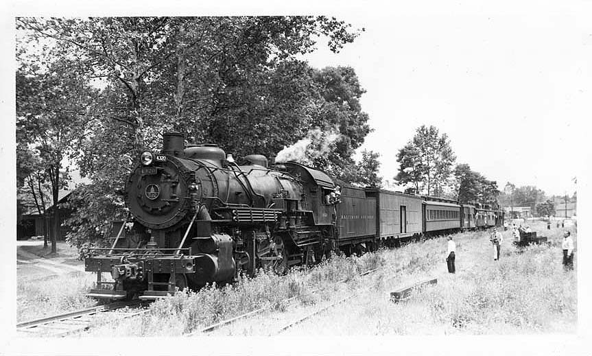
B&O MSME Special at Eckington Yard, Washington, DC, engine Q-1c 4320 with two passenger cars and four cabooses prepares to depart. E.L. Thompson photo, B&ORRHS collection.
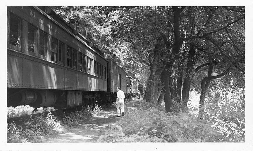
Early on while conducting research on the Georgetown Branch I came across photos of a B&O steam excursion that took place on June 6, 1948 labeled as the “MSME Excursion.” From what I can tell the train was commissioned by the Metropolitan Society of Model Engineers, a prolific and very active model railroading group in the DC area. The train was assembled at the B&O’s Eckington, DC coach yard, where it departed and traveled west on the Metropolitan Branch, to Georgetown Junction where it entered the Georgetown Branch. The train made several stops, on its way to Georgetown and then would return to Eckington, DC. The MSME itself formed at some time in the early 1930s and resided in the “attic” of Union Station where they had a permanent model railroad layout. They would host National Model Railroad conventions, local model contests, other meetings and events, including railfan excursions. For this post, I will share what I know about the train that ran that day in 1948.
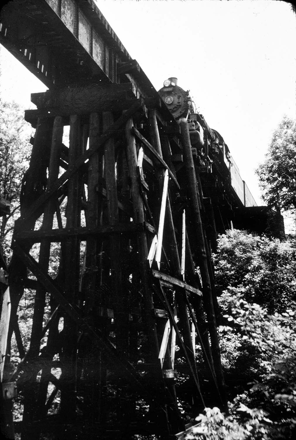
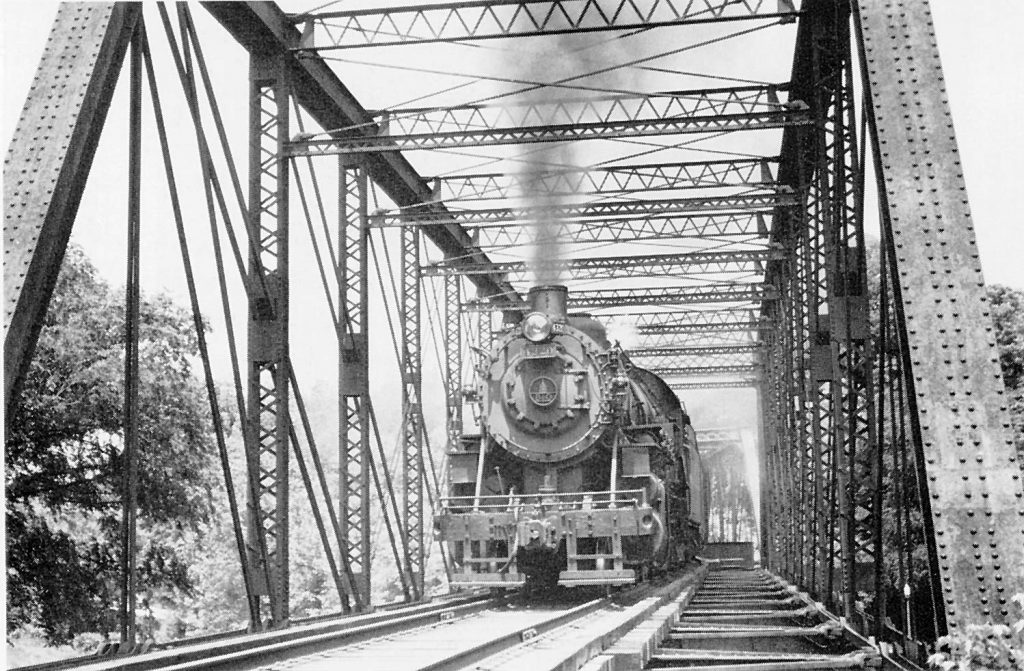
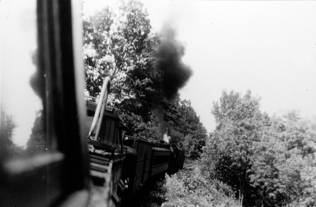
So far, I have yet to uncover a detailed account of the excursion events. My assessment is based on the photos that I have discovered and that have been shared with me. From what I can tell, the train was assembled in the B&O passenger or coach yard in Ivy City. The loco, 4320, was coupled up and the train headed out, engine-first, toward Georgetown Junction. There was a stop at the Rock Creek Trestle, where some chose to photograph the loco from below as it crossed this impressive trestle.
B&O Q1-c 4320 crossing Rock Creek, Jun 6, 1948. Collection of W. Duvall.
The next stop was at Chevy Chase, MD where the train paused on its way west, just past Connecticut Ave. Note how overgrown the yard was at this time.
B&O MSME Special at Chevy Chase, MD. E.L. Thompson photo, B&ORRHS collection.
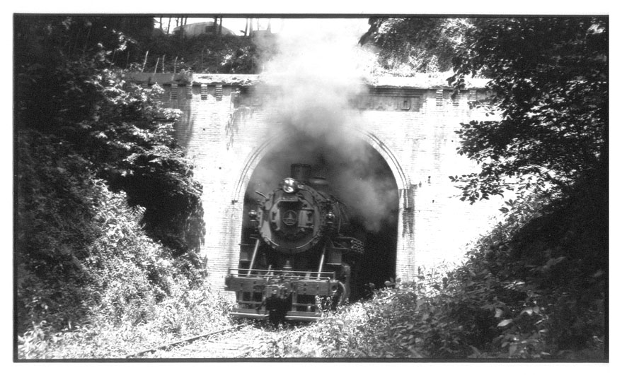
From here, the train continued west, passing through Bethesda and on to Dalecarlia. Whether or not the train stopped in Bethesda, I do not know. The next stop seems to have been Dalecarlia Tunnel for a photo run-by of the train emerging from the tunnel. (photo below.) The train continued down along the palisades and would next pause at Fletcher’s Boathouse along the C&O Canal. I believe the train likely backed up as patrons hiked the short distance to the bridges over the Canal where they did a run-by or simply staged a photo.
I believe this is from the MSME excursion train. Photo from Impossible Challenge, Herbert H. Harwood, Jr., 1979, Barnard Roberts & Company publisher
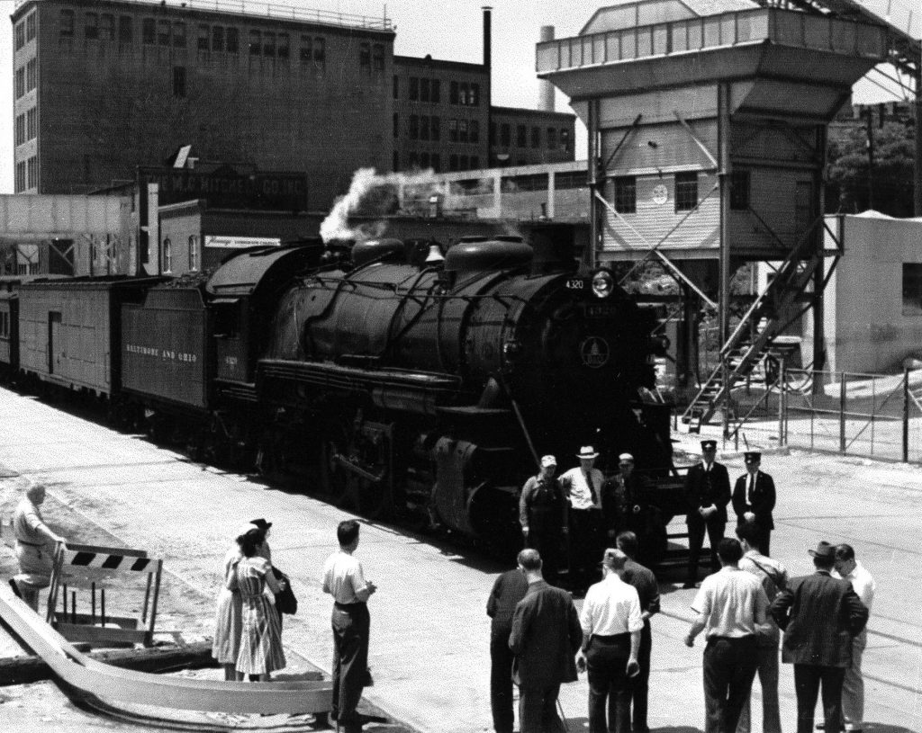
After this pause, the train then continued on to Georgetown, where it terminated near the “new yard” for a break and a photo op.
Jun 6, 1948, James Martin collection, B&O RR Historical Society Archives collection.
At this point, the railroad did a bit of switching of the train, changing the order from: <<West <[4320]–[baggage]–[4602]–[C-2312]–[C-2250]–[C-1995]–[C-2806] to: [C-2312]–[C-2250]–[C-1995]–[C-2806]–[baggage]–[4602]–<[4320]East>> The loco would run tender-first back up the branch, at the head end of the train. You can see the rearranged train in these images:
B&O MSME Special mustering for departure from Georgetown, DC, the west end “long siding”. E.L. Thompson photo, B&ORRHS collection. B&O MSME Special heading West, Jun 6, 1948, Photo by Lawrence Winnemore, B&O RR Historical Society collection.
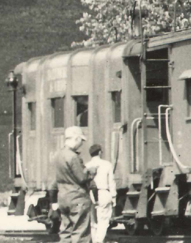
This last image is a really special action shot, taken from the window of caboose C-2250 as 4320 works hard to pull the excursion uphill back toward home. If I had to guess, I’d say this was in the area of Dalecarlia, but I really can’t be sure. So let’s take a look at the individual players on the train.
B&O Q1-c 4320
Built in September, 1913 by Baldwin Locomotive Works, Mikado 4320 weighed in at 284,500 lbs. The loco was retired a few years later June 19, 1951 at the Mt. Clare shops, Baltimore, MD. When the excursion happened, it was likely one of the few steamers in the area still in service and probably only used for special occasions like this. At this point diesels were really becoming ubiquitous in the DC area.
4320 Emerging from Dalecarlia Tunnel, 6/6/48. Photo by Paul Westhaeffer, B&ORRHS Collection.
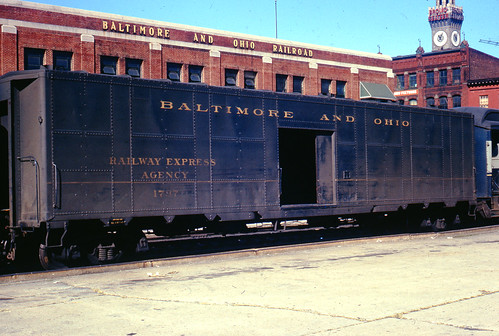
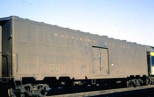
B&O REA Express Car, 17xx
B&O MSME Special at Chevy Chase, MD. E.L. Thompson photo, B&ORRHS collection.
Troop sleeper cars were built by Pullman during WWII to facilitate the movement of troops during the war. Afterwards, many were rebuilt into express baggage cars. Shops would cover and modify window and door openings, ends and other features to suit their needs. Unfortunately I don’t yet have a good side view of this car, so its actual number remains a mystery but is likely 17xx. Here’s a couple similar cars, found in the wonderful Barriger Library collection:
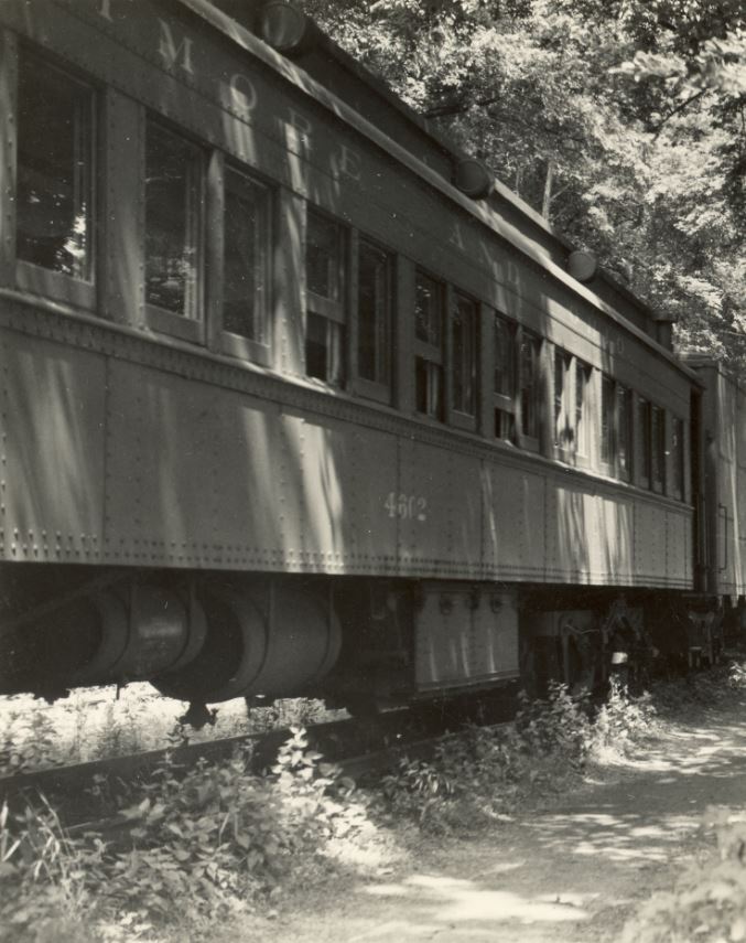
B&O MSME Special at Georgetown, DC. E.L. Thompson photo, B&ORRHS collection.
Joe Nevin clued me in on this car. This is a class A-13, of vintage pre-1910 construction. The car sides had steel sheathing installed over the wood siding. By WWII these cars were in excursion and special use until returned to full service during the war. By 1947, they went back into special ops (like an excursion on the Georgetown Branch).
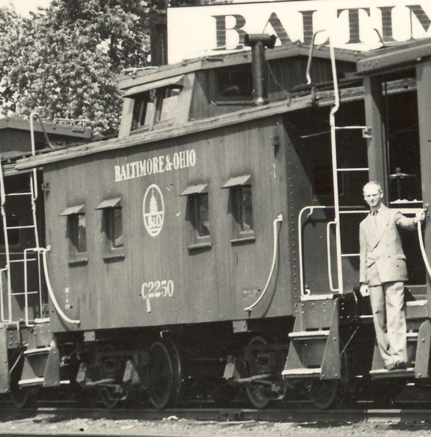
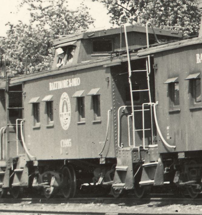
The I-16 class was converted from old M-13 class boxcars, for use during wartime service when steel was restricted. Many railroads built composite “wartime” cabooses during this period. Car is red, with white lettering and is looking fresh!
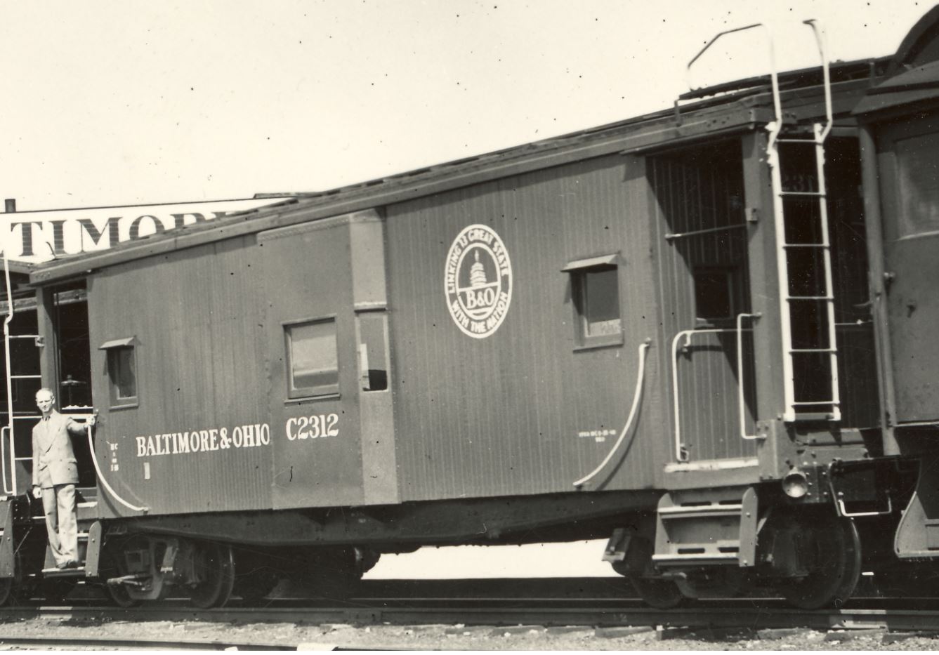
C-2806 I-12 subclass, built in 1945, all steel construction. Red with yellow lettering.
As for modeling this train, I have begun putting together my representation. Here is the approach so far:
Q1-c 4320: Precision Scale Q1-c. An exquisite model and really the “first” brass loco that I’ve owned. It needs a bit of work, as the mechanism is not super-smooth and it needs DCC/sound installed.
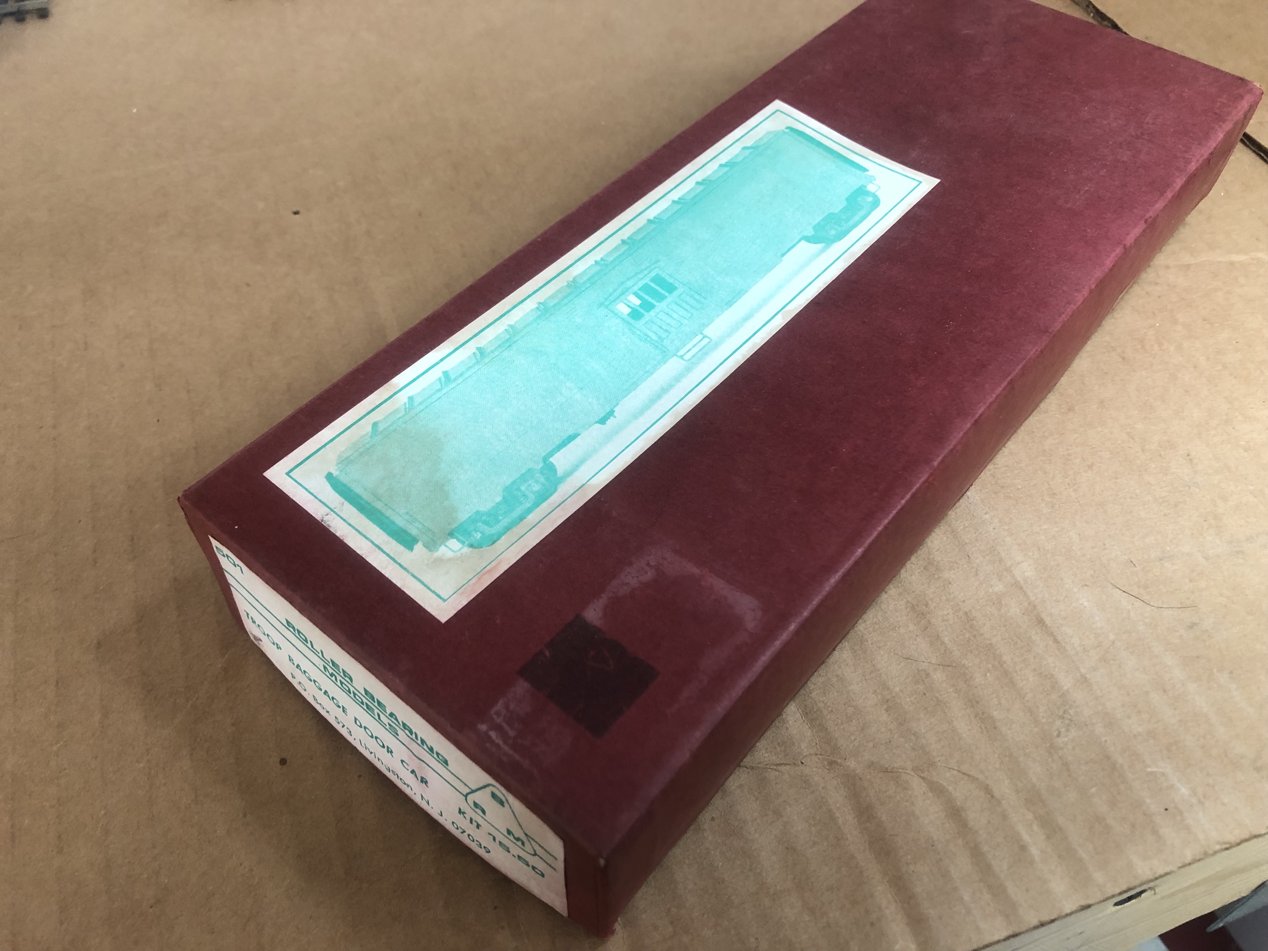
Express Baggage Car 17xx: I found an old Roller Bearing Models – Troop Baggage Door Car kit, #501 (see pic below), but it’s completely incorrect for this car. Joe N. told me that the Walthers model is from a C&O prototype and not quite correct for the B&O (the window spacing and door placement are wrong), but I think I’m going to seek one out and use it as a stand-in for now.
A-13 Coach 4602: To do this properly will be a challenge, as no models exist of this type of car. I have a stand-in Bachmann Spectrum heavyweight to use in the meantime.
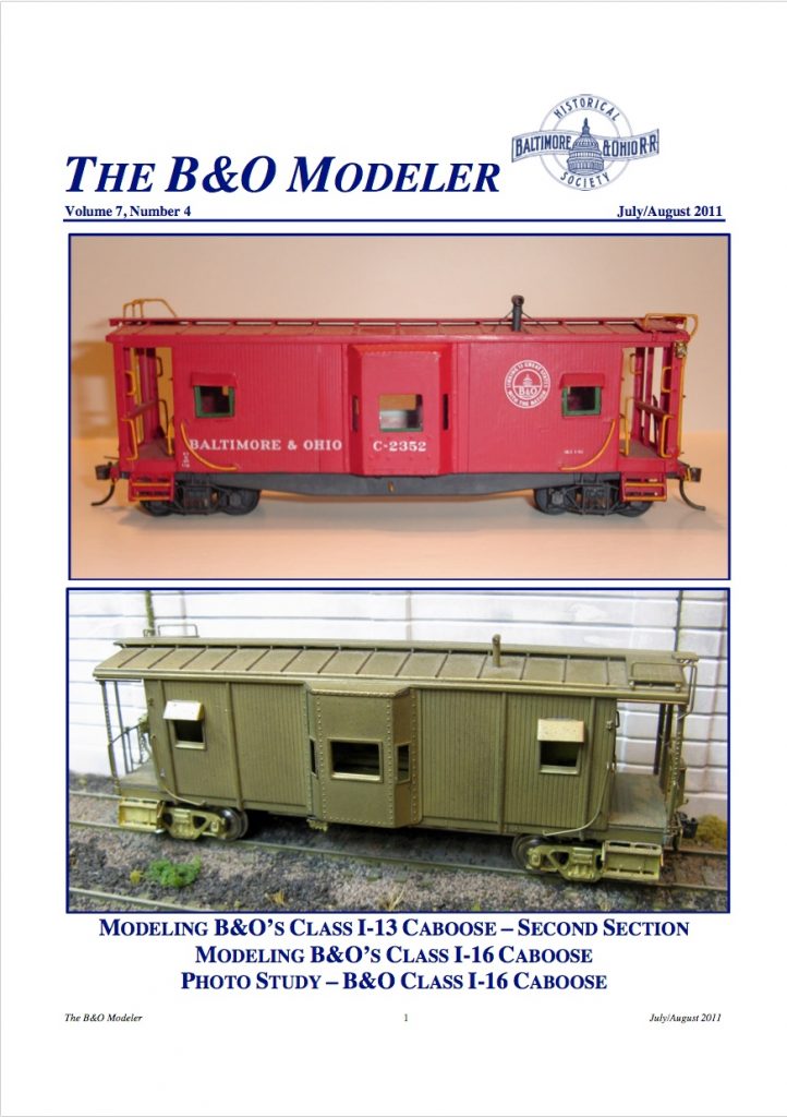
I-16 C-2312: So far I have collected an old Pro Custom Hobbies wood/metal I-16 kit, and an Accurail 40′ double-sheathed boxcar and some additional detail parts to do my build. The B&O Modeler magazine (Vol 7, Number 4, Pg 5) featured an article by Chris Tilley on kitbashing an I-16 which I plan to follow.
I-5 2250 & 1995: I’m holding out for the Spring Mills Depot models, which I have faith will be coming in the future. I do have an I-5 Pacific Mountain Shops resin kit that I will build and use as a stand-in.
I-12 2806: I have a gorgeous SMD I-12 lettered correctly which I will use.
If you have more info on this special excursion train, I’d love to hear from you! I also welcome any comments and feedback on my own observations as well as my modeling choices/plans. I have additional photos of the train, but not the permission to publicly share them, so hopefully in the future I’ll get that book written and can get them out for all to enjoy.
John King recently shared this absolutely magnificent photo of a ditching crew at work near Georgetown Jct ca 1940. The photo was taken by Leonard Rice.
Georgetown Jct Work Train with caboose C-1925, ca 1940. Leonard W. Rice photo, Collection of John King. All rights reserved.
John notes: Interesting to note that the 2-8-0 was NOT an E-27 but an E-31 which to my eye looks similar to an E-27 but was originally a C.H.& D. locomotive.
I tried placing the location of this photo and the best I can fathom is that it is East of the Junction (crossovers), closer to Silver Spring. I believe the track that the work train is on is the “Silver Spring Lead”; the long siding that extended from Silver Spring yard all the way along the mainline to a point just East of Talbot Ave bridge. The Georgetown Branch would be out of sight to the left, a mile or so ahead. Thank you, John, for sharing this rare and special color image!
It’s a rainy, wet, dreary day here in Maryland; AKA perfect model railroad weather. Decided to put a kit together today so I’m digging into this old Branchline 50′ B&O M-61 boxcar kit.
This neat photo from 1959 of the front of the Hot Shoppes Inc. (later Marriott) HQ at 5161 River Rd was shared on the Bethesda Chevy Chase Back In The Day Facebook Group, by P. Wilson (Thanks!). The Georgetown Branch passed just behind the photographer, the siding that served the building was located just to the left of the building. In the distance to the right, we can see a boxcar spotted at the industry located next door on Landy Ln. I’m not certain what this industry was but they had a large loading hopper.
J. Willard Marriott and George Romney standing in front of the offices of Hot Shoppes, Inc. , 1959. Multimedia Archives, Special Collections, J. Willard Marriott Library, University of Utah, P0164 J. Willard and Alice Sheets Marriott Photograph Collection https://collections.lib.utah.edu/ark:/87278/s6029bvz
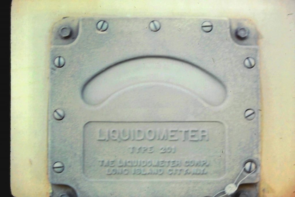
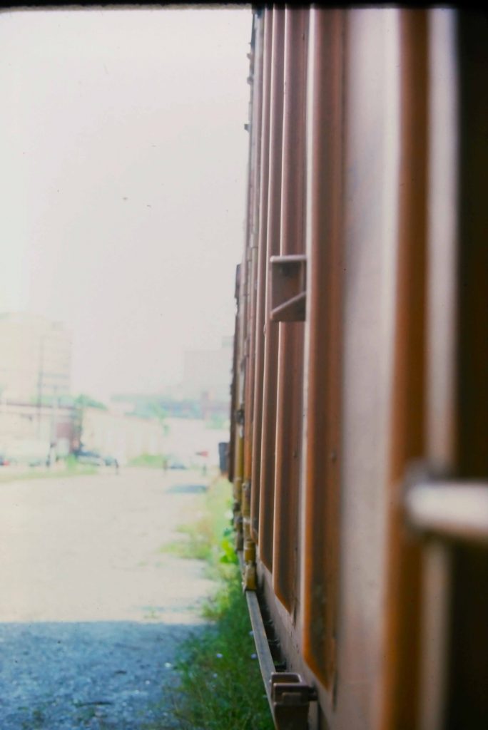
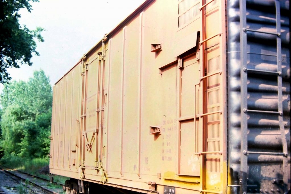
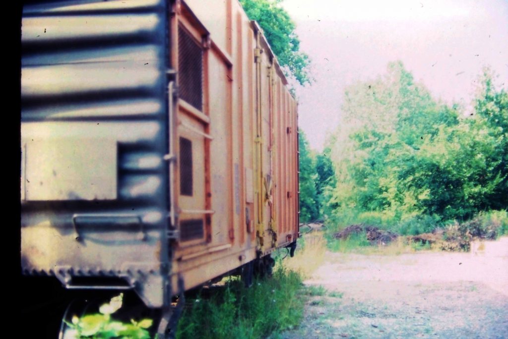
Rich Pearlman shared these four photos with me that he shot as a kid in Bethesda. The car is sitting on what was the passing siding/team track in Bethesda. Thanks to some wonderful sleuthing by folks over on the Freight Car Enthusiasts Facebook Group, the car was identified. This is a General American Railcar 40′ mechanical refrigerator car, built 9/1957. I can’t read the rebuild date but similar cars have dates in the 1971-75 range. I also can’t make out the reporting marks, but I believe they are URTX based on what the FB group revealed and other photos that are online of similar cars.
This is an oddball to me. This refrigerator car parked in the yard in downtown Bethesda. Why? At this point, I don’t know what industry was left in Bethesda. I don’t think Maloney was even receiving rail cars at this point and most of the others had departed long ago. There was some LCL service and I’m assuming that’s what this was. But for who? And what was it transporting? A mystery that will likely go unsolved. Would love to hear your thoughts! And, thanks again, Rich!