I thought this recent story was interesting. Enjoy!
How the Washington Branch Railway and the Camden Line shaped the region’s suburbs
I thought this recent story was interesting. Enjoy!
How the Washington Branch Railway and the Camden Line shaped the region’s suburbs
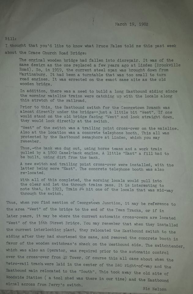
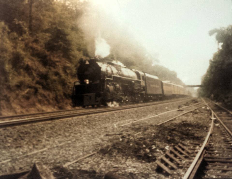
I was lucky enough to meet and chat with Norm Nelson on several occasions. He was key to understanding some of the complexities of operations on the Georgetown Branch, as he had first-hand knowledge of how it operated being that he actually ran trains up and down the Branch. He was friendly and enjoyed discussing the minutiae of railroading. My kind of guy. So imagine my joy when my friend Greg C. sent me the following letter regarding Norm’s recollection of the history of the Talbot Ave (or Grace Church Rd) bridge over the Metropolitan & Georgetown Branches of the B&O. Norm recollects a conversation he had with Bruce Fales, another prolific railfan in the greater DC area (of which I have purchased a few old photos credited to him) in which he outlines the history of the bridge and the Branch at that point. Really fascinating stuff! Greg’s brother-in-law Andy got the letter from Richard Schaffer who should have credit for the items. I’m not sure who the photographer is in the photo below.
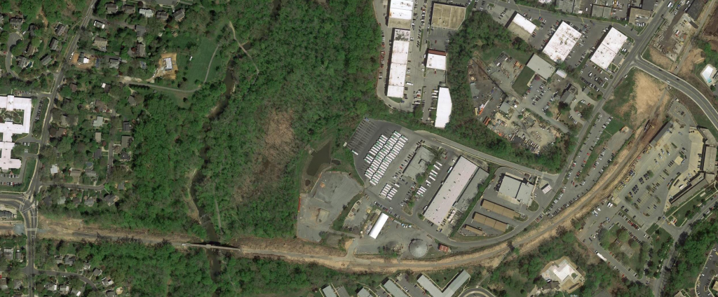
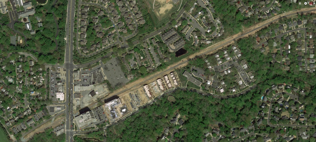
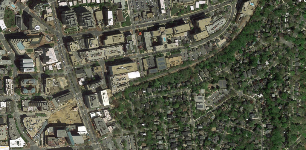
I didn’t realize just how frequently Google Maps images are updated, but this is impressive to me. Here are a few images I snagged today which show the Georgetown Branch right of way as it stands very recently, earlier this Summer. You can see all of the clearing that has happened along the RoW very well. Very impressive. I really wish I could walk the line one last time before they do permanent grading, just to see what the RoW was like when the GB was new. Oh well! 🙁
https://ggwash.org/view/68579/the-fascinating-story-of-dcs-aqueducts-and-reservoirs
An interesting story covering the history of aqueducts in and around Washington, DC. Anyone know where that tunnel image is from? (http://collections.si.edu/search/detail/edanmdm:nmah_1840608)As many of you know, the Georgetown Branch of the B&O served the Dalecarlia Reservoir which was fed by the Washington Aqueduct.
Construction thunders on in Bethesda on the Purple Line project and as they make way for the station in Bethesda, the old right of way for the Georgetown Branch is unearthed for probably the last time. The buildings above the right of way were demolished, and now grading is complete. They’ve dug down a bit further than the original right of way, but it’s as good as it will get. Take a look at the photo below. You can just make out the concrete bridge carrying Wisconsin Ave over the old RoW at the bottom of the photo. The large angled pilings in the bottom right cover the RoW and it curves over toward those red awnings in the distance. Can you see it?!
They got rid of the dirt ramp on the right, created a dirt ramp on the left, and made something that kind of looks like a helicopter pad #PurpleLine #Bethesda @FourCornersSean pic.twitter.com/jTRhG6qUBn
— Songbae (@SongbaeLee) May 29, 2018
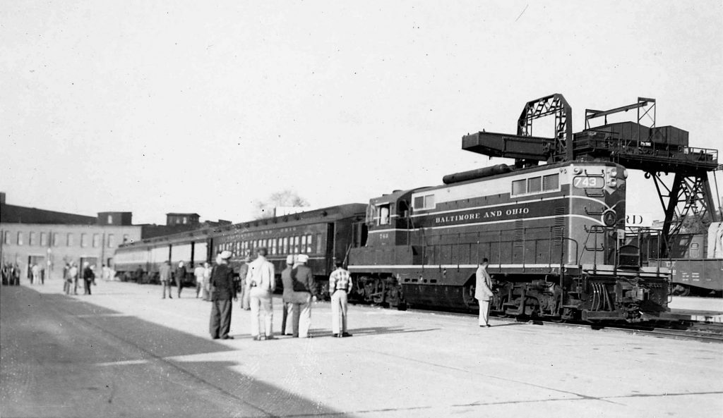
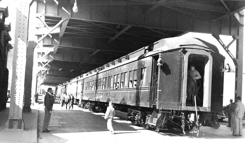
In the fall of 1954 the National Railway Historic Society put together an excursion train which included a trip down the Georgetown Branch. I recently purchased two prints off of eBay which show the train being mustered in Eckington Yard down in Washington, DC as well as the train at the end of the Branch under the Whitehurst Freeway in Georgetown. Enjoy!
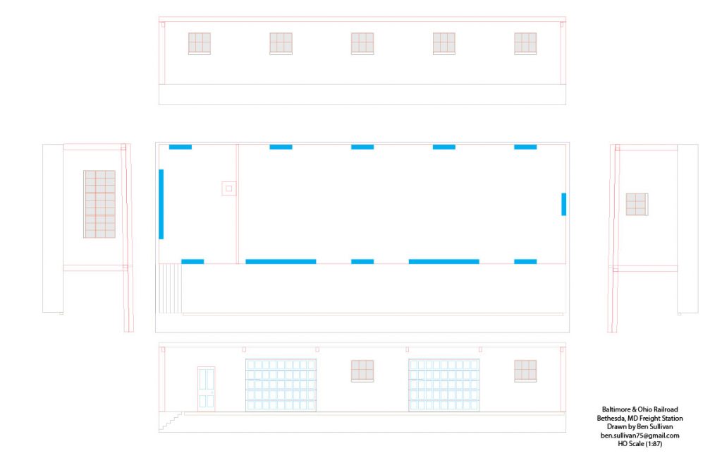
I re-worked my drawing of the Bethesda Freight Station, I’m calling this v.2. I was looking at the first attempt, in laser-cut form, on the layout, and noticed that the loading dock was extremely high. I pulled an HO scale delivery truck up to the dock and it came up about 1/4 of the way up the back door of the truck. Unacceptable.
I went back to my archive photos and the drawings. I reassessed how I got my original measurements and made new references off of the photos, trusting more in some known dimensions I had, namely the garage doors and windows. I also used some logic to determine door size as well as the height of the loading dock. I assumed the loading dock height to be about 42″. I assume the door is about 7′ high. After re-drawing the plans, here is what I’ve come up with:
I’m MUCH more pleased with this result. I know it’s not perfect, but I think it will be about 95% close to correct. I’m going to print this one out, mock it up and see how it looks on the layout. More to come, soon!
I just found out about this neat documentary covering the history of the Talbot Avenue bridge which crossed the B&O’s Metropolitan Branch at Georgetown Junction. If the preview doesn’t work, click the link below.
The Bridge from Jay Mallin on Vimeo.
The small historic village of Lyttonsville laid right at the spot where the Georgetown Branch broke away from the Metropolitan Branch of the B&O. The line was built around 1892 to serve the new power plant at Connecticut Ave in Chevy Chase. The Lyttonsville property was purchased some time around 1850 and has a rich history.
Lytton was in his sixties when the Metropolitan Southern Railroad division of the Baltimore and Ohio Railroad Company began planning to construct a freight rail line from the railroad’s Metropolitan Branch, which in the 1880s had linked northwest Washington to West Virginia. The railroad had to acquire right of way along the length of the new line and its 1827 charter gave it two ways to acquire it: direct negotiation with property owners along the route or through condemnation proceedings against recalcitrant owners with whom they couldn’t come to terms.
Read more:
Some great news about the doomed Talbot Avenue Bridge, although I’m not sure which specific parts will be saved. My guess is it will be the span itself, and perhaps it will be placed in a park on new footings, as the original supports were completely rusted away in some places and in really bad shape. Hurrah!
Silver Spring bridge to be saved as symbol of segregation history