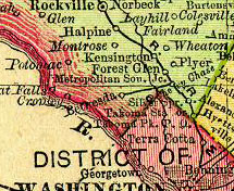
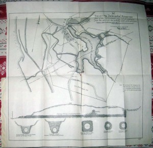
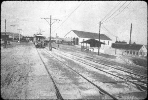
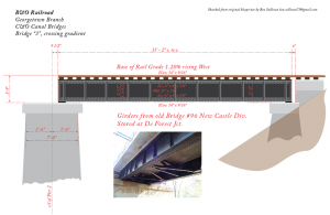
Whilst digging around for information on the Girls Reform School that was located at the current site of Sibley Hospital (more on this later) I stumbled on some background to the construction of the Metropolitan Southern, one of the three predecessor line to the Georgetown Branch, through the Dalecarlia Reservoir. The article first describes the Dalecarlia area but then goes on to outline the agreement between the US and the B&O as they laid their line through the reservoir. Most of it seems occupied with the concern that the US had to keep the water in the reservoir clean and separate from the intrusion of the rail line. Interesting stuff!
The survey of the boundary lines of the aqueduct lands both in the District of Columbia and in Maryland which was commenced in the fiscal year 1890 91 was continued but not much was done during the year Boundary stones suitably marked were planted at all the angles except two that were not already marked from the Dalecarlia receiving reservoir to above Cabin John Bridge By an act of Congress approved by the President on the 11th of July 1892 the Attorney General the Secretary of War and engineer commissioner of the District of Columbia were empowered to select from the lands in the District of Columbia belonging to the United States a site for a girls reform school Under the decision of the commission a tract containing 19.39 acres and comprising nearly the whole of the reservoir land lying between the Conduit road and the Little Falls road was surveyed and existed from the reservoir lands for this purpose.
Interestingly, the article goes on to describe the genesis of the Georgetown Branch:
THE EXECUTIVE DOCUMENTS OF THE HOUSE OF REPRESENTATIVES
FOR THE SECOND SESSION OF THE FIFTY THIRD CONGRESS 1893-94
IN THIRTY ONE VOLUMES
WASHINGTON GOVERNMENT PRINTING OFFICE
1895
Appendix BBB – Washington Aqueduct pg 4287
During the year the Metropolitan Southern selected and surveyed its route through the lands of receiving reservoir as authorized in the following approved by the President on the 3d of March 1891:
Be it enacted by the Senate and House of Representatives of the United States of America Congress assembled That the Metropolitan Southern Railroad Company is hereby authorized to construct its road across the grounds of the United States forming a part of the grounds of the receiving reservoir in Montgomery County in the State Maryland north of the northeast boundary line of tne District of Columbia and for that purpose said company is hereby granted a width of sixty feet at grade and such additional width as it may require for slopes of cuttings and embankments across said grounds for its right of way through the grounds aforesaid: Provided, That the location and plans of said road through said grounds shall be approved by the Secretary of War before the commencement of any work on said grounds and the work of construction and the operating of said road shall be subject to such regulations as he may prescribe and the damages for the use and occupation of the right of way herein granted shall be fixed by a board of three Army officers appointed by the Secretary of War and the payment of said damages so fixed shall be a condition precedent to the exercise of the rights by this act granted which are to terminate at the pleasure of the Secretary of War in case of persistent neglect by said company or by its successors to comply with the regulations aforesaid.
pp 4288 REPORT OF THE CHIEF OF THE ENGINEERS, U. S. ARMY.
The location and plans of the road were submitted by the company and approved by the Secretary of War on the 25th of January 1893 and the regulations concerning the work of construction and the operating of the road were prescribed by him on the same date These regulations which had previously December C 1892 been accepted by the company are as follows:
. Regulations respecting the construction and the operating of the Metropolitan Southern Railroad through the lands of the United States, in Montgomery County, Maryland pertaining to the receiving reservoir, by virtue of an act of Congress approved by the President of the United States on the 3rd of March 1891
1. In that part of its route where the Metropolitan Southern Railroad shown in the plan of Parcel No 1 of the plans of tho railroad and between said parcel and the railway tunnel is not in cutting substantial retaining walls shall be constructed by the railroad company between the reservoir and the railroad to such height, not less than the height of the roadbed, as will, with paved gutters behind them, be sufficient to catch and lead alongside the railroad and away from the reservoir, all the drainage from the roadbed, the land pertaining thereto, and the land behind it, either southward through the railroad tunnel or northward to the small stream that is to be crossed by the railroad near station No. 317 of the plans of the railroad. The retaining walls shall be kept in good order by said railroad company and its successors
2. Paved drainage gutters shall be constructed by said railroad company behind the above-mentioned walls and across the railroad bridge and through the tunnel and cuttings, of ample size for the above purpose, and they shall always be kept by said railroad company and its successors in good order and free from obstructions. No drainage water shall ever be permitted by said railroad company or its successors to flow from or across the roadbed or the lands pertaining thereto, or the land behind it, into the reservoir.
3. The crossing of the conduit between Parcels Nos. 1 and 2 shall be made by a substantial iron or steel bridge of not less than fifty (50) feet span, the abutments of which shall not be less than twenty-five (25) feet from the middle line of the conduit measured on the middle line of the railroad, and the said railroad company shall have the right, subject to the act of March 3, 1891, to maintain said bridge over said conduit. No part of said bridge between the abutments shall be lass than nine (9) feet above the surface of the ground as it lies over the conduit and no deposit of any material shall be made by said railroad company or its successors between the abutments.
4 No dumping or deposit of any material shall be made by said railroad company on the land of the United States outside the boundaries of the land ceded to said company. If any other deposits of material shall interfere with access by wagons and carts to the “north connection” of the reservoir, a convenient wagon road thereto shall be graded by said railroad company to the satisfaction of the engineer officer in charge of the Washington aqueduct. Efficient means shall be provided by said railroad company for preventing any leakage through the bridge, and all drainage and washing of earth upon the space between the abutments of the bridge and upon the laud of the United States near the north connection not ceded by the United States to said company.
5. A substantial fence (10) feet high shall be constructed by said railroad company between the railroad and the reservoir from the Government line near station No 317 to the Government line near the mouth of the tunnel. The design, the location, and the construction of the fence shall be subject to tho approval of the engineer officer in charge of the Washington aqueduct, and it shall be painted and kept in good order and repair by said railroad company and its successors, The employes and servants of said railroad company and its successors shall not be allowed access to or to cross the United States lands around the reservoir.
6. In all blasting in the construction of the railroad, and especially in the railroad tunnel under Dalecarlia hill, great care shall be used by said railroad company and its agents not to injure the tunnels 4 and 5 of the Washington aqueduct, and for all damage done to these tunnels by such blasting, said railroad company and its successors shall be responsible, and said railroad company and its successors shall make good all damages to the conduit, tunnels, and other property of the United States by said company and its successors, and by its and their agents.
7. All of the slopes of railroad cuttings and embankments within view from the reservoir shall be sodded and kept in good order and repair by said railroad company and its successors.
8. No claim shall ever be made by said railroad company or its successors for any damage done to tho railroad and its appurtenances either in the vicinity of or below the receiving reservoir by the water from the reservoir or the Washington aqueduct, or the water of Little Falls Branch in time of freshets at any time or under any circumstances.
9. Stone monuments properly marked and of a design to be approved by the engineer officer in charge of the Washington aqueduct shall be planted by said railroad company at all the angles of the land conveyed by the United States to said company before commencing work on said land, and the said monuments are to be maintained in place and in good order by said company and its successors.
10. The railroad bridges crossing the streams on the land ceded by the United States to said railroad company and the bridge near station No. 317 of the plans of the railroad shall be strong and substantial, and shall be maintained in good order by said company and its successors. The waterways under the bridges shall be of ample size to carry the water of these streams under all circumstances, and said railroad company and its successors shall keep said waterways free and unobstructed.
11. The said railroad company shall provide convenient bridges or paved crossings for wagons over the railroad whenever and wherever they may be deemed necessary by the engineer officer in charge of the Washington aqueduct, and it and its successors shall maintain the same in good order.
12. The said railroad company shall suitably pave and keep in repair the floor of the culvert near station No. 317 of the plans of said railroad, and shall construct and keep in repair a paved gutter through this culvert of ample size to carry the water of the stream that is to flow through the culvert. Both the floor of the culvert and the gutter are to be kept free of obstruction by said railroad company and its successors.
13. The said railroad company shall construct, and it and its successors shall maintain at its and their own expense, a substantial post and rail fence on the boundary lines of the property ceded by the United Stales, but this requirement shall only apply to the boundaries between the lands ceded and the lands that remain the property of the United States.
14. Before commencing work on the lands ceded by the United States the Metropolitan Southern Railroad Company shall deposit with the Treasurer of the United States, to the credit of the Washington aqueduct, the sum of one thousand five hundred (1,500) dollars, for the purpose of making good to the United States the cost of such inspection of the operations of said company as the Secretary of War may consider necessary for the protection of the Washington aqueduct and its appurtenances, and the said company shall deposit as aforesaid such further sums as the said Secretary may require. The said moneys shall be disbursed like other moneys appropriated for the Washington aqueduct, and whatever may remain of said deposits after the completion of said railroad through said lands, shall be returned to the said company with an account of their disbursement in detail.
15. If the United States shall at time desire to construct additional waste any weir from the Washington aqueduct, and a channel for the discharge from said waste weir through that parcel of United States land which is southwest of Dalecarlia Hill and projects from the aqueduct lands between boundary stones W.A.19-B and W.A.22-B, then the said Metropolitan Southern Railroad Company or its successors shall, on the demand of the Secretary of War, construct and maintain at its or their own expense, a suitable and substantial iron or masonry railway bridge over said channel on such plans as may be approved by the said Secretary.
16. The Secretary of War may make such changes in these regulations and such additional regulations as he from time to time may consider necessary.
ENG 93 269
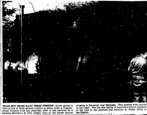
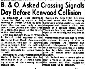
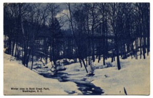
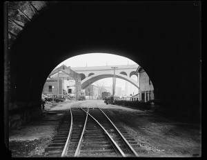
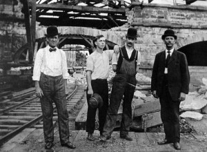
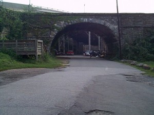
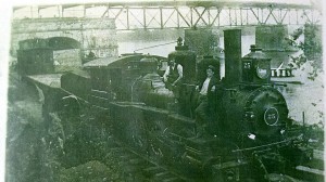
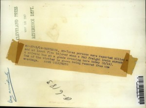
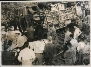 The location has me stumped. I’m fairly certain it’s not in downtown Bethesda. It appears to be a single track so may have been over by River Rd. or Kenwood (Dorset Rd.). Perhaps some of the roads just north of Bethesda crossed at grade. I would have to dig around some old aerials and maps to see. Would love your input or any feedback on this! (*photos from eBay)
 EDIT: UPDATE